


Why visit Tostedt
Townapedia lists 72 museums and landmarks, 13 parks and trails, 32 places to eat, 7 places to stay and 8 attractions in and around town.
Highlights include Buschs Hofladen, Erlebnispädagogik Kathleen Grygo, Vorgeschichtliche Grabhügel and Metallatelier Tietgen & Schmalz.
Weather in Tostedt
Forecast from MET Norway (CC BY 4.0). Full forecast
About Tostedt
Tostedt (Low German Töst) is a municipality in the district of Harburg, in Lower Saxony, Germany. It is the central administration of the collective municipality (Samtgemeinde Tostedt) which consists of 9 joint communities.
From the Wikipedia article Tostedt (this version), under CC BY-SA 4.0.
Things to do8
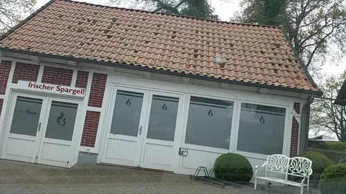
Buschs Hofladen
Farm and orchard · 1.3 km
2 Niedersachsenstraße, Tostedt
Mo-Fr 08:00-18:00; Sa 08:00-13:00





Museums and landmarks72


Metallatelier Tietgen & Schmalz
Monument and historic site · 5.6 km
13 Esteweg, Kakenstorf
Mo-Fr 09:00-17:00; Sa 15:00-17:00


Eiszeit-Findlingspark
Monument and historic site · 2.7 km
Auf dem roten Felde, Tostedt


60 more on the map.
Parks, trails and playgrounds13

Freibad Tostedt
Sports field and stadium · 1.1 km
14 Am Freibad, Tostedt
Mo-Fr 07:30-20:00; Sa,Su 10:00-20:00




1 more on the map.
Restaurants and cafes32

Bäckerei Weiss
Bakery · 1.1 km
25 Unter den Linden, Tostedt
Mo-Fr 05:30-18:00; Sa 05:30-17:00; Su 08:00-17:00
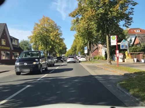

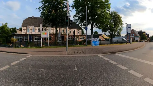
Restaurant Bostelmanns Hotel
Restaurant · German · 0.9 km
1 Unter den Linden, Tostedt
Mo-Th 11:45-14:00,17:30-21:30; Sa,Su 11:45-14:00,17:30-21:30
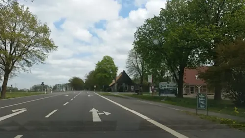
Restaurant Zum Estetal
Restaurant · German · 5.1 km
11 Bergstraße, Kakenstorf
Mo-Sa 10:00-13:00,16:00-23:00; Tu off; We 16:00-23:00; Su 10:00-23:00

Cafe Bäckerei Schrader
Bakery · 1.1 km
18 Unter den Linden, Tostedt
Mo-Fr 06:00-18:00;Sa-Su 06:00-17:00

Cafe Weiss
Cafe · 1.1 km
25 Unter den Linden, Tostedt
Mo-Fr 05:30-18:00; Sa 05:30-17:00; Su 08:00-17:00
Asia
Restaurant · Asian
62 Bahnhofstraße, Tostedt
Tu-Su 12:00-15:00,17:30-22:00
Breda Eiscafe
Cafe · Ice Cream · 0.7 km
17 Bahnhofstraße, Tostedt
Mo-Su 10:00-22:00


Dieckhof
Bar and pub · 1.3 km
16 Dieckhofstraße, Tostedt
Tu-Sa 17:00-24:00
20 more on the map.
History
The first recording of Tostedt go back to 1105. In 1625 the jurisdiction was established in Tostedt, and Tostedt still has a local court with jurisdiction of the trade register in the Elbe-Weser triangle region. The house of the old post office Am Sande was once a coaching inn, where the Emperor Napoleon once stayed overnight.
From the History section of Tostedt on Wikipedia, under CC BY-SA 4.0.
Where to stay7
Churches and places of worship9
Freie Evangeliums-Christengemeinde Tostedt
Church · Evangelical · 1.8 km
5 Vorwerk-Bogen, Tostedt
Shopping16
Gas and EV charging20
Schools, colleges and libraries16
Healthcare4
Map of Tostedt
197 places. The map loads OpenStreetMap tiles when you open it.
Getting there and nearby towns
Hamburg Finkenwerder Airport (XFW) is the nearest airport with scheduled flights listed in OpenStreetMap, 30 km away.
- Stelle 29 km northeast, about 29 min by car
- Zeven 30 km west, about 30 min by car
- Winsen 34 km east, about 34 min by car
- Visselhövede 33 km south, about 33 min by car
- Hamburg 36 km northeast, about 36 min by car
- Kirchlinteln 46 km southwest, about 46 min by car
- Walsrode 47 km south, about 47 min by car
- Verden 51 km southwest, about 51 min by car
- Bremen 65 km west, about 1 h by car
- Uelzen 66 km southeast, about 1 h by car
Drive times are estimates from straight-line distance, not routes.
Local news
Headlines from INDB.
Reviews, tips and questions
Loading what members have shared...
Sources and licences
- GeoNames (CC BY 4.0): population, coordinates, regions and time zone
- Mapillary (see each image): photos
- OpenStreetMap contributors (ODbL 1.0): places, airports, map data
- Wikidata (CC0 1.0): elevation, founding date, time zone, website
- Wikimedia Commons (see each image): photos
- Wikipedia (CC BY-SA 4.0): overview and history text
Photo credits
- Stolperstein in Tostedt für Anna Riepshoff, Smarties, CC BY-SA 4.0
- Stolperstein in Tostedt für Boleslaw Marzec, Smarties, CC BY-SA 4.0
- Stolperstein in Tostedt für Erna Rosen, Smarties, CC BY-SA 4.0
- Stolperstein in Tostedt für Käthe Rosen, Smarties, CC BY-SA 4.0
- Stolperstein in Tostedt für Martha Rosen, Smarties, CC BY-SA 4.0
- Stolperstein in Tostedt für Olga Rosen, Smarties, CC BY-SA 4.0
- Kirche der Freien evangelische Gemeinde Tostedt, smarties, CC BY-SA 4.0
- Herz Jesu Kirche in Tostedt, smarties, CC BY-SA 4.0
- Grundschule Poststraße in Tostedt, smarties, CC BY-SA 4.0
- Realschule Tostedt, smarties, CC BY-SA 3.0
- Gymnasium Tostedt, smarties, CC BY-SA 3.0
- Stolperstein in Tostedt für Rosette Dörnbrack, Smarties, CC BY-SA 4.0
- Stolperstein in Tostedt für Rosette Dörnbrack 002, Smarties, CC BY-SA 4.0
- Kriegerdenkmal am Schützenhaus Tostedt, smarties, CC BY-SA 4.0
- Schützenhaus Tostedt, smarties, CC BY-SA 4.0
- Hauptschule Tostedt, smarties, CC BY-SA 3.0
- Grundschule Poststraße in Tostedt Statue, smarties, CC BY-SA 4.0
- Tennishalle Tostedt, smarties, CC BY-SA 4.0
- Tostedt Herz 1, Kirchenfan, CC0
- Tostedt Herz 2, Kirchenfan, CC0
- Tostedt Herz 3, Kirchenfan, CC0
- Tostedt Herz 4, Kirchenfan, CC0
- Tostedt Herz 6, Kirchenfan, CC0
- Tostedt Herz 5, Kirchenfan, CC0
- Polizei Tostedt, smarties, CC BY-SA 4.0
- Tostedt Reiter 1, Kirchenfan, CC0
- Sportplatz Düvelshöpen in Tostedt, smarties, CC BY-SA 4.0
- Stolperstein in Tostedt für Familie Rosen, Smarties, CC BY-SA 4.0
- Stolperstein in Tostedt für Anna Riepshoff und Boleslaw Marzec, Smarties, CC BY-SA 4.0
- Gedenkstein in Tostedt - Rathaus, smarties, CC BY-SA 4.0
- Tostedt Kreuz 1, Kirchenfan, CC0
- Kriegerdenkmal am Rathaus Tostedt, smarties, CC BY-SA 4.0
- Historisches Toilettenhäuschen in Tostedt, smarties, CC BY-SA 4.0
- Bahnhofsschild Tostedt 1507130910, Clic, CC BY-SA 4.0
- Tostedt Rathaus, smarties, CC BY-SA 3.0
- Kakenstorf Ort, smarties, CC BY-SA 4.0
- Otter Dorfladen Schuenhoff, smarties, CC BY-SA 3.0
- Otter Gemeindemittelpunkt, smarties, CC BY-SA 3.0
- Otterberg 001, smarties, CC BY-SA 4.0
- Otter in Otter, smarties, CC BY-SA 4.0
- Obere Wuemmeniederung4, smarties, CC BY-SA 3.0
- Kakenstorf Grabhuegel, smarties, CC BY-SA 3.0
- Kunstschmiede in Bötersheim, smarties, CC BY-SA 4.0
- Ehemalige Sparkasse in Tostedt, smarties, CC BY-SA 4.0
- Todtgluesingen Findlingspark, smarties, CC BY-SA 3.0
- Ehemaliges Pastorat und Pfarrscheune in Tostedt - heutiges Haus des Heimatvereins, smarties, CC BY-SA 4.0
- Kampener Muehle2, smarties, CC BY-SA 3.0
- Freibad Tostedt, smarties, CC BY-SA 4.0
- NSG Glüsinger Bruch 001, smarties, CC BY-SA 4.0
- NSG Großes Moor und Aueniederung bei Wistedt, smarties, CC BY-SA 4.0
- Kauers Wittmoor, smarties, CC BY-SA 3.0
- Abenteuerspielplatz in Tostedt-Todtglüsingen, smarties, CC BY-SA 4.0
- Tostedt Ort, smarties, CC BY-SA 3.0
- Der Dieckhof in Tostedt, smarties, CC BY-SA 4.0
- Tostedt Kirche, smarties, CC BY-SA 3.0
- Gedenkplatz im Bestattungswald Bötersheim, smarties, CC BY-SA 4.0
- Christus Centrum in Tostedt, smarties, CC BY-SA 4.0
- Friedhofskapelle auf dem Friedhof Tostedt, smarties, CC BY-SA 4.0
- Kirche der Freien Evangeliums-Christengemeinde Tostedt, smarties, CC BY-SA 4.0
- Elias-Schule Wistedt, smarties, CC BY-SA 4.0
- Waldorfschule Kakenstorf, smarties, CC BY-SA 4.0
- Alte Grundschule in Tostedt, smarties, CC BY-SA 4.0
- Grundschule Otter, smarties, CC BY-SA 4.0
- Grundschule Todtglüsingen, smarties, CC BY-SA 4.0
- Grundschule Wistedt, smarties, CC BY-SA 4.0
- Street-level photo, veloroute_hamburg, CC BY-SA 4.0
- Street-level photo, robffm, CC BY-SA 4.0
- Street-level photo, hotteliene, CC BY-SA 4.0
- Street-level photo, hotteliene, CC BY-SA 4.0
- Street-level photo, tian, CC BY-SA 4.0
- Street-level photo, hotteliene, CC BY-SA 4.0
- Street-level photo, tian, CC BY-SA 4.0
- Street-level photo, XCLP, CC BY-SA 4.0
- Street-level photo, veloroute_hamburg, CC BY-SA 4.0
- Street-level photo, veloroute_hamburg, CC BY-SA 4.0
- Street-level photo, robffm, CC BY-SA 4.0
- Street-level photo, tian, CC BY-SA 4.0
- Street-level photo, hotteliene, CC BY-SA 4.0
- Street-level photo, veloroute_hamburg, CC BY-SA 4.0
- Street-level photo, robffm, CC BY-SA 4.0
- Street-level photo, hendel, CC BY-SA 4.0
- Street-level photo, hotteliene, CC BY-SA 4.0
- Street-level photo, hotteliene, CC BY-SA 4.0
- Street-level photo, hendel, CC BY-SA 4.0
- Street-level photo, hendel, CC BY-SA 4.0
- Street-level photo, veloroute_hamburg, CC BY-SA 4.0
- Street-level photo, hotteliene, CC BY-SA 4.0
- Street-level photo, hotteliene, CC BY-SA 4.0
- Street-level photo, zoegglmeyr, CC BY-SA 4.0
- Street-level photo, tian, CC BY-SA 4.0


Page built November 8, 2026. Spotted a mistake? Tell us or suggest a place.