


Spaichingen, Germany
Spaichingen is a town of 12,466 people in Baden-Wurttemberg, Germany.
Why visit Spaichingen
Townapedia lists 34 museums and landmarks, 14 parks and trails, 59 places to eat, 9 places to stay and 9 attractions in and around town.
Highlights include Hirnbuehl, Hohenkarpfen, Gewerbemuseum and Kunststiftung Hohenkarpfen.
Weather in Spaichingen
Forecast from MET Norway (CC BY 4.0). Full forecast
About Spaichingen
Spaichingen (German pronunciation: [ˈʃpaɪçɪŋən] ; Swabian: Spoachenga) is a town in the district of Tuttlingen in Baden-Württemberg, Germany. It is situated 11 kilometers northwest of Tuttlingen, and 13 km southeast of Rottweil. It is 660 meters above sea level. Population: 13,187 (2020).
From the Wikipedia article Spaichingen (this version), under CC BY-SA 4.0.
Things to do9


Museums and landmarks34





Gradmessungspfeiler
Monument and historic site · 2.2 km
Obeliskartiger Pfeiler aus Sandstein, einer von 35 Hauptpunkten des Rheinischen Dreiecksnetzes und Bestandteil der Europäischen Gradmessung


22 more on the map.
Parks, trails and playgrounds14




2 more on the map.
Restaurants and cafes59
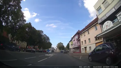

Hütte Klippeneck
Restaurant · German · 3.7 km
Warme Küche: 11:30-14:00 und 17:00-21:00
7 Auf dem Klippeneck, Denkingen
We-Su 11:00-22:00; Mo,Tu off

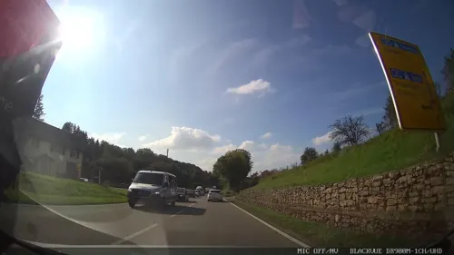
Nachtcafe Aldingen
Bar and pub · 3.0 km
Kneipe, Wirtschaft,Cafebar.Erlebnisgastronomie
4 Mühlstraße, Aldingen
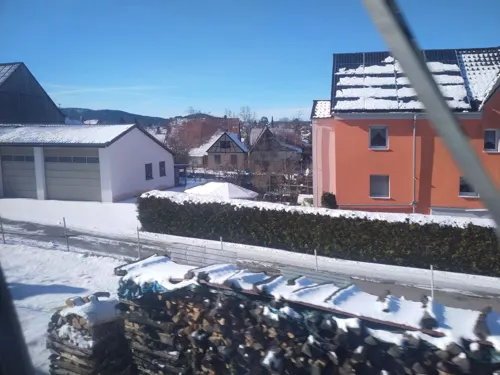
San Marco
Restaurant · Pizza · 0.8 km
225 Hauptstraße, Spaichingen
We-Su 11:00-14:00,17:00-22:00
El Dorado
Restaurant · German · 0.6 km
2 Zotteneck, Spaichingen
Mo-Th 16:00-01:00, Fr 16:00-03:00, Sa 15:00-03:00, Su 09:00-01:00
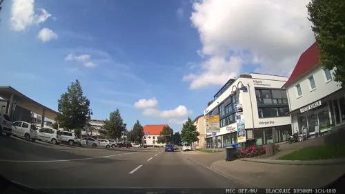



47 more on the map.
History
Spaichingen’s history is long and interesting. First of all there was settlement as early as 2000 BC, where now is Spaichingen.
In the year 791 Spaichingen received a deed of gift from the monastery of St. Gallen. According to a document from 1381, Spaichingen was a part of Austria for over 400 years and belonged to the Upper Austrian Office Rottenburg and the Upper Bailiwick of Oberhohenberg, based in Fridingen. Furthermore, Spaichingen got an emblem in 1482.
Moreover Spaichingen was located on a strategically important road, therefore it suffered heavy losses and damage during many troop transits. However, even looting and pillaging could not prevent Spaichingen from developing into a respectable economic center in the 1530s.
During the Thirty Years War the town lost more than half of its inhabitants.
In 1623 Spaichingen was granted the right to hold a weekly market. Finally becoming a town in 1828, it joined the district of Tuttlingen in 1938.
From September 1944 to April 1945, there was concentration camp located in Spaichingen. It was established by the armament company Mauser from Oberndorf. At least 95 prisoners died in the camp. Because of this concentration camp, a memorial was built next to the cemetery. Surviving multiple air strikes, Spaichingen became a part of the French influence territory after the Second World War.
From the History section of Spaichingen on Wikipedia, under CC BY-SA 4.0.
Where to stay9
Jugend- und Weiterbildungsstätte Klippeneck
Motel and hotel · 3.8 km
7 Auf dem Klippeneck, Denkingen
Churches and places of worship22
Dreifaltigkeitsberg
Church · Catholic · 2.2 km
1 Dreifaltigkeitsberg, Spaichingen
Gemeindehaus Freie Evangeliums-Versammlung e.V.
Church · Evangelical · 0.9 km
2 Rudolf-Diesel-Straße, Spaichingen
Freien Evangeliums Christengemeinde Aldingen
Church · Nondenominational · 3.4 km
Evangelische Dreieinigkeitskirche
Church · Protestant · 4.1 km
26 In Lachen, Denkingen
Shopping18
Gas and EV charging6
Schools, colleges and libraries11
Healthcare7
Gesundheitszentrum/ MVZ Spaichingen
Clinic and pharmacy · 0.9 km
31 Robert-Koch-Straße, Spaichingen
Map of Spaichingen
189 places. The map loads OpenStreetMap tiles when you open it.
Getting there and nearby towns
Friedrichshafen Airport (FDH) is the nearest airport with scheduled flights listed in OpenStreetMap, 73 km away.
- Trossingen 7 km west, about 7 min by car
- Tuttlingen 12 km southeast, about 12 min by car
- Villingen-Schwenningen 18 km west, about 18 min by car
- Stockach 32 km southeast, about 32 min by car
- Sulz am Neckar 33 km north, about 33 min by car
- Titisee-Neustadt 44 km southwest, about 44 min by car
- Überlingen 47 km southeast, about 47 min by car
- Tübingen 55 km northeast, about 55 min by car
- Reutlingen 58 km northeast, about 58 min by car
- Waldkirch 57 km west, about 57 min by car
Drive times are estimates from straight-line distance, not routes.
Local news
Headlines from INDB.
Reviews, tips and questions
Loading what members have shared...
Sources and licences
- GeoNames (CC BY 4.0): population, coordinates, regions and time zone
- Mapillary (see each image): photos
- OpenStreetMap contributors (ODbL 1.0): places, airports, map data
- Wikidata (CC0 1.0): elevation, founding date, time zone, website
- Wikimedia Commons (see each image): photos
- Wikipedia (CC BY-SA 4.0): overview and history text
Photo credits
- St. Peter und Paul Spaichingen, Stolp, CC BY-SA 4.0
- Aldingen-6511, DKrieger, CC BY-SA 4.0
- Hohenkarpfen 20.09.2005 15-30-17, Hansueli Krapf, CC BY-SA 3.0
- Hohenkarpfen-5846, DKrieger, CC BY-SA 4.0
- Birch Tree - panoramio, Dg-505, CC BY 3.0
- Klippeneck0512-38, No machine-readable author provided. Ktm lc4 assumed (based on copyright claims)., Public domain
- Gewerbemuseum Spaichingen, Stolp, CC BY-SA 4.0
- Dreifaltigkeitsberg (Spaichingen)-0760, DKrieger, CC BY-SA 4.0
- Aldingen, de Mauritiuskirche IMG 4828 2023-04-30 14.09, Michielverbeek, CC BY 4.0
- Stele Dreifaltigkeitsberg 20171230 1248, Reneman, CC BY-SA 4.0
- 1200 Jahre Denkingen neben der kath. Kirche von Denkingen, EinEngener, CC BY-SA 4.0
- Dreifaltigkeitskirche, Ramessos, Public domain
- Kunstmuseum Hohenkarpfen, Prekario, CC BY-SA 3.0
- Dürbheimer Moos-5201-Iridient, DKrieger, CC BY-SA 4.0
- Klippeneck - Voller Parkplatz - panoramio, Alexander Reuss, CC BY 3.0
- Spaichinen, Kirche Sankt Josef IMG 4813 2023-04-30 13.33, Michielverbeek, CC BY 4.0
- Spaichinen, Kirche Sankt Josef IMG 4802 2023-04-30 13.31, Michielverbeek, CC BY 4.0
- Colin Dehnke, Heffernan, CC BY-SA 4.0
- Neodorcadion virleti male side, Siga, CC BY-SA 4.0
- Neodorcadion virleti male front, Siga, CC BY-SA 4.0
- Neodorcadion virleti female side, Siga, CC BY-SA 4.0
- Soronia grisea natur, Siga, CC BY-SA 4.0
- Neodorcadion virleti male natur, Siga, CC BY-SA 4.0
- Neodorcadion virleti female natur, Siga, CC BY-SA 4.0
- Megatoma undata side, Siga, CC BY-SA 4.0
- Megatoma undata head, Siga, CC BY-SA 4.0
- Megatoma undata natur, Siga, CC BY-SA 4.0
- Dermestes murinus front, Siga, CC BY-SA 4.0
- Dermestes murinus side, Siga, CC BY-SA 4.0
- Dermestes murinus up, Siga, CC BY-SA 4.0
- Lichenophanes varius natur, Siga, CC BY-SA 4.0
- Trichius fasciatus male side, Siga, CC BY-SA 4.0
- Street-level photo, chuck, CC BY-SA 4.0
- Street-level photo, tobiasreg, CC BY-SA 4.0
- Street-level photo, pablopita, CC BY-SA 4.0
- Street-level photo, chuck, CC BY-SA 4.0
- Street-level photo, chuck, CC BY-SA 4.0
- Street-level photo, chuck, CC BY-SA 4.0
- Street-level photo, chuck, CC BY-SA 4.0
- Street-level photo, chuck, CC BY-SA 4.0
- Street-level photo, chuck, CC BY-SA 4.0
- Street-level photo, chuck, CC BY-SA 4.0
- Street-level photo, chuck, CC BY-SA 4.0


Page built November 8, 2026. Spotted a mistake? Tell us or suggest a place.