


Villingen-Schwenningen, Germany
Villingen-Schwenningen is a town of 81,770 people in Baden-Wurttemberg, Germany, founded in January 1, 1972.
Why visit Villingen-Schwenningen
Townapedia lists 49 museums and landmarks, 37 parks and trails, 258 places to eat, 17 places to stay and 19 attractions in and around town.
Highlights include Capitol VS, BlueBoxx, Franziskanermuseum and Romäusturm.
Weather in Villingen-Schwenningen
Forecast from MET Norway (CC BY 4.0). Full forecast
About Villingen-Schwenningen
Villingen-Schwenningen (German pronunciation: [ˈfɪlɪŋən ˈʃvɛnɪŋən] ; Low Alemannic: Villinge-Schwenninge) is a city in the Schwarzwald-Baar district in southern Baden-Württemberg, in south-western Germany. It had 89,743 inhabitants as of September 2024.
From the Wikipedia article Villingen-Schwenningen (this version), under CC BY-SA 4.0.
Travel tips from other travellers: Villingen-Schwenningen on Wikivoyage (CC BY-SA 4.0).
Things to do19

Capitol VS
Cinema and theater · 2.6 km
24 Alleenstraße, Villingen-Schwenningen
Tu-Th 18:00-01:00; Fr 18:00-03:00; Sa 15:00-03:00; Su 15:00-01:00

BlueBoxx
Cinema and theater · 2.5 km
11 Bertholdstraße, Villingen-Schwenningen
"täglich 30 Minuten vor Beginn der ersten Vorstellung"

CineStar
Cinema and theater · 3.3 km
1 Schützenstraße, Villingen-Schwenningen
"15 Minuten vor dem ersten Film "


Aussichtsturm Hubenloch
Scenic view · 3.0 km
Funkturm aus Stahl mit Aussichtsplattform in 25m Höhe. Treppen, kein Aufzug. Im Winter geschlossen. Im Sommer manchmal offen, Zeiten...

Königsfeld im Schwarzwald
Monument and historic site · 10.0 km
Municipality in Germany
Wanne Observation Tower
Monument and historic site · 1.3 km
Observation tower in Villingen
Aussichtsturm Wanne
Scenic view · 1.3 km
30m Turm mit enger Wendeltreppe, offenes Stahlgerüst, 3 Plattformen, erbaut 1888. Leider inzw. hoher Wald, Aussicht teilw. zugewachsen

Hofladen Glatz
Farm and orchard · 4.2 km
Hofladen mit Gemüse, Eier, Milch
16 Oswald-Meder-Straße, Villingen-Schwenningen
24/7


7 more on the map.
Museums and landmarks49

Franziskanermuseum
Museum · 2.8 km
Kulturgeschichtliches Museum
2 Rietgasse, Villingen-Schwenningen
Tu-Sa 13:00-17:00; Su 11:00-17:00

Romäusturm
Monument and historic site · 2.7 km
Mehr Infos: https://www.villingen-schwenningen.de/tourismus-erleben/vs-erleben/sehenswuerdigkeiten/stadtbezirk-villingen/tore-und-tuerme/
off

Heimat- und Uhrenmuseum
Museum · 3.2 km
Kulturgeschichtliches Museum
16 Kronenstraße, Villingen-Schwenningen
Tu-Fr, Su 10:00-12:00, 14:00-18:00; Sa 14:00-18:00

Bickentor
Monument and historic site · 2.4 km
Das Bickentor in Villingen wurde um das Jahr 1260 erbaut und ist heute 18 Meter hoch. Der Grundriss des mittelalterlichen Tores beträgt...

Magdalenenberg
Monument and historic site · 4.2 km
Iron Age tumulus in Germany

Oberes Tor
Monument and historic site · 2.5 km
Der Baubeginn ist wegen nachhaltiger Umbauten leider nicht feststellbar. Das älteste datierte Bauteil stammt von 1493/94. Im 2. Stock...

Riettor
Monument and historic site · 2.8 km
Der Bau reicht bis in das Jahr 1233 zurück. Dendrochronoligische Untersuchungen ergaben, dass das Bauholz im Winter 1232/33 gefällt...

Museum Art.Plus
Museum · 12.4 km
Art museum in Donaueschingen, Germany

Uhrenindustriemuseum Schwenningen
Museum · 2.8 km
39 Bürkstraße, Villingen-Schwenningen
Mo off; Tu-Sa 13:00-17:00; Su 11:00-17:00

Dickenhardt Grabhügel
Monument and historic site · 2.4 km
Info-Tafel + 2 Bänkle. 2 Gräber ca. 600 v.Chr. im Museum.
24/7
37 more on the map.
Parks, trails and playgrounds37


Eisstadion
Sports field and stadium · 2.9 km
7 Zum Mooswäldle, Villingen-Schwenningen
Dec 21-Mar 20 Mo 10:00-11:45,19:30-21:30; Dec 21-Mar 20 Tu-Fr...




25 more on the map.
Restaurants and cafes258
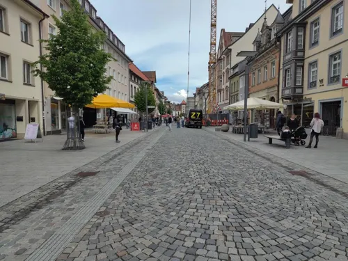
Bombay Delight
Restaurant · Indian · 2.7 km
27 Rietstraße, Villingen-Schwenningen
Mo,We-Fr 11:00-14:30,17:00-22:00; Tu off; Sa,PH...
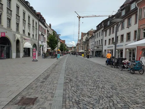
Eis-Café Zampolli
Ice cream · Ice Cream, Coffee, Sandwich, Crepe · 2.7 km
Eis, Kaffee, Kuchen, Toast, Crepe, Snacks, Frühstück, etc / Gäste WLAN free WiFi customers / "Nette Toilette" (public OK)
33 Rietstraße, Villingen-Schwenningen
Mo-Sa 10:00-21:00; Su 13:00-21:00

Roadhouse
Restaurant · Barbecue · 1.8 km
Truckerromantik Gaststätte
2 Neuer Markt, Villingen-Schwenningen
Mo-Th 11:00-21:00; Sa 11:00+
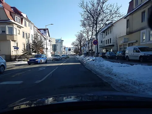
Royal Pizza Heimservice
Restaurant · Pizza · 3.2 km
Selbstabholer erhalten 15% Rabatt;außer Angebote.
1 Römerstraße, Villingen-Schwenningen
Tu-Sa 16:00-22:30; Su,PH 12:00-22:00
Am Pulvertürmle
Restaurant · Steak, Pasta, Salad · 2.4 km
Küche bis 21:30, an Feiertagen bis 21:00
Tu-Sa 11:30-14:00,17:30-23:00; Su 11:00-14:00
Bosporus
Restaurant · Turkish · 2.8 km
2 Alleenstraße, Villingen-Schwenningen
Mo-Fr 11:30-14:00,17:00-22:00;Sa 17:00-23:00;Su,PH 12:00-22:00
Burggaststätte
Restaurant · Italian · 3.5 km
9 Hummelbühlstraße, Villingen-Schwenningen
Su,PH 11:30-20:30; Mo,We-Sa 17:00-21:30; Tu off

Cafe Bistro Vau
Cafe · Regional, Tuscan, Coffee Shop · 3.0 km
18 Friedrich-Ebert-Straße, Villingen-Schwenningen
Tu-Fr 09:30-14:30, Sa 09:30-24:00, Su 10:00-13:30
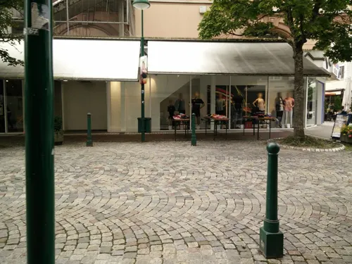


Cafe Hildebrand
Restaurant · German · 2.5 km
1/1 Zollhäusleweg, Villingen-Schwenningen
We-Su 11:00-22:00
246 more on the map.
History
In the Middle Ages, Villingen was a town under Austrian lordship. During the Protestant Reformation it remained Catholic. Villingen came to international attention when it was besieged by Marshal of France Camille d'Hostun, duc de Tallard on 17 July 1704. Colonel Von Wilstorff put up a stout defence of the outdated fortifications, and after six days the siege failed.
Schwenningen remained a village until the 19th century. In 1858, the first watch factory was established, and watchmaking and precision mechanics have been important industries ever since. The town styled itself "the greatest watch city in the world" at one time, and the Kienzle Uhren watchmaking company was founded there in 1822 and remained until moving to Hamburg in 2002. The Museum of Clockmaking celebrates the town's clock and watchmaking history.
During World War II, in March 1940, the Stalag V-B prisoner-of-war camp was established, in which Polish, French, British, Serbian, Soviet, Belgian, American and Italian POWs were held. Additionally, in November 1942, the Stalag 315 prisoner-of-war camp was relocated from Przemyśl in German-occupied Poland to Villingen, and was later further relocated to the German-occupied Netherlands in 1943.
From the History section of Villingen-Schwenningen on Wikipedia, under CC BY-SA 4.0.
Where to stay17
Holiday Inn Villingen-Schwenningen
Motel and hotel
3/1 Klinikstraße, Villingen-Schwenningen
Churches and places of worship40
St. Franziskus
Church · Catholic · 3.2 km
9 Jakob-Kienzle-Straße, Villingen-Schwenningen
Benediktinerkirche
Church · Catholic · 2.8 km
19 Schulgasse, Villingen-Schwenningen
Heilig Kreuz Kirche
Church · Catholic · 1.9 km
34 Hochstraße, Villingen-Schwenningen
Jakobuskirche Marbach
Church · Catholic · 3.9 km
8 Kirchdorfer Straße, Villingen-Schwenningen
Johanneskirche
Church · Protestant · 2.3 km
42 Mozartstraße, Villingen-Schwenningen
Pauluskirche
Church · Protestant · 3.5 km
10 Paulusplatz, Villingen-Schwenningen
Versöhnungskirche
Church · Protestant · 4.0 km
9 Am Talacker, Villingen-Schwenningen
Shopping65
Gas and EV charging45
Schools, colleges and libraries39
Stadtbibliothek am Muslenplatz
Library · 3.2 km
2 In der Muslen, Villingen-Schwenningen
Villingen-Schwenningen University of Police
School · 1.6 km
250 Sturmbühlstraße, Villingen-Schwenningen
Bibliothek der DHBW VS
Library · 3.1 km
30 Friedrich-Ebert-Straße, Villingen-Schwenningen
Healthcare16
Apotheke im Haslach
Clinic and pharmacy · 3.5 km
16 Breslauer Straße, Villingen-Schwenningen
Apotheke in der Klinikstraße
Clinic and pharmacy
3 Klinikstraße, Villingen-Schwenningen
Map of Villingen-Schwenningen
250 places. The map loads OpenStreetMap tiles when you open it.
Getting there and nearby towns
Lahr Airport (LHA) is the nearest airport with scheduled flights listed in OpenStreetMap, 60 km away.
- Bad Dürrheim 5 km southeast, about 5 min by car
- Waldkirch 40 km west, about 40 min by car
- Waldshut-Tiengen 53 km southwest, about 53 min by car
- Wehr 65 km southwest, about 1 h by car
- Wildberg 65 km north, about 1 h by car
- Reutlingen 71 km northeast, about 1 h 15 min by car
- Weil im Schönbuch 75 km northeast, about 1 h 15 min by car
- Weil der Stadt 81 km north, about 1 h 15 min by car
- Weil am Rhein 83 km southwest, about 1 h 30 min by car
- Weingarten 90 km east, about 1 h 30 min by car
Drive times are estimates from straight-line distance, not routes.
Local news
Headlines from INDB.
Reviews, tips and questions
Loading what members have shared...
Sources and licences
- GeoNames (CC BY 4.0): population, coordinates, regions and time zone
- Mapillary (see each image): photos
- OpenStreetMap contributors (ODbL 1.0): places, airports, map data
- Wikidata (CC0 1.0): elevation, founding date, time zone, website, landmarks and historic places
- Wikimedia Commons (see each image): photos
- Wikipedia (CC BY-SA 4.0): overview and history text
Photo credits
- Villinger Riettor, Erbrechtler1, CC BY-SA 4.0
- Zzpl. Kirchnsaal-1, Osingar, CC BY-SA 4.0
- Museum Biedermann, Museum Art.Plus, CC BY-SA 3.0
- Aussichtsturm Wanne, Villinger10 at English Wikipedia, CC BY-SA 3.0
- Ruine Warenburg (VS)-5208, DKrieger, CC BY-SA 4.0
- Spitalgarten Franziskanermuseum, Franziskanermuseum, CC BY-SA 4.0
- Villinger Münster, HostaMadosta, CC BY-SA 3.0
- D-VS-GaD-Suedseite, Okmijnuhb, CC BY 3.0
- Neckar-Ursprung im Schwenninger Moos, Harke, CC BY-SA 3.0
- FTS Alt und Werkstattbau, No machine-readable author provided. Marc28 assumed (based on copyright claims)., CC BY-SA 3.0
- Hubenloch2, Erbrechtler1, CC BY-SA 4.0
- Villingen Benediktinerkirche Schulgasse, Photo: Andreas Praefcke, CC BY 3.0
- Landappbw 385505 1819 Capitol Capitol Schwenningen, Harry Schneckenburger, CC0
- Villingen BlueBoxx, Photo: Andreas Praefcke, CC BY 3.0
- Villingen Theater am Ring 1, Photo: Andreas Praefcke, CC BY 3.0
- Katholische Kirche St. Franziskus in Schwenningen - panoramio, qwesy qwesy, CC BY 3.0
- GaH Front, Aletz, CC BY-SA 4.0
- Karl Brachat Realschule 2023, Stefangrotz, CC BY-SA 4.0
- Pauluskirche Schwenningen-5761, DKrieger, CC BY-SA 4.0
- Marbach, Kirche St. Jakobus, Rauenstein, CC BY-SA 3.0
- Altstadtkirche Villingen-5147, DKrieger, CC BY-SA 3.0
- Versöhnungskirche Marbach-4048, DKrieger, CC BY-SA 4.0
- Unteres Tor in Villingen, GFHund, CC BY 4.0
- Villingen-5536, DKrieger, CC BY-SA 3.0
- Landappbw 307785 1819 Theater am Turm Villingen, Harry Schneckenburger, CC0
- Aussichtsturm Hubenloch-01, Muck, CC BY-SA 4.0
- Franziskanermuseum Osianderplatz, Lutz Hugel und Kathrin Hugger, www.visual-artwork.de, CC BY-SA 3.0
- Landappbw 307005 1818 Riettor Villingen, Harry Schneckenburger, CC0
- Villingen Schriftzug, Mournever, CC BY-SA 4.0
- Villingen Benediktinerkirche, Photo: Andreas Praefcke, CC BY 4.0
- Altbau des Gymnasiums am Romäusring, Patrick Schygulla, CC BY-SA 3.0
- AussichtsturmInfoTafel, InspectiveKontoS1.23, CC BY-SA 3.0
- GaD Gymnasium am Deutenberg, Jolongauss, CC0
- Münster Villingen Westseite, GFHund, CC BY 4.0
- Karl Brachat Realschule 2023 8, Stefangrotz, CC BY-SA 4.0
- Landappbw 310957 1820 Stadtkirche Schwenningen 960x960, Harry Schneckenburger, CC0
- NSG 3.028 BaWü 2, Thorsten Sontowski, CC BY-SA 4.0
- Schwenningen am Neckar-2050, DKrieger, CC BY-SA 4.0
- Aussichtsturm Wanne-02, Muck, CC BY-SA 4.0
- Aussichtsturm Wanne-08-Plattform 3, Muck, CC BY-SA 4.0
- SWV Wegweiser VSVS001 Villingen Am Bickentor, Karthoo, CC0
- SWV Wegweiser VSVS012 Villingen Oberes Tor, Karthoo, CC0
- Helios Arena - panoramio, qwesy qwesy, CC BY 3.0
- Street-level photo, deleted_user, CC BY-SA 4.0
- Street-level photo, changchun1, CC BY-SA 4.0
- Street-level photo, deleted_user, CC BY-SA 4.0
- Street-level photo, changchun1, CC BY-SA 4.0
- Street-level photo, changchun1, CC BY-SA 4.0
- Street-level photo, tobim91, CC BY-SA 4.0
- Street-level photo, changchun1, CC BY-SA 4.0
- Street-level photo, tobim91, CC BY-SA 4.0
- Street-level photo, theSharon, CC BY-SA 4.0
- Street-level photo, changchun1, CC BY-SA 4.0
- Street-level photo, changchun1, CC BY-SA 4.0
- Street-level photo, tobim91, CC BY-SA 4.0
- Street-level photo, ramap, CC BY-SA 4.0
- Street-level photo, tobim91, CC BY-SA 4.0
- Street-level photo, changchun1, CC BY-SA 4.0
- Street-level photo, tobim91, CC BY-SA 4.0


Page built November 8, 2026. Spotted a mistake? Tell us or suggest a place.