


Why visit Stadtallendorf
Townapedia lists 190 museums and landmarks, 31 parks and trails, 92 places to eat, 11 places to stay and 10 attractions in and around town.
Highlights include Hunburgturm, Burgholz, Burg Schmitthof and Burg Amöneburg.
Weather in Stadtallendorf
Forecast from MET Norway (CC BY 4.0). Full forecast
About Stadtallendorf
Stadtallendorf (German pronunciation: [ˌʃtatˈʔaləndɔʁf] ) is a town in the district of Marburg-Biedenkopf, Hesse, Germany. It lies about 18 km (11 miles) east of Marburg. In 2010, the town hosted the 50th Hessentag state festival.
From the Wikipedia article Stadtallendorf (this version), under CC BY-SA 4.0.
Things to do10




SB-Bio-Scheune
Farm and orchard · 4.3 km
Mo-Fr 08:00-18:00; Sa 08:00-18:00; Su off
Museums and landmarks190


Heimatmuseum Amöneburg
Museum · 6.8 km
2 Schulgasse, Amöneburg
Mo-Th 08:00-12:00,14:00-16:00, Fr 08:00-12:00, Su[1,3] 14:00-18:00


Burg Schweinsberg
Monument and historic site · 7.1 km
1 Burg, Stadtallendorf

Nellenburg
Monument and historic site · 7.5 km
Reste einer Befestigungsanlage

Steimbel
Monument and historic site · 6.3 km
Ehemaliges Zwangsarbeiterlager Steimbel in Neustadt, Daten von Lagis Hessen, DIZ Stadtallendorf i.U.v. Frau Doktor Peters, Hessen DOP


178 more on the map.
Parks, trails and playgrounds31



Freibad Kirchhain
Sports field and stadium · 5.0 km
30 Am Schwimmbad, Kirchhain
"In der Freibadsaison von 10:00 - 20:00 Uhr"




19 more on the map.
Restaurants and cafes92

Brücker Mühle
Restaurant · Regional · 6.2 km
6 Am Friedenstein, Amöneburg
We-Sa 12:00-18:00; Su,PH 12:00-17:00
Café Noll
Cafe · German, Regional, Ice Cream, Breakfast, Cake, Salad, Pastry, Fries · 6.6 km
Warme Speisen von 11-14:30 Uhr und ab 17:00 Uhr
15 Brießelstraße
Mo off; Tu-Sa 09:00-19:00; Su,PH 11:00-19:00

Ristorante Pizzeria Delizia
Restaurant · Italian · 6.7 km
16 Steinweg, Kirchhain
Mo-Su 11:30-14:00,17:00-22:30; Tu off

CLASSICO
Cafe · Ice Cream
5 Niederkleiner Straße, Stadtallendorf
Mo-Th 08:00-22:00; Fr 08:00-24:00; Sa 00:00-02:00,10:00-24:00; Su...
Gasthaus Zur Sonne
Restaurant · German · 6.4 km
Mo,Sa 16:30-24:00; Tu-Fr 11:00-14:00,16:30-24:00; Su 10:00-14:30
Pizzeria Adria
Restaurant · Italian · 6.5 km
Su 11:30-14:00,17:30-24:00, Tu-Fr 11:30-14:00,17:30-24:00; Sa 17:30-24:00

Schäfers Backstuben
Bakery · 0.6 km
6 Straße des 17. Juni, Stadtallendorf
Mo-Fr 08:00-21:00; Sa 08:00-21:00
Schäfers Backstuben
Bakery · 5.7 km
47 Niederrheinische Straße, Kirchhain
Mo-Fr 05:30-18:00; Sa 05:30-16:00
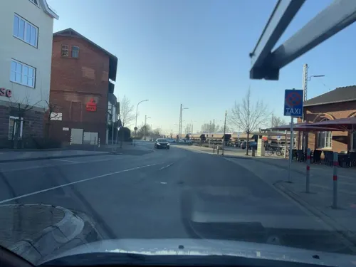
Schäfers Backstuben
Bakery · 6.4 km
9 Am Bahnhof, Kirchhain
Mo-Fr 05:30-17:00; Sa 07:00-13:00; Su 07:30-12:00
Pizza Cafeteria Dolci
Restaurant · Pizza · 0.6 km
2, Stadtallendorf
Mo closed, Tu-Fr, Su 10:00-14:00, 17:00-22:00, Sa 10:00-14:00, 17:00-22:30
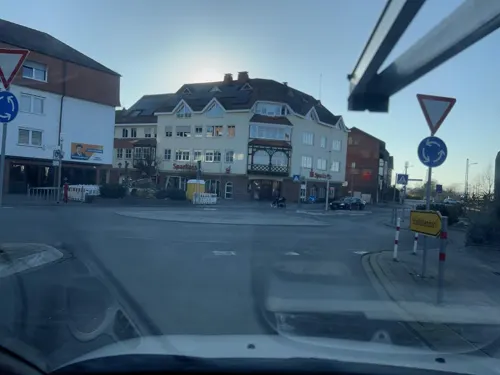


Unikat / Jasmin
Restaurant · Syrian, German, Burger, Oriental, Fries, Middle Eastern, Pasta, Dessert · 6.4 km
9 Am Bahnhof, Kirchhain
Mo-Sa 12:00-22:00; Tu,Th 17:00-22:00; We off; Su 10:00-22:00
80 more on the map.
History
Stadtallendorf was given city rights in 1960; it had been known until then simply as Allendorf.
During World War II, Stadtallendorf was a secret munitions centre. The armament firms WASAG (Westfälisch-Anhaltische Sprengstoff Actien-Gesellschaft, "Westphalian & Anhaltish Explosives A.G.") and DAG produced munitions and explosives in two separate large facilities located in the woods nearby. At the time, it was one of the largest of all munitions production centres in Europe. The Munition centre continued throughout the war without being detected by the Allies. Labor was provided by both German and foreign forced laborers, including prisoners of war and concentration camp inmates, housed in about a dozen camps in the surrounding area.
The 6 square kilometre premises where the wartime arms works were built were said to be one of Germany's biggest contaminated former industrial sites, in parts with high concentrations of chemical contaminants on residential properties. Since 1991, the premises have undergone a far-reaching cleanup; in March 2006, the job was officially declared done. According to information from the Hesse Environment Ministry, the cleanup cost € 167 million. 154 tonnes of contaminants were dug out of the ground, 697 tonnes were dug out of a dump, and 3 tonnes of TNT – still capable of exploding – were unearthed.
From the History section of Stadtallendorf on Wikipedia, under CC BY-SA 4.0.
Where to stay11
Milano
Motel and hotel · German · 0.7 km
7 Niederrheinische Straße, Stadtallendorf
Ringhotel Parkhotel Stadtallendorf
Motel and hotel
1 Schillerstraße, Stadtallendorf
Churches and places of worship28
Stadtkirche
Church · Lutheran · 6.6 km
41 Hinterm Kirchhof, Kirchhain
Evangelische Kirche Hatzbach
Church · Protestant · 5.9 km
4 Glockenstraße, Stadtallendorf
Shopping24
Gas and EV charging13
Schools, colleges and libraries23
Berufliche Schulen des Landkreises Marburg-Biedenkopf in Kirchhain
School · 6.3 km
18 Dresdener Straße, Kirchhain
Healthcare10
Gesundheitszentrum Kirchhain
Clinic and pharmacy · 6.4 km
11 Mühlgasse, Kirchhain
Map of Stadtallendorf
250 places. The map loads OpenStreetMap tiles when you open it.
Getting there and nearby towns
Fritzlar Air Base (FRZ) is the nearest airport with scheduled flights listed in OpenStreetMap, 38 km away.
- Alsfeld 20 km southeast, about 20 min by car
- Grünberg 26 km south, about 26 min by car
- Reiskirchen 28 km southwest, about 28 min by car
- Lollar 29 km southwest, about 29 min by car
- Gladenbach 31 km west, about 31 min by car
- Borken 31 km northeast, about 31 min by car
- Laubach 31 km south, about 31 min by car
- Lauterbach 34 km southeast, about 34 min by car
- Biedenkopf 35 km west, about 35 min by car
- Lich 36 km southwest, about 36 min by car
Drive times are estimates from straight-line distance, not routes.
Local news
Headlines from INDB.
Reviews, tips and questions
Loading what members have shared...
Sources and licences
- GeoNames (CC BY 4.0): population, coordinates, regions and time zone
- Mapillary (see each image): photos
- OpenStreetMap contributors (ODbL 1.0): places, airports, map data
- Wikidata (CC0 1.0): elevation, founding date, time zone, website
- Wikimedia Commons (see each image): photos
- Wikipedia (CC BY-SA 4.0): overview and history text
Photo credits
- Stadtallendorf Luft, Pazzee at German Wikipedia, CC BY-SA 3.0
- 27 80 6451 585-3, 1, Stadtallendorf, Landkreis Marburg-Biedenkopf, GeorgDerReisende, CC BY-SA 4.0
- 23 87 6461 032-1, 1, Stadtallendorf, Landkreis Marburg-Biedenkopf, GeorgDerReisende, CC BY-SA 4.0
- Bahnhof, 1, Stadtallendorf, Landkreis Marburg-Biedenkopf, GeorgDerReisende, CC BY-SA 4.0
- Fritz Winter Stadtallendorf roof view - panoramio, F-GSPY, CC BY 3.0
- Fritz Winter Stadtallendorf roof view (sunset) - panoramio, F-GSPY, CC BY 3.0
- Herrenwald Stadtallendorf 2020-08-21 03, Leonhard Lenz, CC0
- Herrenwald Stadtallendorf 2020-08-21 02, Leonhard Lenz, CC0
- Herrenwald Stadtallendorf 2020-08-21 01, Leonhard Lenz, CC0
- Herrenwald Stadtallendorf 2020-08-21 04, Leonhard Lenz, CC0
- Herrenwald Stadtallendorf 2020-08-21 05, Leonhard Lenz, CC0
- Herrenwald Stadtallendorf 2020-08-21 06, Leonhard Lenz, CC0
- Herrenwald Stadtallendorf 2020-08-21 07, Leonhard Lenz, CC0
- Herrenwald Stadtallendorf 2020-08-21 08, Leonhard Lenz, CC0
- Herrenwald Stadtallendorf 2020-08-21 09, Leonhard Lenz, CC0
- Herrenwald Stadtallendorf 2020-08-21 10, Leonhard Lenz, CC0
- Herrenwald Stadtallendorf 2020-08-21 11, Leonhard Lenz, CC0
- Herrenwald Stadtallendorf 2020-08-21 12, Leonhard Lenz, CC0
- Herrenwald Stadtallendorf 2020-08-21 17, Leonhard Lenz, CC0
- Herrenwald Stadtallendorf 2020-08-21 13, Leonhard Lenz, CC0
- Herrenwald Stadtallendorf 2020-08-21 18, Leonhard Lenz, CC0
- Herrenwald Stadtallendorf 2020-08-21 19, Leonhard Lenz, CC0
- Herrenwald Stadtallendorf 2020-08-21 20, Leonhard Lenz, CC0
- Herrenwald Stadtallendorf 2020-08-21 21, Leonhard Lenz, CC0
- Herrenwald Stadtallendorf 2020-08-21 14, Leonhard Lenz, CC0
- Herrenwald Stadtallendorf 2020-08-21 15, Leonhard Lenz, CC0
- Herrenwald Stadtallendorf 2020-08-21 16, Leonhard Lenz, CC0
- Herrenwald Stadtallendorf 2020-08-21 22, Leonhard Lenz, CC0
- Herrenwald Stadtallendorf 2020-08-21 23, Leonhard Lenz, CC0
- Herrenwald Stadtallendorf 2020-08-21 24, Leonhard Lenz, CC0
- Herrenwald Stadtallendorf 2020-08-21 25, Leonhard Lenz, CC0
- Am Friedensstein 2, Amöneburg, Flight89, CC BY-SA 3.0
- SchlossAmoeneburgwiki, Peter Voeth, CC BY-SA 3.0
- Kirtorf Lehrbach BurgLehrbach E a, UuMUfQ, CC BY-SA 3.0
- Schmitthof Gleental 2020-10-04 06, Leonhard Lenz, CC0
- Schweinsberg (Stadtallendorf) (05), Hydro, CC BY-SA 4.0
- Burgholz und Kellerwald von Amoeneburg, Elop, CC BY-SA 3.0
- Hunburg (Burgholz) (0001), Gerold Rosenberg ( talk ) 18:57, 19 February 2017 (UTC), CC BY-SA 3.0
- Menhir Langenstein2, Andreas Trepte, CC BY-SA 2.5
- Meisner Newstadt in Hessen Appetitus a temperantia dominantur, David Meisner, Public domain
- St. Johannes Amöneburg (4), Hydro, CC BY-SA 3.0
- Stiftsschule St. Johann 2, Hydro, CC BY-SA 4.0
- Wenigenburg2wiki, Peter Voeth, Die silberlocke at de.wikipedia, CC BY-SA 3.0
- Amöneburg Lindaukapelle von SW, Heinrich Stürzl, CC BY-SA 4.0
- Stephanskirche Schweinsberg (Stadtallendorf) 1, Hydro, CC BY-SA 4.0
- Naturschutzgebiet Saurasen Feldhase, Miosta, CC BY 4.0
- Burgholz church, Andreas Trepte, CC BY-SA 2.5
- Basalt-2378, Hessen, Amöneburg, NSG 1534001, Erikottodamm, CC BY-SA 4.0
- Stadtkirche Stadtallendorf2, Pazzee at German Wikipedia, CC BY-SA 3.0
- Hunburgturm Burgholz, Hydro, CC BY-SA 4.0
- Kirche Rüdigheim (Amöneburg) 3, Hydro, CC BY-SA 4.0
- Kirchhain church St Elisabeth, Andreas Trepte, CC BY-SA 2.5
- Stadtallendorf 05, Börste, CC BY-SA 3.0
- Lidar Burg Hunsgeweide und Umgebung, Commander-pirx, CC BY-SA 4.0
- Kirche Hatzbach Nord, OOroyOo, CC BY-SA 3.0
- Kirchhain Annapark Tempelchen (2), Hydro, CC BY-SA 4.0
- Street-level photo, chuck, CC BY-SA 4.0
- Street-level photo, poxonline, CC BY-SA 4.0
- Street-level photo, poxonline, CC BY-SA 4.0
- Street-level photo, mfa, CC BY-SA 4.0
- Street-level photo, bahnpirat, CC BY-SA 4.0
- Street-level photo, robffm, CC BY-SA 4.0
- Street-level photo, tim3003, CC BY-SA 4.0
- Street-level photo, poxonline, CC BY-SA 4.0
- Street-level photo, poxonline, CC BY-SA 4.0
- Street-level photo, mfa, CC BY-SA 4.0
- Street-level photo, mfa, CC BY-SA 4.0
- Street-level photo, robffm, CC BY-SA 4.0
- Street-level photo, bahnpirat, CC BY-SA 4.0
- Street-level photo, chuck, CC BY-SA 4.0
- Street-level photo, robffm, CC BY-SA 4.0
- Street-level photo, poxonline, CC BY-SA 4.0
- Street-level photo, miguel_andrade, CC BY-SA 4.0
- Street-level photo, mfa, CC BY-SA 4.0
- Street-level photo, bahnpirat, CC BY-SA 4.0
- Street-level photo, chuck, CC BY-SA 4.0
- Street-level photo, chuck, CC BY-SA 4.0
- Street-level photo, chuck, CC BY-SA 4.0


Page built November 8, 2026. Spotted a mistake? Tell us or suggest a place.