


Why visit Lauterbach
Townapedia lists 105 museums and landmarks, 20 parks and trails, 80 places to eat, 33 places to stay and 68 attractions in and around town.
Highlights include Hainigturm, Rapsölpresse Weißgerber, Ankerturm and Burg Lauterbach.
Weather in Lauterbach
Forecast from MET Norway (CC BY 4.0). Full forecast
About Lauterbach
Lauterbach (German pronunciation: [ˈlaʊtɐbax] ) is the district capital (Kreisstadt) of the Vogelsbergkreis district of the federal state of Hesse in central Germany.
From the Wikipedia article Lauterbach, Hesse (this version), under CC BY-SA 4.0.
Things to do68

Hainigturm
Monument and historic site · 2.1 km
Observation tower near Lauterbach
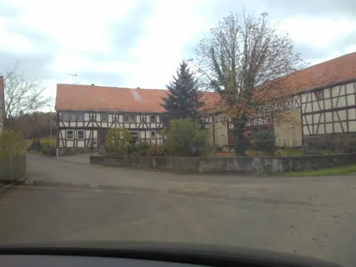




Hofgut Sassen
Farm and orchard · 3.7 km
Mo-Fr 09:00-12:00,14:00-17:00
56 more on the map.
Museums and landmarks105


Burg Lauterbach
Monument and historic site
Rentkammer: Verwaltung der Freiherren Riedesel zu Eisenbach
1 Burg, Lauterbach

Backhaus
Monument and historic site · 3.7 km
14 Hopfmannsfelder Straße, Lauterbach



Die Bärenmauer
Monument and historic site · 6.1 km
Frhrl. Riedeselscher Oberjäger Andreas Jmmisch erlegte hier 1678 den letzten Bären
93 more on the map.
Parks, trails and playgrounds20

Vulkantherme
Sports field and stadium · 8.3 km
Tu,Th 09:00-20:00; We,Fr 09:00-22:00; Sa,Su,PH 09:00-18:00

Heidberg bei Sickendorf
Hiking and trails · 4.2 km
Teilfläche des FFH-Gebietes "Magerrasen bei Lauterbach und Kalkberge bei Schwarz"




8 more on the map.
Restaurants and cafes80

Burg Post
Restaurant · German · 3.8 km
5 Schloß, Lauterbach
We-Fr 12:00+; Sa 11:00+; Su 10:00+; Mo,Tu off
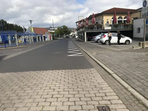
Zentralstation
Cafe · Pizza, German, Regional · 2.8 km
1 Am Waldschlößchen, Lauterbach
Mo-We off; Th-Fr 17:00-23:00; Sa 14:00-23:00; Su 14:00-20:00
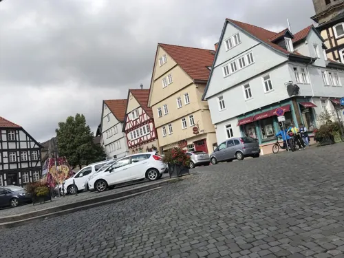
Zur Wachtel
Bar and pub · German
9 Marktplatz, Lauterbach
Tu-Th 11:00-14:00, 17:30-23:00; Fr, Sa 11:00-14:00, 17:00-00:00;...



Café-Bistro in der VulkanTherme
Cafe · 8.3 km
Mo 14:00-20:00; Tu,Th 09:00-20:00; We,Fr 09:00-22:00; Sa,Su,PH 09:00-18:00
68 more on the map.
History
Lauterbach was founded between 400 and 800 AD. In 812 the town was mentioned for the first time in a document of the church in Schlitz. In the Middle Ages, Lauterbach belonged to the cloister in Fulda. Then in the 12th century Lauterbach became a fief of the count Ziegenhein from the cloister in Fulda. In 1266, Lauterbach received municipal rights. In the same year, Lauterbach started to build the castle (Burg) and the city wall.
Over the following centuries, ownership rights of Lauterbach changed often and were complicated. Lauterbach became Lutheran following the Reformation. With a pact in 1684, Lauterbach came under the control of the Riedesel zu Eisenbach (Riedesel). Up to 1806, the Riedesels had a small but independent territory. Following the Napoleonic Wars and Congress of Vienna, Lauterbach belonged to the Grand Duchy of Hesse. In 1852, Lauterbach became the seat of the new founded district (Kreis) of Lauterbach. In 1972, local governments were re-organized, and the new, larger district Vogelsberg was founded of which Lauterbach remains the seat of government.
From the History section of Lauterbach, Hesse on Wikipedia, under CC BY-SA 4.0.
Where to stay33
Churches and places of worship22
Evangelische Kirche Frischborn
Church · Protestant · 3.5 km
3 Mittelgasse, Lauterbach
Evangelische Kirche Rixfeld
Church · Protestant · 6.4 km
30 Vogelsbergstraße, Herbstein
Evangelische Pfarrkirche
Church · Protestant · 5.9 km
1 Helmut-Caspar-Weg, Lauterbach
Shopping21
Gas and EV charging10
Schools, colleges and libraries14
Bildungs- und Technologiezentrum für Elektro- und Informationstechnik
School
25 Vogelsbergstraße, Lauterbach
Mittelpunktschule Wartenberg-Angersbach
School · 2.9 km
1 Schillerstraße, Wartenberg
Healthcare8
Map of Lauterbach
250 places. The map loads OpenStreetMap tiles when you open it.
Getting there and nearby towns
Fritzlar Air Base (FRZ) is the nearest airport with scheduled flights listed in OpenStreetMap, 54 km away.
- Schlitz 12 km east, about 12 min by car
- Schotten 24 km southwest, about 24 min by car
- Neuhof 26 km southeast, about 26 min by car
- Steinau an der Straße 36 km south, about 36 min by car
- Reiskirchen 40 km west, about 40 min by car
- Wächtersbach 43 km south, about 43 min by car
- Rotenburg an der Fulda 46 km northeast, about 46 min by car
- Lollar 49 km west, about 49 min by car
- Melsungen 56 km north, about 56 min by car
- Rodenbach 60 km southwest, about 1 h by car
Drive times are estimates from straight-line distance, not routes.
Local news
Headlines from INDB.
Reviews, tips and questions
Loading what members have shared...
Sources and licences
- GeoNames (CC BY 4.0): population, coordinates, regions and time zone
- Mapillary (see each image): photos
- OpenStreetMap contributors (ODbL 1.0): places, airports, map data
- Wikidata (CC0 1.0): elevation, founding date, time zone, website, landmarks and historic places
- Wikimedia Commons (see each image): photos
- Wikipedia (CC BY-SA 4.0): overview and history text
Photo credits
- Lauterbach (DerHexer) WLMMH 66109 2011-09-17 03, DerHexer , Wikimedia Commons, CC BY-SA 4.0
- Lauterbach (DerHexer) WLMMH 66109 2011-09-17 01, DerHexer , Wikimedia Commons, CC BY-SA 4.0
- Lauterbach (DerHexer) WLMMH 66109 2011-09-17 08, DerHexer , Wikimedia Commons, CC BY-SA 4.0
- Lauterbach (DerHexer) WLMMH 66109 2011-09-17 05, DerHexer , Wikimedia Commons, CC BY-SA 4.0
- Lauterbach (DerHexer) WLMMH 66109 2011-09-17 02, DerHexer , Wikimedia Commons, CC BY-SA 4.0
- Lauterbach (DerHexer) WLMMH 66109 2011-09-17 04, DerHexer , Wikimedia Commons, CC BY-SA 4.0
- Lauterbach (DerHexer) WLMMH 66109 2011-09-17 07, DerHexer , Wikimedia Commons, CC BY-SA 4.0
- Lauterbach (DerHexer) WLMMH 66109 2011-09-17 06, DerHexer , Wikimedia Commons, CC BY-SA 4.0
- Lauterbach (DerHexer) WLMMH 66068 2011-09-17 10, DerHexer , Wikimedia Commons, CC BY-SA 4.0
- Lauterbach (DerHexer) WLMMH 66068 2011-09-17 09, DerHexer , Wikimedia Commons, CC BY-SA 4.0
- Lauterbach (DerHexer) WLMMH 66022 2011-09-17 02, DerHexer , Wikimedia Commons, CC BY-SA 4.0
- Lauterbach (DerHexer) WLMMH 66022 2011-09-17 07, DerHexer , Wikimedia Commons, CC BY-SA 4.0
- Lauterbach (DerHexer) WLMMH 66022 2011-09-17 06, DerHexer , Wikimedia Commons, CC BY-SA 4.0
- Lauterbach (DerHexer) WLMMH 66022 2011-09-17 01, DerHexer , Wikimedia Commons, CC BY-SA 4.0
- Lauterbach (DerHexer) WLMMH 66022 2011-09-17 04, DerHexer , Wikimedia Commons, CC BY-SA 4.0
- Lauterbach (DerHexer) WLMMH 66022 2011-09-17 03, DerHexer , Wikimedia Commons, CC BY-SA 4.0
- Lauterbach (DerHexer) WLMMH 66022 2011-09-17 05, DerHexer , Wikimedia Commons, CC BY-SA 4.0
- Lauterbach (DerHexer) WLMMH 66068 2011-09-17 06, DerHexer , Wikimedia Commons, CC BY-SA 4.0
- Lauterbach (DerHexer) WLMMH 66068 2011-09-17 08, DerHexer , Wikimedia Commons, CC BY-SA 4.0
- Lauterbach (DerHexer) WLMMH 66068 2011-09-17 03, DerHexer , Wikimedia Commons, CC BY-SA 4.0
- Lauterbach (DerHexer) WLMMH 66068 2011-09-17 02, DerHexer , Wikimedia Commons, CC BY-SA 4.0
- Lauterbach (DerHexer) WLMMH 66068 2011-09-17 04, DerHexer , Wikimedia Commons, CC BY-SA 4.0
- Lauterbach (DerHexer) WLMMH 66068 2011-09-17 07, DerHexer , Wikimedia Commons, CC BY-SA 4.0
- Lauterbach (DerHexer) WLMMH 66068 2011-09-17 05, DerHexer , Wikimedia Commons, CC BY-SA 4.0
- Lauterbach (DerHexer) WLMMH 66068 2011-09-17 01, DerHexer , Wikimedia Commons, CC BY-SA 4.0
- Lauterbach (DerHexer) WLMMH 66022 2011-09-17 09, DerHexer , Wikimedia Commons, CC BY-SA 4.0
- Lauterbach (Hessen), an der Lauter, Dguendel, CC BY 3.0
- Lauterbach (DerHexer) WLMMH 66022 2011-09-17 11, DerHexer , Wikimedia Commons, CC BY-SA 4.0
- Lauterbach (DerHexer) WLMMH 66022 2011-09-17 10, DerHexer , Wikimedia Commons, CC BY-SA 4.0
- Flussabschnitt der Lauter in Lauterbach (Hessen), MwykMlaut, CC0
- Lauterbach (DerHexer) WLMMH 66026 2011-09-17 02, DerHexer , Wikimedia Commons, CC BY-SA 4.0
- Lauterbach (DerHexer) WLMMH 65719 2011-09-17 02, DerHexer , Wikimedia Commons, CC BY-SA 4.0
- Lauterbach (DerHexer) WLMMH 66022 2011-09-17 12, DerHexer , Wikimedia Commons, CC BY-SA 4.0
- Lauterbach (DerHexer) WLMMH 66026 2011-09-17 04, DerHexer , Wikimedia Commons, CC BY-SA 4.0
- Lauterbach (DerHexer) WLMMH 66001 2011-09-17 05, DerHexer , Wikimedia Commons, CC BY-SA 4.0
- Lauterbach (DerHexer) WLMMH 66001 2011-09-17 04, DerHexer , Wikimedia Commons, CC BY-SA 4.0
- Lauterbach (DerHexer) WLMMH 66001 2011-09-17 03, DerHexer , Wikimedia Commons, CC BY-SA 4.0
- Lauterbach (DerHexer) WLMMH 66001 2011-09-17 06, DerHexer , Wikimedia Commons, CC BY-SA 4.0
- Lauterbach (DerHexer) WLMMH 66001 2011-09-17 02, DerHexer , Wikimedia Commons, CC BY-SA 4.0
- Hainigturm, J. Braukmann, CC BY-SA 3.0
- Lauterbach - Schloss 1050 49 48, Sven Teschke, CC BY-SA 3.0 de
- Vogelsbergschule5, Sabine Füg, CC BY-SA 3.0
- Dirlammen Evangelische Kirche 2503, Reinhardhauke, CC BY-SA 3.0
- Bad salzschlirf hessen kirche kath - proj rectilinear, UuMUfQ, CC BY-SA 3.0
- Bahnhofstraße 48 Lauterbach 2, Exact42, CC BY-SA 3.0
- Lauterbach schloss sickendorf 20120523 by Emha 0687 crop, Emha, CC BY-SA 3.0 de
- DE HE 66698 2, Meikel1965, CC BY-SA 3.0
- Kirche-allmenrod-001, Unknown author, Public domain
- Lauterbach-Maar (DerHexer) WLMMH 66614 2011-09-16 14, DerHexer , Wikimedia Commons, CC BY-SA 4.0
- Lauterbach Sickendorf Kirche F, UuMUfQ, CC BY-SA 3.0
- 66766 Helmut-Caspar-Weg 1 Wallenrod, Exact42, CC BY-SA 3.0
- Lauterbach hessen adolf-spieß-straße 6 katholisches missionshaus, UuMUfQ, CC BY-SA 3.0
- Lauterbach Frischborn Hopfmannsfelder Strasse 14 Backhaus 66464, UuMUfQ, CC BY-SA 3.0
- Lauterbach-Frischborn (DerHexer) WLMMH 66472 2011-09-18 03, DerHexer , Wikimedia Commons, CC BY-SA 4.0
- Lauterbach Wallenrod Am kalten Born NR 162165 Pasture Winter W, UuMUfQ, CC BY-SA 3.0
- Schalksbachteiche, Felix Ritz, CC BY-SA 3.0
- Weinberg bei Stockhausen, Felix Ritz, CC BY-SA 3.0
- Lauterbach Allmenrod Bienwiesen 318195 pasture, UuMUfQ, CC BY-SA 3.0
- Salzschlirf kurhaus kurpark, Geolina163, CC BY-SA 3.0
- Herbstein Rixfeld Protestant Church df, UuMUfQ, CC BY-SA 3.0
- Schloss eisenbach hauptburg 20070824, Emha /Manuel Heinrich, CC BY-SA 3.0
- Münchswiesen bei Frischborn, Felix Ritz, CC BY-SA 3.0
- Lauterbach Allmenrod Thorkuppe C pano 360 202307, UuMUfQ, CC BY-SA 4.0
- Lauterbach Maar Bilskuppe 555520689 N det, UuMUfQ, CC BY-SA 3.0
- Lauterbach (Hessen), der Ankerturm, Dguendel, CC BY 3.0
- Street-level photo, live, CC BY-SA 4.0
- Street-level photo, zuse, CC BY-SA 4.0
- Street-level photo, troher15, CC BY-SA 4.0
- Street-level photo, troher15, CC BY-SA 4.0
- Street-level photo, troher15, CC BY-SA 4.0
- Street-level photo, nakaner, CC BY-SA 4.0
- Street-level photo, troher15, CC BY-SA 4.0
- Street-level photo, troher15, CC BY-SA 4.0
- Street-level photo, ramap, CC BY-SA 4.0
- Street-level photo, troher15, CC BY-SA 4.0
- Street-level photo, nakaner, CC BY-SA 4.0
- Street-level photo, nrailuj, CC BY-SA 4.0
- Street-level photo, nrailuj, CC BY-SA 4.0
- Street-level photo, ramap, CC BY-SA 4.0
- Street-level photo, live, CC BY-SA 4.0
- Street-level photo, zuse, CC BY-SA 4.0
- Street-level photo, zuse, CC BY-SA 4.0
- Street-level photo, nakaner, CC BY-SA 4.0
- Street-level photo, nrailuj, CC BY-SA 4.0
- Street-level photo, DerMaster0815, CC BY-SA 4.0
- Street-level photo, nrailuj, CC BY-SA 4.0
- Street-level photo, ramap, CC BY-SA 4.0


Page built November 8, 2026. Spotted a mistake? Tell us or suggest a place.