


Why visit Reiskirchen
Townapedia lists 12 museums and landmarks, 9 parks and trails, 46 places to eat, 3 places to stay and 4 attractions in and around town.
Highlights include Busecker Schloss and An der Jossoller bei Hattenrod.
Weather in Reiskirchen
Forecast from MET Norway (CC BY 4.0). Full forecast
About Reiskirchen
Reiskirchen (German pronunciation: [ʁaɪsˈkɪʁçn̩]) is a municipality in the district of Gießen, in Hesse, Germany and is located 11 km east of Gießen.
From the Wikipedia article Reiskirchen (this version), under CC BY-SA 4.0.
Things to do4

Museums and landmarks12

Busecker Schloss
Monument and historic site · 3.4 km
15 Ernst-Ludwig-Straße, Buseck


Zörb's Kreuz
Monument and historic site · 4.9 km
Gedenkstein für verunfallten Holzrücker


Parks, trails and playgrounds9




Restaurants and cafes46
Landhotel & Gasthof Alte Schmiede
Restaurant · 3.2 km
1-5 Weidenstraße, Buseck
We-Fr,Su 11:30-14:00,18:00+; Mo,Sa 18:00+; Tu off

La Bruschetta
Restaurant · Italian · 3.1 km
41 Untergasse
Mo, We-Fr 17:00-23:00; Sa-Su 11:30-14:00, 17:00-23:00
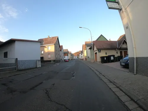
Bella Vista
Restaurant · 3.4 km
33 Fünfhausen, Buseck
Tu-Sa 17:00-23:00; Su 11:30-14:30,17:00-23:00; Mo off
Noch‘n Gedicht
Restaurant · Regional · 5.8 km
1 Bürgerhausstrasse
Mo-Fr 16:30-23:00; We off; Sa,Su 11:00-14:30,16:30-23:00
Bäckerei Dickel
Bakery · 3.1 km
34 Untergasse, Buseck
Mo-Fr 06:00-18:00; Sa 06:01-12:00
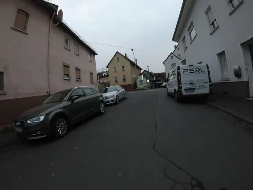
Bäckerei Lukasch
Bakery
53 Grünberger Straße, Reiskirchen
Mo-Fr 05:30-17:00; Sa 05:30-12:30; Su 07:00-10:30
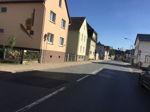
Bäckerei Volkmann
Bakery
32 Grünberger Straße, Reiskirchen
Mo-Fr 05:00-15:00; Sa 05:00-13:00; Su 07:30-10:30


34 more on the map.
Where to stay3
Churches and places of worship19
Ev. Kirche Lindenstruth
Church · Protestant · 1.7 km
18 Untergasse, Reiskirchen
Ev. Kirche zu St. Veits Berg
Church · Protestant · 3.6 km
8 Veitsberg, Reiskirchen
Evangelische Kirche Burkhardsfelden
Church · Lutheran · 2.5 km
18 Kirchplatz, Reiskirchen
Katholische Kirche St. Marien
Church · Catholic · 3.8 km
39 Bismarckstraße, Buseck
Shopping12
Gas and EV charging7
Schools, colleges and libraries7
Healthcare6
Apotheke an der Wieseck
Clinic and pharmacy · 1.1 km
3 Bänningerstraße, Reiskirchen
Map of Reiskirchen
125 places. The map loads OpenStreetMap tiles when you open it.
Getting there and nearby towns
Siegerlandflughafen (SGE) is the nearest airport with scheduled flights listed in OpenStreetMap, 54 km away.
- Schotten 23 km southeast, about 23 min by car
- Rosbach vor der Höhe 35 km south, about 35 min by car
- Usingen 36 km southwest, about 36 min by car
- Weilburg 42 km west, about 42 min by car
- Wächtersbach 50 km southeast, about 50 min by car
- Steinbach am Taunus 51 km south, about 51 min by car
- Rodenbach 52 km south, about 52 min by car
- Schlitz 52 km east, about 52 min by car
- Frankfurt am Main 55 km south, about 55 min by car
- Offenbach 56 km south, about 56 min by car
Drive times are estimates from straight-line distance, not routes.
Local news
Headlines from INDB.
Reviews, tips and questions
Loading what members have shared...
Sources and licences
- GeoNames (CC BY 4.0): population, coordinates, regions and time zone
- Mapillary (see each image): photos
- OpenStreetMap contributors (ODbL 1.0): places, airports, map data
- Wikidata (CC0 1.0): elevation, founding date, time zone, website
- Wikimedia Commons (see each image): photos
- Wikipedia (CC BY-SA 4.0): overview and history text
Photo credits
- B49-Ortsdurchfahrt Reiskirchen Richtung Grünberg, Manfred&Barbara Aulbach, CC BY-SA 3.0
- Evangelische Kirche Reiskirchen, Außen 01, Cherubino, CC BY-SA 3.0 de
- Evangelische Kirche (Reiskirchen) Brüstungsbilder 04, Cherubino, CC BY-SA 3.0 de
- Evangelische Kirche Reiskirchen, Kanzel 01, Cherubino, CC BY-SA 3.0 de
- Evangelische Kirche Reiskirchen, Kanzel 02, Cherubino, CC BY-SA 3.0 de
- Evangelische Kirche Reiskirchen, Außen 10, Gerold Rosenberg ( talk ) 18:25, 24 November 2014 (UTC), CC BY-SA 3.0
- Evangelische Kirche Reiskirchen, Außen 18, Cherubino, CC BY-SA 4.0
- Evangelische Kirche Reiskirchen, Außen 03, Cherubino, CC BY-SA 3.0 de
- Evangelische Kirche (Reiskirchen) Brüstungsbilder 12, Cherubino, CC BY-SA 3.0 de
- Evangelische Kirche (Reiskirchen) Brüstungsbilder 05, Cherubino, CC BY-SA 3.0 de
- Evangelische Kirche Reiskirchen, Außen 02, Cherubino, CC BY-SA 3.0 de
- Evangelische Kirche Reiskirchen, Wetterhahn 02, Cherubino, CC BY-SA 3.0 de
- Evangelische Kirche (Reiskirchen) Brüstungsbilder 06, Cherubino, CC BY-SA 3.0 de
- Evangelische Kirche (Reiskirchen) Brüstungsbilder 03, Cherubino, CC BY-SA 3.0 de
- Evangelische Kirche Reiskirchen, Blick nach Osten 03, Cherubino, CC BY-SA 3.0 de
- Oberdorfstraße 24 (Reiskirchen) 01, Cherubino, CC BY-SA 4.0
- Evangelische Kirche Reiskirchen, Sakramentsnische 02, Cherubino, CC BY-SA 3.0 de
- Evangelische Kirche Reiskirchen, Nische 01, Cherubino, CC BY-SA 3.0 de
- Evangelische Kirche Reiskirchen, Orgel 03, Cherubino, CC BY-SA 3.0 de
- Evangelische Kirche Reiskirchen, Blick nach Westen 02, Cherubino, CC BY-SA 3.0 de
- Evangelische Kirche Reiskirchen, Orgel 04, Cherubino, CC BY-SA 3.0 de
- Evangelische Kirche Reiskirchen, Gefallenendenkmal 08, Cherubino, CC BY-SA 4.0
- Evangelische Kirche Reiskirchen, Wetterhahn 01, Cherubino, CC BY-SA 3.0 de
- Evangelische Kirche (Reiskirchen) Brüstungsbilder 02, Cherubino, CC BY-SA 3.0 de
- Gesamtanlage Oberdorfstraße (Reiskirchen) 01, Cherubino, CC BY-SA 4.0
- Evangelische Kirche Reiskirchen, Gefallenendenkmal 03, Cherubino, CC BY-SA 3.0 de
- Evangelische Kirche Reiskirchen, Blick nach Osten 04, Cherubino, CC BY-SA 3.0 de
- Evangelische Kirche Reiskirchen, Außen 09, Gerold Rosenberg ( talk ) 18:22, 24 November 2014 (UTC), CC BY-SA 3.0
- Evangelische Kirche Reiskirchen, Blick nach Osten 05, Cherubino, CC BY-SA 3.0 de
- Evangelische Kirche Reiskirchen, Gefallenendenkmal 06, Cherubino, CC BY-SA 3.0 de
- Evangelische Kirche (Reiskirchen) Brüstungsbilder 14, Cherubino, CC BY-SA 3.0 de
- Evangelische Kirche (Reiskirchen) Brüstungsbilder 15, Cherubino, CC BY-SA 3.0 de
- Evangelische Kirche (Reiskirchen) Brüstungsbilder 01, Cherubino, CC BY-SA 3.0 de
- Evangelische Kirche Reiskirchen, Blick nach Westen 01, Cherubino, CC BY-SA 3.0 de
- Evangelische Kirche Reiskirchen, Blick nach Westen 03, Cherubino, CC BY-SA 3.0 de
- Evangelische Kirche (Reiskirchen) Brüstungsbilder 16, Cherubino, CC BY-SA 3.0 de
- Evangelische Kirche Reiskirchen, Gefallenendenkmal 09, Cherubino, CC BY-SA 4.0
- Evangelische Kirche Reiskirchen, Gefallenendenkmal 07, Cherubino, CC BY-SA 3.0 de
- Evangelische Kirche Reiskirchen, Gefallenendenkmal 05, Cherubino, CC BY-SA 3.0 de
- Evangelische Kirche Reiskirchen, Portal 03, Cherubino, CC BY-SA 3.0 de
- Albach Kirche (1), Silke Koch, CC BY 3.0
- Schloss Grossen Buseck 2, M. Sporleder, MSporleder at German Wikipedia, CC BY-SA 3.0 de
- Katholische Kirche in Großen Buseck, Peter Buseck, CC BY-SA 3.0
- Evangelische Kirche Beuern Außen 01, Cherubino, CC BY-SA 4.0
- Oppenrod Kirche (1), Wikiwal, CC BY-SA 3.0
- Giessen Roedgen Kirchenring 12 61986, UuMUfQ, CC BY-SA 3.0
- Evangelische Kirche (Burkhardsfelden) von Südosten 08, Cherubino, CC BY-SA 3.0 de
- Evangelische Kirche Lindenstruth, Außen 01, Cherubino, CC BY-SA 3.0 de
- Bersrod Kirche (1), Jörg R. Becker, CC BY 3.0
- Evangelische Kirche Veitsberg, Außen 02, Cherubino, CC BY-SA 3.0 de
- Winnerod Kirche (3), Wikiwal, CC BY-SA 3.0
- Kirche Wirberg Blick nach Osten 01, Cherubino, CC BY-SA 3.0 de
- 2011-09 Reinhardshain, Pulv, CC BY-SA 3.0
- Kümmelberg, Fernando Ferkelkraut, CC BY-SA 4.0
- Heimatmuseum Hirtenhaus 03, Cherubino, CC BY-SA 3.0 de
- Stolperstein Bernhard Berlin, 1, Kaiserstraße 24, Großen-Buseck, Buseck, Landkreis Gießen, GeorgDerReisende, CC BY-SA 4.0
- Stolperstein Julius Berlin, 1, Kaiserstraße 24, Großen-Buseck, Buseck, Landkreis Gießen, GeorgDerReisende, CC BY-SA 4.0
- Street-level photo, grinninghamster, CC BY-SA 4.0
- Street-level photo, troher15, CC BY-SA 4.0
- Street-level photo, moenk, CC BY-SA 4.0
- Street-level photo, grinninghamster, CC BY-SA 4.0
- Street-level photo, grinninghamster, CC BY-SA 4.0
- Street-level photo, ramap, CC BY-SA 4.0
- Street-level photo, dominik354, CC BY-SA 4.0
- Street-level photo, grinninghamster, CC BY-SA 4.0
- Street-level photo, troher15, CC BY-SA 4.0
- Street-level photo, grinninghamster, CC BY-SA 4.0
- Street-level photo, dominik354, CC BY-SA 4.0
- Street-level photo, grinninghamster, CC BY-SA 4.0
- Street-level photo, grinninghamster, CC BY-SA 4.0
- Street-level photo, DerMaster0815, CC BY-SA 4.0
- Street-level photo, troher15, CC BY-SA 4.0
- Street-level photo, grinninghamster, CC BY-SA 4.0
- Street-level photo, grinninghamster, CC BY-SA 4.0
- Street-level photo, dominik354, CC BY-SA 4.0
- Street-level photo, grinninghamster, CC BY-SA 4.0
- Street-level photo, grinninghamster, CC BY-SA 4.0
- Street-level photo, troher15, CC BY-SA 4.0
- Street-level photo, grinninghamster, CC BY-SA 4.0
- Street-level photo, robffm, CC BY-SA 4.0
- Street-level photo, troher15, CC BY-SA 4.0
- Street-level photo, troher15, CC BY-SA 4.0


Page built November 8, 2026. Spotted a mistake? Tell us or suggest a place.