


Why visit Alsfeld
Townapedia lists 85 museums and landmarks, 29 parks and trails, 86 places to eat, 14 places to stay and 46 attractions in and around town.
Highlights include Oberhof, Auerberg, Schwälmer Dorfmuseum Holzburg and Alsfelder Märchenhaus.
Weather in Alsfeld
Forecast from MET Norway (CC BY 4.0). Full forecast
About Alsfeld
Alsfeld (German pronunciation: [ˈalsfɛlt] ) is a town in the center of Hesse, in Germany.
From the Wikipedia article Alsfeld (this version), under CC BY-SA 4.0.
Travel tips from other travellers: Alsfeld on Wikivoyage (CC BY-SA 4.0).
Things to do46

Oberhof
Farm and orchard · 3.5 km
8 Am Oberhof, Alsfeld
Fr 08:00-18:00



34 more on the map.
Museums and landmarks85

Schwälmer Dorfmuseum Holzburg
Museum · 8.3 km
Regionalmuseum für die Kultur der Schwalm Museumscafé
2a Hohlweg, Schrecksbach
Apr-Oct: Su[1] 14:00-17:00

Alsfelder Märchenhaus
Museum
2 Sackgasse, Alsfeld
Sa 10:30-12:30,14:00-17:00; Su 14:00-17:00


Altes Burghaus
Monument and historic site · 9.2 km
5 Immichenhainer Straße, Schrecksbach


73 more on the map.
Parks, trails and playgrounds29





Freibad
Sports field and stadium · 0.8 km
May-Sep: Mo, We, Fr, Sa, Su, PH 07:00-20:00, Tu 09:00-20:00, Th 09:00-21:00

17 more on the map.
Restaurants and cafes86

Seehotel Michaela
Restaurant · Regional, German, Burger · 5.3 km
1 Am Stausee, Antrifttal
Mo-Su 07:00-22:00
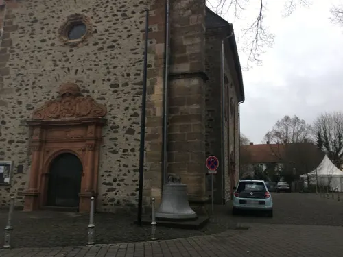
Gasthaus Graulich
Restaurant · 5.9 km
Am Wochenende durchgehend warme Küche.
8 Hintergasse
Mo,We-Fr 17:00+; Sa,Su,PH 11:30+
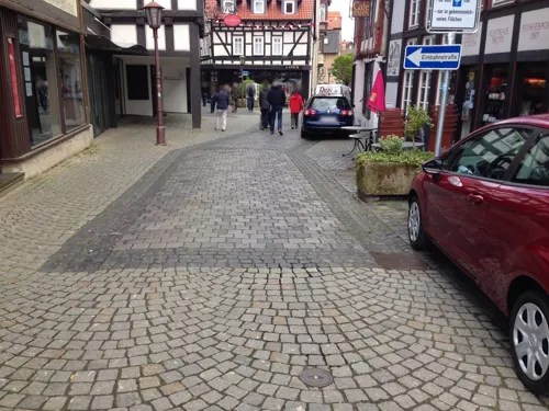
Mainzer Tor
Restaurant · Regional
13-15 Mainzer Tor, Alsfeld
Mo-Th 10:00-22:00; Fr,Sa 10:00-23:00; Su,PH 11:00-15:00
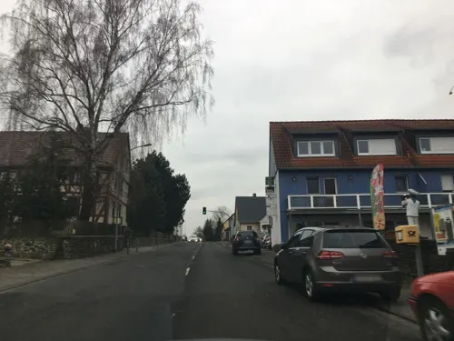
Ristorante Al Vecchio Borgo
Restaurant · Italian · 1.8 km
21a Lauterbacher Straße, Alsfeld
Mo,We-Su 11:00-14:30,17:00-23:00, Tu closed
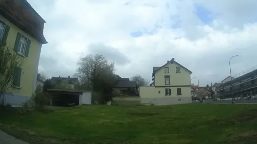
Pappert
Bakery · 1.4 km
78 Grünberger Straße, Alsfeld
Mo-Fr 07:00-19:00, Sa 07:00-18:00, Su 07:00-17:00
Schwälmer Brotladen
Bakery
41 Schellengasse, Alsfeld
Mo-Fr 06:30-18:30, Sa 06:30-16:30, Su 07:00-17:30

Zur Gemütlichkeit
Bar and pub
10 Amthof, Alsfeld
Tu-Sa 18:00+; Su 17:00+; "Während der Fußball-Bundesliga Samstag...
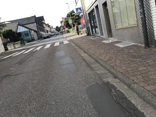


Cafe Rahn
Cafe
6 Mainzer Tor, Alsfeld
Mo 07:00-14:00; Sa 07:00-17:00; Su 13:30-17:00; Tu-Fr 07:00-18:00
74 more on the map.
History
Alsfeld was first mentioned in an official document in 1069. Excavations in the Walpurgiskirche have discovered that a Romanesque church existed here already in the 9th and 10th centuries. It is therefore estimated that the town was founded in Carolingian times. Between 1180 and 1190 the Counts of Thuringia built a castle along the historic trading route of the Kurze Hessen. That location favored the development of Alsfeld and it was subsequently documented as a town as early as 1222.
Since 1247 Alsfeld has been part of Hesse and in 1254 the town joined the Rheinischer Städtebund. Hermann II built himself a castle here in 1395 and for a time turned the town into his official residence. The city enjoyed rising prosperity due its favourable geographical location and the policies of the Landgrave of Hesse. Trades and handcrafts flourished and Alsfeld developed into a wealthy, industrious municipality on the “Street through the short Hesse”. Evidence of this is the church, monastery, towers, town hall and water supply system. Of great importance were the guilds, which gained influence over local government through the so-called “Korebrief” (constitution). From 1567 Alsfeld belonged to Hesse-Marburg and from 1604 on to Hesse-Darmstadt.
From the History section of Alsfeld on Wikipedia, under CC BY-SA 4.0.
Where to stay14
Ölmühle und Kräutergarten Zwei Lindenhof
Campground · 9.1 km
Aussiedlerhof, Ottrau
Churches and places of worship30
Ev. Kirche
Church · Protestant · 9.3 km
15 Grebenauer Straße, Alsfeld
evang. - luth. Kirchengemeinde Holzburg - Fischbach
Church · Lutheran · 8.5 km
Burgstraße, Schrecksbach
Shopping27
Gas and EV charging17
Schools, colleges and libraries16
Albert-Schweitzer-Schule (Oberstufe)
School · 1.0 km
10 In der Krebsbach, Alsfeld
Healthcare7
Map of Alsfeld
250 places. The map loads OpenStreetMap tiles when you open it.
Getting there and nearby towns
Fritzlar Air Base (FRZ) is the nearest airport with scheduled flights listed in OpenStreetMap, 41 km away.
- Lauterbach 16 km southeast, about 16 min by car
- Schlitz 22 km southeast, about 22 min by car
- Grünberg 28 km southwest, about 28 min by car
- Schotten 29 km south, about 29 min by car
- Laubach 31 km southwest, about 31 min by car
- Borken 33 km north, about 33 min by car
- Reiskirchen 35 km southwest, about 35 min by car
- Lich 41 km southwest, about 41 min by car
- Neuhof 41 km southeast, about 41 min by car
- Eichenzell 41 km southeast, about 41 min by car
Drive times are estimates from straight-line distance, not routes.
Local news
Headlines from INDB.
Reviews, tips and questions
Loading what members have shared...
Sources and licences
- GeoNames (CC BY 4.0): population, coordinates, regions and time zone
- Mapillary (see each image): photos
- OpenStreetMap contributors (ODbL 1.0): places, airports, map data
- Wikidata (CC0 1.0): elevation, founding date, time zone, website
- Wikimedia Commons (see each image): photos
- Wikipedia (CC BY-SA 4.0): overview and history text
Photo credits
- Alsfeld01 2010-07-03, KlausFoehl, CC BY-SA 3.0
- Altes Burghaus Schrecksbach (01), Presse03, CC BY-SA 3.0
- Alsfeld Apotheke am Rathaus 2314, Reinhardhauke, CC BY-SA 3.0
- Alsfeld20 2010-07-03, KlausFoehl, CC BY-SA 3.0
- Alsfeld - Dreifaltigkeitskirche, Oliver Abels ( SBT ), CC BY 2.5
- Alsfeld Leonhardsturm, Ymblanter, CC BY-SA 4.0
- Alsfeld Märchenhaus, Ymblanter, CC BY-SA 4.0
- Alsfeld Elbenrod An der Leit 1 bd 12447, UuMUfQ, CC BY-SA 3.0
- Alsfeld Altenburg Am Schlossberg 28 N b 13273, UuMUfQ, CC BY-SA 3.0
- Alsfeld Altenburg AmSchlossberg 34 Kirche, UuMUfQ, CC BY-SA 3.0
- Alsfeld Berfa Schulstrasse 10 12412, UuMUfQ, CC BY-SA 3.0
- Alsfeld Hattendorf Herrenweg 5 12485 db2, UuMUfQ, CC BY-SA 3.0
- Alsfeld Lingelbach Grebenauer Strasse 15 Kirche 12554, UuMUfQ, CC BY-SA 3.0
- Naturschutzgebiet Antrifttalsperre bei Angenrod, Vorsperre, Sabrina9811, CC BY-SA 4.0
- Grebenau Schwarz NR 162265 Auerberg W, UuMUfQ, CC BY-SA 3.0
- Alsfeld, Auf dem Kreuz 12-20160504-002, Tilman2007, CC BY-SA 4.0
- Alsfeld Eifa Rainroeder Strasse 2 13312, UuMUfQ, CC BY-SA 3.0
- Alsfeld Markt 10, Ymblanter, CC BY-SA 4.0
- Alsfeld Markt 8, Ymblanter, CC BY-SA 4.0
- Antrifttal Seibelsdorf Catholic Church b, UuMUfQ, CC BY-SA 3.0
- Alsfeld Marburger Strasse 69 13137, UuMUfQ, CC BY-SA 3.0
- Alsfeld-Rittergasse 3 4 von Suedwesten-20140407, Mylius, GFDL 1.2
- Stolperstein Adele Bettmann, 1, Pfarrwiesenweg 12, Alsfeld, Vogelsbergkreis, GeorgDerReisende, CC BY-SA 4.0
- Stolperstein Alice Stein, 1, Zeller Weg 3, Alsfeld, Vogelsbergkreis, GeorgDerReisende, CC BY-SA 4.0
- Stolperstein Alsfeld Rittergasse 4 Arno Lorsch, Gmbo 2013, CC0
- Schlosskirche Alsfeld-Altenburg, ChrisStueber, CC BY-SA 4.0
- Schwalmtal Rainrod Natural monument Geldkopf Basalt 2024 Apr e, UuMUfQ, CC BY-SA 4.0
- Street-level photo, troher15, CC BY-SA 4.0
- Street-level photo, chuck, CC BY-SA 4.0
- Street-level photo, chuck, CC BY-SA 4.0
- Street-level photo, troher15, CC BY-SA 4.0
- Street-level photo, poxonline, CC BY-SA 4.0
- Street-level photo, troher15, CC BY-SA 4.0
- Street-level photo, poxonline, CC BY-SA 4.0
- Street-level photo, ramap, CC BY-SA 4.0
- Street-level photo, nrailuj, CC BY-SA 4.0
- Street-level photo, poxonline, CC BY-SA 4.0
- Street-level photo, poxonline, CC BY-SA 4.0
- Street-level photo, poxonline, CC BY-SA 4.0
- Street-level photo, tmka, CC BY-SA 4.0
- Street-level photo, troher15, CC BY-SA 4.0
- Street-level photo, troher15, CC BY-SA 4.0
- Street-level photo, atze02, CC BY-SA 4.0
- Street-level photo, chuck, CC BY-SA 4.0
- Street-level photo, chuck, CC BY-SA 4.0
- Street-level photo, chuck, CC BY-SA 4.0
- Street-level photo, benjamin1180, CC BY-SA 4.0


Page built November 8, 2026. Spotted a mistake? Tell us or suggest a place.