


Why visit Stadthagen
Townapedia lists 108 museums and landmarks, 49 parks and trails, 94 places to eat, 8 places to stay and 11 attractions in and around town.
Highlights include Harkopfs Hofladen, Hofladen Strakerjahn, Altes Rathaus and Museum Amtspforte Stadthagen.
Weather in Stadthagen
Forecast from MET Norway (CC BY 4.0). Full forecast
About Stadthagen
Stadthagen (German pronunciation: [ʃtatˈhaːɡn̩] ) is the capital of the district of Schaumburg, in Lower Saxony, Germany. It is situated approximately 20 km east of Minden and 40 km west of Hanover. The city consists of the districts Brandenburg, Enzen-Hobbensen, Hörkamp-Langenbruch, Krebshagen, Obernwöhren, Probsthagen, Reinsen and Wendthagen-Ehlen. Earlier, there were also the districts Habichhorst, Bruchhof, Blyinghausen, Enzen and Hobbensen.
From the Wikipedia article Stadthagen (this version), under CC BY-SA 4.0.
Things to do11

Harkopfs Hofladen
Farm and orchard · 2.5 km
20 Rodenberger Straße, Stadthagen
Mo, Tu, Th, Fr 08:30-13:00, 14:30-18:00; We 08:30-13:00
Hofladen Strakerjahn
Farm and orchard · 2.4 km
22 Kreisstraße, Stadthagen
We 14:30-18:30
Bioland Hof Ellersiek
Farm and orchard · 4.9 km
2 Am Lohhof, Heuerßen
Fr 09:00-12:00,16:00-18:30


Museums and landmarks108

Altes Rathaus
Monument and historic site
1 Am Markt, Stadthagen
"von nov bis febr an den nachmittagen ab 13:00 geschlossen"


Fürstliches Mausoleum
Monument and historic site
Am Kirchhofe, Stadthagen

Schloss Stadthagen
Monument and historic site
33B Obernstraße, Stadthagen


Mausoleum of Prince Ernst
Monument and historic site
Mausoleum in Stadthagen, Lower Saxony




96 more on the map.
Parks, trails and playgrounds49

Tropicana
Sports field and stadium · 1.0 km
2 Jahnstraße, Stadthagen
Mo 13:00-22:00; Tu,Th 06:30-22:00; We,Fr 08:00-22:00; Sa,Su...


DirtPark Stadthagen
Park
Büschingstraße, Stadthagen
Mo-Fr 13:00-20:00,Sa-Su 08:00-20:00, sunrise-sunset
Schaugarten Stadthagen
Park
3 Habichhorster Straße, Stadthagen
Mar-Oct We 13:00-17:00 "Arbeitstag", May-Sep Su 14:00-18:00 "Schautag"


37 more on the map.
Restaurants and cafes94

Sülbecker Krug
Restaurant · German · 5.2 km
6 Mindener Straße, Nienstädt
Mo off; Tu,Sa 18:00-21:00; We-Fr 12:00-14:00,18:00-21:00; Su...
Berghotel Sülbeck
Restaurant · German · 5.0 km
4 Bergstraße, Nienstädt
Mo, We-Fr 11:30-14:00,16:30+; Sa-Su 11:30+; Tu off
Bernhard’s am Markt
Restaurant · Pizza, Ice Cream, Cake, Coffee Shop, German, Italian
15 Am Markt, Stadthagen
Mo-Th 09:00-20:00; Fr-Sa 09:00-22:00; Su 14:00-18:00
China Garten
Restaurant · Chinese
1 Kurze Straße, Stadthagen
Mo-Sa 11:30-15:00,17:30-23:00, Su,PH 11:30-23:00
Golf-Restaurant
Restaurant · Pizza, Noodle, Soup, Fish, Pasta, Salad, Steak, Meat, Dessert, Juice, Beverages, Drinks, Coffee · 6.4 km
2 Röserheide, Obernkirchen
Mo off; Tu-Su 11:00-21:00
Mercado
Restaurant · Mediterrean
23 Am Markt, Stadthagen
Mo-Th 10:00-23:00; Fr,Sa 10:00-02:00, Su 10:00-22:00
Ratskeller
Restaurant · German
1 Am Markt, Stadthagen
Mo,We-Sa 11:00-23:00; Su 11:30-14:30,18:00-21:00
Singholinos
Restaurant · International · 1.4 km
56 Schachtstraße, Stadthagen
Tu-Fr 10:30-14:00,17:00-22:30; Sa 14:00-23:00; Su,PH 12:00-21:00
Waldklause Liekwegen
Restaurant · Regional · 5.0 km
12 Am Schierbach, Nienstädt
Mo, Tu off; We-Sa 17:00+; Su 11:00-14:00, 17:00+
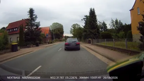
Zeus
Restaurant · Greek · 1.8 km
96 Habichhorster Straße, Stadthagen
Mo-Sa 17:00-22:00, Su 12:00-15:00, 17:00-22:00
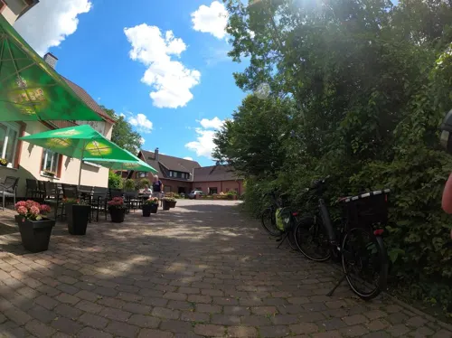


Zum dicken Heinrich
Restaurant · Regional · 5.4 km
11 Am Hülsebrink, Lüdersfeld
Mo-Fr 06:00-15:00, 17:00+; Sa-Su 08:00-24:00
82 more on the map.
History
Count Adolf III of Holstein created a new settlement at the foot of the Bückeberg around 1224. Its site near the Hellweg route testifies to his strategic and commercial wisdom. After the successful clearances of the Dülwald forest around 1224, a new settlement by the name of indago comitis (the count's enclosure - the same name as The Hague) was first recorded in 1244 when it was described as a city and fort. In 1287 the town changed its name to Grevenalveshagen (Count Adolf's enclosure) and it finally acquired its current name of Stadthagen in 1378. Further highlights of the town's early history are the acquisition of the town seal in 1320 and the bestowal of the privileges of a town in 1344.
Around 1400 stone fortifications were erected. The surviving remnants of these include the tower at the Cattle Market, a small tower at the Castle, and sections of the town wall.
From the History section of Stadthagen on Wikipedia, under CC BY-SA 4.0.
Where to stay8
Churches and places of worship25
Evangelisch-Reformierte Kirche Stadthagen
Church · Reformed
35 Klosterstraße, Stadthagen
Shopping36
Gas and EV charging12
Schools, colleges and libraries26
Gemeindebücherei der Samtgemeinde Nienstädt
Library · 4.2 km
1 Bahnhofstraße, Nienstädt
Healthcare12
Map of Stadthagen
250 places. The map loads OpenStreetMap tiles when you open it.
Getting there and nearby towns
Hannover Airport (HAJ) is the nearest airport with scheduled flights listed in OpenStreetMap, 36 km away.
- Obernkirchen 8 km southwest, about 8 min by car
- Bad Nenndorf 12 km east, about 12 min by car
- Rehburg-Loccum 16 km north, about 16 min by car
- Wunstorf 19 km northeast, about 19 min by car
- Wennigsen 26 km east, about 26 min by car
- Vlotho 29 km southwest, about 29 min by car
- Aerzen 31 km south, about 31 min by car
- Ahlem 32 km east, about 32 min by car
- Wettbergen 33 km east, about 33 min by car
- Hannover 36 km east, about 36 min by car
Drive times are estimates from straight-line distance, not routes.
Local news
Headlines from INDB.
Reviews, tips and questions
Loading what members have shared...
Sources and licences
- GeoNames (CC BY 4.0): population, coordinates, regions and time zone
- Mapillary (see each image): photos
- OpenStreetMap contributors (ODbL 1.0): places, airports, map data
- Wikidata (CC0 1.0): elevation, founding date, time zone, website, landmarks and historic places
- Wikimedia Commons (see each image): photos
- Wikipedia (CC BY-SA 4.0): overview and history text
Photo credits
- Stolpersteinlage Stadthagen Marktstraße 3, Gmbo 2013, CC0
- Marktstraße 2, 1, Stadthagen, Landkreis Schaumburg, GeorgDerReisende, CC BY-SA 4.0
- Marktstraße 1, 1, Stadthagen, Landkreis Schaumburg, GeorgDerReisende, CC BY-SA 4.0
- Marktstraße 6, 1, Stadthagen, Landkreis Schaumburg, GeorgDerReisende, CC BY-SA 4.0
- Klosterstraße, 1, Stadthagen, Landkreis Schaumburg, GeorgDerReisende, CC BY-SA 4.0
- Stolperstein Stadthagen Marktstraße 3 Hedwig Steinberg, Gmbo 2013, CC0
- Stolperstein Stadthagen Marktstraße 3 Elias Lion, Gmbo 2013, CC0
- Stolperstein Stadthagen Marktstraße 3 Anna Heimann, Gmbo 2013, CC0
- Stolpersteine Stadthagen Marktstraße 3, Gmbo 2013, CC0
- Markt, 1, Stadthagen, Landkreis Schaumburg, GeorgDerReisende, CC BY-SA 4.0
- Marktplatz (Stadthagen) IMG 1288, losch, CC BY-SA 3.0
- Marktplatz (Stadthagen) IMG 1291, losch, CC BY-SA 3.0
- Brunnen am Marktplatz (Stadthagen) IMG 1284, losch, CC BY-SA 3.0
- Stolpersteinlage Stadthagen Markt 6, Gmbo 2013, CC0
- Durchbruch der Gene, Stadthagen 1, Gerd Fahrenhorst, CC BY 4.0
- Durchbruch der Gene, Stadthagen 3, Gerd Fahrenhorst, CC BY 4.0
- Durchbruch der Gene, Stadthagen 2, Gerd Fahrenhorst, CC BY 4.0
- Stolperstein Stadthagen Markt 8 Ruth Weinberg, Gmbo 2013, CC0
- Stolperstein Stadthagen Markt 8 Rudolf Weinberg, Gmbo 2013, CC0
- Stolperstein Stadthagen Markt 8 Hanna Lilienfeld, Gmbo 2013, CC0
- Stolperstein Stadthagen Markt 8 Paula Lilienfeld, Gmbo 2013, CC0
- Stolpersteine Stadthagen Markt 8, Gmbo 2013, CC0
- Stolperstein Stadthagen Markt 8 Frieda Löhnberg, Gmbo 2013, CC0
- Stolpersteinlage Stadthagen Markt 8, Gmbo 2013, CC0
- Stadthagen Markt, Beckstet, CC BY-SA 3.0
- Stolperstein Stadthagen Markt 6 John Wolf, Gmbo 2013, CC0
- Stolpersteine Stadthagen Markt 6, Gmbo 2013, CC0
- Stolperstein Stadthagen Markt 6 Bertha Wolf, Gmbo 2013, CC0
- Marktplatz (Stadthagen) IMG 1313, losch, CC BY-SA 3.0
- 31655 Stadthagen-Am Markt 4-Brauhaus, Uwe Barghaan, CC BY-SA 4.0
- Figurenbrunnen Stadthagen 2022-07, Gerd Fahrenhorst, CC BY 4.0
- Figurenbrunnen, Marktplatz Stadthagen 2, Gerd Fahrenhorst, CC BY 4.0
- Echternstraße, 3, Stadthagen, Landkreis Schaumburg, GeorgDerReisende, CC BY-SA 4.0
- Echternstraße, 2, Stadthagen, Landkreis Schaumburg, GeorgDerReisende, CC BY-SA 4.0
- Figurenbrunnen, Marktplatz Stadthagen 1, Gerd Fahrenhorst, CC BY 4.0
- Echternstraße 1a, 1, Stadthagen, Landkreis Schaumburg, GeorgDerReisende, CC BY-SA 4.0
- Echternstraße 37, 1, Stadthagen, Landkreis Schaumburg, GeorgDerReisende, CC BY-SA 4.0
- Klosterkirche (Stadthagen) IMG 1270, losch, CC BY-SA 3.0
- Klosterkirche (Stadthagen) IMG 1268, losch, CC BY-SA 3.0
- Querstraße 9, 1, Stadthagen, Landkreis Schaumburg, GeorgDerReisende, CC BY-SA 4.0
- Fürstenmausoleum Stadthagen 01 Auferstehungsmonument 1, Adriaen de Vries (1545/56–1626), CC BY 3.0
- 3-Steinbruch Liekwegen HA 212 Landkreis Schaumburg, Kathy2408, CC BY-SA 4.0
- Altes Rathaus (Stadthagen) IMG 1286, losch, CC BY-SA 3.0
- Aerial image of Schloss Stadthagen (view from the southeast), Carsten Steger, CC BY-SA 4.0
- Ratsgymnasium Stadthagen, Stefan Flöper, CC BY-SA 4.0
- St.-Johannis-Kapelle Stadthagen, Stefan Flöper, CC BY-SA 4.0
- Stadthagen StMartini v W, Beckstet, CC BY-SA 3.0
- Landsbergscher Hof, Gilzum, CC0
- Ehemalige Synagoge Stadthagen 02, Didi43, CC BY-SA 4.0
- Aerial image of Stadtgarten Stadthagen (view from the south), Carsten Steger, CC BY-SA 4.0
- Klosterkirche (Stadthagen) IMG 1280, losch, CC BY-SA 3.0
- Museum Amtspforte 02, Didi43, CC BY-SA 4.0
- Heuerßen Kirche St. Jürgen 2009-08-19, Harti (der von Party2hearty), Public domain
- Kirche in Lauenhagen Ansicht von Norden, Kiwi05, CC BY-SA 4.0
- Kirche in Seggebruch, Matten77777, CC BY-SA 3.0
- Suelbeck SHG Kirche, Nisporeivol, CC BY-SA 4.0
- Kirche in Pollhagen, Kiwi05, CC BY-SA 4.0
- Die Weserrenaissance (Sonnen) - 004 - Stadthagen, Amtspforte, Max Sonnen, Public domain
- Stolperstein Stadthagen Bahnhofstraße 15 Alfred Katz, Gmbo 2013, CC0
- Rittergut Remeringhausen Eingang Wassergraben, Nifoto, CC BY-SA 4.0
- Street-level photo, kphklaus, CC BY-SA 4.0
- Street-level photo, thx, CC BY-SA 4.0
- Street-level photo, thx, CC BY-SA 4.0
- Street-level photo, thx, CC BY-SA 4.0
- Street-level photo, Schmarvis, CC BY-SA 4.0
- Street-level photo, xanu, CC BY-SA 4.0
- Street-level photo, derlipper, CC BY-SA 4.0
- Street-level photo, Langfahrer, CC BY-SA 4.0
- Street-level photo, Hightower-, CC BY-SA 4.0
- Street-level photo, thx, CC BY-SA 4.0
- Street-level photo, thx, CC BY-SA 4.0
- Street-level photo, thx, CC BY-SA 4.0
- Street-level photo, hotteliene, CC BY-SA 4.0
- Street-level photo, aceini, CC BY-SA 4.0
- Street-level photo, xanu, CC BY-SA 4.0
- Street-level photo, Schmarvis, CC BY-SA 4.0
- Street-level photo, xanu, CC BY-SA 4.0
- Street-level photo, Schmarvis, CC BY-SA 4.0
- Street-level photo, Langfahrer, CC BY-SA 4.0
- Street-level photo, Schmarvis, CC BY-SA 4.0
- Street-level photo, xanu, CC BY-SA 4.0
- Street-level photo, Langfahrer, CC BY-SA 4.0
- Street-level photo, stefanro74, CC BY-SA 4.0


Page built November 8, 2026. Spotted a mistake? Tell us or suggest a place.