


Why visit Strausberg
Townapedia lists 32 museums and landmarks, 16 parks and trails, 78 places to eat, 14 places to stay and 12 attractions in and around town.
Highlights include Hofladen, "Die Andere Welt Bühne" (ehemaliges "Wasserwerk" auf dem "Alten Postgelände"), Bunker Garzau and Stadtmuseum Strausberg.
Weather in Strausberg
Forecast from MET Norway (CC BY 4.0). Full forecast
About Strausberg
Strausberg (German: [ˈʃtʁaʊsˌbɛʁk] ) is a town in Brandenburg, in eastern Germany, located 30 km (19 mi) east of Berlin. With a population of about 27,000 it is the largest town in the district of Märkisch-Oderland.
From the Wikipedia article Strausberg (this version), under CC BY-SA 4.0.
Things to do12

Hofladen
Farm and orchard · 6.2 km
1 Dorfstraße, Altlandsberg
Jan-Mar: Mo-Sa 08:00-16:00; Apr-Oct: Mo-Sa 08:00-17:00, Su...

"Die Andere Welt Bühne" (ehemaliges "Wasserwerk" auf dem "Alten Postgelände")
Cinema and theater · 4.0 km



Museums and landmarks32


Stadtmuseum Strausberg
Museum · 1.0 km
33 August-Bebel-Straße, Strausberg
May-Sep: Tu-Fr 10:00-16:00; Sa-Su 10:00-15:00; Oct-Apr: Tu-Sa 10:00-15:00


Schloss Garzau
Monument and historic site · 6.2 km
91 Alte Heerstraße, Garzau-Garzin

Revolutionärer Matrose
Monument and historic site
Denkmal für den Kieler Matrosenaufstand 1918 von Hans Kies. Die Bronzeskulptur ist der Zweitguss des Matrosen von 1960 im Volkspark...


Westlicher Oberleitungsmast der Strausseefähre
Monument and historic site · 0.9 km
20 more on the map.
Parks, trails and playgrounds16

Strausbad
Sports field and stadium · 0.7 km
30a Wriezener Straße, Strausberg
Mo 13:30-15:00,19:00-21:00; We 16:00-21:00; Th 19:00-21:00; Fr...

Strandbad Bötzsee
Sports field and stadium · 4.5 km
Altlandsberger Chaussee, Eggersdorf
Mo-Su 10:00-20:00




4 more on the map.
Restaurants and cafes78
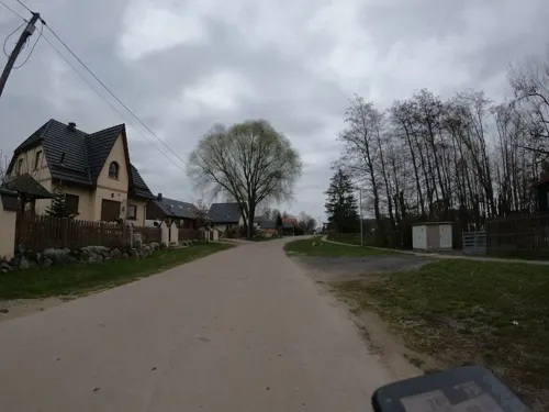
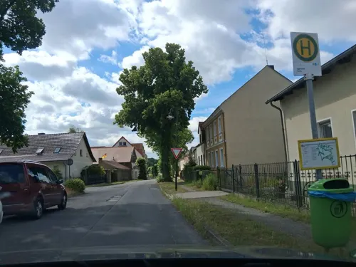


Gasthof Strausberg Nord
Restaurant · Regional · 2.0 km
8a Prötzeler Chaussee, Strausberg
Mo-Fr 07:00-22:00; Sa-Su 08:00-22:00
Hami Cuisine
Restaurant · Asian · 5.9 km
93 Am Försterweg, Strausberg
Mo-Sa 11:00-21:00; PH 12:00-20:00; Su 12:00-20:00
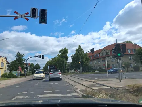
Landhaus am See
Restaurant · Bavarian · 0.7 km
1 Fichteplatz, Strausberg
Mo,We,Th,Fr,Sa 12:00-21:00; Su 12:00-20:00
Pizza Swat
Restaurant · Pizza, Burger, Pasta, Salad · 5.7 km
29 Albin-Köbis-Ring, Strausberg
11:30-21:00
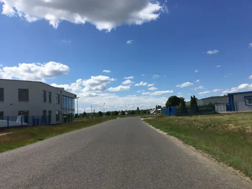
Restaurant Doppeldecker
Restaurant · Regional, German, Burger, Fish, Steak, Sandwich · 2.1 km
H11 Flugplatzstraße F1, Strausberg
Tu-Su 12:00-21:00; Mo off
Trattoria Casa Romana
Restaurant · Italian, Pizza, Pasta, Fish, Bar And Grill · 4.6 km
20 Altlandsberger Chaussee, Petershagen/Eggersdorf
PH,Mo-Su 11:00-22:00


Zum alten Steuerhaus
Restaurant · German · 3.4 km
19 Hohensteiner Chaussee, Strausberg
PH,Tu-Su 10:00-22:00
66 more on the map.
History
Strausberg was founded circa 1240, and in 1333 its first town hall was built. From 1373 to 1415, it was part of the Bohemian Crown. Today, a historic defensive wall borders the old town. In the 19th century, industrialization took place and the town developed a local labour movement, including union structures and a local branch of both the Social Democratic and the Communist Party of Germany.
In World War II Strausberg housed a switching centre for teleprinter links encrypted by the Lorenz cipher from Hitler and the High Command to various Army Group commanders (see Fish (cryptography)). During the war, men and women from the German-occupied Netherlands, Poland, Italy and the Soviet Union were brought to the town to perform forced labour since 1941, and a women's subcamp of the Sachsenhausen concentration camp was established in 1944. In early 1945, a death march of prisoners of various nationalities from the dissolved camp in Żabikowo to Sachsenhausen passed through the town.
After 1945, the town became part of East Germany and the seat of its Ministry of National Defence. Strausberg was the administrative seat of the Strausberg district until a 1993 merger with Bad Freienwalde and Seelow formed "Märkisch-Oderland", with Seelow becoming the new administrative seat of the district. It is where the German Army Command is located.
From the History section of Strausberg on Wikipedia, under CC BY-SA 4.0.
Where to stay14
Seehotel Villago
Motel and hotel · Mediterranean · 4.4 km
89 Altlandsberger Chaussee, Petershagen/Eggersdorf
Hotel Seeschloss am Bötzsee
Motel and hotel · 4.5 km
102 Altlandsberger Chaussee, Petershagen-Eggersdorf
Gasthof Strausberg Nord Gästehaus
Motel and hotel · 1.9 km
2 Am Biotop, Strausberg
Churches and places of worship11
Dorfkirche Wilkendorf
Church · Protestant · 3.9 km
13 Prötzeler Straße, Altlandsberg
Shopping26
Gas and EV charging9
Flüssiggasvertrieb Klhaus
Gas station · 4.7 km
12 Gladowshöher Schillerweg, Strausberg
Schools, colleges and libraries19
Fachinformationsstelle Strausberg
Library · 2.6 km
20 Prötzeler Chaussee, Strausberg
Healthcare18
Map of Strausberg
235 places. The map loads OpenStreetMap tiles when you open it.
Getting there and nearby towns
Berlin Brandenburg Airport "Willy Brandt" (BER) is the nearest airport with scheduled flights listed in OpenStreetMap, 35 km away.
- Rehfelde 5 km south, about 5 min by car
- Petershagen 9 km southwest, about 9 min by car
- Zeuthen 31 km southwest, about 31 min by car
- Berlin 33 km west, about 33 min by car
- Wandlitz 34 km northwest, about 34 min by car
- Zossen 50 km southwest, about 50 min by car
- Velten 49 km west, about 49 min by car
- Zehdenick 58 km northwest, about 58 min by car
- Potsdam 59 km west, about 59 min by car
- Templin 65 km northwest, about 1 h by car
Drive times are estimates from straight-line distance, not routes.
Local news
Headlines from INDB.
Reviews, tips and questions
Loading what members have shared...
Sources and licences
- GeoNames (CC BY 4.0): population, coordinates, regions and time zone
- Mapillary (see each image): photos
- OpenStreetMap contributors (ODbL 1.0): places, airports, map data
- Wikidata (CC0 1.0): elevation, founding date, time zone, website
- Wikimedia Commons (see each image): photos
- Wikipedia (CC BY-SA 4.0): overview and history text
Photo credits
- 20150405 xl 3642-Strausberg--Der Rote Matrose--Roter Matrose--Hans Kies--Bronze, Molgreen, CC BY-SA 4.0
- 20231024 xl 1701-Strausberg Stadt, Molgreen, CC BY-SA 4.0
- 20230318 xl 161545518-Angoraziegenbock (Gerhard Rommel, 1985), Strausberg, Ecke An der Stadtmauer-Müncheberger Straße, Molgreen, CC BY-SA 4.0
- 20230318 xl 161510093-Angoraziegenbock (Gerhard Rommel, 1985), Strausberg, Ecke An der Stadtmauer-Müncheberger Straße, Molgreen, CC BY-SA 4.0
- Strausberg - Steinbockskulptur (Mountain Goat Sculpture) - geo.hlipp.de - 29618, Colin Smith on geo.hlipp.de, CC BY-SA 2.0
- Skulptur Müncheberger Str An der Stadtmauer (Strausberg) Angoraziegenbock&Gerhard Rommel&19852, OTFW , Berlin, CC BY-SA 3.0
- Skulptur Müncheberger Str An der Stadtmauer (Strausberg) Angoraziegenbock&Gerhard Rommel&1985, OTFW , Berlin, CC BY-SA 3.0
- Skulptur Müncheberger Str An der Stadtmauer (Strausberg) Angoraziegenbock&Gerhard Rommel&19854, OTFW , Berlin, CC BY-SA 3.0
- Skulptur Müncheberger Str An der Stadtmauer (Strausberg) Angoraziegenbock&Gerhard Rommel&19855, OTFW , Berlin, CC BY-SA 3.0
- Skulptur Müncheberger Str An der Stadtmauer (Strausberg) Angoraziegenbock&Gerhard Rommel&19853, OTFW , Berlin, CC BY-SA 3.0
- 20150405 xl 3626-Strausberg--Steinbock-Skulptur, Molgreen, CC BY-SA 4.0
- Strausberg - Bahnuebergang (Level Crossing) - geo.hlipp.de - 29617, Colin Smith on geo.hlipp.de, CC BY-SA 2.0
- 20241005 xl 1134-Gedenktafel ehemalige für jüdische Synagoge Strausberg (1817 - 9. November 1938), Molgreen, CC BY-SA 4.0
- 20230622 xl 1606, Parkplatz für Lastenräder, S-Bahnhof Strausberg Stadt, Molgreen, CC BY-SA 4.0
- 20230318 xl 161342366-Plastik Wildschwein, Strausberg, Straße An der Stadtmauer, Molgreen, CC BY-SA 4.0
- 20241005 xl 1134-Gedenktafel ehemalige für jüdische Synagoge Strausberg (1817 - 9. November 1938) 2, Molgreen, CC BY-SA 4.0
- Skulptur An der Stadtmauer (Strausberg) Wildsau&Peter Fritzsche&19824, OTFW , Berlin, CC BY-SA 3.0
- Skulptur An der Stadtmauer (Strausberg) Wildsau&Peter Fritzsche&1982, OTFW , Berlin, CC BY-SA 3.0
- Skulptur An der Stadtmauer (Strausberg) Wildsau&Peter Fritzsche&19823, OTFW , Berlin, CC BY-SA 3.0
- Skulptur An der Stadtmauer (Strausberg) Wildsau&Peter Fritzsche&19822, OTFW , Berlin, CC BY-SA 3.0
- 20230318 xl 161705706-Plastik Wildschwein, Strausberg, Straße An der Stadtmauer, Molgreen, CC BY-SA 4.0
- Wandmalerei Müncheberger Str 29 (Strausberg) Mural&Idealarts&2, OTFW , Berlin, CC BY-SA 3.0
- Wandmalerei Müncheberger Str 29 (Strausberg) Mural&Idealarts&, OTFW , Berlin, CC BY-SA 3.0
- Strausberg Stadt Bahnhof, Lukas Beck, CC BY-SA 4.0
- Bahnhof Strausberg Stadt, Lukas Beck, CC BY-SA 4.0
- Strausberg - Muencheberger Strasse - geo.hlipp.de - 29620, Colin Smith on geo.hlipp.de, CC BY-SA 2.0
- 20230318 xl 162008381-Alter Mühlstein, Am Mühlenberg, Strausberg, Molgreen, CC BY-SA 4.0
- 20240401 xl 1136-Revolutionärer Matrose (Strausberg) 10, Molgreen, CC BY-SA 4.0
- 20240401 xl 1136-Revolutionärer Matrose (Strausberg) 5, Molgreen, CC BY-SA 4.0
- Garzin1, RonnyKrüger, CC0
- Im Handelscentrum 2, Auto1234, CC BY-SA 3.0
- Schloss Wilkendorf 2, Picture taken by Marcus Cyron, CC BY-SA 3.0
- Strausberg Pfarrkirche St. Marien, Kvikk, CC BY-SA 3.0
- Dorfkirche Garzau Südansicht, Assenmacher, CC BY-SA 4.0
- Pyramide Garzau, Nizarras, CC BY-SA 3.0
- Strausberg St. Josef Nordwestansicht, Assenmacher, CC BY-SA 4.0
- 20231227 xl 1155-Roll-Berge, Molgreen, CC BY-SA 4.0
- Dorfkirche Eggersdorf 10, Marcus Cyron, CC BY-SA 3.0
- Gielsdorf church, Doris Antony , Berlin, CC BY-SA 3.0
- Dorfkirche Buchholz Südostansicht, Assenmacher, CC BY-SA 4.0
- Dorfkirche Hohenstein Südostansicht, Assenmacher, CC BY-SA 4.0
- Dorfkirche in Wilkendorf, Exprimidor, CC BY-SA 4.0
- Westlicher Mast Strausseefaehre06072023 2, Zonk43, CC BY-SA 3.0
- 20240728 xl 1357-Gedenkstele Hans-Georg Jakobson, Molgreen, CC BY-SA 4.0
- 20260804 xl 1304-Nachsorgeklinik am Straussee, Jenseits des Sees, Strausberg, Molgreen, CC BY-SA 3.0
- 20241007 xl 1316-Die Andere Welt Bühne - Theater in Strausberg, Schmorpost, Molgreen, CC BY-SA 4.0
- Heimatmuseum Strausberg, Molgreen, CC BY-SA 4.0
- Friedrich Wilhelm Carl von Schmettau-Pyramide, Enrico Mevius, Public domain
- Schloss Garzau, Enrico Mevius, CC BY 3.0
- 20260827 xl 1504-ehemaliger Jüdischer Friedhof in Strausberg (58834), Molgreen, CC BY-SA 3.0
- Glazeroff stolperstein, The.unexpected.bob, CC BY-SA 4.0
- 20220727 xl 153231380 Strausberg, Schwimmhalle Restaurant Blaue Lagune, Molgreen, CC BY-SA 4.0
- 202406014 xl 0610-Spielplatz altes Postgelände, Molgreen, CC BY-SA 4.0
- 202405138 xl 1204-Gasthof Strausberg Nord, Molgreen, CC BY-SA 4.0
- Steuerhaus, Molgreen, CC BY-SA 4.0
- Landgasthof Zum Mühlenteich, Molgreen, CC BY-SA 4.0
- Seehotel Villago, Molgreen, CC BY-SA 4.0
- 20260526 xl 0741-Hotel Seeschloss am Bötzsee, Molgreen, CC BY-SA 3.0
- Kirche in Garzau IMG 0651-be, Enrico Mevius, Public domain
- Wesendahl church 2016 S, Hans G. Oberlack, CC BY-SA 4.0
- 20231126 xl 1252-Aldi Nord in Strausberg Nord 2, Molgreen, CC BY-SA 4.0
- Einkaufszentrum in Strausberg Hegermühle, Molgreen, CC BY-SA 4.0
- 20220724 xl 154702063 jc Strausberg, Berliner Straße 69, Tankstelle ELAN und Autoservice pit stop, Molgreen, CC BY-SA 4.0
- 20220717 xl 134443189-Tankstelle-Waschanlage-Strausberg-Hegermühle, Molgreen, CC BY-SA 4.0
- Bibliothek Petershagen-Eggersdorf, Molgreen, CC BY-SA 4.0
- 20160821 xl P1060692-Theodor-Fontane-Gymnasium Strausberg.WMC, Molgreen, CC BY-SA 4.0
- Street-level photo, atpl_pilot, CC BY-SA 4.0
- Street-level photo, kartonage, CC BY-SA 4.0
- Street-level photo, DBSEV_SBB, CC BY-SA 4.0
- Street-level photo, carlheinz, CC BY-SA 4.0
- Street-level photo, carlheinz, CC BY-SA 4.0
- Street-level photo, DBSEV_SBB, CC BY-SA 4.0
- Street-level photo, stefanhrt, CC BY-SA 4.0
- Street-level photo, atpl_pilot, CC BY-SA 4.0
- Street-level photo, kartonage, CC BY-SA 4.0
- Street-level photo, dsmm, CC BY-SA 4.0
- Street-level photo, stefanhrt, CC BY-SA 4.0
- Street-level photo, carlheinz, CC BY-SA 4.0
- Street-level photo, stefanhrt, CC BY-SA 4.0
- Street-level photo, DBSEV_SBB, CC BY-SA 4.0
- Street-level photo, armarian, CC BY-SA 4.0
- Street-level photo, DBSEV_SBB, CC BY-SA 4.0


Page built November 8, 2026. Spotted a mistake? Tell us or suggest a place.