


Why visit Wernigerode
Townapedia lists 151 museums and landmarks, 26 parks and trails, 136 places to eat, 56 places to stay and 85 attractions in and around town.
Highlights include Volkslichtspiele Wernigerode, Baumann's Cave, Luftfahrtmuseum Wernigerode and Schiefes Haus.
Weather in Wernigerode
Forecast from MET Norway (CC BY 4.0). Full forecast
About Wernigerode
Wernigerode (German pronunciation: [ˌvɛɐnɪɡəˈʁoːdə] ) is a town in the Harz district of the German state of Saxony-Anhalt. Until 2007, it was the capital of the District of Wernigerode. Its population was 32,181 in 2020.
From the Wikipedia article Wernigerode (this version), under CC BY-SA 4.0.
Travel tips from other travellers: Wernigerode on Wikivoyage (CC BY-SA 4.0).
Photos of Wernigerode


Things to do85

Volkslichtspiele Wernigerode
Cinema and theater · 0.6 km
1 Salzbergstraße, Wernigerode
"Abhängig vom Programmplan. Montags geschlossen."

Baumann's Cave
Cinema and theater · 10.0 km
Cave in Rübeland, Oberharz am Brocken, Saxony-Anhalt, Germany

Kaiser Tower
Monument and historic site · 2.2 km
Observation tower near Wernigerode


Wilhelm Raabe Tower
Monument and historic site · 11.2 km
Observation tower near Blankenburg in Harz



Hermann's Cave
Monument and historic site · 10.1 km
Show cave in Germany
73 more on the map.
Museums and landmarks151


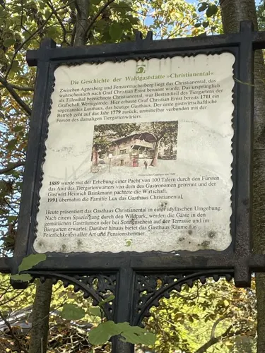

Brockenhaus
Museum · 12.1 km
Building at the summit of Brocken, Germany


form gestaltung in der ddr
Museum · 0.8 km
Kleine private Überblicksausstellung zum Thema "form gestaltung in der ddr". Gut gestaltete und serienmäßig produzierte...
2a Gießerweg, Wernigerode
Sa-Su 10:00-14:00
Museumshof "Ernst Koch" Silstedt
Museum · 5.2 km
4A Am Plan, Wernigerode
Th 14:00-17:00; Sa 10:00-12:00
139 more on the map.
Parks, trails and playgrounds26

Bürgerpark Wernigerode
Park · 1.1 km
27 Dornbergsweg, Wernigerode
Apr,Oct: 09:00-18:00; May-Sep: 09:00-19:00

Miniaturenpark Kleiner Harz
Park · 0.9 km
Miniature park in in Germany

Ziegenberg bei Heimburg
Park · 7.4 km
Nature reserve in Sachsen-Anhalt, Germany



Karls PopUp Festival
Sports field and stadium · 2.5 km
Der Eintritt ist frei. Einige Attraktionen sind kostenpflichtig.
09:00-20:00


14 more on the map.
Restaurants and cafes136

La Collina
Restaurant · Italian · 0.8 km
15 Burgberg, Wernigerode
Tu-Su 11:30-14:00; Tu-Su 17:30-22:00


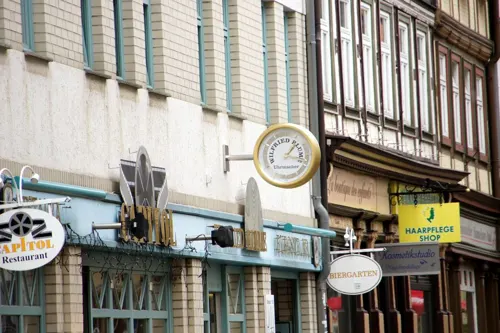

Harburg
Restaurant · Regional · 2.1 km
Fr-Su,PH 11:00-17:00; Mo-Th closed

Cafe Wien
Cafe
4 Breite Straße, Wernigerode
Mo-Sa 09:00-18:00; Su 10:00-18:00

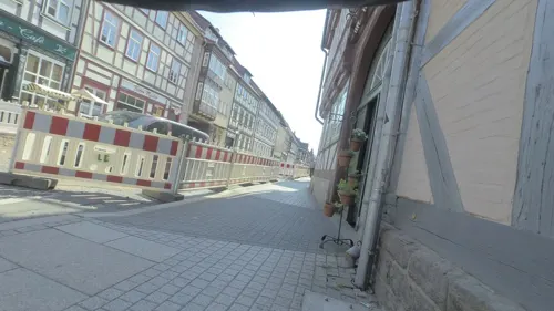
Schnitzelhaus
Restaurant · German · 0.7 km
97 Breite Straße, Wernigerode
Mo-Sa 12:00-15:00,16:30-21:30; Su off
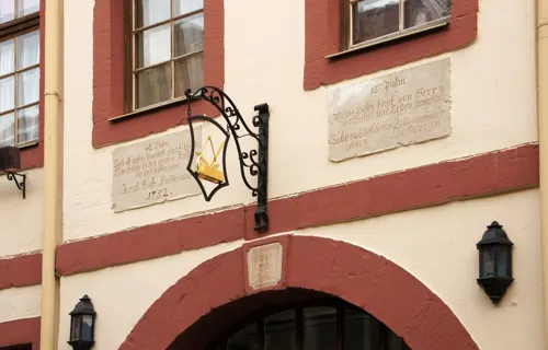
Casa Vita
Restaurant · Mediterranean, Noodle, Pizza, Steak House · 0.6 km
36 Marktstraße, Wernigerode
Tu-Su 17:00-22:00

Altwernigeröder Kartoffelhaus
Restaurant · German
Typische Harzer Nationalgerichte
14 Marktstraße, Wernigerode
Mo-Su, PH 11:00-14:30, 17:00-20:00, 17:00-00:00
Gasthaus & Pension „Zur Waldschänke“
Restaurant · 4.8 km
Pension, Cafe, Restaurant, Sauna-Landschaft
6 Tänntalstraße, Drübeck/Harz
Th 17:00-22:00; Fr 12:00-22:00; Sa11:00-22:00; Su 11:00-18:00;...

124 more on the map.
History
Wernigerode was the capital of the medieval County of Wernigerode and Stolberg-Wernigerode. In 1815, after the Napoleonic Wars, it became part of the Prussian Province of Saxony. The Hasseröder brewery was founded in Wernigerode in 1872.
After World War II, Wernigerode was included in the new state Saxony-Anhalt within the Soviet occupation zone (relaunched in October 1949 as the German Democratic Republic/East Germany). During the Communist years, the town was very close to the inner German border. Wernigerode became part of the restored state of Saxony-Anhalt in 1990 after German reunification.
There are no written sources confirming exactly when the town was established. According to the latest research – for example, by Eduard Jacobs and Walther Grosse – there were no early relations with the Abbey at Corvey (Weser) and the abbot there, Warin, instead the town name suggests it was a protected clearance settlement.
The first area to be settle was the Klint, where there was a lowland castle, the so-called Schnakenburg. In 1805 the ruins of this castle site were demolished. The only part remaining is Haus Gadenstedt at Oberpfarrkirchhof 12 which dates to the year 1582. At the time of the first settlelement there was still ancient forest, typical of the Harz, on the heights of the Klint, which had first to be cleared, hence the suffix rode in the town name which means 'clearing'.
Read more of the history
The town was first mentioned in the records in 1121 in connection with Count Adalbert of Haimar who had moved here from the region near Hildesheim and henceforth was titled the Count of Wernigerode. On 17 April 1229 the settlement was granted town rights along the lines of that for Goslar. In 2004 Wernigerode celebrated the 775th anniversary of that occasion.
As a result of the immigration of new townsfolk from the surrounding villages a new settlement, later called Neustadt, grew up on the northeastern edge of the old town. It was a farming settlement that lay outside the walls of the old town. St. John's Church was built as the parish church of Wernigerode's Neustadt in the last third of the 13th century in the Romanesque style.
The counts of Wernigerode, who can be traced back to the early 12th century, were successively vassals of the margraves of Brandenburg (1268), and the archbishops of Magdeburg (1381). On the extinction of the family in 1429 the county fell to the counts of Stolberg, who founded the Stolberg-Wernigerode branch in 1645. The latter surrendered its military and fiscal independence to Prussia in 1714, but retained some of its sovereign rights till 1876. The counts were raised to princely rank in 1890.
Ulrich von Fresenius (1 September 1888; died 12 November 1962), 10 January 1933 to 20 April 1945
From the History section of Wernigerode on Wikipedia, under CC BY-SA 4.0.
More about Wernigerode
Geography
The town lies at about 250 metres (820 ft) above sea level (NN) on the northeastern flank of the Harz Mountains in central Germany, at the foot of their highest peak, the Brocken, on the B 6 and B 244 federal highways and on the railway line from Halberstadt to Vienenburg that links the cities of Halle (Saale) and Hanover.
The River Holtemme flows through the town and, not far from its western gate, it is joined by the Zillierbach stream, which is also known as the Flutrenne near its mouth. North of the town the Barrenbach flows through several ponds and empties into the Holtemme in the village of Minsleben. The historic town centre consists of an old town and a new town (Altstadt and Neustadt). The town's borough includes Hasserode, Nöschenrode, the residential estates of Stadtfeld, Burgbreite and Harzblick as well as the villages of Benzingerode, Minsleben, Silstedt, Schierke and Reddeber.
The borough measures 9.5 kilometres (5.9 mi) from west to east and 6 kilometres (3.7 mi) from north to south. Its highest point is the Brocken, at 1,141 metres (3,743 ft) above NN, and its lowest is at 215 metres (705 ft).
The town lies on the German-Dutch holiday road known as the Orange Route.
Arts and culture
Wernigerode is the home of the choir Rundfunk-Jugendchor Wernigerode.
Steinerne and Kleine Renne, and the nearby well of Wernigeröder Bürgerbrunnen
From the Wikipedia article Wernigerode, under CC BY-SA 4.0.
Notable people from Wernigerode
 Martin Heinrich KlaprothGerman chemist (1743-1817)Photo: Unknown author, Public domain
 Nils PetersenGerman association football playerPhoto: Granada, CC BY-SA 4.0
 Paul RennerGerman type designer (1878–1959)Photo: Eduard Wasow (1890-1942), Public domain
 Christopher GrotheerGerman skeleton racerPhoto: Sandro Halank , Wikimedia Commons, CC BY-SA 4.0
 Guido FulstGerman cyclistPhoto: Nicola at German Wikipedia, CC BY-SA 3.0
 Monika Wulf-MathiesGerman politicianPhoto: Mitbestimmer, CC BY-SA 4.0
 Christian Gottlieb KratzensteinGerman physicistPhoto: Copper etching by P. Haas after..., CC BY-SA 4.0
 Henry of Stolberg-WernigerodeRuling Count of the County of Wernigerode (1772-1854)Photo: Artist unknown, upload by User:Karsten11, Public domain
- Wilhelm BittrichGerman general (1894-1979
- Henry Ernest of Stolberg-WernigerodeGerman politician, canon, provost and author of numerous hymns (1716-1778)
- Count Christian Frederich I, Count of Stolberg-Wernigeroderuler of the County of Wernigerode
- Hans Boeckh-BehrensGerman general and Knight's Cross recipients (1898–1955)
Born in Wernigerode, according to Wikidata (CC0). Each name links to its Wikipedia article.
Where to stay56
Churches and places of worship19
St. Stephanus u. St. Laurentius
Church · Lutheran · 3.8 km
Zum Lerchenberg, Wernigerode
Shopping50
Gas and EV charging14
M1 Wernigerode
Gas station · 2.6 km
36 Martin-Heinrich-Klaproth-Straße, Wernigerode
Schools, colleges and libraries24
Harz University of Applied Sciences (Wernigerode campus)
School · 1.8 km
57-59 Friedrichstraße, Wernigerode
Healthcare14
Map of Wernigerode
250 places. The map loads OpenStreetMap tiles when you open it.
Getting there and nearby towns
Magdeburg-Cochstedt Airport (CSO) is the nearest airport with scheduled flights listed in OpenStreetMap, 44 km away.
- Blankenburg 13 km southeast, about 13 min by car
- Bad Harzburg 16 km west, about 16 min by car
- Braunlage 17 km southwest, about 17 min by car
- Halberstadt 20 km east, about 20 min by car
- Vienenburg 20 km northwest, about 20 min by car
- Thale 20 km southeast, about 20 min by car
- Sankt Andreasberg 23 km southwest, about 23 min by car
- Goslar 25 km west, about 25 min by car
- Quedlinburg 26 km east, about 26 min by car
- Schladen 27 km northwest, about 27 min by car
Drive times are estimates from straight-line distance, not routes.
Towns near Wernigerode


Keep exploring
Local news
Headlines from INDB.
Reviews, tips and questions
Loading what members have shared...
Sources and licences
- GeoNames (CC BY 4.0): population, coordinates, regions and time zone
- Mapillary (see each image): photos
- OpenStreetMap contributors (ODbL 1.0): places, airports, map data
- Wikidata (CC0 1.0): elevation, founding date, time zone, website, landmarks and historic places
- Wikimedia Commons (see each image): photos
- Wikipedia (CC BY-SA 4.0): overview and history text
Photo credits
- Wernigerode am Harz, FrankBothe, CC BY-SA 4.0
- Unter den Zindeln (Wernigerode) Sägewerk, Migebert, CC BY-SA 4.0
- Dampflokwerkstatt HSB Wernigerode 2023, Migebert, CC BY-SA 4.0
- Heltauer Platz 1 (Wernigerode), Migebert, CC BY-SA 4.0
- Logenhaus (Wernigerode), Migebert, CC BY-SA 4.0
- Infotafel Logenhaus (Wernigerode), Migebert, CC BY-SA 4.0
- Adolph-Diesterweg-Schule (Wernigerode), Migebert, CC BY-SA 4.0
- Unter den Zindeln 11 (Wernigerode) Müntzer, Migebert, CC BY-SA 4.0
- Adolph-Diesterweg-Schule Wernigerode 2022-05-11 2, Z thomas, CC BY-SA 4.0
- Adolph-Diesterweg-Schule Wernigerode 2022-05-11 3, Z thomas, CC BY-SA 4.0
- Adolph-Diesterweg-Schule Wernigerode 2022-05-11 1, Z thomas, CC BY-SA 4.0
- Adolph-Diesterweg-Schule Wernigerode 2022-05-11 4, Z thomas, CC BY-SA 4.0
- Wilhelm-Raabe-Schule (Wernigerode), Migebert, CC BY-SA 4.0
- Portal Wilhelm-Raabe-Schule (Wernigerode), Migebert, CC BY-SA 4.0
- Denkmal vor der Raabe-Schule am Heltauer Platz (Wernigerode), Migebert, CC BY-SA 4.0
- Diesterwegschule Wernigerode 2022-05-11, Z thomas, CC BY-SA 4.0
- Bahnhofstraße 20-26 (Wernigerode), Migebert, CC BY-SA 4.0
- Sonnenuhr adolph Diesterweg Schule Wernigerode 2022-05-17 1, Z thomas, CC BY-SA 4.0
- Adolph Diesterweg Schule Wernigerode 2022-05-17 2, Z thomas, CC BY-SA 4.0
- Adolph Diesterweg Schule Wernigerode 2022-05-17 1, Z thomas, CC BY-SA 4.0
- Sonnenuhr adolph Diesterweg Schule Wernigerode 2022-05-17 2, Z thomas, CC BY-SA 4.0
- Unter den Zindeln 11 (Wernigerode) Müntzer-Schule, Migebert, CC BY-SA 4.0
- Sonnenuhr adolph Diesterweg Schule Wernigerode 2022-05-17 3, Z thomas, CC BY-SA 4.0
- Pfarrstraße 56 (Wernigerode), Migebert, CC BY-SA 4.0
- Pfarrstraße (Wernigerode) Straßenstein, Migebert, CC BY-SA 4.0
- Pfarrstraße 56 (Wernigerode) Villa, Migebert, CC BY-SA 4.0
- Klares Loch (Wernigerode) Forelle, Migebert, CC BY-SA 4.0
- Walpurgisnacht, 1990. Wernigerode, DDR Sludgeulper 3292983821 aaed11e5a5 o, Sludge G., CC BY-SA 2.0
- Hinterstraße 2 Wernigerode 2022-05-11, Z thomas, CC BY-SA 4.0
- Klares Loch Wernigerode 2022-05-13, Z thomas, CC BY-SA 4.0
- Zaun Diesterweg Schule Wernigerode 2022-05-17, Z thomas, CC BY-SA 4.0
- Klares Loch (Wernigerode) Treppe, Migebert, CC BY-SA 4.0
- Baumannshoehle, Benutzer:Hejkal, CC BY-SA 2.0 de
- WR-Kaiserturm, Benutzer:Hejkal, CC BY-SA 3.0
- Kleine Renne, Benutzer:Hejkal, CC BY-SA 3.0 de
- KoenigshuetteWasserfall, Kassandro, CC BY-SA 3.0
- Steinerne Renne 2014, Dampftrain, CC BY-SA 3.0
- Wilhelm-raabe-warte-hinten, www.total-reality.de, CC BY 3.0
- 080 Brockenhaus - Harz, W. Bulach, CC BY-SA 4.0
- Bürgerpark Wernigerode, Miniaturenpark 01, Migebert, CC BY-SA 3.0
- Struvenberg - Naturschutzgebiet Ziegenberg, ArtMechanic, CC BY-SA 3.0
- CampusWernigerode, Hochschule Harz (FH), CC BY-SA 3.0
- 00 3286 Schloss Wernigerode (Harz), W. Bulach, CC BY-SA 4.0
- Kloster Drübeck 2009, Benutzer:Hejkal, CC BY-SA 3.0 de
- Christuskirche Hasserode, Olaf Meister, CC BY-SA 3.0
- Sankt-Katharina-Kirche Altenrode, Olaf Meister, CC BY-SA 3.0
- Sankt-Bartholomäus-Kirche Drübeck, Olaf Meister, CC BY-SA 3.0
- Blick auf den Peterstein 01, Valundriel, CC BY-SA 4.0
- Kanzleistraße 4 (Wernigerode) Fürstin-Anna-Lyzeum, Migebert, CC BY-SA 4.0
- Wernigerode später Frühling im Lustgartens von Wernigerode im Harz Foto 2005 Wolfgang Pehlemann Wiesbaden PICT0037, Wolfgang Pehlemann Wiesbaden Germany, CC BY-SA 3.0 de
- Transall-Luftfahrtmuseum Wernigerode, Major18, CC0
- Laurentiuskirche Darlingerode, Olaf Meister, CC BY-SA 3.0
- Minsleben St. Margarethakerk, RomkeHoekstra, CC BY-SA 3.0
- Nsg stollensystem büchenberg 2022-05-16 27, Z thomas, CC BY-SA 4.0
- Wernigerode Kirche kath, Kirchenfan, CC0
- Wernigerode St. Sylvestrikirche, Hajotthu, CC BY-SA 3.0
- WR Harzmuseum, Lutz Hartmann ( Luha at German Wikipedia ), CC BY-SA 3.0
- Blick zum Agnesberg vom Bürgerpark, Migebert, CC BY-SA 3.0
- 3968 Wernigerode - Cafe Wien, W. Bulach, CC BY-SA 4.0
- Postamt Wernigerode, Olaf Meister, CC BY-SA 4.0
- Wernigerode (2013-06-05), by Klugschnacker in Wikipedia (17), Klugschnacker, CC BY-SA 3.0
- Breite Straße 17 (Wernigerode), Migebert, CC BY-SA 4.0
- Breite Straße 47 (Wernigerode), Migebert, CC BY-SA 4.0
- Marktstraße 10 (Wernigerode), Olaf Meister, CC BY-SA 4.0
- Kirche reddeber märz2017 (15), Z thomas, CC BY-SA 4.0
- Kreuzkirche Wernigerode 2019-02-24 (1), Z thomas, CC BY-SA 4.0
- Neue Mühle in Silstedt, Olaf Meister, CC BY-SA 4.0
- Wernigerode - panoramio (16), Michael aus Halle, CC BY-SA 3.0
- Burgberg15 wernigerode märz2017 (24), Z thomas, CC BY-SA 4.0
- Wernigerode Gerhart-Hauptmann-Gymnasium, Xocolatl ( talk ) 19:51, 11 April 2015 (UTC), CC BY 3.0
- Marianne-Buggenhagen-Schule Darlingerode 2020, Andreas Werner , www.andi-werner.de, CC BY-SA 3.0 de
- Gymnasium Stadtfeld große dammstraße 2019-06-30 -2, Z thomas, CC BY-SA 4.0
- Westernstraße 10 Wernigerode 2023-03-03 2, Z thomas, CC BY-SA 4.0
- Wernigerode, Nöschenröder Straße 74 20170510 002, Tilman2007, CC BY-SA 4.0
- Salzbergstraße 1 (Wernigerode) Volkslichtspiele, Migebert, CC BY-SA 4.0
- Museum Schiefes Haus, Christian Reinboth, CC BY-SA 4.0
- 00 4111 Wernigerode - Harz, W. Bulach, CC BY-SA 4.0
- Harburgblick, Benutzer:Hejkal, CC BY-SA 3.0 de
- KLG 0568 Wernigerode, Johanniskirche, Wolkenkratzer, CC BY-SA 4.0
- Georgii-Kapelle (Wernigerode), Migebert, CC BY-SA 4.0
- TalsperreKönigshütteStaumauer, Kassandro at German Wikipedia, Public domain
- Wernigerode - Steingrube 4a - Feuerwehrmuseum, H. Zell, CC BY-SA 3.0
- Bürgerpark Wernigerode, Schreiberteich mit Weiden, Migebert, CC BY-SA 3.0
- Drübeck, der Klostergarten, Dguendel, CC BY 4.0
- Waldhofbad Wernigerode 01, Migebert, CC BY-SA 4.0
- Street-level photo, allefm, CC BY-SA 4.0
- Street-level photo, britiger, CC BY-SA 4.0
- Street-level photo, Langfahrer, CC BY-SA 4.0
- Street-level photo, Langfahrer, CC BY-SA 4.0
- Street-level photo, peterneubauer, CC BY-SA 4.0
- Street-level photo, allefm, CC BY-SA 4.0
- Street-level photo, allefm, CC BY-SA 4.0
- Street-level photo, Schaltkreis, CC BY-SA 4.0
- Street-level photo, thetornado76, CC BY-SA 4.0
- Street-level photo, surveyor99, CC BY-SA 4.0
- Street-level photo, sunnyteater, CC BY-SA 4.0
- Street-level photo, surveyor99, CC BY-SA 4.0
- Street-level photo, pilvi, CC BY-SA 4.0
- Street-level photo, peterneubauer, CC BY-SA 4.0
- Street-level photo, pilvi, CC BY-SA 4.0
- Street-level photo, peterneubauer, CC BY-SA 4.0
- Street-level photo, britiger, CC BY-SA 4.0
- Street-level photo, allefm, CC BY-SA 4.0
- Street-level photo, britiger, CC BY-SA 4.0
- Street-level photo, Langfahrer, CC BY-SA 4.0
- Street-level photo, Hightower-, CC BY-SA 4.0
- Street-level photo, allefm, CC BY-SA 4.0
- Street-level photo, surveyor99, CC BY-SA 4.0


Page built November 9, 2026. Spotted a mistake? Tell us or suggest a place.