


Übach-Palenberg, Germany
Übach-Palenberg is a town of 25,544 people in North Rhine-Westphalia, Germany.
Why visit Übach-Palenberg
Townapedia lists 84 museums and landmarks, 20 parks and trails, 107 places to eat, 4 places to stay and 9 attractions in and around town.
Highlights include Obstbaubetrieb Roosen, Theater Traumkarussell 2.0, Sammlung Riediger and Schloss Breill.
Weather in Übach-Palenberg
Forecast from MET Norway (CC BY 4.0). Full forecast
About Übach-Palenberg
Übach-Palenberg (German pronunciation: [ˈyːbax ˈpaːlənbɛʁk]; Limburgish: Übach-Pallebersch) is a town in the Heinsberg district of North Rhine-Westphalia, Germany. It was formed by the merger of two villages, Palenberg and Übach.
From the Wikipedia article Übach-Palenberg (this version), under CC BY-SA 4.0.
Things to do9

Obstbaubetrieb Roosen
Farm and orchard · 3.5 km
2 Am Beeckfließ, Baesweiler
Mo-Fr 09:00-18:00; Sa 09:00-13:00


Museums and landmarks84

Sammlung Riediger
Museum · 1.8 km
By appointment only; Guided tours for groups only by denying
21 Otbertstraße, Übach-Palenberg

Schloss Breill
Monument and historic site · 3.6 km
Der 1754 von J.J. Couven errichtete Flügel des Herrenhauses wurde 1950/51 wieder aufgebaut. Dieses Bauwerk ist dreigeschossig in drei zu...
Schloß Breill, Geilenkirchen

Schloß Rimburg
Monument and historic site · 2.4 km
Im 13. Jahrhundert wurde die Anlage nach einer Zerstörung in der Fehde zwischen Limburg und Brabant wieder errichtet, mit vier...
7 Schloß Rimburg, Übach-Palenberg
Schloss Zweibrüggen
Monument and historic site · 2.7 km
18. Jahrhundert mit früheren Bauteilen. Wasserumwehrte Schlossanlage, Herrenhaus zweigeschossig über hohem Sockel in elf Achsen, die...
40 Zweibrüggen, Übach-Palenberg

Burg Baesweiler
Monument and historic site · 4.3 km
16 Burgstraße, Baesweiler

Gut Muthagen
Monument and historic site · 2.7 km
Es handelt sich um eine vierflügelige Backsteinanlage aus 1708, ursprunglich wasserumwehrt, mit Vorburg und Torhaus mit Laterne. Das...


Battle of Rimburg
Monument and historic site · 2.3 km
The Battle took place on the 2nd of October 1944 in a successful attempt to breach the Siegfried Line. Part of the wider Battle for...

Carolus-Magnus-Zentrum
Monument and historic site · 1.2 km
Verwaltungsgebäude: mit Ziegelsteinfassaden. Zusammenfassung der beiden weiteren Geschosse durch übergreifende Ziegelsteinrahmung;...
50 Carlstraße, Übach-Palenberg

Rimburger Hof
Monument and historic site · 2.0 km
Geschlossenes Geviert von Wohn- und Wirtschaftsgebäuden, gebaut im Sinne zeitgenössischen Reformarchitektur. Der Gutshof galt in der...
55 Bruchhausener Straße, Übach-Palenberg

Chorraum
Monument and historic site · 2.5 km
Der Chorraum der Marienkirche mit seinen zwei Jochen mit dreiseitigem Schluß und den einfachen Strebepfeilen stammt in Teilen noch aus...
72 more on the map.
Parks, trails and playgrounds20

Freibad Merkstein
Sports field and stadium · 3.0 km
Kostenfreie Parkplätze sind reichlich vorhanden.
Buschhofer Weg, Herzogenrath
May Mo-Su 07:00-20:00





Übachtal nördlich Merkstein einschließlich Heidberg und Floesser Büschchen
Hiking and trails · 1.9 km



8 more on the map.
Restaurants and cafes107
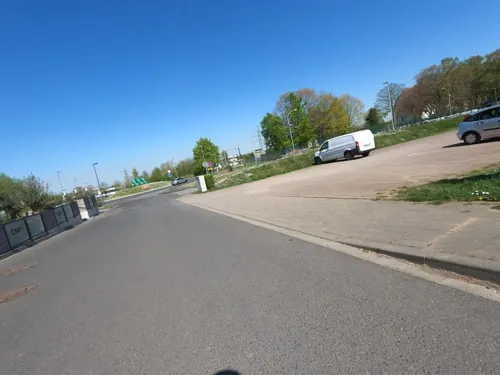
Cap 1
Restaurant · International · 3.2 km
1 Carl-Alexander-Platz, Baesweiler
Tu-Th 11:30-22:00; Fr 11:30-23:00; Sa 09:00-23:00; Su 09:00-22:00
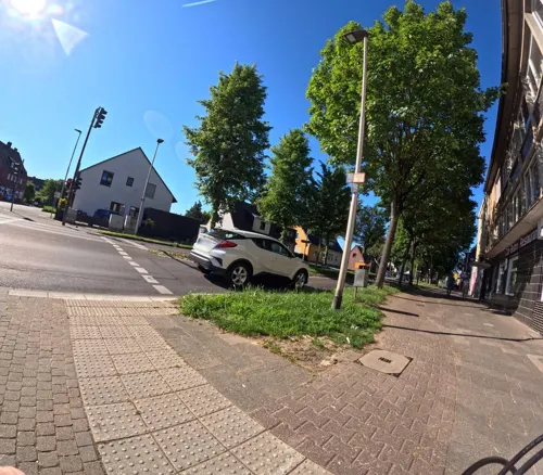
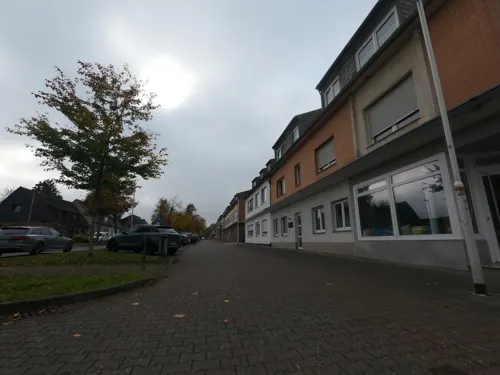
Fräulein Sahne
Cafe · Coffee Shop · 3.7 km
375 Geilenkirchener Straße, Herzogenrath
We-Fr 09:00-17:00,13:30-13:30; Sa-Su 10:00-17:30; PH closed

Sultan Restaurant
Restaurant · Turkish · 1.1 km
62 Roermonder Straße, Übach-Palenberg
Mo-Sa 11:30-23:00; Su 09:00-23:00
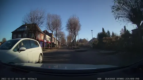
Bäckerei Schneider
Bakery · 3.7 km
381 Geilenkirchener Straße, Herzogenrath
Mo-Fr 06:00-19:00; Sa 06:00-15:00; Su 07:00-13:00

D'r Eck
Bar and pub · 2.5 km
16 Brugstraat, Landgraaf
Mo, Tu 12:00-22:00; We off; Th-Fr 12:00-22:00; Su 10:00-22:00


Eiszauber Milano
Cafe · 3.5 km
17a August-Schmidt-Platz, Herzogenrath
Oct-Apr: Mo off; Tu-Su 09:30-19:00; May-Sep: Mo-Su 09:30-21:00
95 more on the map.
History
867 the village Palenberg was first mentioned in a written document, 1172 the village Übach. 1794 three Bürgermeistereien were created - Übach, Scherpenseel, Frelenberg - which were merged into one municipality in 1935. It received town rights in 1967.
1917 coal mining was started in the town, until in 1962 the Carolus Magnus coal-mine was closed.
From the History section of Übach-Palenberg on Wikipedia, under CC BY-SA 4.0.
Where to stay4
Churches and places of worship30
St. Maria Himmelfahrt
Church · Catholic · 4.0 km
160 Heerlener Straße, Übach-Palenberg
Friedhofskirche St. Dionysius
Church · Catholic · 3.0 km
Annabergstraße, Übach-Palenberg
Martin-Luther-Kirche Merkstein
Church · Protestant · 3.4 km
397c Geilenkirchener Straße, Herzogenrath
Shopping27
Gas and EV charging14
Schools, colleges and libraries18
Healthcare15
Christophorus Apotheke
Clinic and pharmacy
9 Carolus-Magnus-Straße, Übach-Palenberg
Map of Übach-Palenberg
250 places. The map loads OpenStreetMap tiles when you open it.
Getting there and nearby towns
NATO E-3A Airbase Geilenkirchen (GKE) is the nearest airport with scheduled flights listed in OpenStreetMap, 7 km away.
- Würselen 11 km south, about 11 min by car
- Aachen 16 km south, about 16 min by car
- Wassenberg 20 km north, about 20 min by car
- Wegberg 27 km northeast, about 27 min by car
- Mönchengladbach 37 km northeast, about 37 min by car
- Viersen 42 km northeast, about 42 min by car
- Zülpich 45 km southeast, about 45 min by car
- Willich 49 km northeast, about 49 min by car
- Neuss 50 km northeast, about 50 min by car
- Köln 58 km east, about 58 min by car
Drive times are estimates from straight-line distance, not routes.
Local news
Headlines from INDB.
Reviews, tips and questions
Loading what members have shared...
Sources and licences
- GeoNames (CC BY 4.0): population, coordinates, regions and time zone
- Mapillary (see each image): photos
- OpenStreetMap contributors (ODbL 1.0): places, airports, map data
- Wikidata (CC0 1.0): elevation, founding date, time zone, website, landmarks and historic places
- Wikimedia Commons (see each image): photos
- Wikipedia (CC BY-SA 4.0): overview and history text
Photo credits
- Übach von Kirche-2, Kolling, CC BY-SA 3.0
- GI machine gun crew in Aachen (Correct orientation), Ellett. Post-Work: User:W.wolny, Public domain
- Burg Baesweiler, Christian Faulhammer, CC BY-SA 2.5
- Herrenhaus Schloss Breill, Ahoerstemeier, CC BY-SA 4.0
- Merkstein, Pfarrkirche Sankt Willibrord Dm000115 - 01 foto4 2016-09-08 15.19, Michielverbeek, CC BY-SA 4.0
- Schloss zweibrücken, A.Grundig (eigene Aufnahme, self-taken), Public domain
- Grube Adolf, Herzogenrath (3), ArthurMcGill, CC BY-SA 4.0
- Übach Schloss Rimburg, eigene Aufnahme, A.Grundig (überarbeitet von LoKiLeCh), Public domain
- Rimburg Kirche, LoKiLeCh, CC BY 3.0
- Naturschutzgebiet Wurmtal nördlich Herzogenrath (10), ArthurMcGill, CC BY-SA 4.0
- Naturschutzgebiet Rimburger Busch und Kanualbusch (2), ArthurMcGill, CC BY-SA 4.0
- NSG Übachtal nördlich Merkstein einschließlich Heidberg und Flösser Büschchen (5), ArthurMcGill, CC BY-SA 4.0
- Stolpersteine Baesweiler Breite Straße 17 Herschel Falke (Detail), Qwertzu111111, CC BY-SA 4.0
- Schloss Breill bei Hünshoven, Käthe u. Bernd Limburg www.limburg-bernd.de, CC BY-SA 3.0 de
- Schloss Rimburg (14), Lokilech, CC BY-SA 3.0
- Baesweiler Burg (6), Lokilech, CC BY-SA 3.0
- Gut Muthagen bei Hünshoven, Käthe u. Bernd Limburg www.limburg-bernd.de, CC BY-SA 3.0 de
- Stolpersteine Baesweiler Breite Straße 17 Simon Falke (Detail), Qwertzu111111, CC BY-SA 4.0
- Übach Hauptverwaltungsgebäude (1), Lokilech, CC BY-SA 3.0
- Übach Rimburger Mühle (3), Lokilech, CC BY-SA 3.0
- Carl-Alexander-Park, Baesweiler (16), ArthurMcGill, CC BY-SA 4.0
- Wurm, Wurmtal Merkstein, LauraIsabell, CC BY-SA 4.0
- Übach Scherpenseel Kirche (1), Lokilech, CC BY-SA 3.0
- Palenberg Erlöserkirche (2), LoKiLeCh, CC BY 3.0
- Beggendorf Kirche (1), Lokilech, CC BY-SA 3.0
- Schloss Breill in Geilenkirchen, sodele, CC BY-SA 2.0
- Naturschutzgebiet Ehemalige Braunkohle-Abgrabung Ottilie (3), ArthurMcGill, CC BY-SA 4.0
- Rimburg Kirche vom Schloss (3a), LoKiLeCh, CC BY 3.0
- Übach, Piccippi, CC BY-SA 4.0
- Bierkrug Dortmunder Kronenbier 4, LoKiLeCh, CC BY-SA 4.0
- Dortmunder Kronenbier Bleistift 3, LoKiLeCh, CC BY-SA 4.0
- Dortmunder Kronenbier Bleistift 2, LoKiLeCh, CC BY-SA 4.0
- Dortmunder Kronenbier Bleistift, LoKiLeCh, CC BY-SA 4.0
- Bierkrug Dortmunder Kronenbier, LoKiLeCh, CC BY-SA 4.0
- Bierkrug Dortmunder Kronenbier 2, LoKiLeCh, CC BY-SA 4.0
- Bierkrug Dortmunder Kronenbier 3, LoKiLeCh, CC BY-SA 4.0
- Unterführung Audimax Eisenhüttenkunde (2), LoKiLeCh, CC BY-SA 4.0
- Unterführung Audimax Eisenhüttenkunde (1), LoKiLeCh, CC BY-SA 4.0
- Unterführung Audimax Eisenhüttenkunde (3), LoKiLeCh, CC BY-SA 4.0
- 2025-05-11 Kingcrow Rockfabrik (27), Tetris L, CC BY-SA 4.0
- Naturpark Worm-Wildnis (bei Herzogenrath), Qwertzu111111, CC BY-SA 4.0
- Street-level photo, madel, CC BY-SA 4.0
- Street-level photo, madel, CC BY-SA 4.0
- Street-level photo, hektor1989, CC BY-SA 4.0
- Street-level photo, madel, CC BY-SA 4.0
- Street-level photo, hektor1989, CC BY-SA 4.0
- Street-level photo, madel, CC BY-SA 4.0
- Street-level photo, hektor1989, CC BY-SA 4.0
- Street-level photo, hektor1989, CC BY-SA 4.0
- Street-level photo, hektor1989, CC BY-SA 4.0
- Street-level photo, hektor1989, CC BY-SA 4.0
- Street-level photo, hektor1989, CC BY-SA 4.0
- Street-level photo, thmunichways, CC BY-SA 4.0
- Street-level photo, hektor1989, CC BY-SA 4.0
- Street-level photo, madel, CC BY-SA 4.0
- Street-level photo, hektor1989, CC BY-SA 4.0
- Street-level photo, hektor1989, CC BY-SA 4.0
- Street-level photo, hektor1989, CC BY-SA 4.0
- Street-level photo, madel, CC BY-SA 4.0
- Street-level photo, hektor1989, CC BY-SA 4.0
- Street-level photo, madel, CC BY-SA 4.0
- Street-level photo, hektor1989, CC BY-SA 4.0
- Street-level photo, madel, CC BY-SA 4.0
- Street-level photo, hektor1989, CC BY-SA 4.0
- Street-level photo, hektor1989, CC BY-SA 4.0
- Street-level photo, hektor1989, CC BY-SA 4.0
- Street-level photo, madel, CC BY-SA 4.0
- Street-level photo, thomas_munichways, CC BY-SA 4.0


Page built November 8, 2026. Spotted a mistake? Tell us or suggest a place.