


Why visit Wegberg
Townapedia lists 150 museums and landmarks, 36 parks and trails, 147 places to eat, 24 places to stay and 19 attractions in and around town.
Highlights include Einkaufen auf dem Bauernhof Küppers, Puten Farm Ritte, Museum für Europäische Volkstrachten and Flachsmuseum.
Weather in Wegberg
Forecast from MET Norway (CC BY 4.0). Full forecast
About Wegberg
Wegberg (German pronunciation: [ˈveːkbɛʁk] ; Limburgish: Berk [ˈbæʀ(ə)k]) is the northernmost town in the district of Heinsberg in North Rhine-Westphalia, Germany.
From the Wikipedia article Wegberg (this version), under CC BY-SA 4.0.
Things to do19

Einkaufen auf dem Bauernhof Küppers
Farm and orchard · 0.7 km
4 Heidekamp, Wegberg
Mo-Fr 09:00-18:30; Sa 09:00-13:00
Puten Farm Ritte
Farm and orchard · 2.2 km
26 Dülkener Straße, Wegberg
Tu-Fr 09:00-18:00; Sa 09:00-13:00; Su-Mo, PH off

Hofladen Böscherhof
Farm and orchard · 4.0 km
Nov-Mar: Mo-Su, PH 08:00-18:00; Apr-Oct: Mo-Su, PH 08:00-sunset
Kreskenhof
Farm and orchard · 2.2 km
60 Grobenweg, Wegberg
Mo 14:00-18:30; Tu,Th,Fr 08:30-18:30; Sa 08:30-17:00; We off
Hofladen Familie Brocker
Farm and orchard · 3.5 km
Tu-Th 09:00-12:00,15:00-18:00; Fr 09:00-18:00; Sa 09:00-13:00;Su-Mo, PH off
Johi's Hofladen
Farm and orchard · 7.4 km
Mo-Th 09:00-12:30,15:00-18:00; Fr 09:00-18:00; Sa 09:00-12:30
7 more on the map.
Museums and landmarks150
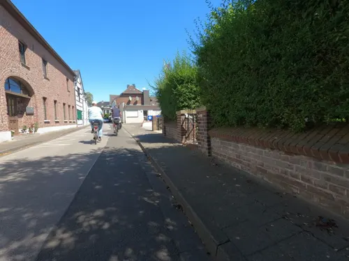
Museum für Europäische Volkstrachten
Museum · 1.9 km
Zweigeschossiges Wohnhaus in sieben Achsen mit einachsigem Mittelrisalit, Backstein, Türgewände und Fensterbänke in Blaustein, im...
7 Kirchplatz, Wegberg
Su 14:00-17:00
Flachsmuseum
Museum · 2.0 km
Bei der sogenannten Zehntscheune in Wegberg - Beeck an der Holtumer Straße handelt es sich um einen Fachwerkbau mit durchgezapften...
Su 14:00-17:00
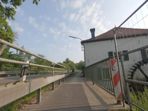
Mühlenmuseum Schrofmühle
Museum · 1.8 km
Wassermühle aus dem 18. und 19. Jahrhundert. Vierflügelige Anlage in Backstein; Wohngebäude Zweigeschossig in acht Achsen, Türgewände...
2 Schrofmühle, Wegberg

Naturschutzstation Haus Wildenrath
Monument and historic site · 7.0 km
Kern der Hofanlage aus dem 18. Jahrhundert; weitgehend erneuert; heute dreiflügelige Anlage in Backstein und Fachwerk; Wohnhaus in...
2 Naturparkweg, Wegberg

Altes Rathaus
Monument and historic site · 7.3 km
Baujahre 1541-1546 und 18. Jh., W bis 1951; freistehender 2-geschossiger Backsteinbau in 5 Achsen, weiß geschlämmt im EG offene...
25 Markt, Erkelenz

Lüttelforster Mühle
Monument and historic site · Regional · 6.3 km
Backsteinwinkelhofanlage, Mühlrad erhalten, jedoch im 19. Jh. verändert
Sa, Su 12:00-22:00; We-Fr 15:00-22:00

Alte Stadtbefestigung
Monument and historic site · 7.2 km
1355 erste Erwähnung, 14. Jh., 15. Jh., A. 16. Jh. Fertig; nur noch in Resten nördlich der Brückstraße erhalten.

Jüdischer Friedhof
Cemetery · 5.3 km
Entstehung und Geschichte der jüdischen Gemeinde von Schwanenberg sind nicht zuletzt im Zusammenhang mit der Situation in Erkelenz zu...

Route gegen das Vergessen
Monument and historic site · 7.1 km
Auf dem alten Friedhof erinnert ein Gedenkstein an sechs russische Männer und eine Frau, die als Zwangsarbeiter im Erkelenzer Land...


Burg Wegberg
Monument and historic site · 0.7 km
Eine wasserumwehrte Anlage, Hausgebäude zweigeschossig in neun Achsen mit einachsigem Mittelrisalit mit Treppengiebel; Backstein;...
8-10 Burgstraße, Wegberg

Schloss Tüschenbroich
Monument and historic site · 2.7 km
Schloß 1172 zuerst erwähnt, Kern um 15oo erbaut; Hauptgebäude heute 17. und 18. Jahrhundert; weiträumige Wasseranlage, der Vorgängerbau...
1 Zur Ulrichskapelle, Wegberg
138 more on the map.
Parks, trails and playgrounds36



Helpensteiner Bachtal, oberes Schaagbachtal und Petersholz
Hiking and trails · 6.8 km


Schwalmbruch, Mühlenbach- und Knippertzbachtal
Hiking and trails · 2.3 km



24 more on the map.
Restaurants and cafes147

Ophover Mühle
Restaurant · 0.7 km
Hauptgebäude zweigeschossig in sechs Achsen; Türgewände und Fensterbänke in Blaustein; die Nebengebäude eingeschossig etwas niedriger,...
14 Forst, Wegberg
Mo-Sa 09:00+; Su 10:00+

Bauerncafe Bolten
Cafe · Regional · 5.8 km
Leckere selbstgemachte Kuchen, ein echtes Bauerncafe
185 Lüttelforst, Schwalmtal
We-Fr 14:00-17:00; Sa 13:00-18:00; Su 09:30-18:00
Akropolis Grill
Restaurant · Greek · 5.4 km
3 Gladbacher Straße
Tu-Sa 11:00-22:00; Su,PH 12:30-22:00; Mo off

Angelpark Tüschenbroich
Restaurant · Seafood · 2.7 km
2 Zur Ulrichskapelle, Wegberg
Mo 06:00-17:00; Tu-Su 06:00-18:00
Brauerei Zum Stefanus
Restaurant · Regional · 7.0 km
59 Mennrath, Mönchengladbach
We-Sa 17:00-18:00+; Su 11:00-18:00+; Mo,Tu off
China Garten
Restaurant · Chinese · 1.6 km
2 Im Wiesengrund, Wegberg
Mo-Sa 12:00-15:00,18:00-23:00; Su, PH 12:00-23:00
City Grillpfanne
Restaurant · Turkish
3 Karmelitergasse, Wegberg
Mo,Tu,Th,Fr 11:30-22:00, Fr,Sa 11:30-23:00, Su,PH 14:00-22:00; We off
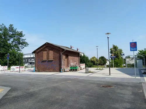
Das kleine Steakhouse
Restaurant · Steak House
5 Am Bahnhof, Wegberg
Tu-Fr 11:30-14:30,17:30-23:00; Sa 17:30-23:00; Su 11:15-23:00
Father & Son Burger and Soulfood Company
Restaurant · Burger, American, Barbecue · 6.4 km
80 Friedrich-List-Allee, Wegberg
Th-Sa 17:00-18:00+


Gasthof Timmermans
Restaurant · Regional · 3.4 km
4 Zum Thomeshof, Wegberg
We-Su 10:00-20:00; Mo,Tu off
Gaststätte Jackels
Restaurant · Regional, German · 2.0 km
68 Harbecker Straße, Wegberg
We-Su 11:30-22:30; Mo,Tu off
135 more on the map.
History
The first mention of Wegberg under the name of Berck is in a document dating from during the reign of Otto I, dated 966.
Its modern-day name appeared around the 14th century, and derives from the city's location on an old Roman road.
The many castles and defense structures (the so-called Motten, sngl. Motte) that dot the area in whole or as ruins are indications of a history of martial as well as raiding forays in and around Wegberg. One infamous stronghold that remains the focal point of many anecdotes is the castle of a robber baron located in nearby Gripekoven. The castle with its walls and swampy trenches was deemed impregnable until 1354, when it was successfully besieged and razed. Today, only a small hill hints at its former location.
From 1543 on, Wegberg was divided between the duchy of Geldern (Guelders) and the duchy of Jülich. The border ran across the city, formed by the rivers Schwalm and Beeckbach. In this period, Wegberg effectively had two mayors. Only in 1816, after the district fell to Prussia, was the division removed. In 1935 the two townships of Wegberg and Beeck were merged.
The city as it exists today emerged from the restructuring of cities and municipalities of 1972, and on July 5, 1973, Wegberg was granted the right to use the official name Stadt Wegberg ("City of Wegberg").
From the History section of Wegberg on Wikipedia, under CC BY-SA 4.0.
Where to stay24
Jugendherberge Mönchengladbach-Hardter Wald
Motel and hotel · 6.9 km
156 Brahmsstraße, Mönchengladbach
Churches and places of worship69
Shopping47
Gas and EV charging15
Schools, colleges and libraries37
Astrid-Lindgren-Schule, Gemeinschaftsgrundschule der Stadt Erkelenz
School · 7.0 km
17 Zehnthofweg, Erkelenz
Freie Waldorfschule Kreis Heinsberg e.V.
School · 6.7 km
12 Dechant-Ruppertzhoven-Weg, Wegberg
Katholische Grundschule Holt Teilstandort Günhoven
School · 7.2 km
293 Stadtwaldstraße, Mönchengladbach
Healthcare17
Die Rheindahlener Gemeinschaftspraxis
Clinic and pharmacy · 5.6 km
37 Max-Reger-Straße, Mönchengladbach
Map of Wegberg
250 places. The map loads OpenStreetMap tiles when you open it.
Getting there and nearby towns
Düsseldorf-Mönchengladbach Airport (MGL) is the nearest airport with scheduled flights listed in OpenStreetMap, 18 km away.
- Mönchengladbach 12 km northeast, about 12 min by car
- Willich 23 km northeast, about 23 min by car
- Krefeld 29 km northeast, about 29 min by car
- Neuss 29 km east, about 29 min by car
- Düsseldorf 36 km east, about 36 min by car
- Würselen 38 km south, about 38 min by car
- Moers 42 km northeast, about 42 min by car
- Aachen 43 km south, about 43 min by car
- Duisburg 46 km northeast, about 46 min by car
- Köln 52 km southeast, about 52 min by car
Drive times are estimates from straight-line distance, not routes.
Local news
Headlines from INDB.
Reviews, tips and questions
Loading what members have shared...
Sources and licences
- GeoNames (CC BY 4.0): population, coordinates, regions and time zone
- Mapillary (see each image): photos
- OpenStreetMap contributors (ODbL 1.0): places, airports, map data
- Wikidata (CC0 1.0): elevation, founding date, time zone, website
- Wikimedia Commons (see each image): photos
- Wikipedia (CC BY-SA 4.0): overview and history text
Photo credits
- Wegberger Mühle 2, Käthe u. Bernd Limburg ( http://www.limburg-bernd.de ), CC BY-SA 3.0 de
- St. Peter und Paul (Wegberg) Heiliges Grab Verehrung, Camillo-venrath, CC BY-SA 4.0
- St. Peter und Paul (Wegberg) Heiliges Grab, Camillo-venrath, CC BY-SA 4.0
- St. Peter und Paul (Wegberg) südlicher Seitenaltar geöffnet, Camillo-venrath, CC BY-SA 4.0
- Skulptur Stadtpark in Wegberg, Schokifaktor, CC BY-SA 4.0
- Betonskulptur im Stadtpark Wegberg von Laura und Christel Lechner, Schokifaktor, CC BY-SA 4.0
- Wegberg Wasserturm Feinspinnerei, Oberlausitzerin64, CC BY-SA 4.0
- Stolperstein Matthias Eickels Wegberg, Lintux, CC BY-SA 4.0
- Stolperstein Kurt Salm Wegberg, Lintux, CC BY-SA 4.0
- Stolperstein Moses Salm Wegberg, Lintux, CC BY-SA 4.0
- Stolperstein Ilse Salm Wegberg, Lintux, CC BY-SA 4.0
- Stolperstein Berta Salm Wegberg, Lintux, CC BY-SA 4.0
- Stolperstein Lotte Salm Wegberg, Lintux, CC BY-SA 4.0
- Stolperstein Jakob Salm Wegberg, Lintux, CC BY-SA 4.0
- Stolperstein Irma Salm Wegberg, Lintux, CC BY-SA 4.0
- Stolperstein Albert Salm Wegberg, Lintux, CC BY-SA 4.0
- Erkelenz altes rathaus, Unknown author, CC BY-SA 3.0
- Wegberg, Burg Wegberg B, Heinz Eßer, CC BY-SA 3.0
- Schloss Tüschenbroich, Wegberg-9473, Raimond Spekking, CC BY-SA 4.0
- Gymnasium Rheindahlen; Mönchengladbach, Anne Offermanns, CC BY-SA 4.0
- Jüdischer Friedhof Schwanenberg, Lentholt, CustosEcc, CC BY 3.0
- Turm der Pfarrkirche St. Peter und Paul, Heinz Eßer, CC BY-SA 3.0
- Merbeck Kirche St. Maternus Ansicht, Käthe u. Bernd Limburg, www.limburg-bernd.de, CC BY-SA 3.0 de
- Gerderhahn Kirche Giebelseite, Käthe u. Bernd Limburg, www.limburg-bernd.de, CC BY-SA 3.0 de
- Ek Leonhardkapelle, Bodoklecksel, CC BY-SA 3.0
- NRW Gerkerather Wald MG-005 File 0269, An2205, CC BY-SA 4.0
- Heilig-Kreuz-Kapelle (Kipshoven)2, Chris06, CC BY-SA 4.0
- Jüdischer Friedhof Erkelenz 03, Papa1234, CC BY 3.0
- Helpensteinerbachtal 01, Gpu31, CC BY-SA 4.0
- Knippertzbach 001, Kevinhayes1960, CC BY-SA 3.0
- Hebebrücke aus alten Zeiten, Sallyofmayflower, CC BY-SA 3.0
- Buschmühle am Mühlenbach NSG HS-006, Huckety, CC BY-SA 3.0
- Motte Tüschenbroich, NSG HS-017, Huckety, CC BY-SA 3.0
- Ophover Mühle 10, Langela Wegberg, CC BY-SA 3.0 de
- HausWildenrath, Bodoklecksel, CC BY-SA 3.0
- Erkelenz cw, J. F. Welser, Public domain
- Burg Wegberg Pano, Sir Gawain, CC BY-SA 3.0
- Ophover Mühle 1, Käthe u. Bernd Limburg ( http://www.limburg-bernd.de ), CC BY-SA 3.0 de
- Gerderath1, Bodoklecksel, CC BY-SA 3.0
- Lüttelforster Mühle 1, Käthe und Bernd Limburg http://www.limburg-bernd.de, CC BY-SA 3.0 de
- Jüdischer Friedhof Erkelenz 01, Papa1234, CC BY 3.0
- Arsbeck Pfarrkirche St. Adelgundis, Käthe u. Bernd Limburg, www.limburg-bernd.de, CC BY-SA 3.0 de
- Rath-Anhoven Kirche St. Rochus Ansicht, Käthe u. Bernd Limburg, www.limburg-bernd.de, CC BY-SA 3.0 de
- Street-level photo, hektor1989, CC BY-SA 4.0
- Street-level photo, hektor1989, CC BY-SA 4.0
- Street-level photo, hektor1989, CC BY-SA 4.0
- Street-level photo, hektor1989, CC BY-SA 4.0
- Street-level photo, lintux, CC BY-SA 4.0
- Street-level photo, madel, CC BY-SA 4.0
- Street-level photo, hektor1989, CC BY-SA 4.0
- Street-level photo, lintux, CC BY-SA 4.0
- Street-level photo, hektor1989, CC BY-SA 4.0
- Street-level photo, lintux, CC BY-SA 4.0
- Street-level photo, hektor1989, CC BY-SA 4.0
- Street-level photo, hektor1989, CC BY-SA 4.0
- Street-level photo, hektor1989, CC BY-SA 4.0
- Street-level photo, lintux, CC BY-SA 4.0
- Street-level photo, lintux, CC BY-SA 4.0
- Street-level photo, hektor1989, CC BY-SA 4.0
- Street-level photo, simonhard, CC BY-SA 4.0
- Street-level photo, hektor1989, CC BY-SA 4.0
- Street-level photo, hektor1989, CC BY-SA 4.0
- Street-level photo, hektor1989, CC BY-SA 4.0
- Street-level photo, canadarunner, CC BY-SA 4.0
- Street-level photo, lintux, CC BY-SA 4.0
- Street-level photo, lintux, CC BY-SA 4.0
- Street-level photo, hektor1989, CC BY-SA 4.0
- Street-level photo, hektor1989, CC BY-SA 4.0
- Street-level photo, hektor1989, CC BY-SA 4.0
- Street-level photo, lintux, CC BY-SA 4.0
- Street-level photo, madel, CC BY-SA 4.0
- Street-level photo, hektor1989, CC BY-SA 4.0
- Street-level photo, endradon, CC BY-SA 4.0
- Street-level photo, endradon, CC BY-SA 4.0
- Street-level photo, hektor1989, CC BY-SA 4.0


Page built November 8, 2026. Spotted a mistake? Tell us or suggest a place.