


Würselen, Germany
Würselen is a town of 37,074 people in North Rhine-Westphalia, Germany.
Why visit Würselen
Townapedia lists 145 museums and landmarks, 51 parks and trails, 173 places to eat, 13 places to stay and 20 attractions in and around town.
Highlights include Aachen, Aachener Thermalquellen, Ludwig Forum für Internationale Kunst and Burg Soerserhaus.
Weather in Würselen
Forecast from MET Norway (CC BY 4.0). Full forecast
About Würselen
Würselen (German pronunciation: [ˈvʏʁzələn] , Ripuarian: Wöschele [ˈβœʃələ]) is a town in the borough of Aachen, in North Rhine-Westphalia, Germany.
From the Wikipedia article Würselen (this version), under CC BY-SA 4.0.
Photos of Würselen


Things to do20

Aachen
Monument and historic site · 5.9 km
City in North Rhine-Westphalia, Germany


Bismarck Tower (Aachen)
Monument and historic site · 8.2 km
Bismarck tower in Aachen, Germany

Gutshof Schloss Berensberg
Farm and orchard · 3.4 km
Das Schloss Berensberg, auch Haus Berensberg und Gut Berensberg genannt, ist ein ehemaliger Adelssitz im Herzogenrather Ortsteil Kohlscheid.
228 Berensberger Straße, Herzogenrath

Öcher Schängche
Cinema and theater · 6.4 km
Theatre in Aachen, Germany

Theater Aachen
Cinema and theater · 6.1 km
Theatre and opera house in Aachen, Germany



Boeven's Hofladen
Farm and orchard · 1.9 km
93 Hauptstraße, Würselen
Tu,Th,Fr 08:30-13:00,15:00-18:00; We 08:30-13:00;Sa 08:00-13:00;...
Bioland-Hof Gut Paulinenwäldchen
Farm and orchard · 2.8 km
26-34 Zum Blauen Stein, Aachen
Mo,Tu,Th,Fr 09:00-18:30; Sa 09:00-14:00; PH off
Milchtankstelle Schümmer
Farm and orchard · 1.6 km
An der Milch-Tankstelle von Karl-Heinz Schümmer in Würselen bekommt man von Montag bis Samstag von 6.30 Uhr bis 19 Uhr und am Sonntag...
172 Hauptstraße, Würselen
8 more on the map.
Museums and landmarks145

Ludwig Forum für Internationale Kunst
Museum · 4.7 km
Modern art museum in Aachen, Germany
97-109 Jülicher Straße, Aachen
Tu-We 12:00-18:00; Th 12:00-22:00; Fr 12:00-18:00; Sa, Su, PH 11:00-18:00


Gut Kaisersruh
Monument and historic site · 2.1 km
Ludwig von Fisenne hatte zu Beginn des 19. Jahrhunderts an den dort vorhandenen Bauernhof einen repräsentativen Herrensitz angebaut und...



Fernmeldemuseum Aachen
Museum · 3.7 km
Die Besichtigung findet immer im Rahmen einer Führung statt. Ein Besuch ohne Ankündigung ist immer am Montag (sofern kein Feiertag) um...
9a Am Gut Wolf, Aachen
Mo 11:00+ || "nach Vereinbarung"
CHIO Aachen-Museum
Museum · 3.8 km
50 Albert-Servais-Allee, Aachen
We,Fr 12:00-17:00; Mo,Tu,Th,Sa,Su,PH off
133 more on the map.
Parks, trails and playgrounds51


Quellgebiet Broichbach mit Schwalbennistwand westlich Broicher Siedlung, nördlich Broich
Hiking and trails · 4.4 km


Wurmtal südlich Herzogenrath, einschließlich Meisbach, Würselen
Hiking and trails · 2.8 km



Aquana Sauna & Freizeitbad
Sports field and stadium · 0.7 km
100 Willy-Brandt-Ring, Würselen
Mo-Th 13:00 - 20:00; Fr 13:00-21:00; Sa-Su, PH 10:00-21:00



39 more on the map.
Restaurants and cafes173
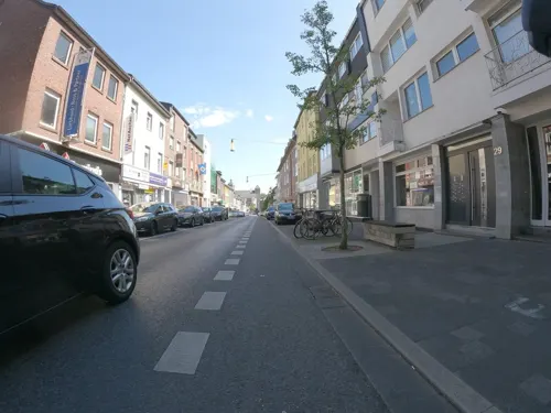
Café D'Moll
Restaurant · Spanish
Spanisches Restaurant-Cocktailbar in Würselen
9 Morlaixplatz, Würselen
Mo-Sa 11:30-15:00,17:00-23:00; Su 11:30-23:00
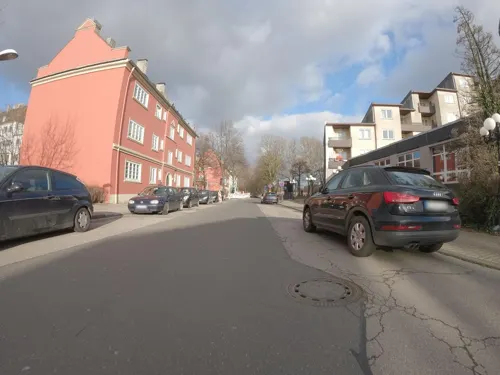
Petermachtpause im TZA
Cafe · Breakfast, Sandwich, Noodle, Mediterranean, Bistro, Cake · 4.6 km
Neben den wechselnden Mittagstisch mit Suppe, Salat und vollwertigen Gerichten gibt es hier auch das klassische...
25 Dennewartstraße, Aachen
Mo-Fr 08:00-14:00 open "Brötchen & Mehr"; Mo-Fr 11:30-13:30 open...
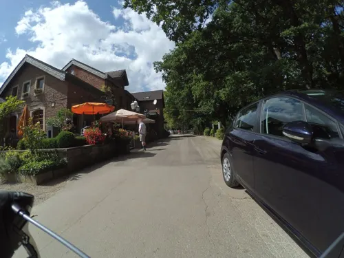
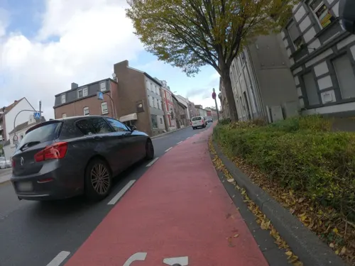
Gaststätte Sängerheim
Bar and pub · 2.4 km
Catering, Tagungen, Feiern ...
163 Alt-Haarener Straße, Aachen
Mo-Fr 17:00+, Sa 10:00-13:00 "Frühschoppen (ohne Speisen)",...
Hao
Restaurant · Asian · 4.7 km
49 Von-Coels-Straße, Aachen
Mo-Sa 11:30-15:00,17:30-22:00; PH,Su 11:30-22:00
Haus Goertz
Restaurant · German · 4.3 km
34 Schulstraße, Herzogenrath
Tu-Sa 17:30-00:00; Su 10:00-14:00,17:30-00:00

Kantine Finanzamt - Café Life
Restaurant · Regional · 3.6 km
Für ALLE geöffnet! Beim Empfang sagen, daß man zum Restaurant will.
210 Krefelder Straße, Aachen
Mo-Th 11:45-13:30; Fr 11:45-13:00
Klömpchensklub | Tivoli
Restaurant · Regional, Burger, Sandwich, German, International, Dessert · 3.8 km
Der Klömpchensklub öffnet nun auch außerhalb der Spieltage seine Türen. Unter Leitung der KOSTbar – VIA Integration gGmbH bietet die...
205 Krefelder Straße, Aachen
Mo-Fr 11:00-15:00
Vereinsheim Dauergartenanlage Groß-Tivoli e. V.
Restaurant · Pizza, German · 3.3 km
Aus der Küche gibt es eher Snacks wie Pizza, Flammkuchen, Bockwurst, etc.
300 Berensberger Straße, Aachen
Apr-Sep: Tu-Fr 11:00-21:00; Apr-Sep: Sa,Su,PH 11:00-20:00;...

161 more on the map.
History
During the time of the Roman Empire, Roman soldiers were based at Würselen, on an area today known as "Mauerfeldchen" (small mural field).
The first mention of the town was as Wormsalt in 870. Between 1265-69, Duke Wilhelm IV of Jülich built the castle of Wilhelmstein. Since 1616 the town has been known as Würselen. In 1972, the neighbouring municipalities of Bardenberg and Broichweiden were incorporated into the town.
From the History section of Würselen on Wikipedia, under CC BY-SA 4.0.
More about Würselen
Geography
Würselen lies north of the city of Aachen in the immediate vicinity of the tripoint of Belgium, Germany and the Netherlands. Its neighbouring settlements are, in clockwise order, the towns of Herzogenrath, Alsdorf and Eschweiler and the city of Aachen. Würselen is part of Aachen's Nordkreis quarter and is the only part of the city borough without external boundaries.
As part of the administrative reform in North Rhine-Westphalia and the related 1971 Aachen Act, the territory of the borough of Würselen was expanded in 1972 to incorporate the hitherto independent municipalities of Bardenberg and Broichweiden. Since then Würselen has consisted of the following quarters:
From the Wikipedia article Würselen, under CC BY-SA 4.0.
Notable people from Würselen
 Torsten FringsGerman association football player and managerPhoto: Werner100359, CC BY-SA 4.0
 Jupp DerwallGerman association football player and manager (1927–2007)Photo: Jürgen Jung ( de:Benutzer:Fotosaar )..., CC BY-SA 2.0 de
 Yannick GerhardtGerman footballerPhoto: Raimond Spekking, CC BY-SA 4.0
 Timo BarthelGerman diver (1996-)Photo: Martin Rulsch , Wikimedia Commons, CC BY-SA 4.0
 Anna GerhardtGerman association football playerPhoto: Rufus46, CC BY-SA 3.0
 Roland BartetzkoGerman soldier, author and terroristPhoto: АрміяInform / Руслан Тарасов, CC BY 4.0
 Norman LangenGerman singerPhoto: Olaf Kosinsky, CC BY-SA 3.0 de
- Nadine CapellmannGerman equestrian
- Orhan AktaşTurkish-German association football player (born 1994)
- Alexander JungbluthGerman politician
- Adolf WamperGerman sculptor (1901–1977)
- David JansenGerman footballer
Born in Würselen, according to Wikidata (CC0). Each name links to its Wikipedia article.
Where to stay13
Churches and places of worship47
St. Willibrord
Church · Roman Catholic · 3.1 km
36 Euchener Straße, Würselen
Shopping60
Gas and EV charging26
Schools, colleges and libraries36
Healthcare21
Map of Würselen
250 places. The map loads OpenStreetMap tiles when you open it.
Getting there and nearby towns
Flugplatz Würselen-Aachen (AAH) is the nearest airport with scheduled flights listed in OpenStreetMap, 3 km away.
- Aachen 6 km southwest, about 6 min by car
- Herzogenrath 6 km northwest, about 6 min by car
- Alsdorf 7 km north, about 7 min by car
- Stolberg 8 km southeast, about 8 min by car
- Eschweiler 10 km east, about 10 min by car
- Baesweiler 11 km north, about 11 min by car
- Übach-Palenberg 11 km north, about 11 min by car
- Niedermerz 12 km northeast, about 12 min by car
- Aldenhoven 14 km northeast, about 14 min by car
- Langerwehe 15 km east, about 15 min by car
Drive times are estimates from straight-line distance, not routes.
Towns near Würselen


Keep exploring
Local news
Headlines from INDB.
Reviews, tips and questions
Loading what members have shared...
Sources and licences
- GeoNames (CC BY 4.0): population, coordinates, regions and time zone
- Mapillary (see each image): photos
- OpenStreetMap contributors (ODbL 1.0): places, airports, map data
- Wikidata (CC0 1.0): elevation, founding date, time zone, website, landmarks and historic places
- Wikimedia Commons (see each image): photos
- Wikipedia (CC BY-SA 4.0): overview and history text
Photo credits
- Blick vom Markt auf St Sebastian, PasseVivant, CC BY-SA 3.0
- Würselen Sebastianskirche, Norbert Schnitzler, CC BY-SA 3.0
- Marktplatz in Würselen, Horst J. Meuter, CC BY-SA 4.0
- Salmanusaltar of St. Sebastian (Würselen), Qwertzu111111, CC BY-SA 4.0
- Blick vom Markt auf St Sebastian Weihnachten 2023, Exterior of St. Sebastian (Würselen), Qwertzu111111, CC BY-SA 4.0
- Büdchen Würselen Markt; Kiosks in North Rhine-Westphalia, Wiki Loves Büdchen, March 2026 in the Städteregion Aachen, Qwertzu111111, CC BY-SA 4.0
- Würselen, de Romaanse westtoren van de Pfarrkirche Sankt Sebastian DmA03-K IMG 8189 2023-09-03 15.32, Michielverbeek, CC BY-SA 4.0
- Würselen, de Pfarrkirche Sankt Sebastian DmA03-K IMG 8181 2023-09-03 15.27, Michielverbeek, CC BY-SA 4.0
- Hauptorgel of St. Sebastian (Würselen); April 2024 in the Städteregion Aachen, Qwertzu111111, CC BY-SA 4.0
- Interior of St. Sebastian (Würselen); April 2024 in the Städteregion Aachen; Church ceilings in North Rhine-Westphalia, Qwertzu111111, CC BY-SA 4.0
- Würselen Kirche innen, Norbert Schnitzler, CC BY-SA 3.0
- Exterior of St. Sebastian (Würselen); Crosses in Würselen; Stone crosses in North Rhine-Westphalia; March 2024 in the Städteregion Aachen (2), Qwertzu111111, CC BY-SA 4.0
- Offener Bücherschrank Würselen, Markt; ein Projekt der Kulturstiftung Würselen; Public bookcases in the Städterregion Aachen, Qwertzu111111, CC BY-SA 4.0
- Exterior of St. Sebastian (Würselen); Crosses in Würselen; Stone crosses in North Rhine-Westphalia; March 2024 in the Städteregion Aachen (1), Qwertzu111111, CC BY-SA 4.0
- Exterior of St. Sebastian (Würselen); Crosses in Würselen; Stone crosses in North Rhine-Westphalia; March 2024 in the Städteregion Aachen (6), Qwertzu111111, CC BY-SA 4.0
- Exterior of St. Sebastian (Würselen); Crosses in Würselen; Stone crosses in North Rhine-Westphalia; March 2024 in the Städteregion Aachen (3), Qwertzu111111, CC BY-SA 4.0
- Exterior of St. Sebastian (Würselen); Crosses in Würselen; Stone crosses in North Rhine-Westphalia; March 2024 in the Städteregion Aachen (5), Qwertzu111111, CC BY-SA 4.0
- Exterior of St. Sebastian (Würselen); Crosses in Würselen; Stone crosses in North Rhine-Westphalia; March 2024 in the Städteregion Aachen (4), Qwertzu111111, CC BY-SA 4.0
- Würselen Rathaus, Norbert Schnitzler, CC BY-SA 3.0
- WK Haaler Straße Oppener Straße Würselen 1901 eingemeißelt 253 cm Mein Jesus Barmherzigkeit, Qwertzu111111, CC BY-SA 4.0
- Bonifatius Stirnberg, Jungenspielbrunnen, Würselen, Fountains in the Städteregion Aachen (04), Qwertzu111111, CC BY-SA 4.0
- Bonifatius Stirnberg, Jungenspielbrunnen, Würselen, Fountains in the Städteregion Aachen (01), Qwertzu111111, CC BY-SA 4.0
- Bonifatius Stirnberg, Jungenspielbrunnen, Würselen, Fountains in the Städteregion Aachen (02), Qwertzu111111, CC BY-SA 4.0
- Bonifatius Stirnberg, Jungenspielbrunnen, Würselen, Fountains in the Städteregion Aachen (03), Qwertzu111111, CC BY-SA 4.0
- WK Haaler Straße Oppener Straße Würselen 1901 eingemeißelt 253 cm Mein Jesus Barmherzigkeit (nach Restaurierung Korpus) Oktober 2023, Qwertzu111111, CC BY-SA 4.0
- Altes Postgebäude Würselen - Lindenplatz 25 Postgebäude A121 P 08.04.2022 - Cultural heritage monuments in Würselen 01, Qwertzu111111, CC BY-SA 4.0
- Altes Postgebäude Würselen - Lindenplatz 25 Postgebäude A121 P 08.04.2022 - Cultural heritage monuments in Würselen 03, Qwertzu111111, CC BY-SA 4.0
- Aachen Germany Imperial-Cathedral-01, CEphoto, Uwe Aranas, CC BY-SA 3.0
- CarolusThermen04, Wi1234, CC BY-SA 3.0
- Aachen Bismarckturm h fern, Norbert Schnitzler, CC BY-SA 3.0
- Aachen BW 2016-07-09 17-24-02, Berthold Werner, CC BY-SA 3.0
- Ludwig Forum Aachen 2017, Sebastianat, CC BY-SA 4.0
- Aachen BW 2016-07-09 16-46-40, Berthold Werner, CC BY-SA 3.0
- Aachen Couvenmuseum, Norbert Schnitzler, CC BY-SA 3.0
- Aachen, Lousberg, Euku : ⇄, CC BY-SA 3.0
- Weiher Westpark aachen, ArthurMcGill, CC BY 3.0
- AC BD Boxgraben 98–100, Grunpfnul, CC BY-SA 4.0
- 1196-18-rwth-aachen-hg-von-hendrik-brixius, Hendrik Brixius, CC BY-SA 3.0
- Tivoli Aachen Front, Peter Tritthart, CC BY 3.0
- Innenhof Burg Wilhelmstein, Würselen-Bardenberg, Unknown author Unknown author, CC BY-SA 4.0
- Deutsche bank stadion, BayernUli, CC BY 3.0
- Blick auf Schulgebäude des HGG - cropped, Mapelbot, CC BY-SA 4.0
- St. Severin (Aachen) 01, Thomas Hummel, CC BY-SA 4.0
- Haupstadionaachen, BayernUli, CC BY 3.0
- St. Peter und Paul (Bardenberg) 04, Qwertzu111111, CC BY-SA 4.0
- Aachen Eissportzentrum, Norbert Schnitzler, CC BY-SA 3.0
- Haarberg (Aachen), Peter Tritthart, CC BY 3.0
- Versöhnungskirche, Aachen-Eilendorf, ArthurMcGill, CC BY 3.0
- Schloss Berensberg 01, Sir Gawain, CC BY-SA 4.0
- Soerser Haus 01, Sir Gawain, CC BY-SA 4.0
- St. Matthias Berensberg Herzogenrath, Choinowski, CC BY-SA 4.0
- Das-Da-Theater - Aachen, ArthurMcGill, CC BY 3.0
- St. Lucia (Broichweiden) 08, Thomas Hummel, CC BY-SA 4.0
- Stolpersteine Levy, Alt-Haarener Straße 191, Aachen, ArthurMcGill, CC BY 3.0
- Stolperstein Gebr. Levy - Aachen (2), ArthurMcGill, CC BY 3.0
- Gut Kaisersruh (Stadt Würselen) außen Luftbild 2019-06-02, AVIA-LUFTBILD, CC BY-SA 4.0
- 49 Wuerselen, Juelicher Strasse gegenueber 1, Norbert KIrchhoff, CC BY-SA 3.0
- Broicher Bach 1, Quelle, Rückhaltebecken, Käthe u. Bernd Limburg, www.limburg-bernd.de, CC BY-SA 3.0 de
- GrubeGouley05, Wolfgang Wesemann, CC BY-SA 4.0
- Westfassade von St. Katharina (Kohlscheid) mit Sandsteinverblendung, Putz und Skulputrenschmuck, Riode1969, CC BY-SA 3.0
- Ev. Kirche Würselen-Vorweiden, Unknown author Unknown author, CC BY-SA 4.0
- St. Germanus (Haaren) 09, Thomas Hummel, CC BY-SA 4.0
- Christuskirche, Aachen-Haaren, ArthurMcGill, CC BY 3.0
- St. Sebastian, Würselen (5), Unknown author Unknown author, CC BY-SA 4.0
- St. Willibrord Euchen (Würselen) 01 von 01, Qwertzu111111, CC BY-SA 4.0
- Würselen Nikolauskirche, Norbert Schnitzler, CC BY-SA 3.0
- Öcher Schängchen, Euku : ⇄, CC BY-SA 3.0
- Metropolis Filmtheater Alter Bahnhof in Würselen Dezember 2020 Lake13, Qwertzu111111, CC BY-SA 4.0
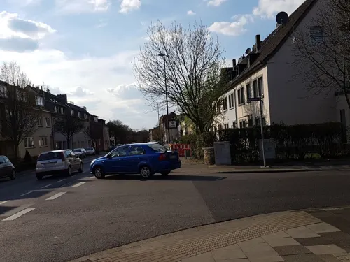
- Street-level photo, FahrradstadtAachen, CC BY-SA 4.0
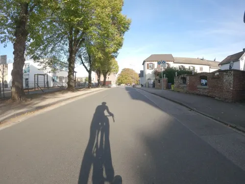
- Street-level photo, FahrradstadtAachen, CC BY-SA 4.0
- Street-level photo, madel, CC BY-SA 4.0
- Street-level photo, paddy257, CC BY-SA 4.0
- Street-level photo, paddy257, CC BY-SA 4.0
- Street-level photo, FahrradstadtAachen, CC BY-SA 4.0
- Street-level photo, FahrradstadtAachen, CC BY-SA 4.0
- Street-level photo, noel, CC BY-SA 4.0
- Street-level photo, Mobilitaetswerk, CC BY-SA 4.0
- Street-level photo, madel, CC BY-SA 4.0
- Street-level photo, madel, CC BY-SA 4.0
- Street-level photo, FahrradstadtAachen, CC BY-SA 4.0
- Street-level photo, FahrradstadtAachen, CC BY-SA 4.0
- Street-level photo, FahrradstadtAachen, CC BY-SA 4.0
- Street-level photo, madel, CC BY-SA 4.0
- Street-level photo, trockennasenaffe, CC BY-SA 4.0
- Street-level photo, peewee32, CC BY-SA 4.0
- Street-level photo, madel, CC BY-SA 4.0
- Street-level photo, madel, CC BY-SA 4.0
- Street-level photo, FahrradstadtAachen, CC BY-SA 4.0
- Street-level photo, madel, CC BY-SA 4.0
- Street-level photo, madel, CC BY-SA 4.0


Page built November 9, 2026. Spotted a mistake? Tell us or suggest a place.