


Why visit Volkmarsen
Townapedia lists 57 museums and landmarks, 20 parks and trails, 47 places to eat, 10 places to stay and 18 attractions in and around town.
Highlights include Esseberg, Gertenberg, Gustav-Hüneberg-Haus and Burgruine Fürstenstein.
Weather in Volkmarsen
Forecast from MET Norway (CC BY 4.0). Full forecast
About Volkmarsen
Volkmarsen (German pronunciation: [ˈfɔlkˌmaʁzn̩] ) is a small town in Waldeck-Frankenberg district in northern Hesse, Germany. It is home to 6840 residents.
From the Wikipedia article Volkmarsen (this version), under CC BY-SA 4.0.
Things to do18





6 more on the map.
Museums and landmarks57

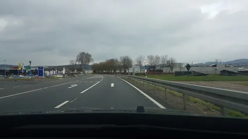

Schloss Welda
Monument and historic site · 5.0 km
12 Ferdinande-von-Brackel-Straße, Warburg


Drei Steine
Monument and historic site · 4.6 km
Drei historische Grenzsteine Waldeck - Westfalen - Volkmarsen (heute dort Grenze Hessen - NRW), am Iberg, im Nordosten des NSG „Iberg bei Hörle“.
45 more on the map.
Parks, trails and playgrounds20


Iberg bei Hörle
Hiking and trails · 4.4 km
Kalkmagerrasen mit Waldflächen am Südwesthang des Iberg, östlich von Hörle.

Scheid bei Volkmarsen
Hiking and trails · 1.9 km
Kalk-Halbtrockenrasen mit Büschen und Bäumen, direkt südlich des Ortsrandes von Volkmarsen. Das NSG besteht aus 2 Teilfläche mit einer...

Stadtbruch von Volkmarsen
Hiking and trails · 0.8 km
Grünland mit Wald an der Twiste, am südwestlichen Ortsrand von Volkmarsen.

Wünne bei Viesebeck
Hiking and trails · 5.3 km
Kalkmagerrasen mit Gehölzen und ehemaligen Steinbruch, nordwestlich von Viesebeck, bei Wolfhagen.



8 more on the map.
Restaurants and cafes47

Zur Kugelsburg
Restaurant · 0.9 km
1 Kugelsburg, Volkmarsen
Th 17:00-22:00, Fr 11:30-22:00, Sa 11:30-22:30, Su 09:00-21:00
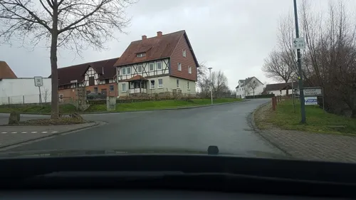
Landgasthof Teuteberg
Restaurant · Regional · 6.7 km
8 Rhoder Straße, Schmillinghausen
Mo-Th 17:00+; Fr-Sa 12:00-14:00,17:00+; Su off
Restaurant "Fairway Wetterburg"
Restaurant · German, Fish, Burger, Chicken · 5.8 km
33 Zum Wiggenberg, Bad Arolsen
Tu-Su 11:30-00:00
Zum Fischhaus
Restaurant · German · 6.3 km
117 Fischhaus, Bad Arolsen
We-Sa 12:00-18:00; Su 11:00-18:00; PH 11:00-18:00




Mamma Mia
Restaurant · Italian
10 Steinweg, Volkmarsen
Tu-Fr 17:30-23:30;Fr,Su,PH 11:30-14:00;Su,PH 17:00-22:00
35 more on the map.
History
Volkmarsen's first documentary mention came in 1155. In a safe-conduct from Pope Gregory IX in 1233, Volkmarsen was first described as a town.
On 24 February 2020, a car drove into a crowd at a carnival parade, injuring 88 people.
From the History section of Volkmarsen on Wikipedia, under CC BY-SA 4.0.
Where to stay10
Churches and places of worship16
Ev. Kirche Neu-Berich
Church · Protestant · 3.6 km
1 Mühlenfeldstraße, Bad Arolsen
Shopping5
Gas and EV charging5
Schools, colleges and libraries3
Healthcare3
Map of Volkmarsen
184 places. The map loads OpenStreetMap tiles when you open it.
Getting there and nearby towns
Kassel Airport (KSF) is the nearest airport with scheduled flights listed in OpenStreetMap, 19 km away.
- Bad Arolsen 8 km southwest, about 8 min by car
- Warburg 9 km north, about 9 min by car
- Wolfhagen 10 km south, about 10 min by car
- Zierenberg 13 km east, about 13 min by car
- Marsberg 20 km west, about 20 min by car
- Hofgeismar 21 km northeast, about 21 min by car
- Korbach 23 km southwest, about 23 min by car
- Vellmar 26 km east, about 26 min by car
- Baunatal 27 km southeast, about 27 min by car
- Kassel 28 km east, about 28 min by car
Drive times are estimates from straight-line distance, not routes.
Local news
Headlines from INDB.
Reviews, tips and questions
Loading what members have shared...
Sources and licences
- GeoNames (CC BY 4.0): population, coordinates, regions and time zone
- Mapillary (see each image): photos
- OpenStreetMap contributors (ODbL 1.0): places, airports, map data
- Wikidata (CC0 1.0): elevation, founding date, time zone, website
- Wikimedia Commons (see each image): photos
- Wikipedia (CC BY-SA 4.0): overview and history text
Photo credits
- Volkmarsen von kugelsburg ds 07 2009, Dirk Schmidt (Celsius auf Wikivoyage), CC BY-SA 3.0
- Arolser Straße 6, 1, Volkmarsen, Landkreis Waldeck-Frankenberg, GeorgDerReisende, CC BY-SA 4.0
- 29.03.93 Volkmarsen 796725+996236+996791 (49866755703), Phil Richards from London, UK, CC BY-SA 2.0
- Bushaltestelle Bahnhof, 1, Volkmarsen, Landkreis Waldeck-Frankenberg, GeorgDerReisende, CC BY-SA 4.0
- Am Bahnhof, 2, Volkmarsen, Landkreis Waldeck-Frankenberg, GeorgDerReisende, CC BY-SA 4.0
- Bahnhof Volkmarsen, Feuermond16, CC BY-SA 4.0
- Am Bahnhof, 1, Volkmarsen, Landkreis Waldeck-Frankenberg, GeorgDerReisende, CC BY-SA 4.0
- Arolser Straße 10, 1, Volkmarsen, Landkreis Waldeck-Frankenberg, GeorgDerReisende, CC BY-SA 4.0
- Bahnhof Volkmarsen, 1, Volkmarsen, Landkreis Waldeck-Frankenberg, GeorgDerReisende, CC BY-SA 4.0
- Arolser Straße 1a, 1, Volkmarsen, Landkreis Waldeck-Frankenberg, GeorgDerReisende, CC BY-SA 4.0
- Arolser Straße 14, 1, Volkmarsen, Landkreis Waldeck-Frankenberg, GeorgDerReisende, CC BY-SA 4.0
- Arolser Straße 5, 1, Volkmarsen, Landkreis Waldeck-Frankenberg, GeorgDerReisende, CC BY-SA 4.0
- Arolser Straße 20, 1, Volkmarsen, Landkreis Waldeck-Frankenberg, GeorgDerReisende, CC BY-SA 4.0
- Radweg Twistesee Volkmarsen Bahnhof, Feuermond16, CC BY-SA 4.0
- Neuer jüdischer Friedhof, 1, Platz der gegenseitigen Achtung, Volkmarsen, Landkreis Waldeck-Frankenberg, GeorgDerReisende, CC BY-SA 4.0
- Neuer jüdischer Friedhof, 2, Platz der gegenseitigen Achtung, Volkmarsen, Landkreis Waldeck-Frankenberg, GeorgDerReisende, CC BY-SA 4.0
- Trafoturm, 1, Am Gleisdreieck, Volkmarsen, Landkreis Waldeck-Frankenberg, GeorgDerReisende, CC BY-SA 4.0
- Scheune, 1, Erpeweg, Volkmarsen, Landkreis Waldeck-Frankenberg, GeorgDerReisende, CC BY-SA 4.0
- Bushaltestelle Rathaus, 1, Volkmarsen, Landkreis Waldeck-Frankenberg, GeorgDerReisende, CC BY-SA 4.0
- Linde Marktplatz Volkmarsen, Hahn1962, CC BY 4.0
- Raiffeisenbank Volkmarsen, PKautz, CC BY-SA 3.0
- Lucas-Alsberg-Allee, 1, Volkmarsen, Landkreis Waldeck-Frankenberg, GeorgDerReisende, CC BY-SA 4.0
- Lucas-Alsberg-Allee, 2, Volkmarsen, Landkreis Waldeck-Frankenberg, GeorgDerReisende, CC BY-SA 4.0
- Kasseler Straße 17, 2, Volkmarsen, Landkreis Waldeck-Frankenberg, GeorgDerReisende, CC BY-SA 4.0
- Kasseler Straße, 1, Volkmarsen, Landkreis Waldeck-Frankenberg, GeorgDerReisende, CC BY-SA 4.0
- Kasseler Straße 17, 1, Volkmarsen, Landkreis Waldeck-Frankenberg, GeorgDerReisende, CC BY-SA 4.0
- Erpe, 5, Volkmarsen, Landkreis Waldeck-Frankenberg, GeorgDerReisende, CC BY-SA 4.0
- Erpe, 8, Volkmarsen, Landkreis Waldeck-Frankenberg, GeorgDerReisende, CC BY-SA 4.0
- Erpe, 6, Volkmarsen, Landkreis Waldeck-Frankenberg, GeorgDerReisende, CC BY-SA 4.0
- Erpe, 9, Volkmarsen, Landkreis Waldeck-Frankenberg, GeorgDerReisende, CC BY-SA 4.0
- Bushaltestelle Lütersheimer Straße, 1, Volkmarsen, Landkreis Waldeck-Frankenberg, GeorgDerReisende, CC BY-SA 4.0
- Bushaltestelle Kugelsburgschule, 1, Volkmarsen, Landkreis Waldeck-Frankenberg, GeorgDerReisende, CC BY-SA 4.0
- Erpe, 11, Volkmarsen, Landkreis Waldeck-Frankenberg, GeorgDerReisende, CC BY-SA 4.0
- Erpe, 3, Volkmarsen, Landkreis Waldeck-Frankenberg, GeorgDerReisende, CC BY-SA 4.0
- Bushaltestelle Niederer Steinweg, 1, Volkmarsen, Landkreis Waldeck-Frankenberg, GeorgDerReisende, CC BY-SA 4.0
- Burgruine Rodersen Gesamtansicht Seite, Köf3, CC BY-SA 3.0
- Wittmarkapelle Südfassade 2010, bdk, CC BY-SA 3.0
- Roedeser Berg mit Windmessmast, DF5GO, CC BY-SA 3.0
- Hollenkammer in Lütersheim, Ralph Busch, CC BY-SA 3.0
- 20170526 Kugelsburg-Castle Volkmarsen, Kno-Biesdorf, CC BY-SA 4.0
- Schloss Welda mit Wirtschaftsgebäuden, Warboerde 13:20, 7. Jun. 2010 (CEST) (Transfered by Brackenheim III /Original uploaded by Warboerde ), CC BY 3.0
- St. Kilian Kirche (Welda)-MJ, Warboerde 13:06, 7. Jun. 2010 (CEST), Public domain
- WieseimWattertal, Visaswises, CC BY-SA 4.0
- Wettesingen ev. Kirche NO, Tebdi, CC BY-SA 4.0
- Evangelische Kirche Schmillinghausen 01, Jkü, CC BY 4.0
- 3 Grenzsteine am Iberg bei Hörle 2022-02-19 a, Baummapper, CC BY-SA 3.0 de
- Warburg - 2018-09-05 - HX-036 Hoppenberg (3), Tsungam, CC BY-SA 4.0
- Buschwerk-kalkmagerrasen, Rainer Schmitz, CC BY-SA 4.0
- Warburg - 2018-04-27 - HX-004 Iberg bei Welda (01), Tsungam, CC BY-SA 4.0
- Warburg - 2018-09-05 - HX-026 Schalkstal (01), Tsungam, CC BY-SA 4.0
- Warburg - 2018-09-05 - HX-027 Weldaer Wald (7), Tsungam, CC BY-SA 4.0
- NSG 1635003 Iberg bei Hörle 2022-02-19 d, Baummapper, CC BY-SA 3.0 de
- Volkmarser Weg NSG Scheid Nord, Feuermond16, CC BY-SA 4.0
- NSG 1635024 Stadtbruch von Volkmarsen 2021-10-10 f, Baummapper, CC BY-SA 3.0 de
- NSG 1633035 Wünne bei Viesebeck 2020-08-20 g, Baummapper, CC BY-SA 3.0 de
- Panorama Twistesee Bad Arolsen, Unknown author, CC BY-SA 3.0
- Wittmarkapelle 2021-10-10 a, Baummapper, CC BY-SA 3.0 de
- Kirche Külte 2022-02-19 a, Baummapper, CC BY-SA 3.0 de
- Volkmarsen - 2018-04-27 - Iberg bei Hörle (06), Tsungam, CC BY-SA 4.0
- Street-level photo, ramap, CC BY-SA 4.0
- Street-level photo, thetornado76, CC BY-SA 4.0
- Street-level photo, thetornado76, CC BY-SA 4.0
- Street-level photo, rb61, CC BY-SA 4.0
- Street-level photo, rb61, CC BY-SA 4.0
- Street-level photo, rb61, CC BY-SA 4.0
- Street-level photo, Schmarvis, CC BY-SA 4.0
- Street-level photo, thetornado76, CC BY-SA 4.0
- Street-level photo, saschahaberkorn, CC BY-SA 4.0
- Street-level photo, thetornado76, CC BY-SA 4.0
- Street-level photo, rb61, CC BY-SA 4.0
- Street-level photo, rb61, CC BY-SA 4.0
- Street-level photo, saschahaberkorn, CC BY-SA 4.0
- Street-level photo, changchun1, CC BY-SA 4.0
- Street-level photo, rb61, CC BY-SA 4.0


Page built November 9, 2026. Spotted a mistake? Tell us or suggest a place.