


Why visit Warburg
Townapedia lists 205 museums and landmarks, 38 parks and trails, 111 places to eat, 26 places to stay and 40 attractions in and around town.
Highlights include Biolandhof Engemann, Finnenberghof, Museum im Stern and Eckmänneken.
Weather in Warburg
Forecast from MET Norway (CC BY 4.0). Full forecast
About Warburg
Warburg (German pronunciation: [ˈvaːɐ̯bʊʁk] ; Westphalian: Warberich or Warborg) is a town in eastern North Rhine-Westphalia, central Germany on the river Diemel near the three-state point shared by Hessen, Lower Saxony and North Rhine-Westphalia. It is in Höxter district and Detmold region. Warburg is the midpoint in the Warburger Börde. Since March 2012 the city is allowed to call itself 'Hanseatic City of Warburg'.
From the Wikipedia article Warburg (this version), under CC BY-SA 4.0.
Things to do40

Biolandhof Engemann
Farm and orchard · 9.0 km
11 Zum Südholz, Willebadessen
Mo-Tu 09:00-12:00,15:00-18:00; Th-Fr 09:00-12:00,15:00-18:00; Sa...




28 more on the map.
Museums and landmarks205


Eckmänneken
Monument and historic site · 0.6 km
2 Lange Straße, Warburg



Schloss Welda
Monument and historic site · 4.7 km
12 Ferdinande-von-Brackel-Straße, Warburg


193 more on the map.
Parks, trails and playgrounds38


Kalkmagerrasen bei Ossendorf
Hiking and trails · 3.5 km
Naturschutzgebiet Kalkmagerrasen bei Ossendorf mit den Teilgebieten Franzosenschanze, Heinberg und Rabensberg


26 more on the map.
Restaurants and cafes111

Zur Kugelsburg
Restaurant · 8.6 km
1 Kugelsburg, Volkmarsen
Th 17:00-22:00, Fr 11:30-22:00, Sa 11:30-22:30, Su 09:00-21:00
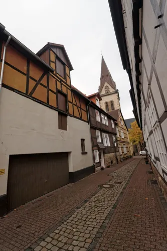
Don Pepe
Restaurant · Spanish
Don Pepe - Culinaria España
11 Kalandstraße, Warburg
Mo-Su 17:00-21:30; Su, PH 12:00-14:00
Hotel Gasthof Luis
Restaurant · German · 9.3 km
Gaststätte mit Restaurant und Hotelbetrieb (3 Sterne)
53 Briloner Straße, Warburg
We-Th 17:00-23:00; Fr-Sa 17:00-00:00; Su 11:30-13:30, 17:00-22:00

Bäckerei Henke Altstadtcafé
Cafe · Coffee Shop
9a Am Markt, Warburg
Mo-Fr 06:00-18:00; Sa 06:00-13:00; Su 07:30-12:00
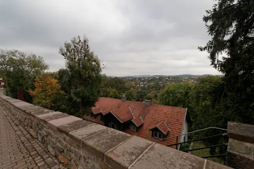
IL Gusto
Restaurant · Italian, Pizza · 0.6 km
136 Paderborner Tor, Warburg
Mo-Sa 11:30-14:30, 17:00-22:00; Su 11:30-22:00
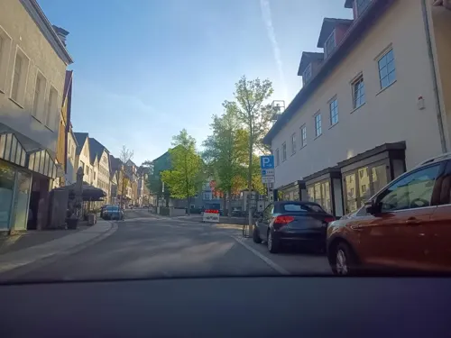
Johal Palace
Restaurant · Indian
12 Hauptstraße, Warburg
Tu-Fr 11:30-14:30, 17:00-22:00; Sa-Su,PH 12:00-22:00
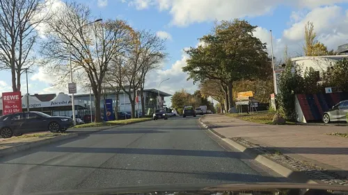
Ratskeller
Restaurant · German
2 Zwischen den Städten, Warburg
Mo-Tu,Th-Su 00:00-03:00; Mo,We-Fr 15:00-24:00; Sa,Su, PH 12:00-24:00
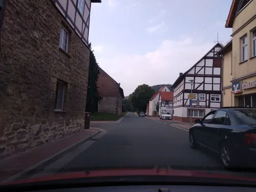


Restaurant Zorbas
Restaurant · Greek · 7.9 km
9 Mittelstraße, Breuna
Mo-Sa 17:00-22:00, Su 12:00-22:00
99 more on the map.
Where to stay26
Churches and places of worship52
Shopping33
Gas and EV charging15
Schools, colleges and libraries21
Healthcare12
Map of Warburg
250 places. The map loads OpenStreetMap tiles when you open it.
Getting there and nearby towns
Kassel Airport (KSF) is the nearest airport with scheduled flights listed in OpenStreetMap, 19 km away.
- Bad Arolsen 15 km southwest, about 15 min by car
- Hofgeismar 17 km east, about 17 min by car
- Wolfhagen 18 km south, about 18 min by car
- Vellmar 27 km southeast, about 27 min by car
- Kassel 31 km southeast, about 31 min by car
- Korbach 30 km southwest, about 30 min by car
- Bad Wünnenberg 31 km west, about 31 min by car
- Baunatal 32 km southeast, about 32 min by car
- Fuldatal 31 km east, about 31 min by car
- Paderborn 37 km northwest, about 37 min by car
Drive times are estimates from straight-line distance, not routes.
Local news
Headlines from INDB.
Reviews, tips and questions
Loading what members have shared...
Sources and licences
- GeoNames (CC BY 4.0): population, coordinates, regions and time zone
- Mapillary (see each image): photos
- OpenStreetMap contributors (ODbL 1.0): places, airports, map data
- Wikidata (CC0 1.0): elevation, founding date, time zone, website
- Wikimedia Commons (see each image): photos
- Wikipedia (CC BY-SA 4.0): overview and history text
Photo credits
- Stadtpanorama-Warburg-2013, Tuxyso, CC BY-SA 3.0
- Unterstraße 74, 12, Warburg, Landkreis Höxter, GeorgDerReisende, CC BY-SA 4.0
- Frankenstraße 35, 1, Warburg, Landkreis Höxter, GeorgDerReisende, CC BY-SA 4.0
- Frankenstraße 30, 1, Warburg, Landkreis Höxter, GeorgDerReisende, CC BY-SA 4.0
- Frankenstraße 36, 1, Warburg, Landkreis Höxter, GeorgDerReisende, CC BY-SA 4.0
- Bußdorfer Straße 5, 1, Warburg, Landkreis Höxter, GeorgDerReisende, CC BY-SA 4.0
- Desenberggasse, 1, Warburg, Landkreis Höxter, GeorgDerReisende, CC BY-SA 4.0
- Bußdorfer Straße, 1, Warburg, Landkreis Höxter, GeorgDerReisende, CC BY-SA 4.0
- Frankenstraße 38, 1, Warburg, Landkreis Höxter, GeorgDerReisende, CC BY-SA 4.0
- Bußdorfer Straße 4, 1, Warburg, Landkreis Höxter, GeorgDerReisende, CC BY-SA 4.0
- Auf dem Piepenbrink, 1, Warburg, Landkreis Höxter, GeorgDerReisende, CC BY-SA 4.0
- Frankenstraße 32, 1, Warburg, Landkreis Höxter, GeorgDerReisende, CC BY-SA 4.0
- Frankenstraße 30, 2, Warburg, Landkreis Höxter, GeorgDerReisende, CC BY-SA 4.0
- Frankenstraße 26, 1, Warburg, Landkreis Höxter, GeorgDerReisende, CC BY-SA 4.0
- Unterstraße 74, 10, Warburg, Landkreis Höxter, GeorgDerReisende, CC BY-SA 4.0
- Wispertorgasse, 2, Warburg, Landkreis Höxter, GeorgDerReisende, CC BY-SA 4.0
- Unterstraße 74, 1, Warburg, Landkreis Höxter, GeorgDerReisende, CC BY-SA 4.0
- Unterstraße 74, 9, Warburg, Landkreis Höxter, GeorgDerReisende, CC BY-SA 4.0
- Bußdorfer Straße 17, 1, Warburg, Landkreis Höxter, GeorgDerReisende, CC BY-SA 4.0
- Halbschalenturm, 5, Göringsgraben, Warburg, Landkreis Höxter, GeorgDerReisende, CC BY-SA 4.0
- Frankenstraße 26, 2, Warburg, Landkreis Höxter, GeorgDerReisende, CC BY-SA 4.0
- Piepenbrinkgasse, 1, Warburg, Landkreis Höxter, GeorgDerReisende, CC BY-SA 4.0
- Bußdorfer Straße 11, 1, Warburg, Landkreis Höxter, GeorgDerReisende, CC BY-SA 4.0
- Unterstraße 78, 1, Warburg, Landkreis Höxter, GeorgDerReisende, CC BY-SA 4.0
- Unterstraße 77, 2, Warburg, Landkreis Höxter, GeorgDerReisende, CC BY-SA 4.0
- Hinter der Mauer Nord 62, 1, Warburg, Landkreis Höxter, GeorgDerReisende, CC BY-SA 4.0
- Unterstraße 74, 2, Warburg, Landkreis Höxter, GeorgDerReisende, CC BY-SA 4.0
- Unterstraße 77, 1, Warburg, Landkreis Höxter, GeorgDerReisende, CC BY-SA 4.0
- Wispertorgasse, 1, Warburg, Landkreis Höxter, GeorgDerReisende, CC BY-SA 4.0
- Unterstraße 82, 1, Warburg, Landkreis Höxter, GeorgDerReisende, CC BY-SA 4.0
- Desenberggasse, 2, Warburg, Landkreis Höxter, GeorgDerReisende, CC BY-SA 4.0
- Unterstraße 78, 2, Warburg, Landkreis Höxter, GeorgDerReisende, CC BY-SA 4.0
- Bußdorfer Straße 19, 1, Warburg, Landkreis Höxter, GeorgDerReisende, CC BY-SA 4.0
- Unterstraße 82, 2, Warburg, Landkreis Höxter, GeorgDerReisende, CC BY-SA 4.0
- Unterstraße 74, 7, Warburg, Landkreis Höxter, GeorgDerReisende, CC BY-SA 4.0
- Unterstraße 74, 8, Warburg, Landkreis Höxter, GeorgDerReisende, CC BY-SA 4.0
- Frankenstraße 20, 2, Warburg, Landkreis Höxter, GeorgDerReisende, CC BY-SA 4.0
- Unterstraße 66, 3, Warburg, Landkreis Höxter, GeorgDerReisende, CC BY-SA 4.0
- Frankenstraße 24, 1, Warburg, Landkreis Höxter, GeorgDerReisende, CC BY-SA 4.0
- Wispertorgasse, 5, Warburg, Landkreis Höxter, GeorgDerReisende, CC BY-SA 4.0
- HöhenburgCalenberg1, Witold Grzesiek, CC BY-SA 3.0
- Eckmaenneken-Haus, erbaut 1471, Warburg, Wilhelm Thomas Fiege, CC BY-SA 3.0
- St. Petri-Hospital (Altbau) Warburg, Wilhelm Thomas Fiege, CC BY 3.0
- Gymnasium Marianum Warburg 02, Wilhelm Thomas Fiege, CC BY-SA 3.0
- Kirche Germete von außen, User:MF-Warburg, CC BY-SA 4.0
- Museum im Stern, Warburg 02, Wilhelm Thomas Fiege, CC BY 3.0
- Heinturm Warburg-Ossendorf (Ostseite) 02, Wilhelm Thomas Fiege, CC BY-SA 3.0
- Warburg, ehem. Lyceum (1923), Hüffertgymnasium (1947) 01, Elmar Nolte, CC BY-SA 4.0
- Schloss Welda mit Wirtschaftsgebäuden, Warboerde 13:20, 7. Jun. 2010 (CEST) (Transfered by Brackenheim III /Original uploaded by Warboerde ), CC BY 3.0
- St. Kilian Kirche (Welda)-MJ, Warboerde 13:06, 7. Jun. 2010 (CEST), Public domain
- Kirche Eissen Westseite, Buschmann23, CC BY-SA 3.0
- Warburg-Altstadtkirche-St. Mariä Heimsuchung, Tuxyso, CC BY-SA 3.0
- Eissen Huessenberg innen, Bladel, CC BY-SA 3.0
- Warburg - 2019-06-23 - NSG Menner Seihe (DSC 7062), Tsungam, CC BY-SA 4.0
- Warburg - 2022-07-17 - Kirche Daseburg (DSC 8948), Tsungam, CC BY-SA 4.0
- Schlossbergschule Rhoden 01, Jkü, CC BY 4.0
- Warburg - 2015-09-19 - Kirche Scherfede (06), Tsungam, CC BY-SA 4.0
- Kirche Niederlistingen 2006-02-25, Magnus Manske, CC BY 2.5
- Warburg - 2018-05-05 - Wohnturmruine Asseler Feld (02), Tsungam, CC BY-SA 4.0
- Warburg - 2018-09-18 - Ev Kirche Rimbeck (03), Tsungam, CC BY-SA 4.0
- Die evangelische Dorfkirche von Herlinghausen 01, Herlingi, CC BY-SA 4.0
- Desenberg mit Burgruine (10573100915), Dirk Vorderstraße, CC BY 2.0
- Warburg - 2018-09-05 - HX-036 Hoppenberg (3), Tsungam, CC BY-SA 4.0
- Warburg - 2018-04-19 - Kalkmagerrasen bei Ossendorf (017), Tsungam, CC BY-SA 4.0
- Buschwerk-kalkmagerrasen, Rainer Schmitz, CC BY-SA 4.0
- Warburg - 2018-05-05 - HX-081 Asseler Wald (23), Tsungam, CC BY-SA 4.0
- Warburg - 2018-05-05 - HX-055 Drachenholl-Diemelaue (03), Tsungam, CC BY-SA 4.0
- Warburg - 2018-05-05 - HX-047 Gaulskopf mit Asseler Wald (06), Tsungam, CC BY-SA 4.0
- Warburg - 2018-04-27 - HX-004 Iberg bei Welda (01), Tsungam, CC BY-SA 4.0
- Warburg - 2018-04-27 - HX-074 Kalkmagerrasen bei Calenberg und Dalheim (07), Tsungam, CC BY-SA 4.0
- Willebadessen - 2017-05-25 - NSG Königsblick (01), Tsungam, CC BY-SA 4.0
- Borgentreich - 2022-03-12 - NSG Körbecker Bruch (DSC 4798), Tsungam, CC BY-SA 4.0
- Wittmarkapelle 2021-10-10 a, Baummapper, CC BY-SA 3.0 de
- Warburg-Blick-auf-Ev-Altstadtkirche-Marianum-v-Fuegeler-Kanone, Tuxyso, CC BY-SA 3.0
- Volkmarsen - 2018-04-27 - Iberg bei Hörle (06), Tsungam, CC BY-SA 4.0
- Street-level photo, txllxt, CC BY-SA 4.0
- Street-level photo, saschahaberkorn, CC BY-SA 4.0
- Street-level photo, amenophis, CC BY-SA 4.0
- Street-level photo, amenophis, CC BY-SA 4.0
- Street-level photo, amenophis, CC BY-SA 4.0
- Street-level photo, txllxt, CC BY-SA 4.0
- Street-level photo, zuse, CC BY-SA 4.0
- Street-level photo, amenophis, CC BY-SA 4.0
- Street-level photo, thetornado76, CC BY-SA 4.0
- Street-level photo, changchun1, CC BY-SA 4.0
- Street-level photo, saschahaberkorn, CC BY-SA 4.0
- Street-level photo, zuse, CC BY-SA 4.0
- Street-level photo, amenophis, CC BY-SA 4.0
- Street-level photo, steinm, CC BY-SA 4.0
- Street-level photo, amenophis, CC BY-SA 4.0
- Street-level photo, amenophis, CC BY-SA 4.0
- Street-level photo, amenophis, CC BY-SA 4.0
- Street-level photo, amenophis, CC BY-SA 4.0
- Street-level photo, amenophis, CC BY-SA 4.0
- Street-level photo, saschahaberkorn, CC BY-SA 4.0
- Street-level photo, changchun1, CC BY-SA 4.0
- Street-level photo, steinm, CC BY-SA 4.0
- Street-level photo, thetornado76, CC BY-SA 4.0
- Street-level photo, rb61, CC BY-SA 4.0


Page built November 8, 2026. Spotted a mistake? Tell us or suggest a place.