


Why visit Weeze
Townapedia lists 155 museums and landmarks, 51 parks and trails, 145 places to eat, 40 places to stay and 15 attractions in and around town.
Highlights include Biohof Büsch, Heeser Spargelhof, Niederrheinisches Museum für Volkskunde und Kulturgeschichte and Schloss Kalbeck.
Weather in Weeze
Forecast from MET Norway (CC BY 4.0). Full forecast
About Weeze
Weeze (German pronunciation: [ˈveːtsə]) is a municipality in the Lower Rhine (Niederrhein) region, located in the northwestern part of North Rhine-Westphalia, specifically in the district of Kleve and the Düsseldorf region.
From the Wikipedia article Weeze (this version), under CC BY-SA 4.0.
Travel tips from other travellers: Weeze on Wikivoyage (CC BY-SA 4.0).
Things to do15

Heeser Spargelhof
Farm and orchard · 6.3 km
18 Hees, Weeze
Tu-Sa 09:00-18:00; Su 09:00-16:00 "(Bitte aktuelle Öffnungszeiten...
Hüdderather Hofladen
Farm and orchard · 4.2 km
11 Hüdderath, Kevelaer
Mo,Tu off; We-Fr 09:00-18:00; Sa 09:00-14:00
Spargel- und Erdbeerhof Baumanns
Farm and orchard · 5.0 km
56 Keylaer, Kevelaer
Apr-Jun Mo-Fr 09:00-18:00; Apr-Jun Sa,Su 09:00-13:00; Jul Mo-Sa...

Gemüsehof Joeressen
Farm and orchard · 6.3 km
78 Ervelensteg, Goch
Mo-Th

Konzert- und Bühnenhaus der Wallfahrtsstadt Kevelaer
Cinema and theater · 6.2 km
5 Bury St. Edmunds-Straße, Kevelaer
3 more on the map.
Museums and landmarks155

Niederrheinisches Museum für Volkskunde und Kulturgeschichte
Museum · 5.8 km
Tu-Su 11:00-17:00; Mo off

Schloss Kalbeck
Monument and historic site · 5.3 km
Großzügige zweiflügelige Anlage, Neorenaissance; Ersatz für 1907 abgebranntes Alt-Kalbeck; auch Renteigebäude, Pavillon und Garten geschützt


Royal Air Force Museum Laarbruch-Weeze
Museum · 4.3 km
6 Flughafen-Ring, Weeze
We, Sa, Su 14:00-17:00 || "Gruppen nach Vereinbarung"

Haus zu den Fünf Ringen
Monument and historic site · 6.2 km
1 Steinstraße, Goch

Schloss Wissen
Monument and historic site · 2.2 km
26 Schloßallee, Weeze


Landwehr
Monument and historic site · 5.5 km
Heute Grenze Goch/Uedem; "Keppelsche Lant-Wehr" bzw. "Uedemsche Grentze"
Landwehr
Monument and historic site · 5.6 km
Zwei Teilstücke einer mittelalterlichen Landwehr; südlich: 4m breit, 1.7m hoch; nordlich 6m breit, 1.6m hoch;
Landwehr
Monument and historic site · 5.6 km
Stark verflachter doppelter Wall; nördlich "Gut Fort", die Scheune auf künstlichen Hügel; der Bach ist Grenze Goch/Weeze
Landwehr
Monument and historic site · 6.7 km
Heute Grenze Uedem/Goch/Weeze; "Keppelsche Lant-Wehr", "Uedemsche Grentze" und "Kahlbecksche Grentze"
143 more on the map.
Parks, trails and playgrounds51

De Maasduinen National Park
Park · 8.6 km
National park in the Netherlands

Niersseitenarme und Niersmoräste bei Hüdderath
Hiking and trails · 3.4 km



39 more on the map.
Restaurants and cafes145

Papa Mi
Restaurant · Ice Cream · 5.8 km
Sushi-Restaurant Vietnamesisch
6 Auf dem Wall
Mo-Su 11:00-22:30
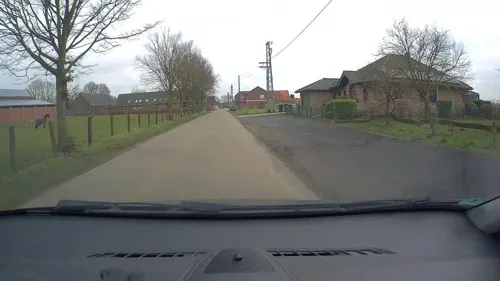
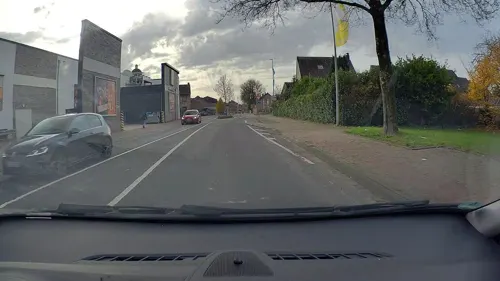
Büsch
Cafe · German, Coffee Shop, Sandwich, Cake · 5.5 km
1 Antwerpener Platz, Kevelaer
Mo-Sa 07:00-22:00; Su,PH 07:00-12:00
Michelone
Restaurant · Pizza
2 Alter Markt, Weeze
Tu-Th 11:30-14:00,17:00-22:30; Fr,Sa 11:30-14:00,17:00-23:00; Su...
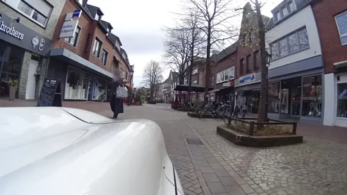
Steakhaus Argentina
Restaurant · Argentinian · 5.7 km
4 Johannes-Stalenus-Platz, Kevelaer
We-Su,PH 11:30-15:00,17:30-22:00
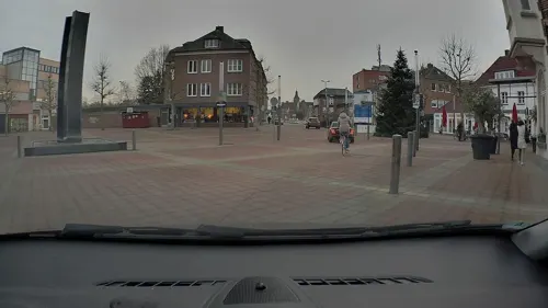




Cumsalis
Restaurant · 5.8 km
20 Hauptstraße, Kevelaer
Mo 17:00-22:00; We, Th 17:00-22:00; Fr 17:00-23:00; Sa...
Die gläserne Hostienbäckerei
Bakery · 5.7 km
28 Neustraße, Kevelaer
Mo-Th 09:00-12:00,15:00-17:00; We,Fr 09:00-12:00
Hollandia Pfannkuchenhaus
Restaurant · Pancake · 5.8 km
14 Busmannstraße
Mo-Th 11:30-20:00; Fr-Su 11:30-22:00
133 more on the map.
History
Individual artifacts from the area's earliest settlement date back to the early/middle Stone Age. In subsequent periods, various historical items have been found on municipal soil. These include a burial site with 1,000 tumuli in the area of Kalbeck, settlement remains on the Hees, remnants of a Roman road between Cologne and Nijmegen in the Netherlands, and a significant discovery of Roman silver coins. Franconian burial sites from around the 8th century have also been unearthed near the town center.
Weeze's history is reflected in several landmarks, such as the restored Catholic Church of St. Cyriakus, archaeological excavations from the Stone and Bronze Ages, Wissen Castle complete with its moat, Kalbeck Castle, and the ruins of Hertefeld Castle.
The area in and around present-day Weeze was first mentioned in a document from King Lothar II in 855. In this document, the King presented Count Ansfried with an estate east of the River Niers, known mainly as Villa Geizefurt and situated primarily in the farmstead area of Kalbeck.
The area was populated before the name "Weeze" was officially recorded for the first time in a document in 1226. In this document, Earl Henry III of Alpen presented the Zisterzienserkloster Kamp with an estate in the farmstead of Vornick.
From the History section of Weeze on Wikipedia, under CC BY-SA 4.0.
Where to stay40
Churches and places of worship37
St. Marien Basilika
Church · Roman Catholic · 5.7 km
Kapellenplatz, Kevelaer
Orthodoxe Johanneskapelle
Church · Orthodox · 5.6 km
4 Amsterdamer Straße
Shopping46
Gas and EV charging25
Schools, colleges and libraries23
Collegium Augustinianum Gaesdonck
School · 6.2 km
220 Gaesdoncker Straße, Goch
Berufskolleg des Kreises Kleve - Teilstandort Goch/ Arnold-Janssen-Schule
School · 6.4 km
9 Jakobstraße, Goch
Geschwister-Devries-Schule, katholische Grundschule
School · Catholic · 6.8 km
20 Kervenheimer Straße, Uedem
Healthcare20
Augenarztpraxis Fackeldey und Simon
Clinic and pharmacy · 6.0 km
64 Busmannstraße, Kevelaer
Zentralapotheke der Katholisches Karl-Leisner-Klinikum gGmbH
Clinic and pharmacy · 6.5 km
37 Wellesweg, Uedem
Map of Weeze
250 places. The map loads OpenStreetMap tiles when you open it.
Getting there and nearby towns
Airport Weeze (NRN) is the nearest airport with scheduled flights listed in OpenStreetMap, 5 km away.
- Xanten 18 km east, about 18 min by car
- Wesel 29 km east, about 29 min by car
- Moers 36 km southeast, about 36 min by car
- Krefeld 41 km southeast, about 41 min by car
- Duisburg 45 km southeast, about 45 min by car
- Willich 47 km southeast, about 47 min by car
- Oberhausen 49 km east, about 49 min by car
- Mönchengladbach 52 km south, about 52 min by car
- Bottrop 52 km east, about 52 min by car
- Essen 59 km east, about 59 min by car
Drive times are estimates from straight-line distance, not routes.
Local news
Headlines from INDB.
Reviews, tips and questions
Loading what members have shared...
Sources and licences
- GeoNames (CC BY 4.0): population, coordinates, regions and time zone
- Mapillary (see each image): photos
- OpenStreetMap contributors (ODbL 1.0): places, airports, map data
- Wikidata (CC0 1.0): elevation, founding date, time zone, website, landmarks and historic places
- Wikimedia Commons (see each image): photos
- Wikipedia (CC BY-SA 4.0): overview and history text
Photo credits
- St Cyriakus Weeze, Tohma ( talk ), CC BY-SA 4.0
- Weeze Rathaus 2013, Larske, CC BY-SA 3.0
- Bürgerhaus Weeze, Tohma ( talk ), CC BY-SA 4.0
- Weezetrainstationpanorama, Pimvantend, CC BY-SA 3.0
- Stolperstein Koopmann Paula Weeze 1905-1942, Graph Pixel, CC0
- Stolperstein Koopmann Rosemarie Weeze 1932-1942, Graph Pixel, CC0
- Stolperstein Koopmann Heinrich Weeze 1894-1942, Graph Pixel, CC0
- Stolperstein Koopmann Marion Weeze 1930-1942, Graph Pixel, CC0
- Stolperstein Koopmann Leonhard Weeze 1862-1943, Graph Pixel, CC0
- Stellwerk Weeze, Tohma ( talk ), CC BY-SA 4.0
- Stolperstein Hertz Simon Weeze 1888-1942, Graph Pixel, CC0
- Strohpferd-Skulptur nahe Weeze - geo.hlipp.de - 19854, Gregory Smith on geo.hlipp.de, CC BY-SA 2.0
- Kriegsgräberstätte Weeze 19, Dat doris, CC BY-SA 4.0
- Kriegsgräberstätte Weeze 20, Dat doris, CC BY-SA 4.0
- Kriegsgräberstätte Weeze 18, Dat doris, CC BY-SA 4.0
- Kriegsgräberstätte Weeze 15, Dat doris, CC BY-SA 4.0
- Kriegsgräberstätte Weeze 17, Dat doris, CC BY-SA 4.0
- Kriegsgräberstätte Weeze 16, Dat doris, CC BY-SA 4.0
- Kriegsgräberstätte Weeze 14, Dat doris, CC BY-SA 4.0
- Kriegsgräberstätte Weeze 12, Dat doris, CC BY-SA 4.0
- Kriegsgräberstätte Weeze 13, Dat doris, CC BY-SA 4.0
- Kriegsgräberstätte Weeze 09, Dat doris, CC BY-SA 4.0
- Kriegsgräberstätte Weeze 07, Dat doris, CC BY-SA 4.0
- Kriegsgräberstätte Weeze 11, Dat doris, CC BY-SA 4.0
- Kriegsgräberstätte Weeze 08, Dat doris, CC BY-SA 4.0
- Kriegsgräberstätte Weeze 10, Dat doris, CC BY-SA 4.0
- Kriegsgräberstätte Weeze 01, Dat doris, CC BY-SA 4.0
- Kriegsgräberstätte Weeze 21, Dat doris, CC BY-SA 4.0
- Tussen Wellerlooi en Twisteden, meer in Maasduinen 2009-08-16 18.30, Michielverbeek, CC BY-SA 3.0
- Arnojan6, Peter Bouss at German Wikipedia, Public domain
- 2024-09-08 Evangelische Kirche Markt Goch ZvD 18, Ziko, CC BY-SA 4.0
- Goch, Haus zu den Fünf Ringen, 2012-05 CN-01, kaʁstn Disk / Cat, CC BY-SA 3.0 de
- 2024-09-08 Steintor Goch 09, Ziko, CC BY-SA 4.0
- Basilika, Gnadenkapelle in Kevelaer, Pkw98, CC BY-SA 3.0
- Goch - Museum 02 ies, Frank Vincentz, CC BY-SA 3.0
- Schloss Wissen, Rainer Lippert, CC0
- MarMagGo, Laird-of-Harpsdale at German Wikipedia, Attribution
- Kevelaer-StAntonius-1-Asio, Asio otus, CC BY-SA 3.0
- Weeze - Sankt Cyriakus 02 ies, Frank Vincentz, CC BY-SA 3.0
- Eingang NMK, NiederrheinMuseumKevelaer, CC BY-SA 4.0
- Weeze, de evangelische kerk Dm12 foto2 2013-04-30 13.35, Michielverbeek, CC BY-SA 3.0
- 452 Kervenheimer Mühle, Burg Kevelaer-Kervenheim, Käthe u. Bernd Limburg, www.limburg-bernd.de, CC BY-SA 3.0 de
- Kevelaer, Germany - panoramio (9), Ben Bender, CC BY-SA 3.0
- Genadekapel Kevelaer 24-04-2019 11-46-50, Paul Hermans, CC BY-SA 4.0
- Street-level photo, poxonline, CC BY-SA 4.0
- Street-level photo, dakrys, CC BY-SA 4.0
- Street-level photo, poxonline, CC BY-SA 4.0
- Street-level photo, poxonline, CC BY-SA 4.0
- Street-level photo, fietsersbond, CC BY-SA 4.0
- Street-level photo, poxonline, CC BY-SA 4.0
- Street-level photo, poxonline, CC BY-SA 4.0
- Street-level photo, poxonline, CC BY-SA 4.0
- Street-level photo, poxonline, CC BY-SA 4.0
- Street-level photo, poxonline, CC BY-SA 4.0
- Street-level photo, poxonline, CC BY-SA 4.0
- Street-level photo, poxonline, CC BY-SA 4.0
- Street-level photo, poxonline, CC BY-SA 4.0


Page built November 8, 2026. Spotted a mistake? Tell us or suggest a place.