


Why visit Wesel
Townapedia lists 69 museums and landmarks, 65 parks and trails, 237 places to eat, 14 places to stay and 24 attractions in and around town.
Highlights include Niederrhein-Westfälische Braumanufaktur, Tinthof, Otto-Pankok-Museum and Stadtwerke Wasserturm.
Weather in Wesel
Forecast from MET Norway (CC BY 4.0). Full forecast
About Wesel
Wesel (German pronunciation: [ˈveːzl̩] ) is a city in North Rhine-Westphalia, in western Germany. It is the capital of the Wesel district.
From the Wikipedia article Wesel (this version), under CC BY-SA 4.0.
Photos of Wesel


Things to do24
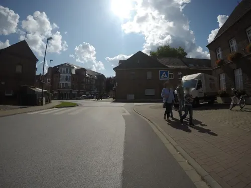
Niederrhein-Westfälische Braumanufaktur
Farm and orchard · 7.5 km
Braumanufaktur
4 Brauereistraße, Hamminkeln
siehe Homepage
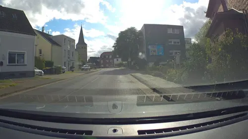
Tinthof
Farm and orchard · 6.2 km
Eigene Käseherstellung, Eier, Hühner und Hähne, hochwertiges Rindfleisch
7 Weseler Straße, Voerde (Niederrhein)
We 17:00-19:00; Sa 09:00-12:00

Baumeistershof
Farm and orchard · 7.9 km
Sommerblumen, Kürbisse, Heu und Stroh
34 Mehrstraße, Voerde (Niederrhein)
"nach Vereinbarung"
Bioland Hankel
Farm and orchard · 4.2 km
Gemüse von A Artischocke bis Z Zucchini
56c Perricher Weg, Wesel
Fr 15:00-17:00
Eimers und Eimers
Farm and orchard · 7.7 km
Verschiedenste Gemüsesorten, wie Wurzelpetersilie, Pastinake, Porree und Möhre im Selbstbedienungsladen
3 Im Hasselt, Hamminkeln
Jul-Apr open "Selbstbedienung"
Heinen
Farm and orchard · 4.8 km
Spargel, Erdbeeren, Äpfel, Eier, Obst und Gemüse
121 Obrighovener Straße, Wesel
Mo-Sa 08:00-19:00; Su 08:00-14:00
Hofladen Abels
Farm and orchard · 5.1 km
Kartoffeln aus eigenem Anbau, Eier aus eigener Bodenhaltung, regionale und saisonale Produkte
19 Weseler Straße, Wesel
Tu, Th, Fr 10:00-18:00, We 15:00-18:00, Sa 10:00-13:00
Ruth Pattay
Farm and orchard · 3.2 km
Heidschnucken-Lammfleisch, Heidschnuckenfelle
1 Fort I, Wesel
"nach telefonischer Vereinbarung"
Wollverkauf Sprock
Farm and orchard · 7.8 km
Wolle und Lammfleischverkauf
83 Grünstraße, Voerde (Niederrhein)
"nach Vereinbarung"
Hofladen Landluft
Farm and orchard · 7.2 km
Saisonblumen, Kartoffeln, Eier, Schwarzbrot, Fruchtaufstriche, Obst und Gemüse
15 Westerheide, Wesel
Mo 14:00-18:00, We-Su 14:00-18:00
Obstkelterei van Nahmen
Farm and orchard · 7.3 km
27 Diersfordter Straße, Hamminkeln
Mo-Fr 09:00-18:00; Sa 09:00-13:00
Hof Fengels
Farm and orchard · 7.0 km
Obst der Saison von unseren Streuobstwiesen, Honig, Eier
245 Frankfurter Straße, Voerde (Niederrhein)
Tu 09:00-13:00; Th 09:00-18:00
12 more on the map.
Museums and landmarks69


Klever Landwehr
Monument and historic site · 7.7 km
40km lange Landwehr in den Kreisen Wesel und Borken


Pfeiler der Alten Eisenbahnbrücke
Monument and historic site · 2.0 km


Archaeological Park of Xanten
Monument and historic site · 11.7 km
Archaeological ancient Roman site in Xanten, Germany, with reconstructed buildings


Colonia Ulpia Traiana
Monument and historic site · 11.7 km
Ancient Roman city

Lower German Limes
Monument and historic site · 11.5 km
UNESCO World Heritage Site in Germany, Netherlands

Gut Bossigt
Monument and historic site · 2.3 km
99 Konrad-Duden-Straße, Wesel

Haus Esselt
Monument and historic site · 7.3 km
4 Otto-Pankok-Weg, Hünxe
57 more on the map.
Parks, trails and playgrounds65



Droste Woy, Rheinaue zwischen Wesel und Bislich
Hiking and trails · 5.9 km

RheinBad Wesel
Sports field and stadium · 2.2 km
9 Rheinpromenade, Wesel
Mo 06:00-08:00, 12:00-20:00; Tu-Fr 06:00-08:00, 10:00-20:00; Sa-Su...
53 more on the map.
Restaurants and cafes237
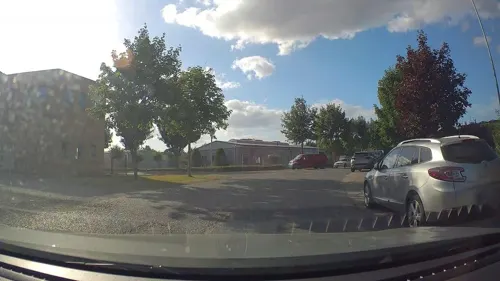
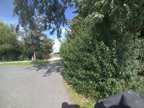
Hofcafé Elverich
Cafe · Regional, Cake, Waffle · 6.0 km
Das Familiencafé mit Biergarten und Tieren. Ankommen, abschalten und den Alltag außen vor lassen während die Kids spielen - das ist...
2a Elverich, Rheinberg
Fr-Sa 09:00-18:00
Restaurant Zum Hasen Hein
Restaurant · Regional · 6.7 km
76 Hamminkelner Straße, Hamminkeln
Mo-Sa 17:00-23:00; Su 10:00-23:00
Bäckerei Schollin
Bakery · 5.4 km
121 Frankfurter Straße, Voerde (Niederrhein)
Mo-Fr 05:00-18:00; Sa 05:00-15:00; Su 07:00-13:00

Antonella
Restaurant · Italian · 1.2 km
1 Kornmarkt, Wesel
Tu-Sa 12:00-15:00,17:00-22:30; Su,PH 12:00-22:00; Mo off
Chun’s China Restaurant
Restaurant · Chinese · 2.7 km
4 Pastor-Schmitz-Straße
Mo,We-Sa 12:00-15:00,17:00-22:00; Su 12:00-22:00
UMI Papami
Restaurant · Asian · 1.2 km
11 Kornmarkt, Wesel
Mo-Tu 11:00-22:00; We off; Th-Sa 11:00-22:00; Su 12:00-22:00

Bäckerei Jöhren
Bakery · 5.1 km
30 Alte Hünxer Straße, Voerde (Niederrhein)
Mo-Fr 05:30-18:00, Sa 05:30-13:00, Su 07:30-11:30
225 more on the map.
History
The city originated from a Franconian manor that was first recorded in the 8th century.
In the 12th century, the Duke of Clèves took possession of Wesel. The city became a member of the Hanseatic League during the 15th century. Wesel was second only to Cologne in the lower Rhine region as an entrepôt. It was an important commercial centre: a clearing station for the transshipment and trading of goods.
In 1545, a Walloon community in Wesel was noted, with French-language church services.
In 1590, the Spanish captured Wesel after a four-year siege. The city changed hands between the Dutch and Spanish several times during the Eighty Years War. In 1672, a French force under Louis II de Bourbon, Prince de Condé captured the city.
Wesel was inherited by the Hohenzollerns of the Margraviate of Brandenburg in 1609 but they were unable to take control of Wesel until the Treaty of Nijmegen in 1678. In 1688, a French Huguenot commune was founded in the town. Although the city had been heavily fortified the Prussians evacuated the city during the Seven Years' War and it was occupied by the French. It was returned to Prussia at the end of the war. Friedrich Wilhelm von Dossow was the Prussian Governor of Wesel during the 18th century.
Read more of the history
In 1805, during the Napoleonic Wars, Wesel was ceded to the French Empire under the Treaty of Schönbrunn. It became part of the Grand Duchy of Berg, established in March 1806 as a French client state under Joachim Murat, before being annexed to France-proper in January 1808. The French heavily fortified the city constructing a rectangular fort called the Citadelle Napoleon at Büderich and the Citadelle Bonaparte on an island in the Rhine off Wesel. Though blockaded by the Allies in 1813 the city remained in French hands until after the Battle of Waterloo. After the Napoleonic Wars the city became part of the Prussian Province of Jülich-Cleves-Berg in 1815 then the Rhine Province in 1822; the Citadelle Napoleon was renamed Fort Blücher.
Forced laborers of the 3rd SS construction brigade were dispatched in the town in 1943.
During World War II, as a strategic depot, Wesel became a target of Allied bombing. Air raids, using impact and air-burst bombs, on 16, 17, 18 and 19 February 1945, destroyed 97% of the town. The Wehrmacht blew up bridges along the Rhine and Lippe to prevent Allied forces from advancing. The Wehrmacht also destroyed the 1,950m-long railway bridge, the last Rhine bridge remaining in German hands, on 10 March. On 23 March, Wesel came under the fire of over 3,000 guns when it was bombarded anew, in preparation for Operation Plunder. The shelling was assisted by a raid of RAF bombers and a larger raid that night, during which ten individual bombers each dropped a 10,000 kg bomb on Wesel at 2100 hours. Before the town was finally taken by Allied troops, 97% of its structures were destroyed. In the ensuing attacks by Allied forces, the town was taken with minimal casualties. Operation Varsity – the largest airborne landings of the war in one day and one location – dropped 18,000 troops into the area to take the hills behind Wesel. The British 1st Commando Brigade was already attacking Wesel, carried into action by LVT Buffalos. The remainder of the Allied force crossed the Rhine in more amphibious vehicles.
From almost 25,000 in 1939, the population was reduced to 1,900 by May 1945. In 1946, Wesel became part of the new state North Rhine-Westphalia of West Germany.
From the History section of Wesel on Wikipedia, under CC BY-SA 4.0.
More about Wesel
Geography
Wesel is situated at the confluence of the Lippe River and the Rhine.
Suburbs of Wesel include Lackhausen, Obrighoven, Ginderich, Feldmark, Fusternberg, Büderich, Flüren and Blumenkamp.
From the Wikipedia article Wesel, under CC BY-SA 4.0.
Notable people from Wesel
 Ida NoddackGerman chemist (1896–1978)Photo: Unknown author Unknown author, CC BY-SA 3.0
 Peter Minuitthird director-general of New Netherland, founder of the Swedish colony of New Sweden in 1638 (1580–1638)Photo: Unknown, Public domain
 Michael MöllenbeckGerman discus thrower (1969–2022)Photo: Suffolk Booklover, CC BY 2.0
 Bartholomaeus Bruyn the ElderGerman Renaissance painter (1493–1555)Photo: Bartholomaeus Bruyn the Elder, Public domain
 Steffen PetersOlympic medalists in equestrianPhoto: World Dressage Masters / Susan J. Stickle, CC BY 2.0
 Jan JoestpainterPhoto: Jan Joest, Public domain
 Johann Arnold NeringGerman architect (1659-1695)Photo: ernstol, CC BY-SA 3.0
 Franz EtzelGerman politician (1902-1970)Photo: CDU, CC BY-SA 3.0 de
 Tobias KempeGerman footballerPhoto: Northside, CC BY-SA 3.0
 Derick Baegertpainter (1440-1515)Photo: Derick Baegert, Public domain
- Joachim von RibbentropGerman Foreign Minister of Nazi Germany (1893–1946)
- Hans Lippershay(1571-1619) German-Dutch spectacle-maker
Born in Wesel, according to Wikidata (CC0). Each name links to its Wikipedia article.
Where to stay14
Zum Hasen Hein
Motel and hotel · German · 6.7 km
76 Hamminkelner Straße, Hamminkeln
Landhotel Zum Hasen Hein
Motel and hotel · 6.7 km
76 Hamminkelner Straße, Hamminkeln
Churches and places of worship35
Evangelische Kirche Spellen
Church · Protestant · 6.3 km
13 Friedrich-Wilhelm-Straße, Voerde (Niederrhein)
Friedenskirche zu den Heiligen Engeln
Church · Catholic · 1.7 km
Am Kirchplatz, Wesel
Shopping58
Gas and EV charging21
Schools, colleges and libraries33
Healthcare23
Map of Wesel
250 places. The map loads OpenStreetMap tiles when you open it.
Getting there and nearby towns
Airport Weeze (NRN) is the nearest airport with scheduled flights listed in OpenStreetMap, 34 km away.
- Hünxe 6 km southeast, about 6 min by car
- Hamminkeln 8 km north, about 8 min by car
- Voerde 9 km southeast, about 9 min by car
- Xanten 12 km west, about 12 min by car
- Alpen 12 km southwest, about 12 min by car
- Dingden 11 km north, about 11 min by car
- Rheinberg 14 km south, about 14 min by car
- Dinslaken 14 km southeast, about 14 min by car
- Schermbeck 17 km east, about 17 min by car
- Bocholt 19 km north, about 19 min by car
Drive times are estimates from straight-line distance, not routes.
Towns near Wesel


Keep exploring
Local news
Headlines from INDB.
Reviews, tips and questions
Loading what members have shared...
Sources and licences
- GeoNames (CC BY 4.0): population, coordinates, regions and time zone
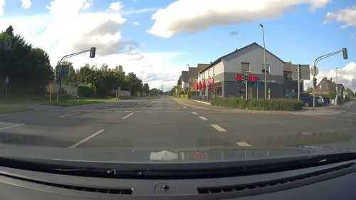
- Mapillary (see each image): photos
- OpenStreetMap contributors (ODbL 1.0): places, airports, map data
- Wikidata (CC0 1.0): elevation, founding date, time zone, website, landmarks and historic places
- Wikimedia Commons (see each image): photos
- Wikipedia (CC BY-SA 4.0): overview and history text
Photo credits
- Wesel01, Markus Schweiß, CC BY-SA 3.0
- Selimiye Camii VIKZ Wesel Wesel-3229, User:Creosoph, CC BY-SA 4.0
- Wesel Baudenkmal 104 Haus Breiter Weg 39 Wesel-3227-LR, User:Creosoph, CC BY-SA 4.0
- Wesel Vatan Camii DITIB Wesel-3380, User:Creosoph, CC BY-SA 4.0
- Wesel 628 928 669 RB 32 Wesel-Bocholt (12104166523), Rob Dammers, CC BY 2.0
- Wesel DBS 189 054-0 gemengde goederentrein r. NL (12104539206), Rob Dammers, CC BY 2.0
- Wesel ICE-3M 4685 naar Frankfurt (12104536896), Rob Dammers, CC BY 2.0
- Wesel Baudenkmal 139 Forsthaus Am Nordglacis 18 Wesel-3225, User:Creosoph, CC BY-SA 4.0
- Wesel B.E.G. 295 057-4 met platte wagens uit Emmerich (12104257194), Rob Dammers, CC BY 2.0
- Wesel-Mahnmal für die Opfer des Krieges und der Gewaltherrschaft-Hans van Breek, Dat doris, CC BY-SA 4.0
- Wesel Baudenkmal 21 Haus Lipperheystr. 2 Wesel-3237, User:Creosoph, CC BY-SA 4.0
- Wesel Baudenkmal 22 Haus Lipperheystr. 4 Wesel-3238, User:Creosoph, CC BY-SA 4.0
- Wesel Baudenkmal 23 Haus Lipperheystr. 6 Wesel-3241, User:Creosoph, CC BY-SA 4.0
- Wesel Baudenkmal 24 Haus Lipperheystr. 8 Wesel-3242, User:Creosoph, CC BY-SA 4.0
- Wesel Baudenkmal 25 Haus Lipperheystr. 10 Wesel-3243, User:Creosoph, CC BY-SA 4.0
- Wesel Baudenkmal 26 Haus Lipperheystr. 12 Wesel-3245, User:Creosoph, CC BY-SA 4.0
- Wesel Baudenkmal 27 Haus Lipperheystr. 14 Wesel-3246, User:Creosoph, CC BY-SA 4.0
- Kreishaus Wesel, Muck68, CC BY-SA 4.0
- Wesel Baudenkmal 08 Haus Fluthgrafstr. 12 Wesel-3315, User:Creosoph, CC BY-SA 4.0
- Clp 20150420 4463 Bf Wesel Überblick, Platte, CC BY-SA 4.0
- Clp 20150420 4465 Bf Wesel Überblick, Christian Liebscher, CC BY-SA 4.0
- St. Martini Wesel Wesel-3318, User:Creosoph, CC BY-SA 4.0
- Clp 20150304 4201 Bf Wesel Bahnhofskopf Nord, Christian Liebscher, CC BY-SA 4.0
- Clp 20150422 4556 Hp Wesel-Feldmark Bstg, Christian Liebscher, CC BY-SA 4.0
- Stolperstein Wesel Mühlstein-Tanne, Isidor, Anhdroid, CC BY-SA 4.0
- Wesel Baudenkmal 05 Lutherhaus Wesel-3323, User:Creosoph, CC BY-SA 4.0
- Clp 20150420 4476 Bf Wesel Bstg, Christian Liebscher, CC BY-SA 4.0
- Clp 20150420 4473 Bf Wesel Kehrgleise, Christian Liebscher, CC BY-SA 4.0
- Clp 20150420 4472 Bf Wesel Zsig 26ZR2, Christian Liebscher, CC BY-SA 4.0
- Wesel, Germany - panoramio (14), Ben Bender, CC BY-SA 3.0
- Wesel, Germany - panoramio (13), Ben Bender, CC BY-SA 3.0
- Wesel, Germany - panoramio (10), Ben Bender, CC BY-SA 3.0
- Clp 20150422 4553 Hp Wesel-Feldmark Bstg, Christian Liebscher, CC BY-SA 4.0
- Clp 20150304 4180 Bf Wesel Nebengebäude, Christian Liebscher, CC BY-SA 4.0
- Colonia Ulpia Traiana - Aerial views -0102, Raimond Spekking, CC BY-SA 4.0
- Stadium (3) (archaeological park Xanten, Germany, 2005-04-23), Magnus Manske, CC BY-SA 3.0
- Harbor temple (1) (archaeological park Xanten, Germany, 2005-04-23), Magnus Manske, CC BY-SA 3.0
- Limes1, Ziegelbrenner, CC BY-SA 3.0
- Andreas-Vesalius-Gymnasium Wesel, KingKurt, CC BY-SA 4.0
- Bislicher Insel NRW 2, Michael and the Birds, CC BY-SA 3.0
- Brückenreste, Wolfgang Rabsahl (Lizenz bei Hans Schlieper durch den Fotografen), Public domain
- Otto-Pankok-Museum im ehemaligen Wirtschaftsgebäude am Haus Esselt 02, Michael Belter, CC BY-SA 3.0
- Wesel Gut Bossigt, Stahlkocher, CC BY-SA 3.0
- Haus Esselt, Hünxe (02), Michael Belter, CC BY-SA 3.0
- Außenansicht des LVR-Niederrheinmuseums Wesel, Wikischreiberin16, CC BY-SA 4.0
- Schloss Diersfordt Panorama Sueden, Sir Gawain, CC BY-SA 3.0
- Wesel AlterWasserturm, NatiSythen, CC BY-SA 3.0
- Friedenskirche zu den Heiligen Engeln - Fort Fusternberg 03 ShiftN, Claus Derksen , shifted by Rabanus Flavus, CC BY 3.0
- EvKircheBüderich, ᛗᚨᚱᚲᚢᛊ ᚨᛒᚱᚨᛗ, CC BY-SA 4.0
- Gadenkirche Wesel 1, KingKurt, CC BY-SA 4.0
- Aaper Vennekes 2, 46WES, CC BY-SA 4.0
- Rundweg Diersfordter Wildgatter, Frebeck, CC BY-SA 3.0
- RheinvorlandPerrich03, ᛗᚨᚱᚲᚢᛊ ᚨᛒᚱᚨᛗ, Public domain
- St Franziskus Wesel Kolumbarium, D.Kirchhoff, CC BY-SA 4.0
- Christuskirche in Wesel- Flüren, DiWeDu, CC BY-SA 4.0
- Flutmulden an der Lippemündung, Dilemmsen, CC BY-SA 4.0
- Hamminkeln-Evangelische Kirche-Marktstraße 01, Dat doris, CC BY-SA 4.0
- Hamminkeln, kerk1 foto2 2011-04-11 13.34, Michielverbeek, CC BY-SA 3.0
- Brünen, evangelische Kirche foto1 2012-08-03 12.33, Michielverbeek, CC BY-SA 3.0
- Evangelische Kirche Spellen-001, Harald Lordick, CC BY-SA 3.0
- Rainbow over camping Grav-Insel near Wesel - panoramio, Maarten Sepp, CC BY-SA 3.0
- Klever Landwehr 0088, Albert Bömer, Rees-Mehr, CC BY-SA 3.0
- Street-level photo, marczoutendijk, CC BY-SA 4.0
- Street-level photo, poxonline, CC BY-SA 4.0
- Street-level photo, poxonline, CC BY-SA 4.0
- Street-level photo, poxonline, CC BY-SA 4.0
- Street-level photo, geogladbecker, CC BY-SA 4.0
- Street-level photo, geogladbecker, CC BY-SA 4.0
- Street-level photo, geogladbecker, CC BY-SA 4.0
- Street-level photo, poxonline, CC BY-SA 4.0
- Street-level photo, poxonline, CC BY-SA 4.0
- Street-level photo, poxonline, CC BY-SA 4.0
- Street-level photo, sirix, CC BY-SA 4.0
- Street-level photo, poxonline, CC BY-SA 4.0
- Street-level photo, ramap, CC BY-SA 4.0
- Street-level photo, poxonline, CC BY-SA 4.0
- Street-level photo, poxonline, CC BY-SA 4.0


Page built November 9, 2026. Spotted a mistake? Tell us or suggest a place.