


Weilerswist, Germany
Weilerswist is a town of 16,321 people in North Rhine-Westphalia, Germany.
Why visit Weilerswist
Townapedia lists 84 museums and landmarks, 39 parks and trails, 105 places to eat, 8 places to stay and 10 attractions in and around town.
Highlights include Lukas Hofladen, Hofladen "Äpfel + Birnen & Co, Das verrückte Hotel Tartüff and Eifelwasserleitung.
Weather in Weilerswist
Forecast from MET Norway (CC BY 4.0). Full forecast
About Weilerswist
Weilerswist (German pronunciation: [ˌvaɪlɐˈsvɪst] ) is a municipality in the district of Euskirchen in the state of North Rhine-Westphalia, Germany. It is located in the Eifel hills, approximately 10 kilometers north of Euskirchen, and 20 kilometers south-west of Cologne.
From the Wikipedia article Weilerswist (this version), under CC BY-SA 4.0.
Things to do10





Museums and landmarks84


Eifelwasserleitung
Monument and historic site · 5.4 km
Sammlung der Einträge, um sie über den Wikipedia-Artikel zugänglich zu machen.





Rheindorfer Burg
Monument and historic site · 6.3 km
39 Rheindorfer-Burg-Weg, Bornheim


72 more on the map.
Parks, trails and playgrounds39

Phantasialand
Sports field and stadium · 5.8 km
Amusement park
31-41 Berggeiststraße, Brühl
PH,Mo-Su 09:00-18:00



Ehemaliges Munitionsdepot im Friesheimer Busch
Hiking and trails · 3.9 km


27 more on the map.
Restaurants and cafes105

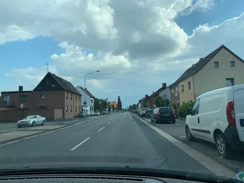
Balkan Spezialitäten Pashtriku
Restaurant · Balkan
5 Deutscher Platz, Weilerswist
Mo-Sa 06:00-22:00; Su 07:00-22:00
Bliesheimer Dorfgemeinschaftshaus "Em Dörp"
Restaurant · German · 3.7 km
63 Frankenstraße, Erftstadt
Th 18:00-21:00, Fr 18:00-22:00, Sa 12:30-21:00, Su 13:00-19:00

Café Trebellii
Cafe · Ice Cream · 6.2 km
3 Holzweg, Bornheim
Apr-Sep 12:00-21:00, Tu off; Oct-Mar 12:00-18:00, Tu off
La Stazione
Restaurant · Italian, Indian
11 Bahnhofsallee, Weilerswist
Tu-Sa 17:00-23:00; Su 12:00-22:00
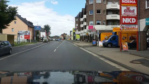
Lotus Asia Imbiss
Restaurant · Asian, Vietnamese, Chinese, Thai
3 Deutscher Platz, Weilerswist
Tu-Fr 12:00-15:00, 17:00-21:00; Sa 12:00-21:00; Su15:00-21:00
Mamma Leone
Restaurant · Italian · 6.1 km
2c Holzdamm, Erftstadt
Tu-Fr 11:00-15:00,17:30-23:00; Sa,Su,PH 10:00-23:00
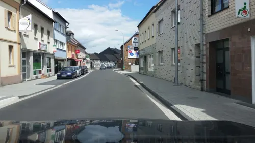
Pizzeria Bella Italia
Restaurant · Italian, Indian
87 Kölner Straße, Weilerswist
Mo-Fr 11:30-22:30; Sa,Su 12:00-22:30
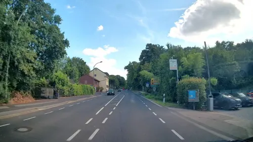
Swist Restaurant Bar
Restaurant · German, Burger, Pizza · 6.2 km
50 Kölner Straße, Swisttal
Tu-Sa 16:00-23:00; Su 12:00-23:00; Mo off


Zur Linde
Restaurant · German · 6.1 km
1 Bachstraße, Swisttal
We-Fr,Su 11:30-14:00,17:00-22:00; Sa 17:00-22:00; Mo,Tu off
93 more on the map.
Where to stay8
Churches and places of worship29
St. Kunibert
Church · Roman Catholic · 6.3 km
24 Kirchstraße, Swisttal
St. Walburga-Kirche
Church · Roman Catholic · 6.4 km
24 Walburgisstraße, Bornheim
Evangeliums Christen - Baptisten Gemeinde Swisttal
Church · Baptist · 6.2 km
2 Breniger Straße, Swisttal
Shopping30
Gas and EV charging17
Schools, colleges and libraries16
Healthcare11
Map of Weilerswist
250 places. The map loads OpenStreetMap tiles when you open it.
Getting there and nearby towns
Cologne Bonn Airport (CGN) is the nearest airport with scheduled flights listed in OpenStreetMap, 24 km away.
- Wesseling 12 km northeast, about 12 min by car
- Zülpich 15 km southwest, about 15 min by car
- Bonn 18 km east, about 18 min by car
- Zündorf 19 km northeast, about 19 min by car
- Köln 21 km north, about 21 min by car
- Leverkusen 32 km north, about 32 min by car
- Bergisch Gladbach 33 km northeast, about 33 min by car
- Solingen 50 km north, about 50 min by car
- Neuss 51 km north, about 51 min by car
- Düsseldorf 52 km north, about 52 min by car
Drive times are estimates from straight-line distance, not routes.
Local news
Headlines from INDB.
Reviews, tips and questions
Loading what members have shared...
Sources and licences
- GeoNames (CC BY 4.0): population, coordinates, regions and time zone
- Mapillary (see each image): photos
- OpenStreetMap contributors (ODbL 1.0): places, airports, map data
- Wikidata (CC0 1.0): elevation, founding date, time zone, website, landmarks and historic places
- Wikimedia Commons (see each image): photos
- Wikipedia (CC BY-SA 4.0): overview and history text
Photo credits
- Pfarrkirche St. Mauritius Weilerswist, Tohma, CC BY-SA 4.0
- 26-01 Bücherschrank Weilerswist 02, Achim Raschka, CC0
- 26-01 Bücherschrank Weilerswist 01, Achim Raschka, CC0
- Weilerswist Bahnhofsallee Bahnhof (01), Prof. emeritus Hans Schneider (Geyersberg), CC BY 4.0
- Weilerswist Bahnhof - panoramio, Blende-AC, CC BY-SA 3.0
- Weilerswist Bonner Straße (02), Prof. emeritus Hans Schneider (Geyersberg), CC BY 4.0
- Weilerswist Bonner Straße (05), Prof. emeritus Hans Schneider (Geyersberg), CC BY 4.0
- Weilerswist Bonner Straße (01), Prof. emeritus Hans Schneider (Geyersberg), CC BY 4.0
- Weilerswist Bahnhofsallee Bahnhof (02), Prof. emeritus Hans Schneider (Geyersberg), CC BY 4.0
- Weilerswist Bahnhofsallee Bahnhof (03), Prof. emeritus Hans Schneider (Geyersberg), CC BY 4.0
- Weilerswist Bahnhofsallee Bahnhof (04), Prof. emeritus Hans Schneider (Geyersberg), CC BY 4.0
- Weilerswist Kölner Straße 54 (03), Prof. emeritus Hans Schneider (Geyersberg), CC BY 4.0
- Weilerswist Kölner Straße 54 (02), Prof. emeritus Hans Schneider (Geyersberg), CC BY 4.0
- Weilerswist Kölner Straße 54 (04), Prof. emeritus Hans Schneider (Geyersberg), CC BY 4.0
- Weilerswist Kölner Straße 54 (01), Prof. emeritus Hans Schneider (Geyersberg), CC BY 4.0
- Weilerswist Kölner Straße 84 (02), Prof. emeritus Hans Schneider (Geyersberg), CC BY 4.0
- Weilerswist Kölner Straße 54 (05), Prof. emeritus Hans Schneider (Geyersberg), CC BY 4.0
- Weilerswist Kölner Straße 84 (01), Prof. emeritus Hans Schneider (Geyersberg), CC BY 4.0
- Weilerswist Kölner Straße 84 (03), Prof. emeritus Hans Schneider (Geyersberg), CC BY 4.0
- Weilerswist Triftstraße-Friedrich-Ebert-Straße (05), Prof. emeritus Hans Schneider (Geyersberg), CC BY 4.0
- Weilerswist Triftstraße-Friedrich-Ebert-Straße (01), Prof. emeritus Hans Schneider (Geyersberg), CC BY 4.0
- Weilerswist Triftstraße-Friedrich-Ebert-Straße (03), Prof. emeritus Hans Schneider (Geyersberg), CC BY-SA 4.0
- Weilerswist Triftstraße-Friedrich-Ebert-Straße (04), Prof. emeritus Hans Schneider (Geyersberg), CC BY 4.0
- Weilerswist Triftstraße-Friedrich-Ebert-Straße (02), Prof. emeritus Hans Schneider (Geyersberg), CC BY 4.0
- Weilerswist Kölner Straße 99 (01), Prof. emeritus Hans Schneider (Geyersberg), CC BY 4.0
- Weilerswist Kölner Straße 99 (03), Prof. emeritus Hans Schneider (Geyersberg), CC BY 4.0
- Weilerswist Kölner Straße 99 (02), Prof. emeritus Hans Schneider (Geyersberg), CC BY 4.0
- Weilerswist Kölner Straße 99 (04), Prof. emeritus Hans Schneider (Geyersberg), CC BY 4.0
- Weilerswist Kölner Straße (01), Prof. emeritus Hans Schneider (Geyersberg), CC BY 4.0
- Weilerswist, Preußischer Rundkopfmeilenstein, Manfred Schröter, Berga, CC BY-SA 4.0
- Weilerswist Mauritiusgasse Kirchhof (01), Prof. emeritus Hans Schneider (Geyersberg), CC BY 4.0
- Weilerswist Kölner Straße 135 (02), Prof. emeritus Hans Schneider (Geyersberg), CC BY 4.0
- Weilerswist Mauritiusgasse Kirchhof (05), Prof. emeritus Hans Schneider (Geyersberg), CC BY 4.0
- Weilerswist Kölner Straße 135 (03), Prof. emeritus Hans Schneider (Geyersberg), CC BY 4.0
- Phantasialand Brühl, Wolkenkratzer, CC BY-SA 3.0
- Mechernich-Vussem Aquäduktbrücke, Mediatus, CC BY-SA 3.0
- Ingang Maus au Chocolat, Wim Strijbosch, CC BY 3.0
- Erftstadt Bliesheim Sankt Lambertuskirche, HOWI - Horsch, Willy, CC BY 3.0
- Geister Rikscha - Phantasialand, JZ85, CC BY-SA 3.0
- Friesheim-Pfarrkirche-St-Martin-012, Horsch, Willy - HOWI, CC BY 3.0
- Walberberg(Bornheim)St.Walburga5408, Reinhardhauke, CC BY-SA 3.0
- Rheindorfer Burg Kloster in Walberberg, Stefan Didam - Schmallenberg, CC BY-SA 3.0
- Hotel Tartüff (1), Mw007, CC BY-SA 4.0
- Heimerzheim St. Kunibert 103, Reinhardhauke, CC BY-SA 3.0
- Feng Ju Palace - Phantasialand, JZ85, CC BY-SA 3.0
- Wakobato - Phantasialand, JZ85, CC BY-SA 3.0
- Erftstadt Liblar evangelische Friedenskirche, HOWI - Horsch, Willy, CC BY 3.0
- Liblar Bergstraße katholische Kirche St-Barbara, HOWI - Horsch, Willy, CC BY 3.0
- Niederberg St. Johann Baptist 03, Achim Raschka ( talk ), CC BY-SA 4.0
- Taron-1, Stefan Scheer, CC BY-SA 4.0
- Raik-3, Stefan Scheer, CC BY-SA 4.0
- Naturschutzgebiet Ententeich BM-023 in Brühl, Rhein-Erft-Kreis, bedroht durch Freizeitpark-Erweiterung, Leucorrhinia, CC BY-SA 4.0
- Markuskirche (Hemmerich) (2), Chris06, CC BY-SA 4.0
- Hemmerich, St. Ägidius (2), Chris06, CC BY-SA 4.0
- FLY-Phantasialand-1, Stefan Senger, CC BY-SA 4.0
- Phantasialand MysteryCastle, Stefan Scheer, CC BY 2.5
- Berggeistweiher Herbst 2018, Bornheim-Walberberg, UlrikeBrühl, CC BY-SA 4.0
- Altwald Bodenbewuchs001 fi8, Greenshooter, CC BY-SA 3.0
- Gut Antoniterhof in Weilerswist Klein-Vernich, Margareteschmitt, CC BY-SA 4.0
- NSG Erftaue und Streuobstwiesen westlich Weilerswist 04, Assenmacher, CC BY 4.0
- Street-level photo, jaakkoh, CC BY-SA 4.0
- Street-level photo, noel, CC BY-SA 4.0
- Street-level photo, jaakkoh, CC BY-SA 4.0
- Street-level photo, walldi222, CC BY-SA 4.0
- Street-level photo, kalcaaro, CC BY-SA 4.0
- Street-level photo, rudirost, CC BY-SA 4.0
- Street-level photo, bonnsoir, CC BY-SA 4.0
- Street-level photo, jaakkoh, CC BY-SA 4.0
- Street-level photo, jaakkoh, CC BY-SA 4.0
- Street-level photo, noel, CC BY-SA 4.0
- Street-level photo, rudirost, CC BY-SA 4.0
- Street-level photo, walldi222, CC BY-SA 4.0
- Street-level photo, walldi222, CC BY-SA 4.0
- Street-level photo, jaakkoh, CC BY-SA 4.0
- Street-level photo, jaakkoh, CC BY-SA 4.0
- Street-level photo, thetornado76, CC BY-SA 4.0
- Street-level photo, dcp, CC BY-SA 4.0


Page built November 8, 2026. Spotted a mistake? Tell us or suggest a place.