


Why visit Zündorf
Townapedia lists 28 museums and landmarks, 10 parks and trails, 116 places to eat, 11 places to stay and 4 attractions in and around town.
Highlights include Cologne Rodenkirchen Bridge, Rolf's Streichelzoo Köln, Schloss Wahn and Schwarzes Krützje.
Weather in Zündorf
Forecast from MET Norway (CC BY 4.0). Full forecast
About Zündorf
Zündorf (German pronunciation: [ˈtsyːndɔʁf]) is a suburb of Cologne, Germany and part of the district of Porz. Zündorf lies on the right bank of the river Rhine, between Langel and Porz. Zündorf has 12.229 inhabitants (as of 31 December 2008) and covers an area of 8,12 km2.
From the Wikipedia article Zündorf (this version), under CC BY-SA 4.0.
Things to do4

Cologne Rodenkirchen Bridge
Bridge · 5.3 km
Freeway(A4)-bridge crossing the Rhine south of Cologne

Rolf's Streichelzoo Köln
Zoo and aquarium · 0.6 km
Mar-Oct: Mo-Fr 09:00-18:30, Sa 09:00-16:00; Nov-Feb: Mo-Fr 10:00-16:00

Museums and landmarks28


Schwarzes Krützje
Monument and historic site · 2.1 km
Gedenken an Ertrunkenen vom 14. Mai 1848


16 more on the map.
Parks, trails and playgrounds10



Yachthafen: Club für Wassersport Porz
Marina and boat launch · 0.6 km
Gastliegeplätze, Strom, Wasser, WC, Dusche, bewirtschaftetes Clubhaus





Restaurants and cafes116
Daisys Tearoom & Garden
Cafe · Breakfast, Cake, Coffee Shop, English, German, Local
21 Gütergasse, Köln
Tu-Fr 09:00-18:00; Sa-Su 09:30-18:00
Edamame
Restaurant · Sushi · 2.3 km
436 Hauptstraße, Köln
Mo-Sa 11:30-15:00,17:00-22:00; Su,PH 15:00-22:00
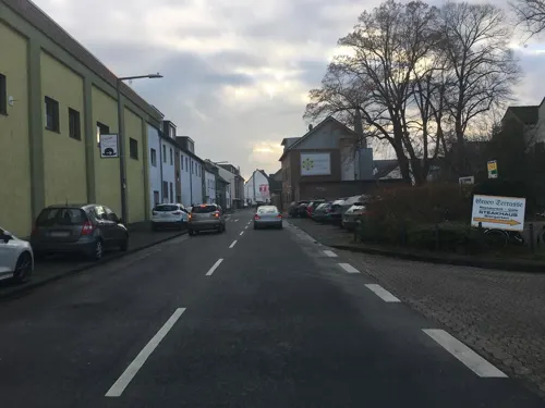

Inci Fisch
Restaurant · Fish, Seafood · 1.4 km
293 Hauptstraße, Köln
Tu,We 14:00-23:00; Th 14:00-22:45; Fr,Sa 14:00-23:30; Su 11:30-23:00
Pizza Martello
Restaurant · Pizza · 1.8 km
33 Mühlenstraße, Köln
Mo off; Tu-Th 10:00-22:00; Fr-Sa 16:30-22:00; Su,PH 11:30-22:00
Brauhaus Eltzhof
Restaurant · 2.9 km
10 Sankt-Sebastianus-Straße, Köln
Mo-Fr 17:00+; Sa 14:00+; Su 12:00+

Bäckerei Schneider
Bakery · 3.0 km
2-4 Bahnhofstraße, Köln
Mo-Fr 05:30-19:00; Sa 06:00-18:00; PH,Su 07:00-15:00
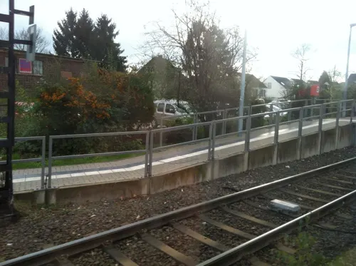
Bäckerei Voosen
Bakery · 3.0 km
81a Bergstraße, Köln
Mo-Fr 06:00-18:30; Sa 06:00-17:00; Su,PH 08:00-17:00
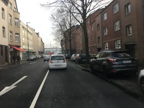
Casona Argentina
Restaurant · Steak House · 2.4 km
Mo-Th 11:30-15:00,17:00-22:30; Fr-Su 11:30-22:30; PH 11:30-22:30


104 more on the map.
Where to stay11
Churches and places of worship19
Shopping33
Gas and EV charging5
Schools, colleges and libraries21
Healthcare15
Map of Zündorf
250 places. The map loads OpenStreetMap tiles when you open it.
Getting there and nearby towns
Cologne Bonn Airport (CGN) is the nearest airport with scheduled flights listed in OpenStreetMap, 7 km away.
- Köln 10 km northwest, about 10 min by car
- Bonn 15 km south, about 15 min by car
- Bergisch Gladbach 14 km northeast, about 14 min by car
- Leverkusen 19 km north, about 19 min by car
- Solingen 34 km north, about 34 min by car
- Remscheid 36 km north, about 36 min by car
- Düsseldorf 44 km northwest, about 44 min by car
- Wuppertal 44 km north, about 44 min by car
- Neuss 45 km northwest, about 45 min by car
- Mönchengladbach 55 km northwest, about 55 min by car
Drive times are estimates from straight-line distance, not routes.
Local news
Headlines from INDB.
Reviews, tips and questions
Loading what members have shared...
Sources and licences
- GeoNames (CC BY 4.0): population, coordinates, regions and time zone
- Mapillary (see each image): photos
- OpenStreetMap contributors (ODbL 1.0): places, airports, map data
- Wikidata (CC0 1.0): elevation, founding date, time zone, website, landmarks and historic places
- Wikimedia Commons (see each image): photos
- Wikipedia (CC BY-SA 4.0): overview and history text
Photo credits
- Stolpersteine Köln, Wohnhaus Marktstraße 7, Köln-Zündorf, © [email protected], CC BY-SA 4.0
- Stolpersteine Köln, Karoline Salomon (Marktstraße 7), Köln-Zündorf, © [email protected], CC BY-SA 4.0
- Stolpersteine Köln, Verlegestelle Marktstraße 7, Köln-Zündorf, © [email protected], CC BY-SA 4.0
- Endstation Linie 7,Köln-Zündorf, G. Friedrich, CC BY 3.0
- Zündorf, Kirchstraße - panoramio, Rembert Satow, CC BY-SA 3.0
- Mariae Geburt (Köln-Zündorf) S, Langenbergstefan, CC BY-SA 3.0
- Wehrturm Zündorf, Rheinseite, Duhon, CC BY 3.0
- Wohnhaus Am Markt 6, Köln-Zündorf, © [email protected], CC BY-SA 4.0
- Rodenkirchener-bruecke-panorama, A.Savin, CC BY-SA 3.0
- Groov 2006, Unknown author, Public domain
- 05Schiffansicht, Lessing-Autor, CC BY-SA 4.0
- Schloss Wahn Innenhof 2, B. Neulich alias Benutzer:Neulich im Roxy Kino, CC BY 3.0
- Köln-Sürth, St. Remigius Westfassade, Andreasdziewior, CC BY-SA 3.0 de
- Lukaskirche, Köln-Porz-7162, Raimond Spekking, CC BY-SA 4.0
- Kirche Bartholomaeus (Urbach), Unknown author, Public domain
- St. fronleichnam koeln porz urbach 2009, Elke Wetzig Elya, CC BY-SA 3.0
- Weiss StGeorg v S, Beckstet, CC BY-SA 3.0
- Auferstehungskirche Sürth 03, Achim Raschka, CC BY-SA 4.0
- Friedenskirche (Köln-Urbach), Journey234, Public domain
- St. Georgskapelle (Köln-Weiß) (01), Chris06, CC BY-SA 4.0
- Schulgebäude Sürther Straße 199, Köln-Sürth - 8665, Elke Wetzig ( User:Elya ), CC BY-SA 4.0
- Paulsmaar, Mabit1, CC BY-SA 4.0
- Eltzhof Wahn 2013 01, Gordito1869, CC BY 3.0
- Wahner Straße 15, Asperatus, CC BY-SA 4.0
- Zuendorf MariaeGeburt2, Beckstet, CC BY-SA 3.0
- Poller Heimatmuseum Einsatz Stolpersteine, Koelner50, CC BY-SA 4.0
- Stolperstein Köln, Klara Mayer (Marktstraße 6), © 1971markus, CC BY-SA 4.0
- Stolperstein Köln, Leo Mayer (Marktstraße 6), © 1971markus, CC BY-SA 4.0
- Stolperstein Köln, Ruth Mayer (Marktstraße 6), © 1971markus, CC BY-SA 4.0
- Stolpersteine Köln, Marktstraße 6, © 1971markus, CC BY-SA 4.0
- Stolpersteine Köln, Wohnhaus Marktstraße 6, © 1971markus, CC BY-SA 4.0
- Schmittgasse 66, Asperatus, CC BY-SA 4.0
- Tram at Zundorf terminus - geo.hlipp.de - 3989, Dr Neil Clifton, CC BY-SA 2.0
- Turning circle at Zundorf - geo.hlipp.de - 3993, Dr Neil Clifton, CC BY-SA 2.0
- Tram at Zundorf - geo.hlipp.de - 3992, Dr Neil Clifton, CC BY-SA 2.0
- Enggasse 19, Asperatus, CC BY-SA 4.0
- Gütergasse 39, Asperatus, CC BY-SA 4.0
- Zuendorf Klosterkapelle, Beckstet, CC BY-SA 3.0
- Zuendorf StMichael1, Beckstet, CC BY-SA 3.0
- Zuendorf Turmhof, Beckstet, CC BY-SA 3.0
- Stolperstein Köln, Albert Brünell (Am Markt 6), © 1971markus, CC BY-SA 4.0
- Stolperstein-porz-hauptstr Albert Tobias, Superbass, CC BY-SA 4.0
- Stolpersteine-Porz-Hauptstr Berta Tobias, Superbass, CC BY-SA 4.0
- Stolperstein Köln, Emma Cahn (Hauptstraße 22), © 1971markus, CC BY-SA 4.0
- Stolperstein Köln, Henriette Cahn (Hauptstraße 22), © 1971markus, CC BY-SA 4.0
- Stolpersteine K-Porz Kaiserstr 59 Jenny Recking, Superbass, CC BY-SA 4.0
- Street-level photo, raymond, CC BY-SA 4.0
- Street-level photo, raymond, CC BY-SA 4.0
- Street-level photo, raymond, CC BY-SA 4.0
- Street-level photo, ifjj1ref, CC BY-SA 4.0
- Street-level photo, ifjj1ref, CC BY-SA 4.0
- Street-level photo, raymond, CC BY-SA 4.0
- Street-level photo, raymond, CC BY-SA 4.0
- Street-level photo, countzero5, CC BY-SA 4.0
- Street-level photo, map_dav, CC BY-SA 4.0
- Street-level photo, ifjj1ref, CC BY-SA 4.0
- Street-level photo, ifjj1ref, CC BY-SA 4.0
- Street-level photo, raymond, CC BY-SA 4.0
- Street-level photo, raymond, CC BY-SA 4.0
- Street-level photo, TechniPorter, CC BY-SA 4.0
- Street-level photo, countzero5, CC BY-SA 4.0
- Street-level photo, TechniPorter, CC BY-SA 4.0
- Street-level photo, TechniPorter, CC BY-SA 4.0
- Street-level photo, TechniPorter, CC BY-SA 4.0
- Street-level photo, miguel_andrade, CC BY-SA 4.0
- Street-level photo, countzero5, CC BY-SA 4.0
- Street-level photo, raymond, CC BY-SA 4.0
- Street-level photo, bernd1960, CC BY-SA 4.0
- Street-level photo, ifjj1ref, CC BY-SA 4.0
- Street-level photo, ifjj1ref, CC BY-SA 4.0


Page built November 8, 2026. Spotted a mistake? Tell us or suggest a place.