


Why visit Wemding
Townapedia lists 6 museums and landmarks, 10 parks and trails, 25 places to eat, 7 places to stay and 11 attractions in and around town.
Highlights include Dobelbuck, Heimatmuseum and KunstMuseum Donau-Ries.
Weather in Wemding
Forecast from MET Norway (CC BY 4.0). Full forecast
About Wemding
Wemding (German pronunciation: [ˈvɛmdɪŋ] ; Alemannic German: Wendi) is a town in the Donau-Ries district of Bavaria, Germany. Wemding is situated on the edge of the Ries meteorite crater in the Geopark Ries.
From the Wikipedia article Wemding (this version), under CC BY-SA 4.0.
Things to do11


Museums and landmarks6



Parks, trails and playgrounds10



Restaurants and cafes25

Fräulein Schlecht
Cafe · Regional, Cake, German, Ice Cream, Juice, Salad, Dessert
6 Langgasse, Wemding
We-Sa 17:00-24:00; Su,PH 09:00-22:00; Mo,Tu off

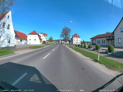
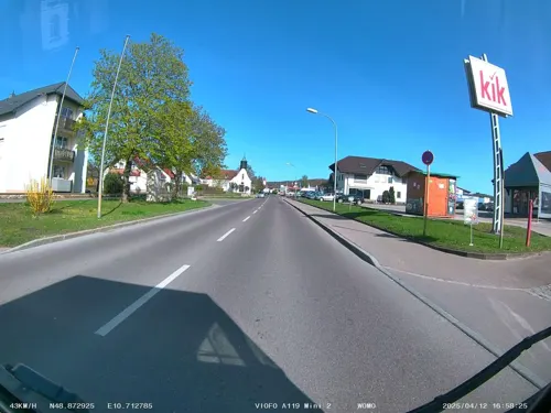


Fraeulein Schlecht Biergarten
Bar and pub
6 Langgasse, Wemding
We-Sa 14:00-23:00; Su,PH 13:00-22:00; Mo,Tu off


Lion Restaurant
Restaurant · Indian, Pizza
9 Weissenbachstraße, Wemding
13 more on the map.
History
The town of Wemding was founded in 793, documented as "Uuemodinga" in a donation deed from Count Helmoin Gosheim. In 1467, the city passed into the possession of Duke Ludwig the Rich of Bavaria. The city was besieged by the Kingdom of Sweden in 1632 during the Thirty Years' War.
Wemding is the location of the Zeitpyramide (Time pyramid), a public art work begun in 1993 and scheduled to be completed in 3183. The most recent block, which was the fourth block, was placed on 9 September 2023, and the next block will be placed in 2033. This project has been noted for falling victim to the fence post problem.
From the History section of Wemding on Wikipedia, under CC BY-SA 4.0.
Where to stay7
Churches and places of worship16
Wallfahrtsbasilika Maria Brünnlein zum Trost
Church · Roman Catholic · 1.4 km
100 Oettinger Straße, Wemding
St. Martin
Church · Roman Catholic · 4.7 km
22 Am Kirchberg, Wolferstadt
Shopping11
Gas and EV charging3
Schools, colleges and libraries4
Volksschule Wolferstadt (Grundschule)
School · 4.8 km
21 Am Kirchberg, Wolferstadt
Healthcare2
Map of Wemding
95 places. The map loads OpenStreetMap tiles when you open it.
Getting there and nearby towns
Flughafen Augsburg (AGB) is the nearest airport with scheduled flights listed in OpenStreetMap, 52 km away.
- Treuchtlingen 16 km northeast, about 16 min by car
- Nördlingen 17 km west, about 17 min by car
- Donauwörth 18 km south, about 18 min by car
- Weißenburg in Bayern 25 km northeast, about 25 min by car
- Gunzenhausen 27 km north, about 27 min by car
- Bopfingen 27 km west, about 27 min by car
- Neresheim 32 km southwest, about 32 min by car
- Eichstätt 35 km east, about 35 min by car
- Neuburg an der Donau 37 km southeast, about 37 min by car
- Dillingen an der Donau 37 km southwest, about 37 min by car
Drive times are estimates from straight-line distance, not routes.
Local news
Headlines from INDB.
Reviews, tips and questions
Loading what members have shared...
Sources and licences
- GeoNames (CC BY 4.0): population, coordinates, regions and time zone
- Mapillary (see each image): photos
- OpenStreetMap contributors (ODbL 1.0): places, airports, map data
- Wikidata (CC0 1.0): elevation, founding date, time zone, website
- Wikimedia Commons (see each image): photos
- Wikipedia (CC BY-SA 4.0): overview and history text
Photo credits
- Wemding - Marktplatz mit histor. Rathaus links, Franzfoto, CC BY-SA 3.0
- St. Johannes der Täufer (Wemding), Kd6=dra, CC0
- Bildstock Pietá (Wemding) 300, Kd6=dra, CC0
- Wemding, Marktplatz 12, Living-wreck, CC BY-SA 4.0
- Wemding, Marktplatz 9, Living-wreck, CC BY-SA 4.0
- Wemding town square, March 2025 03, Calistemon, CC BY-SA 4.0
- Wemding town square, March 2025 01, Calistemon, CC BY-SA 4.0
- Wemding town square, March 2025 02, Calistemon, CC BY-SA 4.0
- Rathaus Wemding, Jkü, CC BY-SA 3.0
- Wallfahrtstraße 1 (Wemding), Kd6=dra, CC0
- Wallfahrtstraße 9 (Wemding), Kd6=dra, CC0
- Mangoldstraße 9 (Wemding), Kd6=dra, CC0
- Ausleger Mangoldstraße 14 (Wemding), Kd6=dra, CC0
- Wemding, Weißenbachstraße 5, Jkü, CC BY 4.0
- Wemding, Weißenbachstraße 11, Jkü, CC BY 4.0
- Barfußpfad Wemding J. Strohhofer (3), Tourist-Info Wemding, CC BY-SA 4.0
- Monheimer Straße 2 (Wemding), Kd6=dra, CC0
- Wemding, Weißenbachstraße 22, Jkü, CC BY 4.0
- Bildstock Pietá (Wemding) Nische, Kd6=dra, CC0
- Bildstock Pietá (Wemding) 030, Kd6=dra, CC0
- Ernst-Steinacker-Grab-Friedhof-Wemding, Zimtstern 2k, CC BY-SA 4.0
- Steinkreuz (Monheimer Straße, Wemding), Jkü, CC BY 4.0
- Kapelle St. Leonhard (Wemding) 02, Jkü, CC BY 4.0
- Kapelle St. Leonhard (Wemding) 03, Jkü, CC BY 4.0
- Kapelle St. Leonhard (Wemding) 01, Jkü, CC BY 4.0
- Gosheim (Huisheim) Burg 533, GFreihalter, CC BY-SA 3.0
- Wallfahrt1, The original uploader was Florian.b at German Wikipedia ., CC BY-SA 2.0 de
- Wemding, Wallfahrtsstraße 6-001, Tilman2007, CC BY-SA 3.0
- Wemding Krone 44, Reinhardhauke, CC BY-SA 3.0
- Gosheim (Huisheim) Mariä Geburt 531, GFreihalter, CC BY-SA 3.0
- Wemding St. Emmeram 48, Reinhardhauke, CC BY-SA 3.0
- Wemding, Spitalkirche-001, Tilman2007, CC BY-SA 3.0
- St Martin - Wolferstadt 001, DALIBRI, CC BY-SA 4.0
- Kapelle zur schmerzhaften Muttergottes (Waldstetten), Jkü, CC BY 4.0
- Wemding Kastenhaus 2, Manfi.B., CC BY-SA 3.0
- Wemding 002, Maria Brünnlein, Wolkenkratzer, CC BY-SA 4.0
- Wemding St. Emmeram 50, Reinhardhauke, CC BY-SA 3.0
- St Martin - Wolferstadt 129, DALIBRI, CC BY-SA 4.0
- Kunstmuseum Donau-Ries - panoramio, Tobi Merk, CC BY 3.0
- Brunnen Schweinsmarkt, Jkü, CC BY 4.0
- Street-level photo, soulcover, CC BY-SA 4.0
- Street-level photo, soulcover, CC BY-SA 4.0
- Street-level photo, soulcover, CC BY-SA 4.0
- Street-level photo, soulcover, CC BY-SA 4.0
- Street-level photo, soulcover, CC BY-SA 4.0
- Street-level photo, soulcover, CC BY-SA 4.0
- Street-level photo, soulcover, CC BY-SA 4.0
- Street-level photo, soulcover, CC BY-SA 4.0
- Street-level photo, soulcover, CC BY-SA 4.0
- Street-level photo, soulcover, CC BY-SA 4.0
- Street-level photo, soulcover, CC BY-SA 4.0
- Street-level photo, soulcover, CC BY-SA 4.0


Page built November 9, 2026. Spotted a mistake? Tell us or suggest a place.