


Wentorf bei Hamburg, Germany
Wentorf bei Hamburg is a town of 12,104 people in Schleswig-Holstein, Germany.
Why visit Wentorf bei Hamburg
Townapedia lists 52 museums and landmarks, 19 parks and trails, 83 places to eat, 6 places to stay and 8 attractions in and around town.
Highlights include Hamburger Sternwarte, Schloss Reinbek, Billtal-Stadion and Schlosspark.
Weather in Wentorf bei Hamburg
Forecast from MET Norway (CC BY 4.0). Full forecast
About Wentorf bei Hamburg
Wentorf bei Hamburg (German pronunciation: [ˈvɛntɔʁf baɪ ˈhambʊʁk] , lit. 'Wentorf near Hamburg') is a municipality in the district of Lauenburg, in Schleswig-Holstein, Germany. It is situated on the river Bille, approx. 10 km northwest of the town of Geesthacht, and adjoining the town of Reinbek. It is situated on the city limits of the city of Hamburg, 20 km east of the centre of the city.
From the Wikipedia article Wentorf bei Hamburg (this version), under CC BY-SA 4.0.
Things to do8



Museums and landmarks52


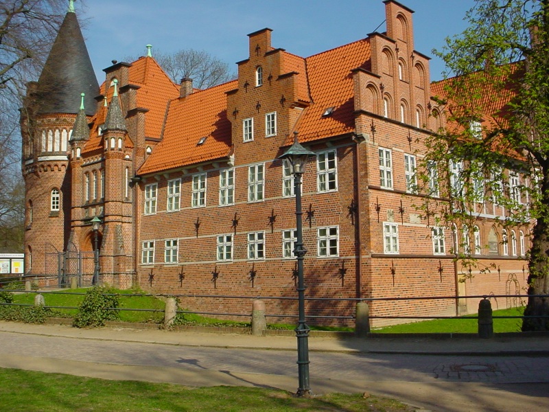

Wasserturm Hamburg-Bergedorf
Monument and historic site · 1.7 km
76a Reinbeker Weg, Hamburg




eh. Victor-Gollancz-Haus
Monument and historic site · 2.9 km
Ehemaliges Victor-Gollancz-Haus, ehemalige Villa Dobbertin
3 Goetheallee, Reinbek


40 more on the map.
Parks, trails and playgrounds19






7 more on the map.
Restaurants and cafes83
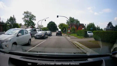
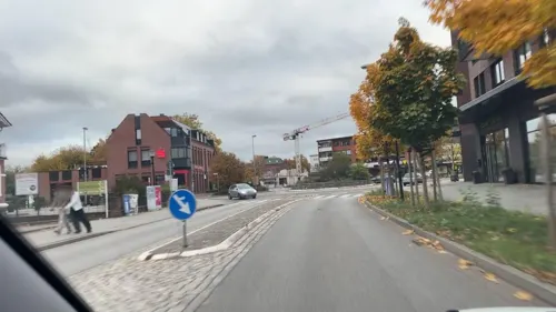
Bamboo
Restaurant · Asian
41 Hamburger Landstraße, Wentorf bei Hamburg
Mo,We-Fr 12:00-15:00,17:00-22:00; Sa,Su,PH 12:00-22:00; Tu off

Burger Lounge
Restaurant · American, Burger · 2.5 km
20 Wentorfer Straße, Hamburg
Sa, Su 11:45-23:30; Mo, Tu 16:00-23:30; We-Fr 11:15-23:45
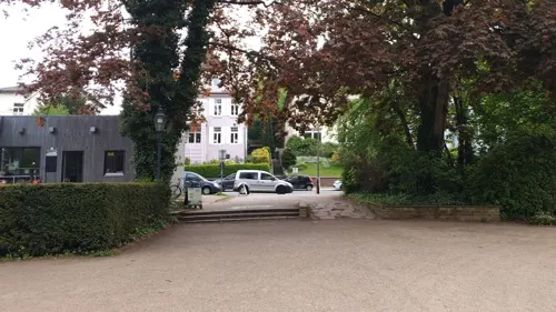
Cafe Chrysander
Cafe · 2.6 km
Café mit Mittagstisch, schöner Außenfläche, stilvolle eingerichtet.
61 Chrysanderstraße, Hamburg
Tu,Fr 08:00-18:00; We,Th,Sa,Su 09:30-18:00
Clubhaus der TSV Reinbek
Restaurant · Regional · 2.5 km
20 Theodor-Storm-Straße, Reinbek
"Je nach Sportbetrieb"
Great Asia House
Restaurant · Chinese · 1.8 km
1-9 Bergstraße, Reinbek
Mo-Fr 11:30-15:00,17:00-23:00, Sa,Su 11:30-23:00
La Villetta
Restaurant · Italian · 1.7 km
2 Hamburger Straße, Reinbek
Tu-Fr 16:00-23:00; Sa,Su 12:00-23:00


71 more on the map.
History
The village Wentorf was first mentioned in 1217 under the name "Wenetdorp". A name routed in "Wendendorf" which simply meant “a village inhabited by Slavs". In the course of its eventful history, Wentorf has changed significantly. Remnants of its distant past can only be found sparsely in the present day.
In the Middle Ages Wentorf belonged to the Reinbek monastery and after the Reformation it was ruled by the duchy of Schwarzenbek. After the administrative reforms of 1889, the old farming village had a structural change. A residential area was built near the river Bille and the train station while craftsmen and workers settled in other nearby areas. By 1910, the village of Wentorf with its beautiful landscape and its then 1200 inhabitants had developed into a suburb of Hamburg. Since the middle of the 19th century, Wentorf was connected to Hamburg City by railroad and country road. As a result, Wentorf had significantly different opportunities to develop compared to most of the neighbouring communities that had kept their rural character.
Shortly before the start of World War II, barracks were built in Wentorf that housed over 3000 soldiers. After 1945 these were used for "displaced persons" and from 1952 to 1960 as a transit camp for refugees from the GDR.
From the History section of Wentorf bei Hamburg on Wikipedia, under CC BY-SA 4.0.
Where to stay6
Churches and places of worship13
Shopping30
Gas and EV charging6
Schools, colleges and libraries22
Ganztagsschule Ernst-Henning-Straße
School · 2.2 km
20 Ernst-Henning-Straße, Hamburg
Healthcare14
Neue Apotheke im Casinopark
Clinic and pharmacy · 0.6 km
14 Am Casinopark, Wentorf bei Hamburg
Map of Wentorf bei Hamburg
250 places. The map loads OpenStreetMap tiles when you open it.
Getting there and nearby towns
Hamburg Airport (HAM) is the nearest airport with scheduled flights listed in OpenStreetMap, 24 km away.
- Winsen 16 km south, about 16 min by car
- Stelle 16 km southwest, about 16 min by car
- Hamburg 18 km west, about 18 min by car
- Seevetal 22 km southwest, about 22 min by car
- Lüneburg 29 km south, about 29 min by car
- Neu Wulmstorf 31 km west, about 31 min by car
- Buchholz in der Nordheide 32 km southwest, about 32 min by car
- Buxtehude 37 km west, about 37 min by car
- Jork 38 km west, about 38 min by car
- Lübeck 50 km northeast, about 50 min by car
Drive times are estimates from straight-line distance, not routes.
Local news
Headlines from INDB.
Reviews, tips and questions
Loading what members have shared...
Sources and licences
- GeoNames (CC BY 4.0): population, coordinates, regions and time zone
- Mapillary (see each image): photos
- OpenStreetMap contributors (ODbL 1.0): places, airports, map data
- Wikidata (CC0 1.0): elevation, founding date, time zone, website, landmarks and historic places
- Wikimedia Commons (see each image): photos
- Wikipedia (CC BY-SA 4.0): overview and history text
Photo credits
- Wentorf, 21465 Wentorf bei Hamburg, Germany - panoramio (10), hh oldman, CC BY 3.0
- Wentorf, 21465 Wentorf bei Hamburg, Germany - panoramio (7), hh oldman, CC BY 3.0
- Wentorf, 21465 Wentorf bei Hamburg, Germany - panoramio, hh oldman, CC BY 3.0
- Wentorf, 21465 Wentorf bei Hamburg, Germany - panoramio (1), hh oldman, CC BY 3.0
- Gebäude Hauptstraße 1 Wentorf bei Hamburg mit Sparkasse 2024-06-29, Strubbl, CC BY-SA 4.0
- Denns Biomarkt im Zollhof Berliner Landstraße 38c Wentorf bei Hamburg 2024-06-29, Strubbl, CC BY-SA 4.0
- Budni in Berliner Landstraße 6 Wentorf bei Hamburg 2024-06-29, Strubbl, CC BY-SA 4.0
- Wentorf Döner in Berliner Landstraße 6 Wentorf bei Hamburg 2024-06-29, Strubbl, CC BY-SA 4.0
- Gebäude Hauptstraße 2 Wentorf bei Hamburg mit Edeka, Rats-Apotheke 2024-06-29, Strubbl, CC BY-SA 4.0
- Gebäude Zollstraße 3 Wentorf bei Hamburg 2024-06-29, Strubbl, CC BY-SA 4.0
- Ecke NW vom Gebäude Casinopark Wentorf bei Hamburg 2024-06-29, Strubbl, CC BY-SA 4.0
- Markt am Casinopark Wentorf bei Hamburg Bild 1 2024-06-29, Strubbl, CC BY-SA 4.0
- Markt am Casinopark Wentorf bei Hamburg Bild 2 2024-06-29, Strubbl, CC BY-SA 4.0
- Markt am Casinopark Wentorf bei Hamburg Bild 4 2024-06-29, Strubbl, CC BY-SA 4.0
- Markt am Casinopark Wentorf bei Hamburg Bild 3 2024-06-29, Strubbl, CC BY-SA 4.0
- Wentorf, 21465 Wentorf bei Hamburg, Germany - panoramio (9), hh oldman, CC BY 3.0
- Bdstern 1, Unknown author, CC BY-SA 3.0
- Billtalstadion Bergedorf nach Sanierung, VinylVictim, CC BY-SA 3.0
- SchlossReinbek2, Reinhard Kraasch, CC BY-SA 4.0
- Hansa-Gymnasium in Hamburg-Bergedorf (01), Minderbinder, CC BY-SA 4.0
- RK 0705 00919 Sachsenwaldschule Reinbek, Reinhard Kraasch, CC BY-SA 4.0
- RK 0604 02301 Schloss Bergedorf, Reinhard Kraasch, CC BY-SA 3.0
- Schule-Ernst-Henning-Straße02, Carol.Christiansen, Public domain
- Michael bergedorf eingang, Dirtsc, CC BY-SA 3.0
- Reinbek, St.Adolf-Stift, ca. 1901, Unknown author Unknown author, Public domain
- Reinbek Friedhofskapelle, Matzematik, CC BY-SA 3.0
- RK 1810 P1650898 Schloss Reinbek, Lindenallee, Reinhard Kraasch, CC BY-SA 4.0
- Bergedorf castle entrance with the guards, Gunasekar, CC BY-SA 3.0
- St. Marien (Hamburg-Bergedorf).1.27465.ajb, Ajepbah, CC BY-SA 3.0 de
- Chrysanderstraße 4, Schornixx, CC BY-SA 3.0
- Sachsenwald Hotel - panoramio, hh oldman, CC BY 3.0
- Schloss Reinbek2-3, IqRS, CC BY 3.0
- Bergedorf Wasserturm 1, Uwe Barghaan, CC BY 3.0
- Boleslav Leczycka - Jakob-Kaiser-Straße 24 (Hamburg-Lohbrügge).Stolperstein.nnw, NordNordWest, CC BY-SA 3.0 de
- Christine Wolosch - Jakob-Kaiser-Straße 24 (Hamburg-Lohbrügge).Stolperstein.nnw, NordNordWest, CC BY-SA 3.0 de
- Stolperstein Hans Stoll, Gudrun Meyer, CC BY-SA 3.0
- Hermann Kahl - Gojenbergsweg 3 (Hamburg-Bergedorf).Stolperstein.nnw, NordNordWest, CC BY-SA 3.0 de
- Jurek Leczycka - Jakob-Kaiser-Straße 24 (Hamburg-Lohbrügge).Stolperstein.nnw, NordNordWest, CC BY-SA 3.0 de
- Das Reinbeker Schloss, Vincent Seydel-Winter, CC BY-SA 4.0
- Main building at Hamburg Obsrevatory 02, Sebastian Koppehel, CC BY 4.0
- Bergedorfer Schloss, PodracerHH at German Wikipedia, CC BY-SA 3.0
- RK 2105 P1840793 Wentorfer Lohe Panzerberg, Reinhard Kraasch, CC BY-SA 4.0
- RK 2406 P2050096 Reinbek - CCR - Sachsenwald-Forum, Reinhard Kraasch, CC BY-SA 4.0
- Street-level photo, TechniPorter, CC BY-SA 4.0
- Street-level photo, hotteliene, CC BY-SA 4.0
- Street-level photo, hotteliene, CC BY-SA 4.0
- Street-level photo, bigbug21, CC BY-SA 4.0
- Street-level photo, tian, CC BY-SA 4.0
- Street-level photo, tian, CC BY-SA 4.0
- Street-level photo, tian, CC BY-SA 4.0
- Street-level photo, tian, CC BY-SA 4.0
- Street-level photo, tian, CC BY-SA 4.0
- Street-level photo, tian, CC BY-SA 4.0
- Street-level photo, pfmlb, CC BY-SA 4.0
- Street-level photo, pfmlb, CC BY-SA 4.0
- Street-level photo, pfmlb, CC BY-SA 4.0
- Street-level photo, xantopi, CC BY-SA 4.0
- Street-level photo, mjay, CC BY-SA 4.0
- Street-level photo, hotteliene, CC BY-SA 4.0
- Street-level photo, tian, CC BY-SA 4.0
- Street-level photo, tian, CC BY-SA 4.0
- Street-level photo, TechniPorter, CC BY-SA 4.0
- Street-level photo, hotteliene, CC BY-SA 4.0
- Street-level photo, TechniPorter, CC BY-SA 4.0
- Street-level photo, tian, CC BY-SA 4.0
- Street-level photo, mjay, CC BY-SA 4.0
- Street-level photo, geoft, CC BY-SA 4.0
- Street-level photo, hotteliene, CC BY-SA 4.0
- Street-level photo, tian, CC BY-SA 4.0
- Street-level photo, tian, CC BY-SA 4.0


Page built November 8, 2026. Spotted a mistake? Tell us or suggest a place.