


Westerrönfeld, Germany
Westerrönfeld is a town of 5,227 people in Schleswig-Holstein, Germany.
Why visit Westerrönfeld
Townapedia lists 35 museums and landmarks, 8 parks and trails, 61 places to eat, 11 places to stay and 5 attractions in and around town.
Highlights include Eroticworld, Schauburg Filmtheater, Anna and Jüdisches Museum.
Weather in Westerrönfeld
Forecast from MET Norway (CC BY 4.0). Full forecast
About Westerrönfeld
Westerrönfeld is a municipality in the district of Rendsburg-Eckernförde, in Schleswig-Holstein, Germany. The name literally means "The field west of the Rön", the Rön being a little tributary of the river Eider. Westerrönfeld is located on the southern bank of the Kiel Canal.
From the Wikipedia article Westerrönfeld (this version), under CC BY-SA 4.0.
Photos of Westerrönfeld


Things to do5
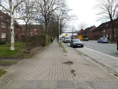
Eroticworld
Cinema and theater · 2.3 km
1C Friedrich-Voß-Straße, Rendsburg
Mo-Th 10:00-22:00; Fr, Sa 10:00-24:00; Su, PH 12:00-22:00
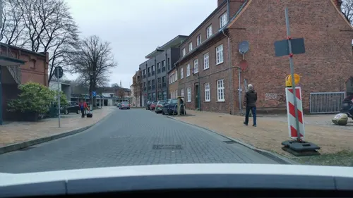
Schauburg Filmtheater
Cinema and theater · 2.9 km
8 Schleifmühlenstraße, Rendsburg
Mo-Fr 10:00-21:00; Sa-Su 11:00-21:00


Museums and landmarks35


Rendsburger Schifffahrtsarchiv
Museum · 2.4 km
5 Königstraße, Rendsburg
We 10:00-17:00; Sa 10:00-13:00
Galerie Müllers
Museum · 3.0 km
4 An der Marienkirche, Rendsburg
Tu-Fr 10:00-13:00,15:00-18:00; Sa,Su 10:00-14:00; Mo off




Alte Schwebefähre
Monument and historic site · 1.9 km
Beschädigter Fährkörper der alten Schwebefähre Rendsburg
23 more on the map.
Parks, trails and playgrounds8



Restaurants and cafes61

Eisstübchen
Cafe · Ice Cream, Coffee Shop, Coffee · 2.0 km
Ein Eiskaffee mit blick auf den Nord-Ostsee-Kanal. Eis und Kuchen werden hier noch selbst vorort gemacht.
2A Am Kreishafen, Rendsburg
Feb-Oct: Tu-Su 11:00-19:00
cafè tagespost
Cafe · Regional · 2.8 km
12-16 Bahnhofstraße, Rendsburg
Mo-Fr 11:00-15:00; Sa,Su,PH off
Ambrosia Bistro-Restaurant
Restaurant · 2.3 km
24 Kaiserstraße, Rendsburg
Mo-Th 11:30-15:00,17:00-23:00; Fr 11:30-15:00,17:00-24:00; Sa...

Alte Markthalle
Restaurant · Regional · 2.9 km
15 Altstädter Markt, Rendsburg
Mo-Fr 12:00+; Sa 10:00+; Su 16:00+
Farina di Nonna
Restaurant · Italian · 2.6 km
10 Materialhofstraße, Rendsburg
Mo-Fr 11:30-22:00; Sa, Su 12:30-22:00
Restaurant Korfu
Restaurant · Greek · 1.4 km
2 Neuwerker Tor, Rendsburg
Mo-Sa 17:00-23:30; Su 12:00-15:00, 17:00-23:30
49 more on the map.
History
The place, which was located at a ford (crossing) of the eider river at the Ochsenweg, was first mentioned in the Kieler Erbebuch in 1437. During the Thirty Years' War, the Swedish troops besieging Rendsburg were stationed in Westerrönfeld, with looting taking place in Westerrönfeld.
Since 1695 there has been a Jewish cemetery in the village where Jewish citizens from Rendsburg were buried.
In the 18th century more than 100 inhabitants died of the plague. For them a cemetery was created especially outside the village.
The community originally belonged to the administrative district (later Amt) Jevenstedt. By refugees, who found a new home in Westerrönfeld, the number of inhabitants grew after the Second World War from 1500 to 2500. In 1948 the municipality left the office. On 1 January 2001 Westerrönfeld gave up self-administration and rejoined the Jevenstedt office.
On 12 December 1991 there was an assassination attempt on two employees of the Abwasserzweckverband in Westerrönfeld. A farmer from Fockbek, who had shot the two officers, drove his car loaded with explosives against the town hall in Fockbek. He then shot himself.
From the History section of Westerrönfeld on Wikipedia, under CC BY-SA 4.0.
More about Westerrönfeld
Geography
The town is located directly at the Kiel Canal. Neighboring municipalities are (clockwise, starting in the north): Rendsburg, Jevenstedt and Schülp. In former times there were some heath areas and inland dunes in the area of the municipality, of which only a few are still preserved.
From 1901 on the village was a stop of the Rendsburger Kreisbahn, which went from Rendsburg to Hohenwestedt. In 1957 this line was closed down.
Westerrönfeld is located on the Bundesstraße 77 (national road) from Rendsburg to Itzehoe and the Bundesstraße 202 (national road), which leads from St. Peter-Ording via Rendsburg in the direction of Kiel and joins the A 210 (national highway) in Osterrönfeld (junction Schacht-Audorf). Thus the community is indirectly connected to the A 7 motorway.
Economy
The town was originally characterized by agriculture, fishing, shipping and shipbuilding. Today the village is an industrial area through the proximity of Rendsburg as well as the traffic connection to Kiel and the connection to the Bundesautobahn 7.
From the Wikipedia article Westerrönfeld, under CC BY-SA 4.0.
Where to stay11
Antje´s Gästehaus Bett & Bike
Motel and hotel · 1.7 km
8 Preußerstraße, Rendsburg
Churches and places of worship6
Freie Christengemeinde Rendsburg
Church · Pentecostal · 2.7 km
1a Materialhofstraße, Rendsburg
Shopping18
Gas and EV charging5
Schools, colleges and libraries15
Healthcare9
Map of Westerrönfeld
173 places. The map loads OpenStreetMap tiles when you open it.
Getting there and nearby towns
Schleswig Air Base (WBG) is the nearest airport with scheduled flights listed in OpenStreetMap, 22 km away.
- Rendsburg 3 km northeast, about 3 min by car
- Büdelsdorf 5 km north, about 5 min by car
- Eckernförde 24 km northeast, about 24 min by car
- Schleswig 27 km north, about 27 min by car
- Kronshagen 29 km east, about 29 min by car
- Kiel 32 km east, about 32 min by car
- Neumünster 32 km southeast, about 32 min by car
- Elmschenhagen 35 km east, about 35 min by car
- Heide 37 km west, about 37 min by car
- Itzehoe 41 km south, about 41 min by car
Drive times are estimates from straight-line distance, not routes.
Towns near Westerrönfeld


Keep exploring
Local news
Headlines from INDB.
Reviews, tips and questions
Loading what members have shared...
Sources and licences
- GeoNames (CC BY 4.0): population, coordinates, regions and time zone
- Mapillary (see each image): photos
- OpenStreetMap contributors (ODbL 1.0): places, airports, map data
- Wikidata (CC0 1.0): elevation, founding date, time zone, website, landmarks and historic places
- Wikimedia Commons (see each image): photos
- Wikipedia (CC BY-SA 4.0): overview and history text
Photo credits
- Westerrönfeld - Jakob-Rohwer-Straße + Jüdischer Friedhof 01 ies, Frank Vincentz, CC BY-SA 3.0
- Westerrönfeld Schmiedestr 18 0059, Pelz, CC BY-SA 4.0
- Westerrönfeld 0054, Pelz, CC BY-SA 4.0
- Westerrönfeld 0052, Pelz, CC BY-SA 4.0
- Jüdischer Friedhof Westerrönfeld msu2017-0286, User:Matthias Süßen, CC BY-SA 4.0
- Westerrönfeld 0056, Pelz, CC BY-SA 4.0
- Sprinter, Westerrönfeld (LRM 20191204 124529), Matti Blume, CC BY-SA 4.0
- Sprinter, Westerrönfeld (LRM 20191204 124522), Matti Blume, CC BY-SA 4.0
- Sprinter, Westerrönfeld (LRM 20191204 124457), Matti Blume, CC BY-SA 4.0
- Rendsburger Hochbrücke-msu-0766-, Matthias Süßen, CC BY-SA 4.0
- Schwebefähre Rendsburg NIK 2821, Nightflyer, CC BY 3.0
- Christkirche (Rendsburg)-msu-2023-0I9A-2632-, Matthias Süßen, CC BY-SA 4.0
- Jüdisches Museum RD, Wusel007, CC BY-SA 3.0
- Kreiskrankenhaus RD, Wusel007, CC BY-SA 3.0
- RD Nordmarkhalle2, Wusel007, CC BY-SA 3.0
- RD Königstr 5 Schifffahrtsarchiv, Wusel007, CC BY-SA 4.0
- Rendsburg - Herrenstraße - St. Martin 01 ies, Frank Vincentz, CC BY-SA 3.0
- Rendsburg - Hans-Heinrich-Beisenkötter-Platz - Stadttheater 02 ies, Frank Vincentz, CC BY-SA 3.0
- ConventGarten, Eingang Ostseite, Gerd Fahrenhorst, CC BY 4.0
- Schule Altstadt, Rendsburg (P1100369), Matti Blume, CC BY-SA 4.0
- Rendsburg - Herrenstraße 01 ies, Frank Vincentz, CC BY-SA 3.0
- Rathaus-Giebel Rendsburg2009, VollwertBIT, CC BY-SA 3.0
- Windmühle Anna in Nübbel, VentiAmica, CC BY-SA 3.0
- Stolperstein für Fred Ring (Rendsburg), Christian Michelides, CC BY-SA 4.0
- Stolperstein für Gersch Rusche (Rendsburg), Christian Michelides, CC BY-SA 4.0
- Stolperstein für Isser Kader (Rendsburg), Christian Michelides, CC BY-SA 4.0
- GPStest msu2017-0228, User:Matthias Süßen, CC BY-SA 4.0
- Janny's Eis in Waren (Müritz), Thomas Kohler, CC BY-SA 2.0
- Ships Welcome Point Rendsburg Nord-Ostsee-Kanal-20200729, Hajotthu, CC BY-SA 3.0
- Christkirche Rendsburg2009, VollwertBIT, CC BY-SA 3.0
- Außenansicht des Helene-Lange-Gymnasiums Rendsburg IV, Helene-Lange-Gymnasium (Rendsburg), CC BY-SA 4.0
- Stadttheater Rendsburg-msu-0857-, Matthias Süßen, CC BY-SA 4.0
- Nord-Ostsee-Kanaltunnel bei Rendsburg, Steiner, Egon, CC BY-SA 3.0 de
- Nord-Ostsee-Kanaltunnel bei Rendsburg, Steiner, Egon, CC BY-SA 3.0 de
- R WP 20161005 13 51 57 Rich (30639309140), Tjark, CC BY 2.0
- R WP 20161005 13 52 55 Rich (30639304730), Tjark, CC BY 2.0
- Gronsfurther Berge, Rendsburg (P1100739-Pano), Matti Blume, CC BY-SA 4.0
- Gronsfurther Berge, Rendsburg (P1100734), Matti Blume, CC BY-SA 4.0
- Gronsfurther Berge, Rendsburg (P1100730), Matti Blume, CC BY-SA 4.0
- Gronsfurth, Rendsburg (P1100733), Matti Blume, CC BY-SA 4.0
- Street-level photo, wusel007, CC BY-SA 4.0
- Street-level photo, kerosin, CC BY-SA 4.0
- Street-level photo, rainerup, CC BY-SA 4.0
- Street-level photo, rainerup, CC BY-SA 4.0
- Street-level photo, wusel007, CC BY-SA 4.0
- Street-level photo, hoeckie1975, CC BY-SA 4.0
- Street-level photo, wusel007, CC BY-SA 4.0
- Street-level photo, kerosin, CC BY-SA 4.0
- Street-level photo, wusel007, CC BY-SA 4.0
- Street-level photo, thetornado76, CC BY-SA 4.0
- Street-level photo, thetornado76, CC BY-SA 4.0
- Street-level photo, peterleth, CC BY-SA 4.0
- Street-level photo, kphklaus, CC BY-SA 4.0
- Street-level photo, rainerup, CC BY-SA 4.0
- Street-level photo, robffm, CC BY-SA 4.0
- Street-level photo, robffm, CC BY-SA 4.0
- Street-level photo, thetornado76, CC BY-SA 4.0
- Street-level photo, rainerup, CC BY-SA 4.0
- Street-level photo, wusel007, CC BY-SA 4.0
- Street-level photo, wusel007, CC BY-SA 4.0
- Street-level photo, peterleth, CC BY-SA 4.0
- Street-level photo, kphklaus, CC BY-SA 4.0


Page built November 9, 2026. Spotted a mistake? Tell us or suggest a place.