


Why visit Witten
Townapedia lists 151 museums and landmarks, 31 parks and trails, 180 places to eat, 9 places to stay and 13 attractions in and around town.
Highlights include Ruhrbühne Witten, Helenenturm, Märkisches Museum and Witten Central Station.
Weather in Witten
Forecast from MET Norway (CC BY 4.0). Full forecast
About Witten
Witten (German pronunciation: [ˈvɪtn̩] ) is a city with almost 100,000 inhabitants in the Ennepe-Ruhr-Kreis (district) in North Rhine-Westphalia, in western Germany.
From the Wikipedia article Witten (this version), under CC BY-SA 4.0.
Travel tips from other travellers: Witten on Wikivoyage (CC BY-SA 4.0).
Photos of Witten


Things to do13


Helenenturm
Scenic view · 1.4 km
Wegen Sanierungsbedarf nur zu besonderen Anlässen zugänglich.

Ruhrviadukt Witten
Bridge · 2.1 km
Teil der Strecke von Witten über Schwelm nach Wuppertal, besteht aus 19 Bögen, in nördlicher Richtung schließt sich eine ebenfalls unter...

Streichelzoo
Zoo and aquarium · 1.6 km
Hohenstein, Witten
Nov-Feb: Mo-Su 11:00-16:00; Mar-Oct: Mo-Su 11:00-18:00

Prinzregenttheater
Cinema and theater · 9.4 km
Theatre in Bochum, Germany




1 more on the map.
Museums and landmarks151


Deutsches Gruben- und Feldbahnmuseum
Museum · 2.6 km
27,29,31,33 Nachtigallstraße, Witten
May-Oct: Su[1] 11:00-18:00


Hochbunker Augustastraße
Monument and historic site · 1.3 km
Errichtet von Lünenburger & Franzen; in den 1980er Jahren im Zug des Kalten Kriegs mit Lüftungsanlage versehen
49,51,53,55 Augustastraße, Witten

Villa Eichengrün
Monument and historic site · 1.3 km
1939 arisiert
17 Husemannstraße, Witten

Villa Hanf
Monument and historic site · 1.5 km
1939 arisiert
14 Parkweg, Witten


139 more on the map.
Parks, trails and playgrounds31

Freibad Annen
Sports field and stadium · 2.3 km
66 Herdecker Straße, Witten
May-Aug: Mo-Su 06:30-20:00



Gärten für die Gemeinschaft
Park · 1.1 km
Untere Gärten: Extensive Beweidung mit Schafen, rotierende Heumahd,: artenreiche Wiesen und Weiden - mit Schattenbäumen,...
Im Wullen, Witten
24/7

Arbeitsgemeinschaft Muttenthalbahn
Playground · 2.6 km
May-Oct: Su[1] 11:00-18:00
19 more on the map.
Restaurants and cafes180
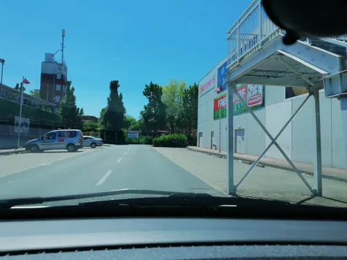
Asia Stern
Restaurant · Asian
Chinesisches Buffet, mongolischer Grill und Sushi
Mo-Sa 11:30-15:00, 17:30-23:30; Su, PH 11:30-23:30

Cafe Del Sol
Restaurant · International · 1.9 km
95 Ruhrstraße, Witten
Mo-Th 09:00-24:00; Fr-Sa 09:00-01:00; Su,PH 09:00-24:00

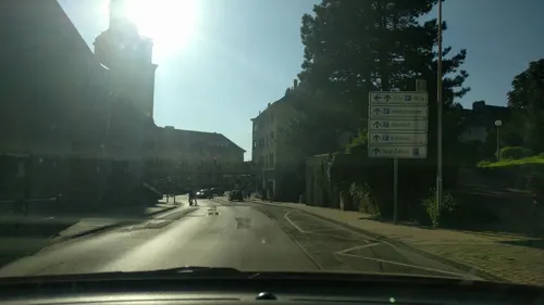

Old House
Bar and pub · Spanish · 1.1 km
1 Hinter der evangelischen Kirche, Witten
Tu-Fr 14:00+; Sa 12:00+; Su 16:00+
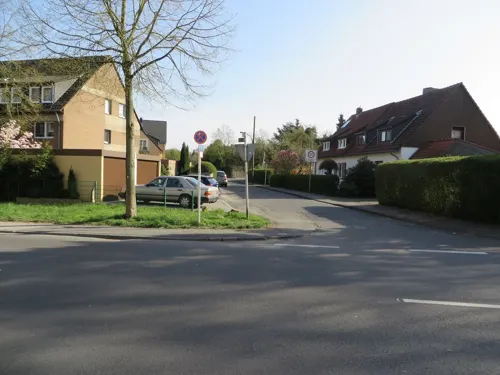
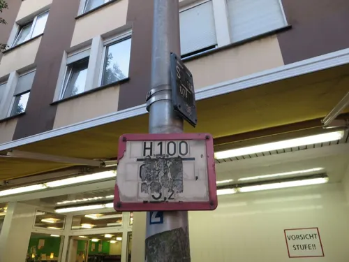
Bistro - grüne Perle
Restaurant · 1.3 km
Bistro im Regionalladen grüne Perle
Mo-Fr 12:00-14:00; PH off

Pizza Factory Da Giuseppe
Restaurant · Pizza · 2.1 km
Https://archive.is/z5BvU
Mo-Su 15:30-02:45; PH 15:30-02:45
168 more on the map.
History
Witten was first mentioned in historic sources in 1214, however the borough Herbede (which was incorporated into the city in 1975) dates back to 851. The city was a mining town from 1578.
In the late 19th century Witten was known for the Roburit dynamite. This dynamite was once used by coal mines around the world. In 1906 an explosion occurred, resulting in the deaths of 41 people.
During World War II, forced laborers of the 3rd SS construction brigade were dispatched in the town by the Nazis in 1943.
In 1946, it was included in North Rhine-Westphalia on its establishment. In 1975 Witten was included in the administrative district Ennepe-Ruhr-Kreis and it is now its biggest city. 1975 was also the year Witten was first counted to have more than 100,000 inhabitants, the threshold to be considered a large city ("Großstadt") in Germany.
From the History section of Witten on Wikipedia, under CC BY-SA 4.0.
More about Witten
Geography
Witten is situated in the Ruhr valley, in the southern Ruhr area.
Witten is divided into eight boroughs and each borough is further divided into two or more city-districts. Every district has its own district-number:
Witten-Mitte: 11 Innenstadt, 12 Oberdorf-Helenenberg, 13 Industriegebiet-West, 14 Krone, 15 Crengeldanz, 16 Hauptfriedhof, 17 Stadion, 18 Industriegebiet-Nord, 19 Hohenstein
Stockum: 31 Stockum-Mitte, 32 Dorney, 33 Stockumer Bruch, 34 Wilhelmshöhe
Annen: 41 Tiefendorf, 42 Wullen, 43 Annen-Mitte-Nord, 44 Annen-Mitte-Süd, 45 Kohlensiepen, 46 Wartenberg, 47 Gedern
Rüdinghausen: 51 Industriegebiet-Ost, 52 Rüdinghausen-Mitte, 53 Buchholz, 54 Schnee
Bommern: 61 Steinhausen, 62 Bommerbank, 63 Bommerfeld, 64 Wettberg, 65 Buschey, 66 Bommeregge
Heven: 71 Papenholz, 72 Hellweg, 73 Wannen, 74 Heven-Dorf, 75 Lake
Herbede: 81 Herbede-Ort, 82 Vormholz, 83 Bommerholz-Muttental, 84 Durchholz, 85 Buchholz-Kaempen
Arts and culture
Hebezeug-Museum – a museum dedicated to cranes and hoist founded by J. D. Neuhaus and is located on the Route der Industriekultur.
Wittener Tage für neue Kammermusik, festival for contemporary chamber music, held annually at the end of April
From the Wikipedia article Witten, under CC BY-SA 4.0.
Notable people from Witten
 Alexandra PoppGerman association football playerPhoto: Steffen Prößdorf, CC BY-SA 4.0
 Otto SchottGerman chemist, glass technologist, and inventor (1851–1935)Photo: SCHOTT AG, Andrea Würzburger,..., CC BY-SA 3.0 de
 Robert GrafGerman actor (1923–1966)Photo: SALAVAT THEATRE, CC BY-SA 4.0
 Jochen NickelGerman actorPhoto: Martina Nolte, CC BY-SA 3.0 de
 Otto SchlüterGerman geographer (1872–1959)Photo: Möller, Fritz, Public domain
 Uwe WittGerman politicianPhoto: Olaf Kosinsky, CC BY-SA 3.0 de
 Tanja WedhornGerman actressPhoto: 9EkieraM1, CC BY-SA 3.0
 Stephan RemmlerGerman singerPhoto: Havelbaude, CC BY-SA 4.0
 Andreas ReckwitzGerman sociologist and cultural scientistPhoto: Jürgen Bauer, CC BY 4.0
 Ewerdt HilgemannGerman visual artist (born 1938)Photo: Meyer-Konstanz, CC BY-SA 4.0
- Ernst NolteGerman historian and philosopher (1923–2016)
- Michael SchulzGerman football player
Born in Witten, according to Wikidata (CC0). Each name links to its Wikipedia article.
Where to stay9
Lukas-Zentrum / Mutterhaus / Martineum
Motel and hotel · Protestant · 0.6 km
39a Pferdebachstraße, Witten
Churches and places of worship30
Shopping66
Gas and EV charging25
Schools, colleges and libraries44
Healthcare19
Map of Witten
250 places. The map loads OpenStreetMap tiles when you open it.
Getting there and nearby towns
Dortmund Airport (DTM) is the nearest airport with scheduled flights listed in OpenStreetMap, 20 km away.
- Stockum 3 km north, about 3 min by car
- Eichlinghofen 6 km northeast, about 6 min by car
- Lütgendortmund 6 km north, about 6 min by car
- Wetter 7 km southeast, about 7 min by car
- Barop 7 km northeast, about 7 min by car
- Herdecke 8 km southeast, about 8 min by car
- Dorstfeld 8 km northeast, about 8 min by car
- Rombergpark-Lücklemberg 8 km east, about 8 min by car
- Bochum 10 km northwest, about 10 min by car
- Dortmund 11 km northeast, about 11 min by car
Drive times are estimates from straight-line distance, not routes.
Towns near Witten


Keep exploring
Local news
Headlines from INDB.
Reviews, tips and questions
Loading what members have shared...
Sources and licences
- GeoNames (CC BY 4.0): population, coordinates, regions and time zone
- Mapillary (see each image): photos
- OpenStreetMap contributors (ODbL 1.0): places, airports, map data
- Wikidata (CC0 1.0): elevation, founding date, time zone, website, landmarks and historic places
- Wikimedia Commons (see each image): photos
- Wikipedia (CC BY-SA 4.0): overview and history text
Photo credits
- Witten 20090218, Dr.G.Schmitz, CC BY-SA 3.0
- Witten Planetenweg Uranus, Reclus, CC0
- Witten Wasserschlösschen, Reclus, CC0
- Witten-Chemie-IMG 1689, Mathias Bigge, CC BY-SA 3.0
- Witten-Chemie-IMG 1691, Mbdortmund, CC BY-SA 3.0
- Witten Umweltmessstation, Reclus, CC0
- Witten Haus Annenstraße 21, Reclus, CC0
- Bahnhof Witten-Ost 1, Reclus, CC0
- Bahnhof Witten-Ost 2, Reclus, CC0
- Bahnhof Witten-Ost 3, Reclus, CC0
- Witten Werkstadt 3, Reclus, CC0
- Witten Tauschwagen Sam, Reclus, CC0
- Witten Werkstadt 9, Reclus, CC0
- Witten Werkstadt 8, Reclus, CC0
- Bahnhof Witten-Ost 4, Reclus, CC0
- Bahnhof Witten-Ost 5, Reclus, CC0
- Bahnhof Witten-Ost 7, Reclus, CC0
- Bahnhof Witten-Ost 11, Reclus, CC0
- Bahnhof Witten-Ost 12, Reclus, CC0
- Bahnhof Witten-Ost 8, Reclus, CC0
- Bahnhof Witten-Ost 10, Reclus, CC0
- Bahnhof Witten-Ost 6, Reclus, CC0
- Bahnhof Witten-Ost 9, Reclus, CC0
- Witten Evangelisches Krankenhaus Glocken, Reclus, CC0
- Witten Evangelisches Krankenhaus Lore, Reclus, CC0
- Witten Haus Annenstraße 8, Reclus, CC0
- Witten Haus Ardeystraße 70, Reclus, CC0
- Witten Kapelle Kreuzgemeinde, Reclus, CC0
- Witten Stolpersteine Ardeystraße 70, Reclus, CC0
- Witten Stolperstein Louis Schacher, Reclus, CC0
- Witten Stolperstein Ilse Schacher, Reclus, CC0
- Witten Stolperstein Mathilde Schacher, Reclus, CC0
- Witten Stolperstein Anna Lotte Benjamin, Reclus, CC0
- Witten Stolperstein Iwan Fulda, Reclus, CC0
- Witten Stolperstein Grete Fulda, Reclus, CC0
- Witten Stolperstein Paul Benjamin, Reclus, CC0
- Witten Westfalenstraße 84 -104, Raenmaen, CC BY-SA 4.0
- Stationsschild Witten-Stadion, Reclus, CC0
- Witten Haus Oberstraße 61, Reclus, CC0
- PRINZREGENTTHEATER BOCHUM, PRINZREGENTTHEATER, CC BY-SA 4.0
- UniWitten aussen Front1, Unknown author, CC BY-SA 3.0
- Witten Wullenstadion, Raenmaen, CC BY-SA 3.0
- Witten Muttental 060509 014 20, Hans-Jürgen Wiese, CC BY-SA 4.0
- Witten Institut für Waldorfpädagogik Turmbau, Reclus, CC0
- Witten Ruhrviadukt 121208, Raenmaen, CC BY-SA 3.0
- Witten Stadtarchiv Schriftzug, Reclus, CC0
- Witten Pestalozzischule, Reclus, CC0
- Witten Annen - Westfeldstraße - St Josef 01 ies, Frank Vincentz, CC BY-SA 3.0
- 2016-07-19 Pauluskirche Bochum-Langendreer, Statler, CC BY-SA 4.0
- Theater der Ruhrbühne Witten e.V., Looohse, CC BY-SA 3.0
- NRW, Witten - Helenenturm 01, Островский Александр, Киев, CC BY-SA 3.0
- WItten Streichelzoo Pfaugehege, Raenmaen, CC BY-SA 4.0
- Witten Märkisches Museum 2, Reclus, CC0
- Witten-hbf, A.Savin, CC BY-SA 3.0
- Witten-Mitte Haus Witten Seitenansicht, grafkoks2002, CC BY-SA 3.0
- Witten Saalbau, Marku1988, CC BY 3.0
- Trotz Allem, Reclus, CC0
- Witten Hochbunker Augustastrasse 2, Reclus, CC0
- Witten Villa Eichengrün (schräg), Reclus, CC0
- Witten Haus Parkweg 14, Reclus, CC0
- Wittener Werkstadt 10-2006, grafkoks2002, CC BY-SA 3.0
- Witten Haus Otto-Seeling-Strasse 2, Reclus, CC0
- Berger-Denkmal HDR, Total Overdose, CC BY-SA 3.0
- Witten Freibad Annen, Jty, CC BY-SA 3.0
- Witten Schwesternpark pano2, Jty, CC BY-SA 2.5
- StadtparkWitten, Unknown author, CC BY-SA 3.0
- Witten Annen - Am Hang - Steinbruch Imberg 04 ies, Frank Vincentz, CC BY-SA 3.0
- Witten Lutherpark-2006, grafkoks2002, CC BY-SA 3.0
- Witten Rathaus hinten, Schumir, CC BY-SA 3.0
- Witten Cafe del Sol 1, Raenmaen, CC BY-SA 4.0
- Witten-Haus-Hohenstein-IMG 0857, Mbdortmund, CC BY-SA 3.0
- Witten Haus Hinter der Evangelischen Kirche 1, Reclus, CC0
- Witten Hotel Ardey, Reclus, CC0
- Witten Mutterhaus, Reclus, CC0
- Witten Annen - Stockumer Straße 02 ies, Frank Vincentz, CC BY-SA 3.0
- Witten Haus Stockumer Straße 33, Reclus, CC0
- Witten-Annen Hotel Georg, Raenmaen, CC BY-SA 3.0
- IMG 4537-Witten, Mbdortmund, CC BY-SA 3.0
- Witten Erlöserkirche, Reclus, CC0
- IMG 2651-Witten-Johanniskirche-Suedwest-1894, Albert Ludorff, Die Bau- und Kunstdenkmäler des Kreises Dortmund-Stadt, Münster 1894, Tafel 48, Public domain
- Witten St-Franziskus, Raenmaen, CC BY-SA 3.0
- Witten Marienkirche, Jty, CC BY-SA 3.0
- Witten-Annen Neuapostolische Kirche, Raenmaen, CC BY 3.0
- Witten Emmaus-Kirche, Reclus, CC0
- Witten Kreuzkirche, Reclus, CC0
- Witten Friedenskirche, Reclus, CC0
- Witten-Annen Ev.-Freikirchirchliche-Baptistengemeinde, Raenmaen, CC BY 3.0
- Witten Königreichssaal, Reclus, CC0
- Witten Stadtgalerie, Reclus, CC0
- Boni-center Witten, Stefan Flöper, CC BY-SA 4.0
- Witten Kaufland, Reclus, CC0
- Witten Zentralbibliothek 2016, Reclus, CC0
- Witten Berufsschule, Raenmaen, CC BY-SA 4.0
- Witten Adolf-Reichwein-Realschule, grafkoks2002, CC BY-SA 3.0
- Witten Blote Vogel Schule, Raenmaen, CC BY-SA 3.0
- Witten - Diakonissenhaus2006, grafkoks2002, CC BY-SA 3.0
- Witten Marienhospital, Marku1988, CC BY 3.0
- Drive-in-Apotheke Witten, Marku1988, CC BY-SA 3.0
- Witten-Annen Stockumer Strasse, Raenmaen, CC BY 3.0
- Witten Haus Bahnhofstraße 32, Reclus, CC0
- Witten-M-IMG 4885, Mbdortmund, GFDL 1.2
- Eingang Zoo Dortmund - panoramio, André Schneider, CC BY-SA 3.0
- Street-level photo, reclus, CC BY-SA 4.0
- Street-level photo, dmolitor, CC BY-SA 4.0
- Street-level photo, thoschi, CC BY-SA 4.0
- Street-level photo, reclus, CC BY-SA 4.0
- Street-level photo, reclus, CC BY-SA 4.0
- Street-level photo, lednerb, CC BY-SA 4.0
- Street-level photo, reclus, CC BY-SA 4.0
- Street-level photo, poxonline, CC BY-SA 4.0
- Street-level photo, ASRvw, CC BY-SA 4.0
- Street-level photo, thoschi, CC BY-SA 4.0
- Street-level photo, mapnrw, CC BY-SA 4.0
- Street-level photo, dmolitor, CC BY-SA 4.0
- Street-level photo, reclus, CC BY-SA 4.0
- Street-level photo, t_hartung, CC BY-SA 4.0
- Street-level photo, mapnrw, CC BY-SA 4.0
- Street-level photo, mac_do, CC BY-SA 4.0
- Street-level photo, reclus, CC BY-SA 4.0
- Street-level photo, reclus, CC BY-SA 4.0
- Street-level photo, reclus, CC BY-SA 4.0
- Street-level photo, reclus, CC BY-SA 4.0
- Street-level photo, reclus, CC BY-SA 4.0
- Street-level photo, reclus, CC BY-SA 4.0
- Street-level photo, reclus, CC BY-SA 4.0
- Street-level photo, reclus, CC BY-SA 4.0
- Street-level photo, reclus, CC BY-SA 4.0
- Street-level photo, lednerb, CC BY-SA 4.0
- Street-level photo, lednerb, CC BY-SA 4.0
- Street-level photo, reclus, CC BY-SA 4.0
- Street-level photo, reclus, CC BY-SA 4.0
- Street-level photo, reclus, CC BY-SA 4.0
- Street-level photo, reclus, CC BY-SA 4.0
- Street-level photo, lednerb, CC BY-SA 4.0
- Street-level photo, lednerb, CC BY-SA 4.0
- Street-level photo, poxonline, CC BY-SA 4.0


Page built November 9, 2026. Spotted a mistake? Tell us or suggest a place.