


Herdecke, Germany
Herdecke is a town of 25,618 people in North Rhine-Westphalia, Germany.
Why visit Herdecke
Townapedia lists 107 museums and landmarks, 56 parks and trails, 185 places to eat, 12 places to stay and 29 attractions in and around town.
Highlights include Harkortturm, Bauernladen Niermann, Burgruine Hohensyburg and Koepchenwerk.
Weather in Herdecke
Forecast from MET Norway (CC BY 4.0). Full forecast
About Herdecke
Herdecke (German pronunciation: [ˈhɛʁˌdɛkə] ) is a town in the district of Ennepe-Ruhr-Kreis, North Rhine-Westphalia in Germany. It is located south of Dortmund in the Ruhr Area. Its location between the two Ruhr reservoirs Hengsteysee and Harkortsee has earned it the nickname Die Stadt zwischen den Ruhrseen (lit. The city between the Ruhr lakes).
From the Wikipedia article Herdecke (this version), under CC BY-SA 4.0.
Things to do29

Harkortturm
Scenic view · 2.8 km
Zur Erinnerung an den Industriepionier Friedrich Harkort (1793-1880)
Harkortstraße
Apr-Oct Su[1] 10:00-17:00

Bauernladen Niermann
Farm and orchard · 2.3 km
Naturlandhof
26 Kirchender Dorfweg, Herdecke
Mo-Fr 08:00-18:30; Sa 08:00-13:00


Theater Hagen
Cinema and theater · 5.0 km
Theatre and opera hosue in Hagen, Germany




17 more on the map.
Museums and landmarks107


Koepchenwerk
Monument and historic site · 1.8 km
Koepchenwerk Pumpspeicherkraftwerk am Hengsteysee bei Herdecke
43 Im Schiffwinkel, Herdecke

Haus Hove
Monument and historic site · 4.4 km
7a Haus Hove, Wetter (Ruhr)

Besucherbergwerk Graf Wittekind
Museum · 3.9 km
Das Besucherbergwerk "Graf Wittekind" wird vom "Förderverein Bergbauhistorischer Stätten Ruhrrevier e.V." ehrenamtlich betrieben....
"Nur nach Anmeldung"

Bürgerhaus
Monument and historic site · 3.3 km
132 Kaiserstraße, Wetter (Ruhr)

Freiherr-vom-Stein-Turm
Monument and historic site · 1.3 km
62 Freiherr-vom-Stein-Straße
Museum für Ur- und Frühgeschichte
Museum · 2.0 km
1 Werdringen, Hagen
We-Fr 10:00-17:00; Sa-Su, PH 11:00-18:00
Villa Bönnhoff
Monument and historic site · 3.6 km
51 Kaiserstraße, Wetter (Ruhr)

Wasserschloss Werdringen
Monument and historic site · 2.0 km
1 Werdringen, Hagen


Mahnmal Bittermark
Monument and historic site · 6.1 km
Memorial place in Dortmund

95 more on the map.
Parks, trails and playgrounds56

Harkortsee-Naturbad Wetter/Ruhr
Sports field and stadium · 3.1 km
38 Gustav-Vorsteher-Straße, Wetter (Ruhr)
Jun 04-Sep 01: Mo-Fr 08:00-10:00,13:00-18:00; Sa-Su 10:00-19:00;...


Ischelandstadion
Sports field and stadium · 4.2 km
17 Stadionstraße, Hagen
Westfalenbad
Sports field and stadium · 4.0 km
Mo-We 06:30-22:00, Th 06:30-22:00, Fr 06:30-22:00, Sa,Su 08:00-20:00

Kanuverein Wasserwanderer Hagen e.V.
Park · 0.7 km
Vereinsgelände des KVW Hagen e.V. DKV Kanustation.



44 more on the map.
Restaurants and cafes185

Zang
Restaurant · Vietnamese · 3.5 km
Https://archive.is/6HMMI
2f Auf dem Schnee, Herdecke
Mo 16:30-21:30; Tu-Fr 11:30-22:30; Sa-Su 12:00-22:30
Blue Elephant
Restaurant · Asian, Thai · 3.9 km
65 Wittbräucker Straße, Herdecke
Mo, We-Sa 11:30-15:00, 17:00-23:00; Su 11:30-23:00

Café und Konditorei Wenning
Cafe · Cake
Hauptstraße, Herdecke
Mo off; Tu-Sa 09:00-18:00; Su,PH 10:00-18:00
Eis Factory
Cafe · Cake, Ice Cream, Breakfast
1 Hauptstraße, Herdecke
Mo,We,Th 09:00-19:00; Fr,Sa 09:00-20:00; Su 10:00-19:00; Tu off
Haus Pfingsten
Restaurant · German
1 Bahnhofstraße
Tu-Th 17:00-21:00; Fr-Sa 12:00-22:00; Su 12:00-21:00
Korkenzieher Weinlokal
Bar and pub · Sandwich
4 Kampstraße, Herdecke
Mo off; Tu-We,Fr-Sa 14:00-22:00; Th 12:00-22:00; Su,PH 14:00-21:00...


173 more on the map.
History
The origin of Herdecke was the foundation of a women's monastery at the beginning of the 9th century. The former monastery church (Stiftskirche), which was rebuilt in the second half of the 13th century, still retains parts of the original Carolingian construction.
In 1324 Herdecke went from ownership of the Electorate of Cologne to the County of Mark. The count took all jurisdiction from the abbess and erected a pillory in front of the church which existed until 1700. 1355 market rights were given by Count Engelbert III. In the following centuries the regionally important corn market developed thanks to the good connection to trading roads from Cologne to the Weser area, Münsterland and Siegerland.
1594 free jurisdiction was canceled. In 1615 Herdecke became a Freiheit. In the winter of 1624/1625, Herdecke was host to a garrison of Spanish military. It was given city rights by Friedrich Wilhelm I in 1739.
From the History section of Herdecke on Wikipedia, under CC BY-SA 4.0.
Where to stay12
Churches and places of worship40
Liebfrauenkirche
Church · Roman Catholic · 2.0 km
23 Liebfrauenstraße, Hagen
St. Philippus und Jakobus
Church · Roman Catholic
11 Wetterstraße, Herdecke
Shopping63
Gas and EV charging21
Schools, colleges and libraries35
Healthcare15
Map of Herdecke
250 places. The map loads OpenStreetMap tiles when you open it.
Getting there and nearby towns
Dortmund Airport (DTM) is the nearest airport with scheduled flights listed in OpenStreetMap, 18 km away.
- Wetter (Ruhr) map
- Wetter 3 km southwest, about 3 min by car
- Hagen 5 km southeast, about 5 min by car
- Witten 8 km northwest, about 8 min by car
- Schwerte 10 km northeast, about 10 min by car
- Dortmund 13 km north, about 13 min by car
- Lütgendortmund 13 km northwest, about 13 min by car
- Sprockhövel 15 km southwest, about 15 min by car
- Kirchlinde 15 km north, about 15 min by car
- Schwelm 16 km southwest, about 16 min by car
- Bochum 18 km northwest, about 18 min by car
Drive times are estimates from straight-line distance, not routes.
Local news
Headlines from INDB.
Reviews, tips and questions
Loading what members have shared...
Sources and licences
- GeoNames (CC BY 4.0): population, coordinates, regions and time zone
- Mapillary (see each image): photos
- OpenStreetMap contributors (ODbL 1.0): places, airports, map data
- Wikidata (CC0 1.0): elevation, founding date, time zone, website, landmarks and historic places
- Wikimedia Commons (see each image): photos
- Wikipedia (CC BY-SA 4.0): overview and history text
Photo credits
- Herdecke, stadhuis foto4 2012-03-26 11.11, Michielverbeek, CC BY-SA 3.0
- Herdecke im Winter Panorama 01, DerMische, CC BY-SA 4.0
- Herdecke im Winter Panorama 02, DerMische, CC BY-SA 4.0
- Herdecke im Winter Panorama 03, DerMische, CC BY-SA 4.0
- Herdecke Robert-Bonnermann-Schule 1, Raenmaen, CC BY-SA 3.0
- Herdecke Robert-Bonnermann-Schule 2, Raenmaen, CC BY-SA 3.0
- Herdecke Sacktraegerbrunnen, Radler59, CC BY-SA 4.0
- Herdecke Kriegerdenkmal, Raenmaen, CC BY-SA 3.0
- 2020 Bahnhof Herdecke 4, Bärwinkel,Klaus, CC BY-SA 4.0
- 2020 Bahnhof Herdecke 1, Bärwinkel,Klaus, CC BY-SA 4.0
- 2020 Bahnhof Herdecke 5, Bärwinkel,Klaus, CC BY-SA 4.0
- Herdecke-Bahnhof, Raenmaen, CC BY-SA 4.0
- 2020 Bahnhof Herdecke 2, Bärwinkel,Klaus, CC BY-SA 4.0
- 2020 Bahnhof Herdecke 3, Bärwinkel,Klaus, CC BY-SA 4.0
- Herdecke TSG Ringerzentrum, Raenmaen, CC BY-SA 3.0
- Herdecke Ruhr-Viadukt-01, Radler59, CC BY-SA 4.0
- Ruhr-Viadukt (Herdecke) (8), DiAuras, CC BY-SA 4.0
- Ruhr-Viadukt (Herdecke) (7), DiAuras, CC BY-SA 4.0
- Ruhr-Viadukt (Herdecke) (9), DiAuras, CC BY-SA 4.0
- Ruhr-Viadukt (Herdecke) (6), DiAuras, CC BY-SA 4.0
- Herdecke Ruhr-Viadukt-03, Radler59, CC BY-SA 4.0
- Theaterhagen, Bärwinkel,Klaus, CC BY 3.0
- Hagen-Stadtmuseum1-Bubo, Bubo, CC BY-SA 3.0
- Do-Bittermark 2684a, Mbdortmund, GFDL 1.2
- Hagen Osthaus Museum, Bärwinkel,Klaus, CC BY 3.0
- Fernuni Hagen 3, Bärwinkel,Klaus, CC BY-SA 4.0
- Seilhängebrücke am Kaltenborn, Ansicht von Westen, Alpenadam, CC BY-SA 3.0
- Hagen - ischelandstadion, JNJ, CC BY 3.0
- Wetter - Haus Hove - Haus Hove 11 ies, Frank Vincentz, CC BY-SA 3.0
- Gemeinschaftskrankenhaus Herdecke en aŭtuno 01, ThomasPusch, CC BY-SA 4.0
- Wasserschlosswerdringen20090610, Contantin W., Public domain
- Haus Schede, Morty, CC BY-SA 3.0
- WetterAltWetterSchöntal, Holger1959, CC BY-SA 3.0
- Wetter - Harkortturm 01 ies, Frank Vincentz, CC BY-SA 3.0
- Villa Ende 1, Raenmaen, CC BY-SA 3.0
- Hagen Baukey + Kaisberg (Burg Wetter) 01 ies, Frank Vincentz, CC BY-SA 3.0
- Hengsteysee PodrPro a005, User PodrPro, CC BY-SA 3.0
- Koepchenwerk am Hengsteysee, Tbachner, CC BY 3.0
- Hohensyburg Syburg, Arnold Paul, CC BY-SA 2.5
- Hagen Kaisbergaue, Bärwinkel,Klaus, CC BY 3.0
- Hagen NSG-Ehemaliger Yachthafen Harkortsee, Bärwinkel,Klaus, CC BY 3.0
- Hagen NSG-Funckenhauser Bachtal, Bärwinkel,Klaus, CC BY 3.0
- Blick auf die Christ-König-Kirche, Bärwinkel,Klaus, CC BY-SA 4.0
- Kreuzkirche Vorhalle 7, Bärwinkel,Klaus, CC BY-SA 4.0
- Hagen, Liebfrauenkirche, Bärwinkel,Klaus, CC BY 3.0
- Hagen, Markuskirche 1, Bärwinkel,Klaus, CC BY-SA 4.0
- Altenhagen St. Josef 1, Bärwinkel,Klaus, CC BY-SA 4.0
- Herdecke, Kirche Wetterstraße, Bärwinkel,Klaus, CC BY 3.0
- Naturschutzgebiet Fürstenbergholz (12), DiAuras, CC BY-SA 4.0
- Harkortturm, Quersus, CC BY-SA 3.0
- RuhrViadukt, Stefan Scheer, CC BY-SA 3.0
- Aufgang zur Brücke mit verschlossenem Tor, Alpenadam, CC BY-SA 3.0
- Syberg 2012-03-11-6122, Slick, CC0
- Wetter - Haus Hove - Haus Hove 04 ies, Frank Vincentz, CC BY-SA 3.0
- Felshang über dem Harkortsee (10), DiAuras, CC BY-SA 4.0
- Blick auf die Ruhr (Hengsteysee) von den Ruhrsteilhängen, Brd.de, CC BY-SA 3.0
- Witten Sun, Raenmaen, CC BY-SA 3.0
- Wetter - Burgstraße - Reformierte Kirche 05 ies, Frank Vincentz, CC BY-SA 3.0
- Dorfkirche zu Kirchende11015, Rainer Halama, CC BY-SA 3.0
- Kaiserstrasse130-WetterRuhr, Th. Schmitz (Wetter), CC BY-SA 3.0
- Haus Ende, Unknown author, Public domain
- Ehemalige Turnhalle, Theodor-Heuss-Str. 1, Alpenadam, CC BY-SA 3.0
- Freiherr-vom-Stein-Turm (Hagen), Tbachner, CC BY-SA 3.0
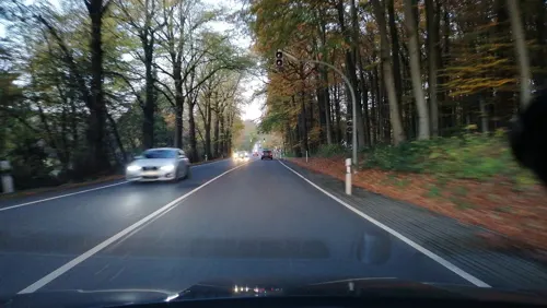
- Street-level photo, d3d9, CC BY-SA 4.0
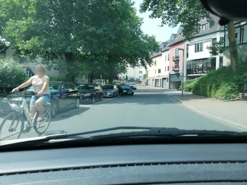
- Street-level photo, thoschi, CC BY-SA 4.0
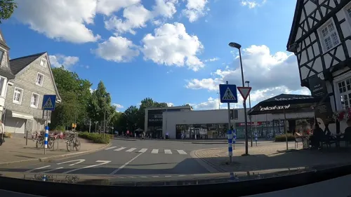
- Street-level photo, thoschi, CC BY-SA 4.0
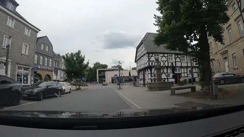
- Street-level photo, thoschi, CC BY-SA 4.0
- Street-level photo, uwekoch, CC BY-SA 4.0
- Street-level photo, thoschi, CC BY-SA 4.0
- Street-level photo, thoschi, CC BY-SA 4.0
- Street-level photo, uwekoch, CC BY-SA 4.0
- Street-level photo, uwekoch, CC BY-SA 4.0
- Street-level photo, uwekoch, CC BY-SA 4.0
- Street-level photo, uwekoch, CC BY-SA 4.0
- Street-level photo, teddy73, CC BY-SA 4.0
- Street-level photo, thoschi, CC BY-SA 4.0
- Street-level photo, uwekoch, CC BY-SA 4.0
- Street-level photo, d3d9, CC BY-SA 4.0
- Street-level photo, klaus100000, CC BY-SA 4.0
- Street-level photo, cuspis, CC BY-SA 4.0
- Street-level photo, thoschi, CC BY-SA 4.0
- Street-level photo, baldur80, CC BY-SA 4.0
- Street-level photo, thoschi, CC BY-SA 4.0
- Street-level photo, thoschi, CC BY-SA 4.0
- Street-level photo, d3d9, CC BY-SA 4.0


Page built November 8, 2026. Spotted a mistake? Tell us or suggest a place.