


Why visit Rödental
Townapedia lists 35 museums and landmarks, 37 parks and trails, 76 places to eat, 13 places to stay and 50 attractions in and around town.
Highlights include Landestheater Coburg, Itztalbrücke, Naturkundemuseum and Schloss Rosenau.
Weather in Rödental
Forecast from MET Norway (CC BY 4.0). Full forecast
About Rödental
Rödental (German: [ˈʁøːdn̩ˌtaːl] , lit. 'Röden Valley') is a town in the district of Coburg, northern Bavaria, Germany, 7 km northeast of Coburg.
From the Wikipedia article Rödental (this version), under CC BY-SA 4.0.
Things to do50

Landestheater Coburg
Cinema and theater · 6.6 km
Theater in Coburg, Germany


38 more on the map.
Museums and landmarks35

Naturkundemuseum
Museum · 6.0 km
6 Park, Coburg
Mo-Su 09:00-17:00; Dec 24-26,Dec 31 off; Jan 01 off; PH...

Schloss Rosenau
Monument and historic site · 1.3 km
Castle near the town of Rödental, Bavaria, Germany
1 Rosenau, Rödental


Von Werthern Schloß
Monument and historic site · 2.9 km
3 Von-Werthern-Straße, Dörfles-Esbach


Eckardtsturm
Monument and historic site · 6.2 km
Als Aussichtsturm für die Öffentlichkeit gesperrt.


Alte Orangerie
Monument and historic site · 1.5 km
8 Rosenau, Rödental
on demand / for rent


23 more on the map.
Parks, trails and playgrounds37
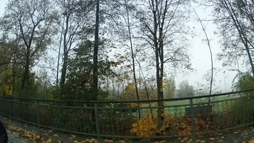
Funtasy World
Sports field and stadium · 1.5 km
7 Coburger Straße, Rödental
Mo-Th 14:00-20:00; Fr 14:00-22:00; Sa 10:00-22:00; Su 10:00-20:00







Aquaria Hallen- und Freibad
Sports field and stadium · 5.6 km
May-Aug PH,Mo-Su 10:00-19:00, Sep-Apr PH,Fr-Su 08:00-21:00,...

Spiel- und Bolzplatz Christenstraße
Playground · 5.8 km
Mar Su[-1]-Oct Su[-1] -1 day: 09:00-21:00; Oct Su[-1]-Mar Su[-1]...
25 more on the map.
Restaurants and cafes76

Landgasthof Morgenthum
Restaurant · German · 2.9 km
2 Lauterbergstraße, Dörfles-Esbach
Mo,We-Fr 17:00-20:30+; Su 11:30-14:30,17:00-20:00
Alte Mühle
Restaurant · Regional, German · 2.4 km
5 Mühlgarten, Rödental
Mo-Sa 18:00-24:00; Su 12:00-15:00
Fliegerklause
Restaurant · Pizza, Burger, German · 4.6 km
1 Zur Brandensteinsebene, Coburg
We-Fr 17:00+; Sa,Su,PH 11:00+
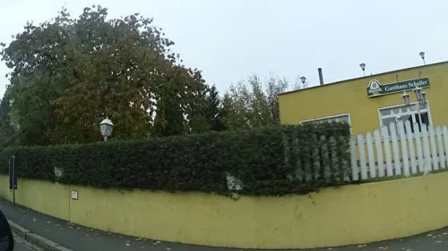
Gasthaus Schaller
Restaurant · German · 3.3 km
27 Neustadter Straße, Dörfles-Esbach
Tu 17:00-24:00; We-Sa 11:00-14:00,17:00-24:00; Su 11:00-14:30,17:00-24:00
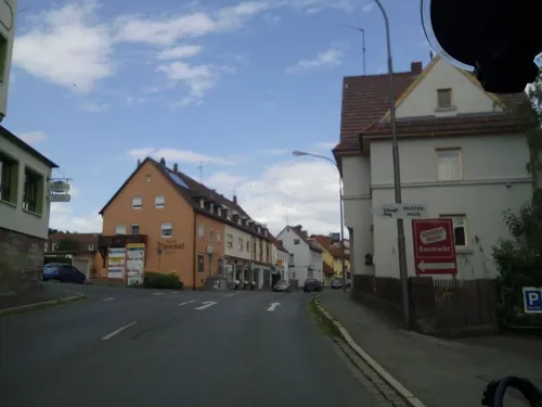
Gasthof Sauerteig
Restaurant · Regional · 0.8 km
100 Oeslauer Straße, Rödental
Tu-Su 11:00 - 14:30; Mo-Sa 17:00 - 21:00
Hessenhof Coburg
Restaurant · German, Regional · 6.2 km
36 Glender Straße, Coburg
Mo-Fr 09:00-14:00,16:00-22:00; Sa 12:00-22:00; Su 10:30-21:00
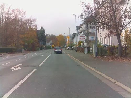
La Fortuna
Restaurant · Pizza · 6.2 km
2 Kanonenweg, Coburg
Tu-Fr 11:00-14:00,17:00-22:00; Sa-Su 17:00-22:30
Restaurant Froschgrundsee
Restaurant · German · 6.0 km
14, Rödental
May-Sep: We-Fr 11:30-22:00; Sa,Su,PH 11:30-17:00; Oct-Apr: We-Sa...
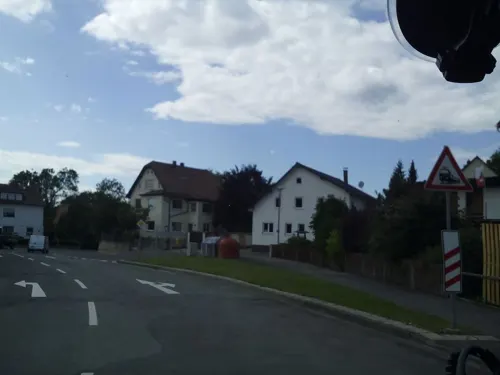
Ristorante Quo Vadis
Restaurant · Pizza · 1.1 km
15 Kronacher Straße, Rödental
Mo-Sa 11:30-14:00, 17:00-22:00; Su 11:30-14:00, 17:00-21:00; PH...


64 more on the map.
Where to stay13
Jugendfreizeitzentrum Am Weinberg
Motel and hotel · 1.4 km
31 Hohe Wart, Rödental
Churches and places of worship18
Haus der Begegnung
Church · Lutheran · 5.3 km
22 Kriegersäcker, Neustadt bei Coburg
Shopping23
Gas and EV charging16
Schools, colleges and libraries12
Healthcare8
Map of Rödental
250 places. The map loads OpenStreetMap tiles when you open it.
Getting there and nearby towns
Verkehrslandeplatz Bayreuth (BYU) is the nearest airport with scheduled flights listed in OpenStreetMap, 55 km away.
- Coburg 7 km southwest, about 7 min by car
- Neustadt bei Coburg 7 km northeast, about 7 min by car
- Lichtenfels 17 km south, about 17 min by car
- Kronach 22 km east, about 22 min by car
- Bad Staffelstein 22 km south, about 22 min by car
- Kulmbach 36 km southeast, about 36 min by car
- Bamberg 45 km south, about 45 min by car
- Haßfurt 47 km southwest, about 47 min by car
- Hirschaid 53 km south, about 53 min by car
- Bayreuth 54 km southeast, about 54 min by car
Drive times are estimates from straight-line distance, not routes.
Local news
Headlines from INDB.
Reviews, tips and questions
Loading what members have shared...
Sources and licences
- GeoNames (CC BY 4.0): population, coordinates, regions and time zone
- Mapillary (see each image): photos
- OpenStreetMap contributors (ODbL 1.0): places, airports, map data
- Wikidata (CC0 1.0): elevation, founding date, time zone, website, landmarks and historic places
- Wikimedia Commons (see each image): photos
- Wikipedia (CC BY-SA 4.0): overview and history text
Photo credits
- Rödental-Domäne, Störfix, CC BY-SA 3.0
- Rödental-Wöhner, Störfix, CC BY-SA 3.0 de
- 96472 Rödental, Germany - panoramio - holger mohaupt, holger mohaupt, CC BY-SA 3.0
- Rödental-Alexandrinenthal, Störfix, CC BY-SA 3.0 de
- Rödental-Zapf, Störfix, CC BY-SA 3.0 de
- Rödental-Grosch, Störfix, CC BY-SA 3.0 de
- Rödental-Schwarzmühle, Störfix, CC BY-SA 3.0 de
- LandestheaterCO, Mike aus dem Bayerwald, CC BY-SA 3.0
- Itztalbruecke-Sept2007, Störfix, CC BY-SA 3.0
- Schloss Rosenau 1900, Unknown author Unknown author, Public domain
- Coburgjuni08 175, Mike aus dem Bayerwald, CC BY-SA 3.0
- Coburg 006morizkirche, PeterBraun74, CC BY-SA 3.0
- Coburg-St.Augustin, Störfix, CC BY-SA 3.0
- HS-Coburg(Campus), Abhi.analyst, CC BY-SA 3.0
- Aerial image of the Coburg Fortress, Carsten Steger, CC BY-SA 4.0
- Aussichtsturm Eckardtsberg07072016, Zonk43, CC BY-SA 4.0
- Hofgarten Coburg - 05, This photograph was taken with a Canon PowerShot S100 by Jed, CC BY-SA 3.0 de
- Lauterburg08 9, Ich, CC BY-SA 2.0 de
- Decca-Sender-Lautertal, Störfix, CC BY-SA 3.0
- Coburg-Schloss-Neuhof, Störfix, CC BY-SA 3.0
- Taimbacher-Forst-Försterei01, Störfix, CC BY-SA 3.0 de
- Rödental-Kirche, Störfix, CC BY-SA 3.0
- Mönchröden-Christuskirche-02, Störfix, CC BY-SA 3.0 de
- Eichen-Hainbuchenwald im Naturwaldreservat Schwengbrunn - Lkr Coburg - Bayern, Machthaber, CC BY-SA 4.0
- Marienkirche Gramzow (Uckermark) 2018 SE, Hans G. Oberlack, CC BY-SA 4.0
- Europäisches Museum für Modernes Glas, Abendöffnung, Lutz Naumann, CC BY-SA 4.0
- Doerfles-Esbach-Kath-Kirche, Störfix, CC BY-SA 3.0 de
- Haarbrücken-Ev-Kirche, Störfix, CC BY-SA 3.0
- Doerfles-Esbach-Ev-Kirche, Störfix, CC BY-SA 3.0 de
- Doerfles-Esbach-Von-Werthern-Str, Störfix, CC BY-SA 3.0 de
- Einberg-St-Marien, Störfix, CC BY-SA 3.0 de
- Unterlauter-Trinitatiskirche-W, Störfix, CC BY-SA 3.0 de
- Oberlauter-St.Bonifatius01, Störfix, CC BY-SA 3.0 de
- Coburg-Eckardtsturm, Störfix, CC BY-SA 3.0
- Gnailes-Wohngebäude, Störfix, CC BY-SA 3.0 de
- Oeslau-Kriegerdenkmal, Störfix, CC BY-SA 3.0 de
- Oeslau St. Hedwig 01, ErwinMeier, CC BY-SA 4.0
- Oeslau-St-Hedwig-02, Störfix, CC BY-SA 3.0 de
- Oeslau-St-Hedwig-01, Störfix, CC BY-SA 3.0 de
- Einberg-St-Marien-3, Störfix, CC BY-SA 3.0 de
- Hofgarten Coburg - 01, This photograph was taken with a Canon PowerShot S100 by Jed, CC BY-SA 3.0 de
- Street-level photo, ramap, CC BY-SA 4.0
- Street-level photo, ramap, CC BY-SA 4.0
- Street-level photo, su1dakra, CC BY-SA 4.0
- Street-level photo, su1dakra, CC BY-SA 4.0
- Street-level photo, ramap, CC BY-SA 4.0
- Street-level photo, ramap, CC BY-SA 4.0
- Street-level photo, achurchner, CC BY-SA 4.0
- Street-level photo, ramap, CC BY-SA 4.0
- Street-level photo, ramap, CC BY-SA 4.0
- Street-level photo, ramap, CC BY-SA 4.0
- Street-level photo, su1dakra, CC BY-SA 4.0
- Street-level photo, ramap, CC BY-SA 4.0
- Street-level photo, ramap, CC BY-SA 4.0
- Street-level photo, ramap, CC BY-SA 4.0
- Street-level photo, ramap, CC BY-SA 4.0


Page built November 8, 2026. Spotted a mistake? Tell us or suggest a place.