


Why visit Lichtenfels
Townapedia lists 69 museums and landmarks, 24 parks and trails, 192 places to eat, 33 places to stay and 36 attractions in and around town.
Highlights include Neue Filmbühne, Hofladen Familie Hümmer, Deutsches Korbmuseum and Kreuzstein.
Weather in Lichtenfels
Forecast from MET Norway (CC BY 4.0). Full forecast
About Lichtenfels
Lichtenfels (German pronunciation: [ˈlɪçtn̩ˌfɛls] ) is a town in the Upper Franconian region of Bavaria, Germany, the administrative seat of Lichtenfels district. It is chiefly known as the German "Basket City".
From the Wikipedia article Lichtenfels, Bavaria (this version), under CC BY-SA 4.0.
Things to do36


Hofladen Familie Hümmer
Farm and orchard · 6.7 km
36 Horsdorfer Straße, Bad Staffelstein
Tu-Fr 09:00-12:30,14:00-18:00; Sa 08:00-13:00; Mo,Su,PH off

Bad Staffelstein
Monument and historic site · 6.9 km
Municipality of Germany

Bad Staffelsteiner WanderHühner
Farm and orchard · 5.9 km
Bei uns erhaltet Ihr täglich nestfrische Freiland-Eier aus dem Hühnermobil in unserem VerkaufsHäuschen.
Mo-Su 08:00-21:00
24 more on the map.
Museums and landmarks69


Kreuzstein
Monument and historic site · 8.1 km
Tief eingeritztes kleines Kreuz, auf der anderen Seite ist ein lat. Balkenkreuz erkennbar.


Oberer Torturm
Monument and historic site
Viergeschossiger Turm aus unverputzten Sandsteinquadern, vorkragender Oberbau, verschieferte Haube
42 Marktplatz, Lichtenfels

Roter Turm
Monument and historic site
Dreigeschossiger Turm aus Sandsteinquadern, Walmdach
14 Stadtknechtsgasse, Lichtenfels
Bamberger Tor
Monument and historic site
Viergeschossiger Torturm aus unverputzten Sandsteinquadern, geschweifte Haube

Bildhäuschen
Monument and historic site · 0.7 km
Sandstein, in der rundbogigen Nische gefasstes Vesperbild


Menosgada
Monument and historic site · 6.4 km
Iron Age Celtic settlement
57 more on the map.
Parks, trails and playgrounds24

Obermain Therme
Sports field and stadium · 6.3 km
1 Am Kurpark, Bad Staffelstein
Su-We 08:00-21:00; Th-Sa 08:00-23:00




Hallenbad Michelau
Sports field and stadium · 4.6 km
32 Bachstraße, Michelau i.OFr.

12 more on the map.
Restaurants and cafes192



Berggasthof Banzer Wald
Restaurant · Regional · 5.7 km
1 Am Banzer Wald, Bad Staffelstein
Th-Sa 16:00-22:00; Su 11:00-14:00; Mo,Tu,We off
Brauerei-Gasthof Wichert
Restaurant · German · 2.1 km
50 Alte Reichsstraße, Lichtenfels
We-Fr 16:00+; Sa,Su 10:00+
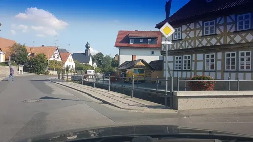
Bräustübl
Restaurant · Regional · 7.8 km
7 Mühlteich, Bad Staffelstein
Tu-Th,Sa,Su 11:00-22:00; Mo,Fr off
Am Stadtturm
Restaurant · Regional · 6.7 km
7 Angerstraße, Bad Staffelstein
Tu-Sa 11:00-14:00,17:00-23:00; Su 11:00-14:00
Brauerei-Gasthof Hennemann
Restaurant · Regional · 7.6 km
13 Am Dorfbrunnen, Bad Staffelstein
We,Th 16:30-22:00; Fr-Su 11:00-14:00,17:00-20:00
Cafe Moritz
Restaurant · Coffee Shop, Regional, International, Burger
9 Marktplatz, Lichtenfels
Mo-Sa 08:00-22:00, Su 09:00-21:00
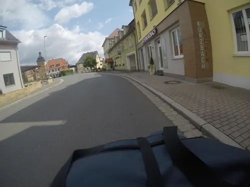
Das Vogelhaus - Cafébar & Lounge
Cafe · Coffee Shop, Sandwich, Breakfast, Ice Cream, Pastry, Salad · 6.7 km
35 Bamberger Straße, Bad Staffelstein
Th-Tu 09:00-20:00
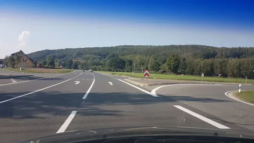


Gasthof Dinkel
Restaurant · Regional · 7.6 km
18 Frauendorfer Straße, Bad Staffelstein
Th-Tu 11:30-21:00
180 more on the map.
History
Lichtenfels was first mentioned in 1142 and chartered in 1231. That was titled and conferred from Otto III, Count Palatine of Burgundy.
After the expiration of the Meranians (Meranier) in 1248 Lichtenfels became part of the Prince-Bishopric of Bamberg (Hochstift Bamberg). With those and with the Secularization in 1802 incorporate to the Prince-electorate (Kurfürstentum) and later to the Kingdom of Bavaria (Königreich Bayern).
The Lichtenfelser are also called, in a sneering kind of way, the scoopers of the pool (Tümpelschöpfer). This name they obtained from the Thirty Years' War (1618–1648), from attempting to retrieve hidden sunken treasures in a pond, which they could not empty out due to rapidly running groundwater.
From the History section of Lichtenfels, Bavaria on Wikipedia, under CC BY-SA 4.0.
Where to stay33
Churches and places of worship62
Johannes-Kirche
Church · Protestant · 4.2 km
2 Kirchplatz, Michelau i.OFr.
Beata Maria Virgine
Church · Roman Catholic · 7.6 km
1 Am Döbertenbach, Bad Staffelstein
Herz Jesu
Church · Roman Catholic · 6.7 km
28 Kirchstraße, Michelau i.OFr.
Kreuzkapelle
Church · Roman Catholic · 6.8 km
43 Bamberger Straße, Bad Staffelstein
Mariä Empfängnis
Church · Catholic · 5.4 km
41 Karolinenstraße, Lichtenfels
Pfarrei Mariä Himmelfahrt Hochstadt am Main
Church · Catholic · 8.0 km
18 Hauptstraße, Hochstadt a.Main
Sankt Andreas
Church · Roman Catholic · 3.3 km
1 Leo-Veth-Straße, Lichtenfels
Spitalkirche
Church · Roman Catholic
14 Bamberger Straße, Lichtenfels
St. Anna
Church · Roman Catholic · 6.5 km
7 Bamberger Straße, Bad Staffelstein
St. Heinrich und Kunigunda
Church · Roman Catholic · 1.5 km
9 Friedrich-Ebert-Straße, Lichtenfels
Shopping45
Gas and EV charging21
Schools, colleges and libraries26
Healthcare19
Adam-Riese-Apotheke
Clinic and pharmacy · 6.2 km
5 Untere Gartenstraße, Bad Staffelstein
THERAmed Zentrum für Therapie und Gesundheit
Clinic and pharmacy · 6.3 km
26 Lichtenfelser Straße, Bad Staffelstein
Map of Lichtenfels
250 places. The map loads OpenStreetMap tiles when you open it.
Getting there and nearby towns
Verkehrslandeplatz Burg Feuerstein (URD) is the nearest airport with scheduled flights listed in OpenStreetMap, 39 km away.
- Bad Staffelstein 6 km southwest, about 6 min by car
- Neustadt bei Coburg 21 km north, about 21 min by car
- Münchberg 52 km east, about 52 min by car
- Pegnitz 56 km southeast, about 56 min by car
- Erlangen 62 km south, about 1 h by car
- Schweinfurt 61 km west, about 1 h by car
- Schwarzenbach an der Saale 63 km east, about 1 h by car
- Wunsiedel 68 km east, about 1 h 15 min by car
- Fürth 75 km south, about 1 h 15 min by car
- Nuremberg 77 km south, about 1 h 15 min by car
Drive times are estimates from straight-line distance, not routes.
Local news
Headlines from INDB.
Reviews, tips and questions
Loading what members have shared...
Sources and licences
- GeoNames (CC BY 4.0): population, coordinates, regions and time zone
- Mapillary (see each image): photos
- OpenStreetMap contributors (ODbL 1.0): places, airports, map data
- Wikidata (CC0 1.0): elevation, founding date, time zone, website, landmarks and historic places
- Wikimedia Commons (see each image): photos
- Wikipedia (CC BY-SA 4.0): overview and history text
Photo credits
- Blick auf Lichtenfels, Schubbay, CC BY-SA 3.0
- Unteres Tor Lichtenfels, Schubbay, CC BY-SA 3.0
- Lichtenfels Bahnhof Luftbild-20231001-RM-155902, Reinhold Möller Ermell, CC BY-SA 4.0
- Lichtenfels Bahnhof Luftbild-20231001-RM-155917, Reinhold Möller Ermell, CC BY-SA 4.0
- Stadtbus Lichtenfels, franke2008 at de.wikipedia, CC BY-SA 3.0
- Bahnhof Lichtenfels, Schubbay, CC BY 2.5
- Bf Lichtenfels, Michael Sander, CC BY-SA 3.0
- Lichtenfels Sundial 2100160, Ermell, CC BY-SA 4.0
- Lichtenfels Unteres Tor 2100159, Ermell, CC BY-SA 4.0
- Lichtenfels unteres Tor 2100171, Ermell, CC BY-SA 4.0
- Lichtenfels - Schweinebrunnen - Schweine, Howwi, CC BY-SA 3.0
- Lichtenfels - Schweinebrunnen - Schwein, Howwi, CC BY-SA 3.0
- Lichtenfels - Schweinebrunnen, Howwi, CC BY-SA 3.0
- Lichtenfels Haustür 2100168, Ermell, CC BY-SA 4.0
- Lichtenfels Stadtbücherei Tür 2100175, Ermell, CC BY-SA 4.0
- Lichtenfels Wasserturm Bhf, Radler59, CC BY-SA 3.0
- Lichtenfels Markt 2100174, Ermell, CC BY-SA 4.0
- Marktplatz Lichtenfels, Schubbay, CC BY-SA 3.0
- Lichtenfels-Bahnhof, Störfix, CC BY-SA 3.0 de
- Lichtenfels Ofr - Marktplatz 1 - Rathaus, Tors, CC BY-SA 3.0
- Lichtenfels (Ofr) - Rathaus - Wappen - 2012-04, Tors, CC BY-SA 3.0 de
- Rathaus Lichtenfels, Schubbay, CC BY-SA 3.0
- Lichtenfels Rathaus Wappen 2100151, Ermell, CC BY-SA 4.0
- Lichtenfels Oberer Torturm-20231001-RM-154913, Ermell, CC BY-SA 4.0
- Lichtenfels Spitalkirche aerial view.-20231001-RM-155716, Ermell, CC BY-SA 4.0
- Lichtenfels Spitalkirche aerial view-20231001-RM-155352, Ermell, CC BY-SA 4.0
- Lichtenfels Mariä Himmelfahrt aerial view-20231001-RM-155025, Ermell, CC BY-SA 4.0
- Lichtenfels Ofr - Marktplatz 15, Tors, CC BY-SA 3.0
- Ehem. Forsthaus Lichtenfels, Schubbay, CC BY-SA 3.0
- Lichtenfels, Bayern. Town hall view, 2006, Norse at English Wikipedia, Public domain
- Lichtenfels Rathaus Tür 2100144, Ermell, CC BY-SA 4.0
- Lichtenfels Rathaus Wappen 2100145, Ermell, CC BY-SA 4.0
- Lichtenfels Fachwerkhaus 2100178, Ermell, CC BY-SA 4.0
- Lichtenfels Fachwerkhaus 2100180, Ermell, CC BY-SA 4.0
- Rathaus Staffelstein, Michael Sander, CC BY-SA 3.0
- Staffelberg Hochplateau 006, Janericloebe, Public domain
- Kloster Banz Luftbild Winter-20240120-RM-160353, Reinhold Möller Ermell, CC BY-SA 4.0
- Lichtenfels, Stadtmauer, Stadtknechtsweg, 003, Tilman2007, CC BY-SA 3.0
- Trieb Kirche Luftbild-20220807-RM-163659, Ermell, CC BY-SA 4.0
- Schwabthal-208, Störfix, CC BY-SA 3.0 de
- Kitschentalrangen-20200629-RM-170744, Ermell, CC BY-SA 4.0
- Ansicht Deutsches Korbmuseum, Deutsches Korbmuseum, CC BY-SA 4.0
- Lichtenfels Ofr - Marktplatz 42 - Oberer Torturm, Tors, CC BY-SA 3.0
- Lichtenfels Ofr - Myconiusstraße 1 - Bildstock, Tors, CC BY-SA 3.0
- Bad Staffelstein, Angerstraße, Hl. Nepomuk-001, Tilman2007, CC BY-SA 3.0
- Lichtenfels, Stadtschloss, 003, Tilman2007, CC BY-SA 3.0
- Marktzeuln, Oberm Rathaus, Sandsteinfiguren 20170325 001, Tilman2007, CC BY-SA 4.0
- Bad Staffelstein, Kirchgasse, Kriegerdenkmal-001, Tilman2007, CC BY-SA 3.0
- Staffelberg, Schrodian, CC BY-SA 3.0
- Gaabsweiher, LenaB10, CC BY-SA 4.0
- Oberau Mainaue P5050427, Ermell, CC BY-SA 4.0
- Uetzing-Wohnstallhaus-258, Störfix, CC BY-SA 3.0 de
- Weisbrem-Gasthof, Störfix, CC BY-SA 3.0 de
- Vierzehnheiligen Basilika Luftbild-20220304-RM-115153, Ermell, CC BY-SA 4.0
- Kirche Michelau, Michael Sander, CC BY-SA 3.0
- Serkendorf-St-Maria, Störfix, CC BY-SA 3.0 de
- Michelau OT Schwürbitz01, Ammerseer, CC BY-SA 3.0
- Bamberger Straße 43 (Bad Staffelstein), Gliwi, CC BY-SA 3.0
- Lichtenfels Ofr - Kronacher Straße 14 - Martin-Luther-Kirche, Tors, CC BY-SA 3.0
- Mariä Himmelfahrt D-4-78-127-2, Benreis, CC BY 3.0
- Mistelfeld Kirche St. Andreas-20210620-RM-155105, Ermell, CC BY-SA 4.0
- Lichtenfels BambergerStr14 Spitalkirche 001, K.Baas, CC BY-SA 4.0
- Bad Staffelstein, St. Anna Kapelle-001, Tilman2007, CC BY-SA 3.0
- Schney St. Heinrich und Kunigunda Luftbild-20231001-RM-163414, Ermell, CC BY-SA 4.0
- Lichtenfels Ofr - Kronacher Straße 10, Tors, CC BY-SA 3.0
- Hochstadt M Kreuzstein, Radler59, CC BY-SA 3.0
- Obermain Therme Bad Staffelstein - SaunaLand, Obermain Therme, CC BY-SA 4.0
- Street-level photo, r66, CC BY-SA 4.0
- Street-level photo, r66, CC BY-SA 4.0
- Street-level photo, su1dakra, CC BY-SA 4.0
- Street-level photo, qso4you_com, CC BY-SA 4.0
- Street-level photo, qso4you_com, CC BY-SA 4.0
- Street-level photo, r66, CC BY-SA 4.0
- Street-level photo, fabchim, CC BY-SA 4.0
- Street-level photo, ramap, CC BY-SA 4.0
- Street-level photo, mfa, CC BY-SA 4.0
- Street-level photo, mfa, CC BY-SA 4.0
- Street-level photo, BerndGo64, CC BY-SA 4.0
- Street-level photo, derzornigemarkus, CC BY-SA 4.0
- Street-level photo, qso4you_com, CC BY-SA 4.0
- Street-level photo, r66, CC BY-SA 4.0
- Street-level photo, r66, CC BY-SA 4.0
- Street-level photo, bernd_niemann, CC BY-SA 4.0


Page built November 8, 2026. Spotted a mistake? Tell us or suggest a place.