


Essex, Massachusetts
Essex is a community of 1,688 people in Essex County, Massachusetts.
Why visit Essex
Townapedia lists 17 museums and landmarks, 17 parks and trails, 6 places to eat, 1 place to stay and 5 attractions in and around town.
Highlights include Crane Beach, Ipswich Range Lights, Benaiah Titcomb House and Castle Hill.
July is the warmest month, with average highs of 80°F; January lows average 18°F, and about 51 inches of snow fall in a normal year.
Weather in Essex
Forecast from the National Weather Service. Full forecast
About Essex
Essex CDP is a census-designated place (CDP) in the town of Essex in Essex County, Massachusetts, United States. The population was 1,471 at the 2010 census.
From the Wikipedia article Essex (CDP), Massachusetts (this version), under CC BY-SA 4.0.
Things to do5

Crane Beach
Beach · 3.2 mi
Conservation and recreation property located in Ipswich, Massachusetts

Ipswich Range Lights
Lighthouse · 3.1 mi
Range lights in Massachusetts, United States

Museums and landmarks17

Benaiah Titcomb House
Monument and historic site · National Register of Historic Places · 1.5 mi
Historic house in Massachusetts, United States

Castle Hill
Monument and historic site · National Register of Historic Places · 3.1 mi
Drumlin with mansion in Ipswich, Massachusetts, USA
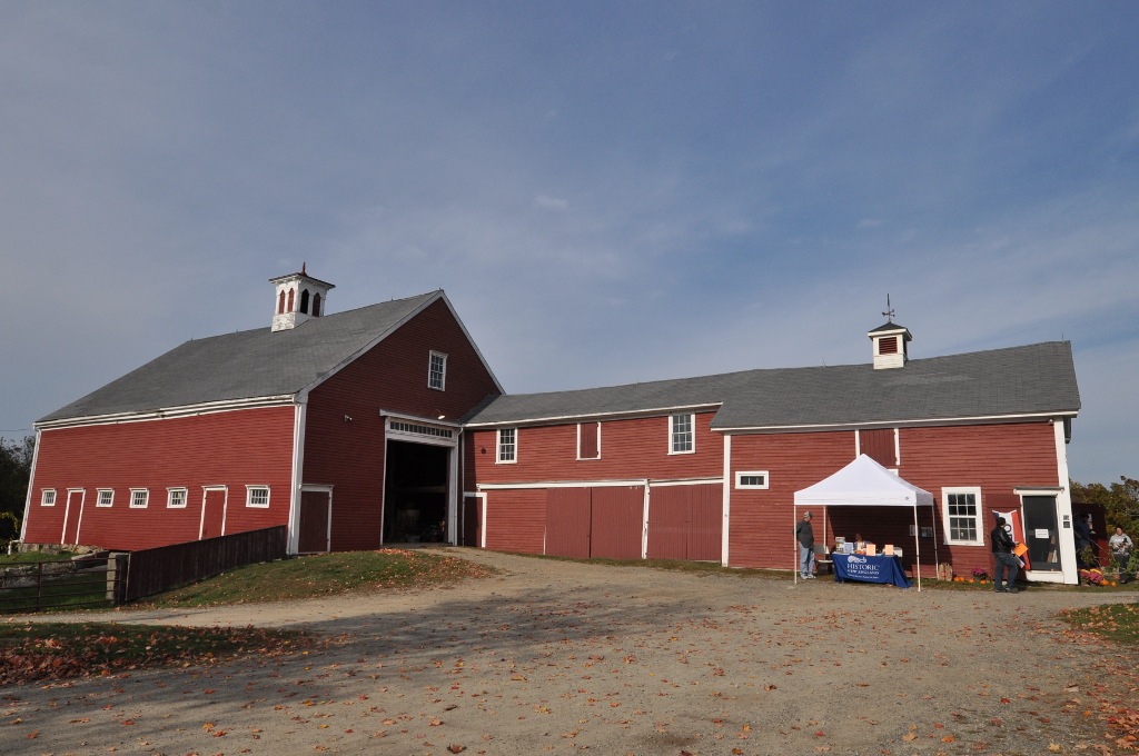
Cogswell's Grant
Monument and historic site · National Register of Historic Places
Historic house in Massachusetts, United States

David Burnham House
Monument and historic site · National Register of Historic Places · 2.3 mi
Historic house in Massachusetts, United States
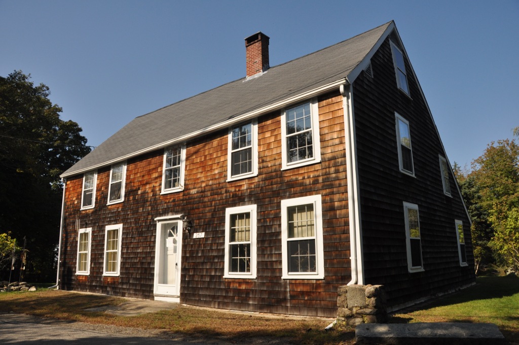
Ella Proctor Herrick House
Monument and historic site · National Register of Historic Places · 2.4 mi
Historic house in Massachusetts, United States
Essex Town Hall and TOHP Burnham Library
Monument and historic site · National Register of Historic Places · 0.9 mi
Rathaus in Massachusetts, United States of America

George Giddings House and Barn
Monument and historic site · National Register of Historic Places · 1.9 mi
Historic farm in Massachusetts, United States

House on Labor-in-Vain Road
Monument and historic site · National Register of Historic Places · 3.1 mi
Historic house in Massachusetts, United States

Isaac Goodale House
Monument and historic site · National Register of Historic Places · 2.0 mi
Historic house in Massachusetts, United States

James Burnham House
Monument and historic site · National Register of Historic Places · 3.4 mi
Historic house in Massachusetts, United States

Puritan House
Monument and historic site · National Register of Historic Places · 3.1 mi
Historic house in Massachusetts, United States

Smith House
Monument and historic site · National Register of Historic Places · 2.4 mi
Historic house in Massachusetts, United States
5 more on the map.
Parks, trails and playgrounds17


Crane Wildlife Refuge
Park · 2.4 mi
Wildlife refuge in Ipswich and Essex, Massachusetts, USA



5 more on the map.
Restaurants and cafes6

Googan's Galley
Restaurant · Coffee Shop, Sandwich · 0.7 mi
1 Martin Street, Essex
Mo-Sa 06:30-17:00; Su 07:00-16:00
Salty's Pizza and Ice Cream
Restaurant · Ice Cream, Pizza · 0.7 mi
2 Martin Street, Essex
Mo-Su 12:00-21:00
The James, Pub and Provisions, Essex
Restaurant · Irish Pub, American · 0.7 mi
55 Main Street, Essex
Mo-Su 11:00-23:00
Where to stay1
Churches and places of worship1
Gas and EV charging1
Schools, colleges and libraries18
Manchester Essex Regional High School
School · 4.0 mi
36 Lincoln Street, Manchester
Manchester Essex Regional Middle School
School · 4.0 mi
36 Lincoln Street, Manchester
Map of Essex
66 places. The map loads OpenStreetMap tiles when you open it.
Climate by month
Monthly table
| Month | High | Low | Rain | Snow |
|---|---|---|---|---|
| Jan | 37°F | 18°F | 3.7 in | 16.0 in |
| Feb | 39°F | 18°F | 3.6 in | 16.4 in |
| Mar | 45°F | 25°F | 4.6 in | 7.6 in |
| Apr | 57°F | 34°F | 4.2 in | 1.4 in |
| May | 66°F | 44°F | 3.5 in | 0.0 in |
| Jun | 75°F | 54°F | 4.0 in | 0.0 in |
| Jul | 80°F | 60°F | 3.4 in | 0.0 in |
| Aug | 79°F | 58°F | 3.4 in | 0.0 in |
| Sep | 72°F | 51°F | 3.8 in | 0.0 in |
| Oct | 61°F | 40°F | 5.0 in | 0.3 in |
| Nov | 51°F | 31°F | 4.0 in | 0.9 in |
| Dec | 42°F | 24°F | 4.8 in | 8.8 in |
U.S. Climate Normals 1991-2020 for Beverly (5 mi away), NOAA NCEI.
People and cost of living
American Community Survey 5-year estimates, 2020-2024, U.S. Census Bureau. Estimates have margins of error, larger for small towns.
Disaster history
Essex County has had 26 federal disaster declarations since 2000, most often for severe storms.
- 2023-09-15: Hurricane Lee (Hurricane)
- 2020-03-27: Covid-19 Pandemic (Biological)
- 2020-03-13: Covid-19 (Biological)
- 2018-07-19: Severe Winter Storm And Snowstorm (Snowstorm)
- 2018-06-25: Severe Winter Storm And Flooding (Severe Storm)
- 2015-04-13: Severe Winter Storm, Snowstorm, And Flooding (Severe Storm)
OpenFEMA disaster declarations summaries.
Getting there and nearby towns
Beverly Municipal Airport (BVY) is the nearest airport with scheduled flights listed in OpenStreetMap, 8 miles away.
- Gloucester 4 mi east, about 7 min by car
- Beverly 7 mi southwest, about 11 min by car
- Danvers 10 mi southwest, about 16 min by car
- Marblehead 11 mi southwest, about 18 min by car
- Boxford 11 mi west, about 18 min by car
- Salem 12 mi southwest, about 19 min by car
- Peabody 12 mi southwest, about 20 min by car
- Newburyport 13 mi northwest, about 21 min by car
- Swampscott 13 mi southwest, about 22 min by car
- Lynn 15 mi southwest, about 24 min by car
Drive times are estimates from straight-line distance, not routes.
Local news
Headlines from INDB, the NEMICO news database.
Reviews, tips and questions
Loading what members have shared...
Sources and licences
- NCES EDGE (Public domain): public schools
- NOAA NCEI U.S. Climate Normals 1991-2020 (Public domain): climate by month
- OpenFEMA (Public domain): disaster declarations
- OpenStreetMap contributors (ODbL 1.0): places, airports, map data
- U.S. Census Bureau (Public domain): population, income, housing, education, commute
- Wikidata (CC0 1.0): elevation, founding date, time zone, website, landmarks and historic places
- Wikimedia Commons (see each image): photos
- Wikipedia (CC BY-SA 4.0): overview and history text
Photo credits
- Looking north on Main St, Essex MA, John Phelan, CC BY 3.0
- EssexMA CogswellsGrant, Magicpiano, CC BY-SA 3.0
- Banks at lowtide Essex River, Essex, MA, Carla Gates, CC BY 2.0
- Small boat - Essex MA - panoramio, joefrogger, CC BY-SA 3.0
- Essex,MA Sailboat at rest - panoramio, joefrogger, CC BY-SA 3.0
- Essex, MA (6297452843), ryan harvey from Portland, OR, CC BY-SA 2.0
- Inland waterway in Essex - panoramio, joefrogger, CC BY-SA 3.0
- Inland waterway-Essex - panoramio, joefrogger, CC BY-SA 3.0
- Essex MA - panoramio, joefrogger, CC BY-SA 3.0
- Essex, Massachusetts, Quintin Soloviev, CC BY 4.0
- Essex Town Hall and TOHP Burnham Library, GMushinsky, CC BY-SA 4.0
- Essex Town Hall and TOHP Burnham Library (cropped), GMushinsky, CC BY-SA 4.0
- Essex Town Hall & TOHP Burnham Library, GMushinsky, CC BY-SA 4.0
- EssexMA TownHallAndLibrary, Magicpiano, CC BY-SA 3.0
- Cross Island, Essex, MA (7752789126), Carla Gates, CC BY 2.0
- EssexMA BenaiahTitcombHouse, Magicpiano, CC BY-SA 3.0
- Cross Island, Essex, MA (7752789006), Carla Gates, CC BY 2.0
- Front view of former Essex carhouse, May 2017, Pi.1415926535, CC BY-SA 4.0
- Side view of former Essex carhouse, May 2017, Pi.1415926535, CC BY-SA 4.0
- CogswellsGrant Barn, User:Magicpiano, CC BY-SA 4.0
- Crane estate (5), Djmcrenn, CC BY 3.0
- EssexMA DavidBurnhamHouse, Magicpiano, CC BY-SA 3.0
- EssexMA GeorgeGiddingsHouseAndBarn, User:Magicpiano, CC BY-SA 4.0
- Blackburn Tavern, 2 Main St, Gloucester MA, John Phelan, CC BY 3.0
- IpswichMA ThomasLowHouse, User:Magicpiano, CC BY-SA 4.0
- GloucesterMA WilliamHaskellHouse, Magicpiano, CC BY-SA 3.0
- IpswichMA SmithHouse, Magicpiano, CC BY-SA 4.0
- IpswichMA JamesBurnhamHouse, Magicpiano, CC BY-SA 3.0
- IpswichMA IsaacGoodaleHouse, Magicpiano, CC BY-SA 4.0
- GloucesterMA EllaProctorHerrickHouse, User:Magicpiano, CC BY-SA 4.0
- IpswichMA LaborInVainHouse, Magicpiano, Public domain
- Long Island and Choate Island, Crane Wildlife Refuge, Ipswich MA, John Phelan, CC BY-SA 3.0
- Ipswich Light, Ipswich, Mass (66146), Tichnor Brothers, Publisher, Public domain
- White Sand coastal dunes Crane beach Ipswich Massachusetts, EgorovaSvetlana, CC BY-SA 4.0
- Barn at Cogswell's Grant, Elizabeth B. Thomsen, CC BY-SA 4.0
- Clam Shack (6709501903), Tim Sackton from Somerville, MA, CC BY-SA 2.0
- Northern Lights and Coastal Marsh (54062671547), Eric Kilby, CC BY-SA 2.0
- Former Conomo station building, May 2017, Pi.1415926535, CC BY-SA 3.0


Page built October 30, 2026. Spotted a mistake? Tell us or suggest a place.