


Why visit Ash
Townapedia lists 4 museums and landmarks, 6 parks and trails, 3 places to eat, 1 place to stay and 2 attractions in and around town.
Highlights include The Toll Bridge, Juilets, Goodnestone Park and Richborough Roman Fort.
Weather in Ash
Forecast from MET Norway (CC BY 4.0). Full forecast
About Ash
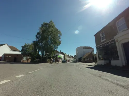
Ash is a village and civil parish in the Dover district of east Kent about three miles west of Sandwich.
From the Wikipedia article Ash, Dover District (this version), under CC BY-SA 4.0.
Photos of Ash


Things to do2

The Toll Bridge
Bridge · 2.7 mi
Bridge in Sandwich, Dover, Kent, England, UK

Museums and landmarks4

Goodnestone Park
Museum · 3.3 mi
Country house and garden in Goodnestone, Dover district, Kent, England, UK

Richborough Roman Fort
Monument and historic site · 2.5 mi
Roman fort at Richborough, Ash, United Kingdom

White Mill
Museum · 2.1 mi
Windmill, now heritage centre, in Sandwich, Kent, England, UK

Updown early medieval cemetery
Monument and historic site · 3.2 mi
Cemetery in Eastry, Kent, England, UK
Parks, trails and playgrounds6

Rare Species Conservation Centre
Park · 2.4 mi
Former zoo in Dover, Kent, United Kingdom


Restaurants and cafes3

History
Ash was once on the main thoroughfare from Canterbury to the channel port of Sandwich. It takes its name from the Old English æsc (ash) and shows its toponymy in its first recorded form, Æsce, in about 1100.
Ash was once part of the Royal manor of Wingham and having been given to the See of Canterbury in 850 AD by King Athelstan, it became a separate parish in 1282, one of the largest in Kent at that time.
The Harflete or Harfleet family were Lords of the Manor for many years. The family died out in the late seventeenth century.
The Grade I listed parish church, is dedicated to St Nicholas and probably built on the site of an earlier Saxon church, dates partly from the 12th century and has a 15th-century tower with a lead spire (once used as a navigation aid for ships), which now houses a ring of ten bells. It also has the best collection of medieval monumental effigies in Kent, including one to Jane Kerriel (c. 1455) which reveals a unique horseshoe head-dress.
Ash is known for its market gardens, and at one time had its own brewery and organ maker. There are two vineyards nearby.
There are many medieval buildings in the village, including 'Molland House' which is named as a Historic Building of Kent and eleven of the twelve original manor houses. In the same lane are a number of Tudor cottages. The Chequer Inn began life as a timber-framed hall house, dating from about 1500.
Read more of the history
From 1916 to 1948 it had a station ("Ash Town") on the East Kent Light Railway, one of Colonel Stephens' lines, which ran between Shepherdswell and Wingham.
From the History section of Ash, Dover District on Wikipedia, under CC BY-SA 4.0.
Notable people from Ash
 William Eyton-JonesBritish naval officerPhoto: Mej1976, CC BY-SA 4.0
- Stephen Wootton BushellEnglish physician and amateur Orientalist (1844–1908)
- Paul FarbraceEnglish cricketer (born 1967)
Born in Ash, according to Wikidata (CC0). Each name links to its Wikipedia article.
Where to stay1
Churches and places of worship7
Schools, colleges and libraries2
Healthcare2
Map of Ash
27 places. The map loads OpenStreetMap tiles when you open it.
Getting there and nearby towns
Manston Airport (MSE) is the nearest airport with scheduled flights listed in OpenStreetMap, 6 miles away.
- Eastry 3 mi southeast, about 4 min by car
- Wingham 3 mi west, about 5 min by car
- Littlebourne 5 mi west, about 8 min by car
- Ramsgate 7 mi northeast, about 12 min by car
- Shepherdswell 7 mi south, about 11 min by car
- Bridge 7 mi west, about 11 min by car
- Saint Peters 8 mi northeast, about 14 min by car
- Margate 8 mi northeast, about 14 min by car
- Canterbury 9 mi west, about 14 min by car
- Broadstairs 9 mi northeast, about 14 min by car
Drive times are estimates from straight-line distance, not routes.
Towns near Ash


Keep exploring
Local news
Headlines from INDB.
Reviews, tips and questions
Loading what members have shared...
Sources and licences
- GeoNames (CC BY 4.0): population, coordinates, regions and time zone
- Mapillary (see each image): photos
- OpenStreetMap contributors (ODbL 1.0): places, airports, map data
- Wikidata (CC0 1.0): elevation, founding date, time zone, website, landmarks and historic places
- Wikimedia Commons (see each image): photos
- Wikipedia (CC BY-SA 4.0): overview and history text
Photo credits
- War Memorial, Ash, Kent, Nick Smith, CC BY-SA 2.0
- Church of St Nicholas, Ash-with-Westmarsh, Kent - gravestone memento mori 02, Acabashi, CC BY-SA 4.0
- Church of St Nicholas, Ash-with-Westmarsh, Kent - Thomas Wood table tomb chest 02, Acabashi, CC BY-SA 4.0
- Church of St Nicholas, Ash-with-Westmarsh, Kent - Sir John Goshall monument, Acabashi, CC BY-SA 4.0
- Church of St Nicholas, Ash-with-Westmarsh, Kent - gravestone memento mori 03, Acabashi, CC BY-SA 4.0
- Church of St Nicholas, Ash-with-Westmarsh, Kent - churchyard headstones and tomb chest 02, Acabashi, CC BY-SA 4.0
- Church of St Nicholas, Ash-with-Westmarsh, Kent - Thomas Wood table tomb chest 01, Acabashi, CC BY-SA 4.0
- Church of St Nicholas, Ash-with-Westmarsh, Kent - gravestone memento mori 01, Acabashi, CC BY-SA 4.0
- Church of St Nicholas, Ash-with-Westmarsh, Kent - Sir John Leverick monument, Acabashi, CC BY-SA 4.0
- Church of St Nicholas, Ash-with-Westmarsh, Kent - chancel piscina, Acabashi, CC BY-SA 4.0
- Church of St Nicholas, Ash-with-Westmarsh, Kent - churchyard barrel tombs 02, Acabashi, CC BY-SA 4.0
- Church of St Nicholas, Ash-with-Westmarsh, Kent - churchyard barrel tomb, Acabashi, CC BY-SA 4.0
- Church of St Nicholas, Ash-with-Westmarsh, Kent - churchyard barrel tombs 01, Acabashi, CC BY-SA 4.0
- Church of St Nicholas, Ash-with-Westmarsh, Kent - tower and stair turret, Acabashi, CC BY-SA 4.0
- Church of St Nicholas, Ash-with-Westmarsh, Kent - barrel tomb ivy, moss and weeds, Acabashi, CC BY-SA 4.0
- 1343735 II THE TOLL BRIDGE, HIGH STREET Sandwich 20250910 0001, Tilman2007, CC BY-SA 4.0
- Goodnestone Park. Dover 1, Dhowes9, CC BY-SA 3.0
- Richborough Roman Fort, Midnightblueowl ( talk ), Public domain
- 1343813 I CHURCH OF ST PETER Sandwich 20250910 0002, Tilman2007, CC BY-SA 4.0
- Church of St Nicholas, Ash-with-Westmarsh, Kent - west nave and tower, Acabashi, CC BY-SA 4.0
- Blackwhitelemur, Hengatie ( talk ), Public domain
- White Mill, Sandwich, Nick smith, CC BY-SA 2.0
- The Black Pig pub, Barnsole, Nick Smith, CC BY-SA 2.0
- Elmstone Church, Kent, UK. - panoramio, Jean Marc Gfp, CC BY 3.0
- St Mary's Church, Sandwich, Kent, Hsq7278, CC BY-SA 4.0
- Street-level photo, tallguy, CC BY-SA 4.0
- Street-level photo, tallguy, CC BY-SA 4.0
- Street-level photo, tallguy, CC BY-SA 4.0


Page built November 10, 2026. Spotted a mistake? Tell us or suggest a place.