


Why visit Bridge
Townapedia lists 8 museums and landmarks, 6 parks and trails, 10 places to eat, 1 place to stay and 2 attractions in and around town.
Highlights include Marlowe Theatre, Fern & Farrow Farm Shop, Canterbury Roman Museum and Dane John Mound.
Weather in Bridge
Forecast from MET Norway (CC BY 4.0). Full forecast
About Bridge
Bridge is a village and civil parish near Canterbury in Kent, South East England.
From the Wikipedia article Bridge, Kent (this version), under CC BY-SA 4.0.
Things to do2

Marlowe Theatre
Cinema and theater · 3.2 mi
Theatre in Canterbury, England (third of that name)

Fern & Farrow Farm Shop
Farm and orchard · 1.0 mi
Frog Lane, Canterbury
We-Fr 09:00-16:00; Sa 09:00-15:00; Su 09:00-12:00
Museums and landmarks8

Canterbury Roman Museum
Museum · 3.0 mi
Museum in Canterbury, Kent, England, UK

Dane John Mound
Monument and historic site · 2.9 mi
Roman cemetery in Canterbury, England

Durovernum Cantiacorum
Monument and historic site · 3.0 mi
Roman city at present-day Canterbury, United Kingdom

Greyfriars
Monument and historic site · 3.2 mi
Former Franciscan convent in Kent

Harris Memorial Garden
Monument and historic site · 3.0 mi
War memorial in Canterbury, England

Kent Museum of Freemasonry
Museum · 3.3 mi
Local history and masonic museum in Canterbury, Kent, United Kingdom

St Augustine's Abbey
Monument and historic site · 2.8 mi
Monastery in Canterbury, Kent, England, UK

The Beaney
Museum · 3.1 mi
Museum, library and art gallery in Canterbury, Kent, United Kingdom
Parks, trails and playgrounds6


Chequer's Wood and Old Park
Park · 2.8 mi
Park in Kent, United Kingdom

Restaurants and cafes10
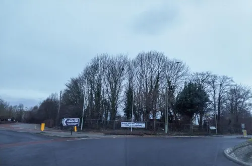
Old Gate Inn
Bar and pub · Regional · 1.5 mi
164 New Dover Road, Canterbury
Mo-Sa 09:00-23:00; Su 09:00-22:00


Plough & Harrow Turkish Restaurant
Restaurant · Turkish
86 High Street, Canterbury
Tu-Su 11:30-22:00


Mama Feelgood's Coffee Shop
Cafe · 1.1 mi
Chalkpit Hill, Canterbury
Mo-Su 09:30-17:00; Su 09:30-16:00; PH 09:30-16:00
Mermaid Inn
Bar and pub · 1.2 mi
The Street, Canterbury
Mo-Tu 18:00-23:00;We-Fr 12:00-15:00,18:00-23:00;Sa 12:00-23:00;Su...
Flo & Ted's
Cafe · Coffee Shop
6 Western Avenue, Canterbury
Mo-Sa 08:00-16:00; Su 09:00-14:00
History
It is likely that the parish took its name from "Bregge", a bridge which crossed the river Nailbourne, a tributary of the Stour. The parish church is dedicated to Saint Peter.
From the History section of Bridge, Kent on Wikipedia, under CC BY-SA 4.0.
More about Bridge
Geography
The village is surrounded by a buffer zone, and is almost entirely residential and agricultural. Its layout is a cross between a linear settlement and a clustered settlement.
From the Wikipedia article Bridge, Kent, under CC BY-SA 4.0.
Notable people from Bridge
- Mark AshtonBritish musician and painter
- Arthur WebbEnglish cricketer (1868-1952)
- Derek Hugginsgallerist and founding director of National Arts Council of Zimbabwe (1940-2021)
- Charles ChapmanBelgian flying ace
Born in Bridge, according to Wikidata (CC0). Each name links to its Wikipedia article.
Where to stay1
Churches and places of worship9
Shopping1
Schools, colleges and libraries2
Bridge and Patrixbourne Church of England Primary School
School · Anglican
Conyngham Lane, Canterbury
Healthcare1
Map of Bridge
40 places. The map loads OpenStreetMap tiles when you open it.
Getting there and nearby towns
Manston Airport (MSE) is the nearest airport with scheduled flights listed in OpenStreetMap, 12 miles away.
- Canterbury 3 mi northwest, about 5 min by car
- Littlebourne 3 mi northeast, about 4 min by car
- Wingham 4 mi northeast, about 7 min by car
- Shepherdswell 6 mi southeast, about 10 min by car
- Herne Bay 9 mi north, about 14 min by car
- Whitstable 9 mi northwest, about 15 min by car
- Folkestone 11 mi south, about 18 min by car
- Faversham 11 mi northwest, about 18 min by car
- Dover 12 mi southeast, about 19 min by car
- Ashford 13 mi southwest, about 21 min by car
Drive times are estimates from straight-line distance, not routes.
Towns near Bridge


Keep exploring
Local news
Headlines from INDB.
Reviews, tips and questions
Loading what members have shared...
Sources and licences
- GeoNames (CC BY 4.0): population, coordinates, regions and time zone
- Mapillary (see each image): photos
- OpenStreetMap contributors (ODbL 1.0): places, airports, map data
- Wikidata (CC0 1.0): elevation, founding date, time zone, website, landmarks and historic places
- Wikimedia Commons (see each image): photos
- Wikipedia (CC BY-SA 4.0): overview and history text
Photo credits
- St Peter Bridge 1, Josh Tilley, CC BY-SA 4.0
- Marlowe Theatre Canterbury, Adam Bishop, CC BY-SA 3.0
- Roman Museum 002a, Linda Spashett ( Storye book ), CC BY 3.0
- Dane John Mound (1), Richard Nevell, CC BY-SA 3.0
- Watling Street route, w:en:User:Neddyseagoon, CC BY-SA 3.0
- Canterbury - Greyfriars Chapel, Pam Fray, CC BY-SA 2.0
- Kent Museum of Freemasonry Entrance, Pre36sunbeam, CC BY-SA 3.0
- 1085027 II PUBLIC LIBRARY AND MUSEUM AT BEANEY INSTITUTE, HIGH STREET Canterbury 20260607 0005, Tilman2007, CC BY-SA 4.0
- Howletts-house, Michael Haslam, CC BY 2.5
- Church of St Mildred Canterbury 1085039 20230812 0042, Tilman2007, CC BY-SA 4.0
- 1241661 II Star Former Church of the Holy Cross Canterbury 20250823 0001, Tilman2007, CC BY-SA 4.0
- St Thomas of Canterbury Church, Canterbury (01), Quartettgeschwister, CC BY-SA 3.0
- Bishopsbourne church, Nick Smith, CC BY-SA 2.0
- St Mary, Patrixbourne, Kent, John Salmon, CC BY-SA 2.0
- Bridge church, Nick Smith, CC BY-SA 2.0
- County of Kent memorial cross, Canterbury Cathedral, August 2022, No Swan So Fine, CC BY-SA 4.0
- St. Augustine's Abbey Spring 2016, Mball93, CC BY-SA 4.0
- Street-level photo, laye, CC BY-SA 4.0


Page built November 10, 2026. Spotted a mistake? Tell us or suggest a place.