


Littlebourne, United Kingdom
Littlebourne is a town of 1,529 people in England, United Kingdom.
Why visit Littlebourne
Townapedia lists 6 museums and landmarks, 4 parks and trails, 12 places to eat, 1 place to stay and 2 attractions in and around town.
Highlights include Howletts Wild Animal Park, Canterbury Roman Museum, Durovernum Cantiacorum and Chequer's Wood and Old Park.
Weather in Littlebourne
Forecast from MET Norway (CC BY 4.0). Full forecast
About Littlebourne
Littlebourne is a village and civil parish 4 miles (6.4 km) east of Canterbury in Kent, South East England.
From the Wikipedia article Littlebourne (this version), under CC BY-SA 4.0.
Things to do2


Fruit Vending Machine
Farm and orchard · 1.2 mi
Fresh fruit vending machine during summer months.
Museums and landmarks6

Canterbury Roman Museum
Museum · 3.7 mi
Museum in Canterbury, Kent, England, UK

Durovernum Cantiacorum
Monument and historic site · 3.7 mi
Roman city at present-day Canterbury, United Kingdom

Goodnestone Park
Museum · 3.4 mi
Country house and garden in Goodnestone, Dover district, Kent, England, UK

Harris Memorial Garden
Monument and historic site · 3.5 mi
War memorial in Canterbury, England

St Augustine's Abbey
Monument and historic site · 3.4 mi
Monastery in Canterbury, Kent, England, UK

Parks, trails and playgrounds4

Chequer's Wood and Old Park
Park · 2.4 mi
Park in Kent, United Kingdom

Restaurants and cafes12
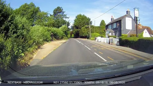
The Evenhill
Bar and pub · 0.4 mi
Originally built as cottages in the 16th century, the historic pub with rooms is situated in the rural village of Littlebourne, near Canterbury.
62 The Hill, Canterbury
Mo-Sa 11:00-23:00; Su 11:00-22:30


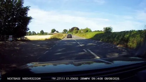
The Railway Station Cafe
Cafe · 1.8 mi
Canterbury Road, Canterbury
Mo-Su 09:00-14:00

Mama Feelgood's Coffee Shop
Cafe · 1.6 mi
Chalkpit Hill, Canterbury
Mo-Su 09:30-17:00; Su 09:30-16:00; PH 09:30-16:00



History
Grassed under fruit trees and in brickearth soul, a gravel pit would contain 12 handaxes and a retouched flake dated to the Lower Palaeolithic. Captain L. Moysey discovered the collection in 1918 and the findings were sent by his mother to the British Museum.
3 mid to late Bronze age urns were uncovered in 1925; found in a disused gravel pit in Olridge Wood and described as ‘bucket urns’.
A magnetometry geophysical survey identified a large enclosure and trackway dated to the late Iron Age and early Roman period. Three Roman coins were found in 1853 by a man digging out his garden. Two coins of Constantius I were found first, then weeks later, a coin of Claudius I. A hoard of three silver Roman denarii were discovered in 2021. The oldest coin depicted Antonius Pius, dated to 141 to 161 AD. The two other coins depicted Septimius Severus of between 195 to 197 AD.
The Howletts Anglo-Saxon cemetery was discovered in 1913 when a gravel pit was opened up at Luddington Wood. The site held 36 or 42 graves and described as Jutish. Examinations of the graves performed ‘no trace of calcined bone or charcoal.’ Along the surface of the soil sat cremated remains. Much of the findings, including quoit brooches, became held in the British Museum. In 696 or 711, Widred of Kent gave 5 plough lands in Littlebourne to St Augustine’s Abbey.
Read more of the history
Littlebourne is a settlement mentioned in the Domesday Book, which recorded population of 48 households with 35 villagers and 14 cottagers. St Augustine Abbey acted as lord to Littlebourne. There was a vineyard run by the monks from St Augustine. A word commonly used to measure vineyards, arpent, is used to refer to the land. During the early 14th century, land in Littlebourne would be granted to St Augustine's Abbey from landowners such as Philip de Intebergh, Walter Russel, John de Forester, John de Grove and Walter Hardy.
From the History section of Littlebourne on Wikipedia, under CC BY-SA 4.0.
More about Littlebourne
Education
Littlebourne Church of England Primary School is a mixed primary school located in Littlebourne for ages 4 to 11. In May of 2019, the school was rated ‘good’ by Ofsted inspectors. In the 2021 Census, around 16.8% of people identified as in some form of full time education, lower than the UK average of 20.4%.
From the Wikipedia article Littlebourne, under CC BY-SA 4.0.
Notable people from Littlebourne
 Phil SpencerBritish television personalityPhoto: eVRydayVR, CC0
- Dicky Mayescricketer (1922-2013)
- John DenneEnglish churchman and antiquarian
Born in Littlebourne, according to Wikidata (CC0). Each name links to its Wikipedia article.
Where to stay1
Churches and places of worship12
Gas and EV charging1
Schools, colleges and libraries3
Wickhambreaux Church of England Primary School
School · Anglican · 1.0 mi
The Street, Canterbury
Map of Littlebourne
41 places. The map loads OpenStreetMap tiles when you open it.
Getting there and nearby towns
Manston Airport (MSE) is the nearest airport with scheduled flights listed in OpenStreetMap, 9 miles away.
- Wingham 2 mi east, about 3 min by car
- Canterbury 4 mi west, about 6 min by car
- Herne Bay 7 mi north, about 11 min by car
- Shepherdswell 7 mi southeast, about 11 min by car
- Whitstable 9 mi northwest, about 14 min by car
- Ramsgate 12 mi east, about 19 min by car
- Margate 12 mi northeast, about 19 min by car
- Dover 12 mi southeast, about 19 min by car
- Faversham 12 mi west, about 20 min by car
- Saint Peters 13 mi northeast, about 20 min by car
Drive times are estimates from straight-line distance, not routes.
Towns near Littlebourne


Keep exploring
Local news
Headlines from INDB.
Reviews, tips and questions
Loading what members have shared...
Sources and licences
- GeoNames (CC BY 4.0): population, coordinates, regions and time zone
- Mapillary (see each image): photos
- OpenStreetMap contributors (ODbL 1.0): places, airports, map data
- Wikidata (CC0 1.0): elevation, founding date, time zone, website, landmarks and historic places
- Wikimedia Commons (see each image): photos
- Wikipedia (CC BY-SA 4.0): overview and history text
Photo credits
- Howletts-house, Michael Haslam, CC BY 2.5
- Roman Museum 002a, Linda Spashett ( Storye book ), CC BY 3.0
- Watling Street route, w:en:User:Neddyseagoon, CC BY-SA 3.0
- Goodnestone Park. Dover 1, Dhowes9, CC BY-SA 3.0
- St Thomas of Canterbury Church, Canterbury (01), Quartettgeschwister, CC BY-SA 3.0
- St. Andrew's Church, Wickhambreaux, Sirmoor536825, CC BY-SA 3.0
- St Vincent Littlebourne 1, Josh Tilley, CC BY-SA 4.0
- County of Kent memorial cross, Canterbury Cathedral, August 2022, No Swan So Fine, CC BY-SA 4.0
- St. Augustine's Abbey Spring 2016, Mball93, CC BY-SA 4.0
- The Haywain inn, Bramling, Kent, Nick Smith, CC BY-SA 2.0
- The Rose Inn, Wickhambreaux., Nick Smith, CC BY-SA 2.0
- Street-level photo, tallguy, CC BY-SA 4.0
- Street-level photo, tallguy, CC BY-SA 4.0
- Street-level photo, tallguy, CC BY-SA 4.0
- Street-level photo, tallguy, CC BY-SA 4.0

Page built November 10, 2026. Spotted a mistake? Tell us or suggest a place.