
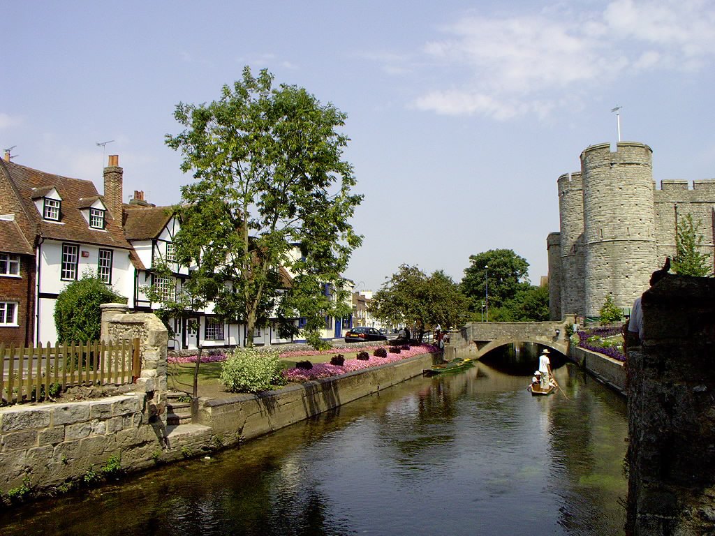


Canterbury, United Kingdom
Canterbury is a town of 55,087 people in England, United Kingdom.
Why visit Canterbury
Townapedia lists 50 museums and landmarks, 57 parks and trails, 224 places to eat, 54 places to stay and 14 attractions in and around town.
Highlights include Marlowe Theatre, Howletts Wild Animal Park, Canterbury Roman Museum and The Beaney House of Art and Knowledge.
Weather in Canterbury
Forecast from MET Norway (CC BY 4.0). Full forecast
About Canterbury
Canterbury ( KAN-tər-bər-ee or -berr-ee) is a city and UNESCO World Heritage Site in the Canterbury district, county of Kent, England; it was a county borough until 1974. Lying on the River Stour not far from its mouth on the Strait of Dover, the city has a mild oceanic climate.
From the Wikipedia article Canterbury (this version), under CC BY-SA 4.0.
Travel tips from other travellers: Canterbury on Wikivoyage (CC BY-SA 4.0).
Photos of Canterbury


Things to do14

Marlowe Theatre
Cinema and theater
Named after english playwriter by Christopher Marlowe. Marlowe is a Shakespeare’s contemporary.
The Friars, Canterbury




Fern & Farrow Farm Shop
Farm and orchard · 4.0 mi
Frog Lane, Canterbury
We-Fr 09:00-16:00; Sa 09:00-15:00; Su 09:00-12:00

2 more on the map.
Museums and landmarks50

Canterbury Roman Museum
Museum
Museum in Canterbury, Kent, England, UK
Butchery Lane, Canterbury
Mo-Su 10:00-17:00

The Beaney House of Art and Knowledge
Museum
18 High Street, Canterbury
Mo off; Tu-Sa 10:00-17:00; Su 11:00-16:00


Sidney Cooper Gallery
Museum
22-23 St. Peter's Street, Canterbury
Tu-Fr 10:30-17:00, Sa 11:30-17:00


Kent Museum of Freemasonry
Museum
Local history and masonic museum in Canterbury, Kent, United Kingdom
Mo-Sa 10:00-16:00

Dane John Mound
Monument and historic site
Roman cemetery in Canterbury, England

Durovernum Cantiacorum
Monument and historic site
Roman city at present-day Canterbury, United Kingdom

Greyfriars
Monument and historic site
Former Franciscan convent in Kent

Harris Memorial Garden
Monument and historic site
War memorial in Canterbury, England

38 more on the map.
Parks, trails and playgrounds57


Tyler Hill Meadow
Park · 2.1 mi
Local Nature Preserve in Hackington, Kent, England

Chequer's Wood and Old Park
Park · 1.6 mi
Park in Kent, United Kingdom
Mount Ephraim Gardens
Park · 5.4 mi
Historic house and gardens, near Faversham, in Hernhill, Swale, Kent, England, UK
45 more on the map.
Restaurants and cafes224
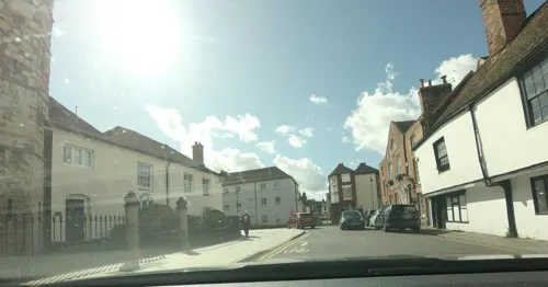
Bangkok House
Restaurant · Thai
13 Church Street, Canterbury
Mo 17:30-22:00; Tu-We 12:00-14:30, 17:30-22:00; Th-Sa 12:00-14:30,...
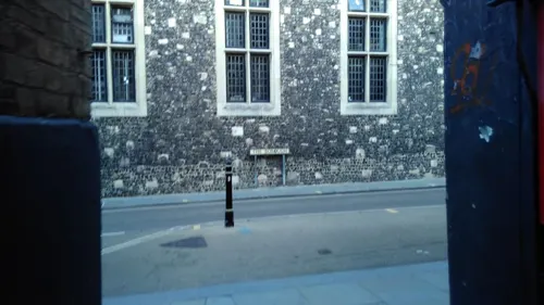
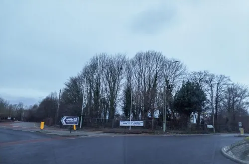
Old Gate Inn
Bar and pub · Regional · 1.5 mi
164 New Dover Road, Canterbury
Mo-Sa 09:00-23:00; Su 09:00-22:00


Franco Manca
Restaurant · Pizza
11 High Street, Canterbury
Mo-Th 12:00-22:00; Fr-Sa 12:00-22:30; Su 12:00-21:00

Ye Olde Beverlie
Bar and pub · 0.8 mi
6 St. Stephen's Green, Canterbury
Mo-Sa 12:00-23:00; Su 12:00-22:30

Happy Samurai
Restaurant · Japanese
4 Butchery Lane, Canterbury
Tu-Th 12:00-15:00,16:00-21:00; Fr,Sa 12:00-21:30; Su 12:00-16:00
Kashmir Tandoori
Restaurant · Indian
20 Palace Street, Canterbury
Mo-Fr 16:00-22:30; Sa 12:00-14:00,16:00-23:00; Su 12:30-22:00
Open in Google Maps · +44 1227 462050;+44 1227 784731;+44 7903 048857
The Corner House
Restaurant · British
1 Dover Street, Canterbury
Tu-Fr 12:00-14:30, 17:00-21:30; Sa 12:00-21:30; Su 12:00-15:30
212 more on the map.
History
The Canterbury area has been inhabited since prehistoric times. Lower Paleolithic axes, and Neolithic and Bronze Age pots have been found in the area. Canterbury was first recorded as the main settlement of the Celtic tribe of the Cantiaci, which inhabited most of modern-day Kent. In the 1st century AD, the Romans captured the settlement and named it Durovernum Cantiacorum. The Romans rebuilt the city, with new streets in a grid pattern, a theatre, a temple, a forum, and public baths. Although they did not maintain a major military garrison, its position on Watling Street relative to the major Kentish ports of Rutupiae (Richborough), Dubrae (Dover), and Lemanae (Lymne) gave it considerable strategic importance. In the late 3rd century, to defend against attack from barbarians, the Romans built an earth bank around the city and a wall with seven gates, which enclosed an area of 130 acres (53 ha).
Read more of the history
Despite being counted as one of the 28 cities of Sub-Roman Britain, it seems that after the Romans left Britain in 410 Durovernum Cantiacorum was abandoned for around 100 years, except by a few farmers and gradually decayed. Over the next 100 years, an Anglo-Saxon community formed within the city walls, as Jutish refugees arrived, possibly intermarrying with the locals. The town's new importance led to its revival, and trades developed in pottery, textiles, and leather. By 630, gold coins were being struck at the Canterbury mint. In 842 and 851, Canterbury suffered great loss of life during Danish raids.
The siege of Canterbury saw a large Viking army besiege Canterbury in 1011, culminating in the city being pillaged. Remembering the destruction caused by the Danes, the inhabitants of Canterbury did not resist William the Conqueror's invasion in 1066. William immediately ordered a wooden motte-and-bailey castle to be built by the Roman city wall. In the early 12th century, the castle was rebuilt with stone. Canterbury Castle was captured by the French Prince Louis during his 1215 invasion of England, before the death of John caused his English supporters to desert his cause and support the young Henry III.
Black Death reached Canterbury in 1348. At 10,000, Canterbury had the 10th largest population in England; by the early 16th century, the population had fallen to 3,000. In 1363, during the Hundred Years' War, a Commission of Inquiry found disrepair, stone-robbing and ditch-filling had led to the Roman wall becoming eroded. Between 1378 and 1402, the wall was virtually rebuilt, and new wall towers were added. In 1381, during Wat Tyler's Peasants' Revolt, the castle and Archbishop's Palace were sacked, and Archbishop Sudbury was beheaded in London. In 1413, Henry IV became the only sovereign to be buried at the cathedral. In 1448 Canterbury was granted a city charter, which gave it a mayor and a high sheriff; the city still has a Lord Mayor and Sheriff.
In 1519 a public cage for talkative women and other wrongdoers was set up next to the town's pillory at the Bullstake, now the Buttermarket. In 1522 a stone cross with gilt lead stars was erected at the same place, and painted with bice and gilded by Florence the painter.
In the mid-16th century many Huguenots, experiencing persecution and conflict in the Low Countries, fled and resettled in Reformed regions such as England. Canterbury hosted the first congregation of so-called 'refugee strangers' in the country. This first Huguenot church in Canterbury was founded around 1548, in part by Jan Utenhove who relocated from Strasbourg, alongside Valérand Poullain and François de la Rivière. When Utenhove travelled to London in 1549, Francois de la Rivière remained to lead the congregation. With the accession of Mary I, the Huguenot residents of Canterbury were compelled to flee in 1553–4 alongside the English Marian exiles to Emden, Wesel, Zürich, Strasbourg, Frankfurt, and later Basel, Geneva, and Aarau.
After the accession of Elizabeth I, a small number of Huguenots returned to London, including Jan Utenhove in 1559. In 1561, a number of Huguenots in London were sent to Sandwich, a settlement which began to grow rapidly with new refugees arriving from Artois and Flanders. This settlement, in June 1575, almost entirely relocated to Canterbury, which had in the previous year gained a small Huguenot population. A number of refugees also arrived around this time from the temporary Huguenot settlements at Rye and Winchelsea. In 1575, the Huguenot population of Canterbury were granted use of the church of St Alphedge but in the following year had begun to use the crypt of Canterbury Cathedral as their church. The Church of the Crypt swiftly became the nucleus of the Huguenot community in Canterbury.
By the 17th century, French-speaking Huguenots comprised two-fifths of Canterbury's population. The Huguenots had a large influence on the economy of Canterbury, and introduced silk weaving into the city which had outstripped wool weaving by 1676.
Canterbury remained an important city in the 17th century. Charles I and Henrietta Maria visited in 1625; musicians played whilst the couple entered the city under a velvet canopy supported by six men holding poles. In 1647, during the English Civil War, riots broke out. The riots became known as the "Plum Pudding Riots". The rioters' trial the following year led to a Kent revolt against Parliamentarian forces, contributing to the start of the second phase of the war. However, Canterbury surrendered peacefully to Parliamentarians at the Battle of Maidstone.
From the History section of Canterbury on Wikipedia, under CC BY-SA 4.0.
More about Canterbury
Geography
Canterbury experiences an oceanic climate (Köppen climate classification Cfb), similar to almost all of the United Kingdom. Canterbury enjoys mild temperatures all year round, being between 1.8 °C (35.2 °F) and 22.8 °C (73 °F). There is relatively little rainfall throughout the year.
The 2021 United Kingdom census showed a population of 55,087. Ethnically, the city was 78.3% white, 8.2% Asian, 5.9% Black, 4.4% Mixed, 1% Arab and 2.1% Other groups.
At the 2001 UK census, the total population of the city itself was 43,432, and 135,278 within the Canterbury district. In 2011, the total district population was counted as 151,200, with an 11.7% increase from 2001, and the population of the city had grown to over 55,000. By 2015, Canterbury's student population, including the University of Kent and Canterbury Christ Church University, and the smaller University for the Creative Arts, was almost 40,000. Canterbury's 2026 population is now estimated at 71,824 .
Arts and culture
The 17th century, double jettied, half-timbered Crooked House bookshop operated by the Catching Lives homelessness charity at the end of Palace Street, opposite Kings School is frequently photographed for its quirky, slanted appearance. Canterbury Roman Museum houses an in situ mosaic pavement dating from around 300 AD. Other surviving Roman structures in the city include Queningate, a blocked gate in the city wall, and the Dane John Mound, once part of a Roman cemetery. The Dane John Gardens were built beside the mound in the 18th century, and a memorial placed on the mound's summit.
Westgate Towers is a museum narrating its earlier use as a jail. The medieval church of St Alphege is as of 2022 used by the King's School. The Old Synagogue, now the King's School Music Room, is one of only two Egyptian Revival synagogues still standing. The city centre contains many timber-framed 16th and 17th century houses but others were destroyed, particularly in the Second World War Baedeker Blitz. Survivors include the Huguenot "Old Weaver's House". St Martin's Mill is the only surviving mill out of the six known to have stood in Canterbury. It was built in 1817 and worked until 1890 but is now a residence.
Education
Canterbury hosts some 31,000 students and has the highest student to permanent resident ratio in the UK. They attend three universities, and other higher education institutions. The University of Kent's main campus extends to 600 acres (243 ha) and is situated on Saint Stephen's Hill, a mile north of Canterbury city centre. In 2014, it enrolled around 20,000 students. Canterbury Christ Church University was founded as a teacher training college in 1962 by the Church of England; in 2005 it became a university. In 2024, it had around 30,000 students. The Franciscan International Study Centre is close to the University of Kent campus.
King's School is the oldest secondary school in the United Kingdom. St. Augustine established it shortly after his 597 arrival in Canterbury though documented history of it only began after dissolution of the monasteries in the 16th century, when it took the present name in honour of Henry VIII.
The city's secondary grammar schools are Barton Court Grammar School, Simon Langton Grammar School for Boys and Simon Langton Girls' Grammar School, all of which in 2008 had over 93% of their pupils gain five or more GCSEs at grades A* to C including English and maths.
There are also non-selective secondary schools in Canterbury:
From the Wikipedia article Canterbury, under CC BY-SA 4.0.
Notable people from Canterbury
 Christopher MarloweEnglish dramatist, poet and translator (1564–1593)Photo: anonymous, Public domain
 Orlando BloomEnglish actor and model (born 1977)Photo: Harald Krichel, CC BY-SA 4.0
 Aphra BehnBritish playwright, poet and spy (1640–1689)Photo: Peter Lely, Public domain
 William Sealy GossetBritish statistician (1876–1937)Photo: User Wujaszek on pl.wikipedia, Public domain
 George RookeRoyal Navy admiral (1650-1709)Photo: Michael Dahl, Public domain
 Trevor PinnockEnglish harpsichordist and conductorPhoto: Andrew Stepan:..., CC BY-SA 3.0
 Maxwell Tylden MastersBritish botanist (1833-1907)Photo: Maull & Co., Public domain
 John SimsEnglish physician and botanist (1749–1831)Photo: Charles Robert Leslie, Public domain
 Ruta GedmintasEnglish actressPhoto: Gage Skidmore from Peoria, AZ,..., CC BY-SA 2.0
 Richard Harris BarhamBritish writer and priest (1788-1845)Photo: Cruikshank, Public domain
 Margot Grahameactress (1911–1982)Photo: Los Angeles Times, CC BY 4.0
- Stephen GrayBritish chemist, physicist, astronomer
Born in Canterbury, according to Wikidata (CC0). Each name links to its Wikipedia article.
Where to stay54
Churches and places of worship64
Shopping64
Gas and EV charging9
Schools, colleges and libraries56
Bridge and Patrixbourne Church of England Primary School
School · Anglican · 2.9 mi
Conyngham Lane, Canterbury
Healthcare19
Map of Canterbury
250 places. The map loads OpenStreetMap tiles when you open it.
Getting there and nearby towns
Manston Airport (MSE) is the nearest airport with scheduled flights listed in OpenStreetMap, 12 miles away.
- Whitstable 6 mi northwest, about 10 min by car
- Herne Bay 7 mi north, about 11 min by car
- Faversham 9 mi west, about 14 min by car
- Folkestone 14 mi south, about 23 min by car
- Hythe 14 mi south, about 23 min by car
- Dover 15 mi southeast, about 24 min by car
- Margate 15 mi northeast, about 24 min by car
- Ramsgate 15 mi east, about 24 min by car
- Saint Peters 16 mi northeast, about 25 min by car
- Sittingbourne 16 mi west, about 25 min by car
Drive times are estimates from straight-line distance, not routes.
Towns near Canterbury


Keep exploring
Local news
Headlines from INDB.
Reviews, tips and questions
Loading what members have shared...
Sources and licences
- GeoNames (CC BY 4.0): population, coordinates, regions and time zone
- Mapillary (see each image): photos
- OpenStreetMap contributors (ODbL 1.0): places, airports, map data
- Wikidata (CC0 1.0): elevation, founding date, time zone, website, landmarks and historic places
- Wikimedia Commons (see each image): photos
- Wikipedia (CC BY-SA 4.0): overview and history text
Photo credits
- Westgate Gardens 5, Michael Pead, CC BY-SA 2.0 uk
- Canterbury - Queen Elizabeth's Guest Chambers, Whn64, CC BY-SA 3.0
- Queen Elizabeth's Guest Chamber, Canterbury JC 07, Jonathan Cardy, CC BY-SA 3.0
- Queen Elizabeth's Guest Chamber, Canterbury JC 06, Jonathan Cardy, CC BY-SA 3.0
- Queen Elizabeth's Guest Chamber, Canterbury JC 01, Jonathan Cardy, CC BY-SA 3.0
- Queen Elizabeth's Guest Chamber, Canterbury JC 04, Jonathan Cardy, CC BY-SA 3.0
- Queen Elizabeth's Guest Chamber, Canterbury JC 03, Jonathan Cardy, CC BY-SA 3.0
- Queen Elizabeth's Guest Chamber, Canterbury JC 05, Jonathan Cardy, CC BY-SA 3.0
- Marlowe Theatre Canterbury, Adam Bishop, CC BY-SA 3.0
- Howletts-house, Michael Haslam, CC BY 2.5
- Roman Museum 002a, Linda Spashett ( Storye book ), CC BY 3.0
- Kent Museum of Freemasonry Entrance, Pre36sunbeam, CC BY-SA 3.0
- Dane John Mound (1), Richard Nevell, CC BY-SA 3.0
- Watling Street route, w:en:User:Neddyseagoon, CC BY-SA 3.0
- Canterbury - Greyfriars Chapel, Pam Fray, CC BY-SA 2.0
- Broadham Down 3, Dudley Miles, CC BY-SA 4.0
- Curtis Wood 7, Dudley Miles, CC BY-SA 4.0
- South Blean 2, Dudley Miles, CC BY-SA 4.0
- Tyler Hill Meadow 1, Dudley Miles, CC BY-SA 4.0
- Norman staircase at Kings School Canterbury, Ymblanter, CC BY-SA 4.0
- Canterbury - Eastbridge Hospital of Saint Thomas the Martyr von 1176, ABrocke, CC BY-SA 3.0
- 1085027 II PUBLIC LIBRARY AND MUSEUM AT BEANEY INSTITUTE, HIGH STREET Canterbury 20260607 0005, Tilman2007, CC BY-SA 4.0
- St Edmund's School Canterbury, main entrance, Brakspear at English Wikipedia, Public domain
- Kent College, UK, Roger May, CC BY-SA 2.0
- St Mary, Patrixbourne, Kent, John Salmon, CC BY-SA 2.0
- The King's School Shop, Maria, CC BY-SA 3.0
- 1260281 II Star HOUSE OF AGNES HOTEL Canterbury 20250823 0002, Tilman2007, CC BY-SA 4.0
- Church of St Pauls of the walls Canterbury 1336814 20230812 0028, Tilman2007, CC BY-SA 4.0
- 1085024 II THE GUILDHALL, 11, HIGH STREET Canterbury 20260607 0001, Tilman2007, CC BY-SA 4.0
- St Thomas of Canterbury Church, Canterbury (01), Quartettgeschwister, CC BY-SA 3.0
- 64, Castle Street, Richard Nevell, CC BY-SA 3.0
- Sidney Cooper Museum, Peter Glyn, CC BY-SA 3.0
- Canterbury Cathedral - Portal Nave Cross-spire, Hans Musil, CC BY-SA 4.0
- Canterbury Cathedral evening (4902497028), Tony Hisgett from Birmingham, UK, CC BY 2.0
- 20May2017 Eastbridge 0010, Meganbatterbee, CC BY-SA 4.0
- A Long Way from the Arctic - Flickr - Charlie From Bristol, Charlie Marshall from Bristol UK, United Kingdom, CC BY 2.0
- Beaney House of Art and Knowledge 2015, Geni, CC BY-SA 4.0
- Augustine Abbey, User Willhsmit on en.wikipedia, Public domain
- County of Kent memorial cross, Canterbury Cathedral, August 2022, No Swan So Fine, CC BY-SA 4.0
- Queen Elizabeths Guest Chamber (4911658976), Tony Hisgett from Birmingham, UK, CC BY 2.0
- St. Augustine's Abbey Spring 2016, Mball93, CC BY-SA 4.0
- Street-level photo, tallguy, CC BY-SA 4.0
- Street-level photo, gregorywilliams, CC BY-SA 4.0
- Street-level photo, tallguy, CC BY-SA 4.0
- Street-level photo, joostjakob, CC BY-SA 4.0
- Street-level photo, laye, CC BY-SA 4.0
- Street-level photo, joostjakob, CC BY-SA 4.0
- Street-level photo, joostjakob, CC BY-SA 4.0
- Street-level photo, tallguy, CC BY-SA 4.0
- Street-level photo, tallguy, CC BY-SA 4.0
- Street-level photo, jjhaslanded, CC BY-SA 4.0
- Street-level photo, jjhaslanded, CC BY-SA 4.0
- Street-level photo, tallguy, CC BY-SA 4.0
- Street-level photo, tallguy, CC BY-SA 4.0


Page built November 10, 2026. Spotted a mistake? Tell us or suggest a place.