


Why visit Babworth
Townapedia lists 9 museums and landmarks, 12 parks and trails, 45 places to eat, 4 places to stay and 3 attractions in and around town.
Highlights include The Majestic Theatre, Town Hall, Bassetlaw Museum (Amcott House) and Bassetlaw Museum.
Weather in Babworth
Forecast from MET Norway (CC BY 4.0). Full forecast
About Babworth
Babworth is a village and civil parish in the Bassetlaw district of Nottinghamshire, England, about 2 miles west of Retford. According to the 2001 census the parish had a population of 1,329, rising to 1,687 at the 2011 Census, but dropping to 1,489 in 2021. In addition to the village of Babworth, the parish also includes Ranby.
From the Wikipedia article Babworth (this version), under CC BY-SA 4.0.
Things to do3


Town Hall
Cinema and theater · 1.4 mi
Former town hall with theatre and cinema hall in Retford, England
Museums and landmarks9

Bassetlaw Museum (Amcott House)
Museum · 1.5 mi
40 Grove Street, Retford
Mo-Sa 10:00-16:45; Su off; Dec 25 off; PH off
Bassetlaw Museum
Museum · 1.5 mi
Local authority museum in the United Kingdom



Parks, trails and playgrounds12

Idle Valley Nature Reserve
Park · 1.5 mi
Nature reserve in Nottinghamshire





Restaurants and cafes45


The Kiwi Cafe
Cafe · Plant-Based, Gluten Free, Sandwich, Cafe, Coffee Shop, Regional, Breakfast · 1.4 mi
5 Glasby Square, Retford
Tu-Sa 09:30-15:00

33 more on the map.
History
Prior to 1066 (the Norman Conquest) Babworth (Babvrde) is known to have belonged substantially to Earl Tosti and was part of the king's manor of Bodmeschell. Tax was paid for six and a half bovats of land. It is also said that Ulmer also held two and a half borate.
After the Norman Conquest, Roger de Busli bought the whole of it and delivered it "by feudal tenure" to Goisfrid. In the Domesday Book of 1086 it is certified to be one carucate and a half, with a border; pasture wood two quarents long, and one broad, which before the Conquest had been valued at 40s but afterwards was valued at 10s.
According to Nomina Villarum, by 1316 the Earl of Lancaster, and Robert de Saundeby, are certified to have been the lords of it. In 1355, nearly the whole of Babworth became the property of Sir Thomas de Grendon, who sold it in 1368 to Sir William Trusbutt. It was later inherited by Trussbutt's son, Sir Robert, who sold the manor "with its appurtenances" to Sir Richard de Willoughby, of Wollaton. Later it became the property of the Earl of Shrewsbury and Lord Cavendish, and in the 18th century it was purchased by Sir Gervas Elwes, and lastly by John Simpson.
Piercy describes Babworth in the early 19th century as follows:
Read more of the history
"The parish, which contains the hamlets of Great, and Little Morton, Morton Grange, and Ranby, contains nearly 6000 acres, of excellent forest land, mostly inclosed. The whole of the land in Babworth is the property of the Hon. J. B. Simpson, which he has in his own occupation, and upon which he has erected a steward’s house, and farming buildings, upon a large scale."
From the History section of Babworth on Wikipedia, under CC BY-SA 4.0.
More about Babworth
Geography
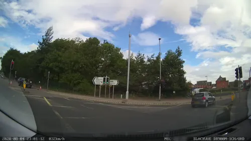
The Apleyhead (Five Lane Ends) roundabout junction was remodelled in October 2007. Bridges were fabricated by Fairfield-Mabey, weighing around 550 tonnes each. The bridges were fitted into place by Mammoet of the Netherlands, with a self-propelled modular transporter (SPMT). Many motorway bridges in the UK are built by Mabey Bridge.
From the Wikipedia article Babworth, under CC BY-SA 4.0.
Notable people from Babworth
- Francis BridgemanRoyal Navy admiral (1848-1929)
Born in Babworth, according to Wikidata (CC0). Each name links to its Wikipedia article.
Where to stay4
Churches and places of worship16
All Hallows Church
Church · Anglican · 1.4 mi
All Hallows Street, Retford
Shopping12
Gas and EV charging1
Schools, colleges and libraries8
Healthcare3
Map of Babworth
113 places. The map loads OpenStreetMap tiles when you open it.
Getting there and nearby towns
RAF Waddington (WTN) is the nearest airport with scheduled flights listed in OpenStreetMap, 22 miles away.
- Retford 1 mi east, about 2 min by car
- Clarborough 4 mi northeast, about 6 min by car
- Worksop 6 mi west, about 10 min by car
- Blyth 6 mi northwest, about 9 min by car
- East Markham 6 mi southeast, about 9 min by car
- Boughton 8 mi south, about 13 min by car
- Woodsetts 8 mi west, about 13 min by car
- Beckingham 8 mi northeast, about 13 min by car
- Gainsborough 10 mi northeast, about 16 min by car
- Dinnington 10 mi west, about 16 min by car
Drive times are estimates from straight-line distance, not routes.
Towns near Babworth


Keep exploring
Local news
Headlines from INDB.
Reviews, tips and questions
Loading what members have shared...
Sources and licences
- GeoNames (CC BY 4.0): population, coordinates, regions and time zone
- Mapillary (see each image): photos
- OpenStreetMap contributors (ODbL 1.0): places, airports, map data
- Wikidata (CC0 1.0): elevation, founding date, time zone, website, landmarks and historic places
- Wikimedia Commons (see each image): photos
- Wikipedia (CC BY-SA 4.0): overview and history text
Photo credits
- Bug Arch at Idle Valley Nature Reserve, Idlevalley, CC BY-SA 3.0
- Bassetlaw Museum, Green goosberry, CC BY-SA 4.0
- St swit hun church retford, Beep boop beep, CC BY-SA 4.0
- Majestic Theatre, Retford, Notts (7), Enchufla Con Clave, CC BY-SA 4.0
- Retford Sebastopol Cannon, Russ Hamer, CC BY-SA 3.0
- Trinity Hospital Retford Main Entrance, Alan Murray-Rust, CC BY-SA 2.0
- Street-level photo, adam2, CC BY-SA 4.0
- Street-level photo, adam2, CC BY-SA 4.0
- Street-level photo, adam2, CC BY-SA 4.0
- Street-level photo, adam2, CC BY-SA 4.0
- Street-level photo, adam2, CC BY-SA 4.0
- Street-level photo, adam2, CC BY-SA 4.0
Page built November 10, 2026. Spotted a mistake? Tell us or suggest a place.