


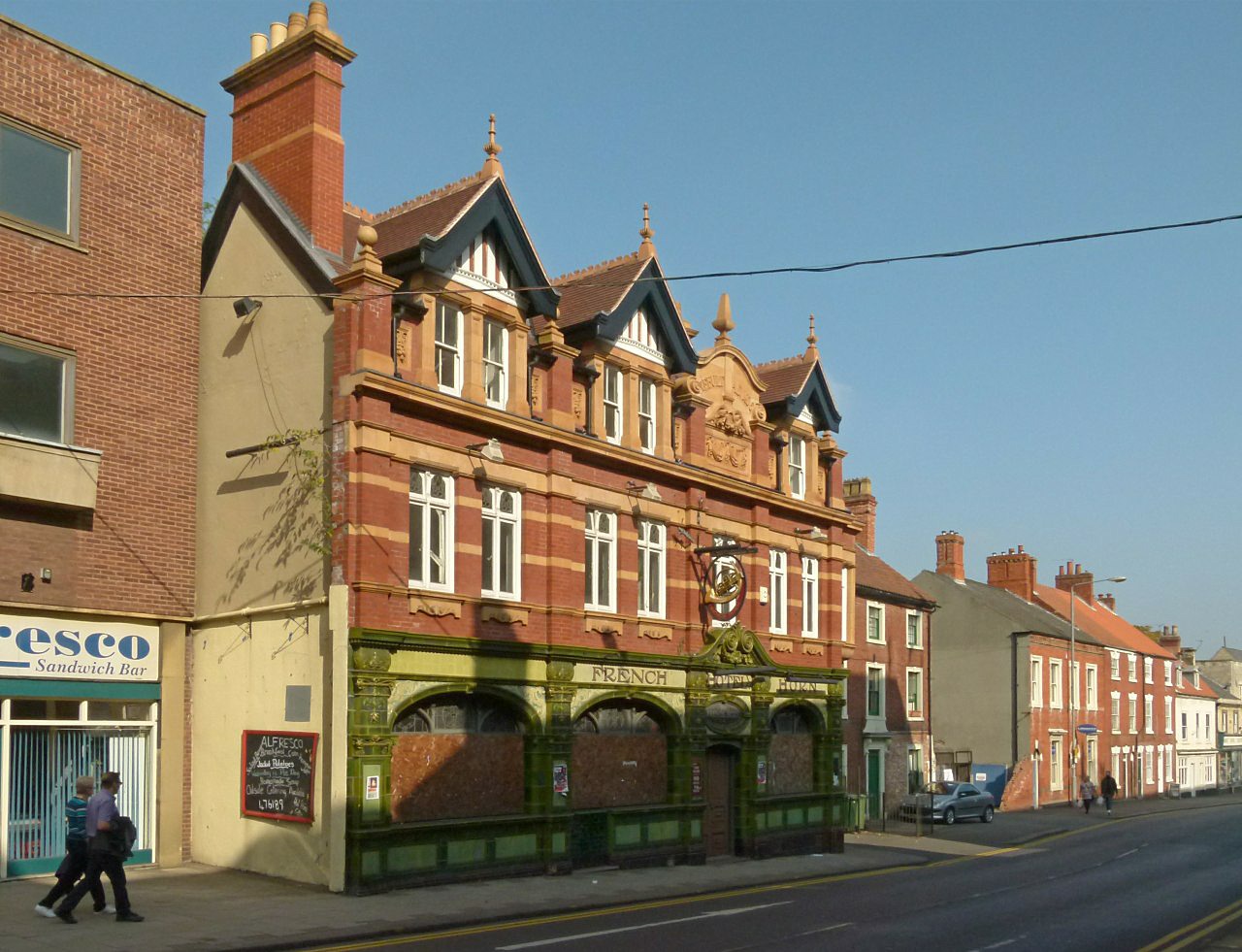


Why visit Worksop
Townapedia lists 2 museums and landmarks, 12 parks and trails, 55 places to eat, 3 places to stay and 2 attractions in and around town.
Highlights include Savoy, Acorn Theatre, Mr Straw's House and Worksop War Memorial.
Weather in Worksop
Forecast from MET Norway (CC BY 4.0). Full forecast
About Worksop
Worksop is a market town in the Bassetlaw District in Nottinghamshire, England. Located close to Nottinghamshire's borders with South Yorkshire and Derbyshire, it is on the River Ryton and not far from the northern edge of Sherwood Forest. The population of the town was recorded at 44,733 in the 2021 Census. To the south of Worksop is the area of the Dukeries.
From the Wikipedia article Worksop (this version), under CC BY-SA 4.0.
Travel tips from other travellers: Worksop on Wikivoyage (CC BY-SA 4.0).
Photos of Worksop


Things to do2

Museums and landmarks2

Mr Straw's House
Museum · 1.0 mi
Property in Worksop, Nottinghamshire, United Kingdom
5-7 Blyth Grove, Worksop

Worksop War Memorial
Monument and historic site
War memorial in Worksop, Nottinghamshire, England, UK
Parks, trails and playgrounds12

Clumber Park
Park · 3.2 mi
Estate in Worksop, Nottinghamshire, England, UK



Restaurants and cafes55




43 more on the map.
History
In the Domesday Book of 1086, Worksop appears as Werchesope. Thoroton states that the Domesday Book records that before the Norman Conquest, Werchesope (Worksop) had belonged to Elsi, son of Caschin, who had "two manors in Werchesope, which paid to the geld as three car". After the conquest, Worksop became part of the extensive lands granted to Roger de Busli. At this time, the land "had one car. in demesne, and twenty-two sochm. on twelve bovats of this land, and twenty-four villains, and eight bord. having twenty-two car. and eight acres of meadow, pasture wood two leu. long, three quar. broad." This was valued at three pounds in Edward the Confessor's time and seven pounds in the Domesday Book. Roger administered this estate from his headquarters in Tickhill.
The manor then passed to William de Lovetot, who established a castle and endowed the Augustinian Worksop Priory around 1103. After William's death, the manor was passed to his eldest son, Richard de Lovetot, who was visited by King Stephen, at Worksop, in 1161. In 1258, a surviving inspeximus charter confirms Matilda de Lovetot's grant of the manor of Worksop to William de Furnival (her son).
A skirmish occurred in the area during the Wars of the Roses on 16 December 1460, commonly known as the Battle of Worksop.
Read more of the history
In 1530, Worksop was visited by Cardinal Thomas Wolsey, who was on his way to Cawood, in Yorkshire. "Then my lord [Wolsey] intending the next day to remove from thence [Newstead Abbey] there resorted to him the Earl of Shrewsbury's keeper, and gentlemen, sent from him, to desire my lord, in their maister's behalf, to hunt in a parke of their maister's, called Worsoppe Parke." (Cavendish's Life of Wolsey)
A surviving (Cotton) manuscript written by Henry VIII nominated Worksop as one of three places in Nottinghamshire (along with Welbeck and Thurgarton) to become "bishoprics to be new made", but nothing was to come of this (White 1875), and the priory later became a victim of the dissolution of the monasteries – being closed in 1539, with its prior and 15 monks pensioned off. All the priory buildings, except the nave and west towers of the church, were demolished at this time and the stone reused elsewhere.
In 1540, John Leland noted that Worksop castle had all but disappeared, saying it was: "clene down and scant knowen wher it was". Leland noted that at that time Worksop was "a praty market of 2 streates and metely well buildid."
Worksop Manor became a prison for Mary, Queen of Scots in 1568. In 1580s the new house was built on the same site for George Talbot, 6th Earl of Shrewsbury. He was the husband of Elizabeth Talbot, Bess of Hardwick.
In the hearth tax records of 1674, Worksop is said to have had 176 households, which made it the fourth-largest settlement in Nottinghamshire after Nottingham (967 households), Newark (339), and Mansfield (318). At this time, the population is estimated to have been around 748 people.
By 1743, 358 families were in Worksop, with a population around 1,500. This had risen by 1801 to 3,391, and by the end of the 19th century had reached 16,455.
During the 18th and 19th centuries, Worksop benefitted from the building of the Chesterfield Canal, which passed through the town in 1777, and the subsequent construction of the Manchester, Sheffield and Lincolnshire Railway in 1849. This led to growth that was further boosted by the discovery of coal seams beneath the town.
Worksop and area surrounding are known as the "Gateway to the Dukeries" due to the former ducal seats of Clumber House, Thoresby Hall, Welbeck Abbey, and Worksop Manor either owned by the Dukes of Newcastle, Portland and Kingston.
From the History section of Worksop on Wikipedia, under CC BY-SA 4.0.
More about Worksop
Economy
The local economy in Worksop is dominated by service industries, manufacturing and distribution. Unemployment levels in the area are now lower than the national average, owing to large number of distribution and local manufacturing companies; these include Premier Foods, RDS Transport, Pandrol and Laing O'Rourke.
Major employers in the area include Premier Foods (Worksop Factory), Greencore, RDS Transport (the Flying Fridge), B&Q, MAKE polymers, OCG Cacao, part of Cargill, Pandrol and the National Health Service (Doncaster and Bassetlaw NHS Trust).
John Harrison's survey of Worksop for the Earl of Arundel reveals that at that time, most people earned their living from the land. A tenant farmer, Henry Cole, farmed 200 acres of land, grazing his sheep on "Manton sheepwalk". This survey also described a corn-grinding water mill (Bracebridge mill) and Manor Mill situated near to Castle Hill, with a kiln and a malthouse.
From the Wikipedia article Worksop, under CC BY-SA 4.0.
Notable people from Worksop
 Donald PleasenceBritish actor (1919–1995)Photo: Allan Warren, CC BY-SA 3.0
 Bruce DickinsonEnglish heavy metal singer (born 1958)Photo: Birgit Fostervold, CC BY-SA 4.0
 Lee WestwoodEnglish golferPhoto: Eugene Goh, CC BY 2.0
 Alexina GrahamEnglish fashion modelPhoto: Patrick Lovell, CC BY-SA 2.0
 John ParrBritish musicianPhoto: Sven Mandel, CC BY-SA 4.0
 Liam PalmerScottish association football playerPhoto: Timmy96, CC0
 Chikodili EmelumaduBritish-Nigerian speculative fiction writerPhoto: British Library, CC BY 3.0
 Thomas Christopher HoflandBritish painter (1777-1843)Photo: Thomas Christopher Hofland, Public domain
 Darren WardWelsh footballer (born 1974)Photo: Alecsandra Dragoi / No 10 Downing Street, CC BY 4.0
 Andrew BurnhamBritish bishop (born 1948)Photo: James Bradley, CC BY 2.0
- Graham TaylorEnglish association football player and manager (1944-2017)
- Mick JonesEnglish footballer
Born in Worksop, according to Wikidata (CC0). Each name links to its Wikipedia article.
Where to stay3
Churches and places of worship16
Saint John the Evangelist
Church · Anglican · 0.5 mi
Overend Road, Worksop
St John the Evangelist's Church, Carlton in Lindrick
Church · 3.2 mi
Shopping14
Gas and EV charging4
Schools, colleges and libraries17
Healthcare7
Worksop Pharmacy Prospect
Clinic and pharmacy · 1.4 mi
Prospect Precinct, Worksop
Map of Worksop
132 places. The map loads OpenStreetMap tiles when you open it.
Getting there and nearby towns
RAF Waddington (WTN) is the nearest airport with scheduled flights listed in OpenStreetMap, 27 miles away.
- Dinnington 5 mi northwest, about 9 min by car
- Retford 8 mi east, about 12 min by car
- Shirebrook 8 mi southwest, about 12 min by car
- Maltby 9 mi north, about 14 min by car
- Bolsover 9 mi southwest, about 14 min by car
- Beighton 9 mi west, about 14 min by car
- Boughton 9 mi southeast, about 15 min by car
- Staveley 10 mi west, about 16 min by car
- Mansfield Woodhouse 10 mi south, about 16 min by car
- Mansfield 12 mi south, about 19 min by car
Drive times are estimates from straight-line distance, not routes.
Towns near Worksop


Keep exploring
Local news
Headlines from INDB.
Reviews, tips and questions
Loading what members have shared...
Sources and licences
- GeoNames (CC BY 4.0): population, coordinates, regions and time zone
- Mapillary (see each image): photos
- OpenStreetMap contributors (ODbL 1.0): places, airports, map data
- Wikidata (CC0 1.0): elevation, founding date, time zone, website, landmarks and historic places
- Wikimedia Commons (see each image): photos
- Wikipedia (CC BY-SA 4.0): overview and history text
Photo credits
- Worksop Priory2, Leeds543, CC BY-SA 3.0
- 114-116 Bridge Street, Worksop, Alan Murray-Rust, CC BY-SA 2.0
- French Horn Public House, Worksop, Alan Murray-Rust, CC BY-SA 2.0
- Potter Street, Worksop, Alan Murray-Rust, CC BY-SA 2.0
- 102-106 Bridge Street, Worksop, Alan Murray-Rust, CC BY-SA 2.0
- The Lion Hotel, Worksop, Alan Murray-Rust, CC BY-SA 2.0
- 98-108 Bridge Street, Worksop, Alan Murray-Rust, CC BY-SA 2.0
- 118 Bridge Street, Worksop, Andrew Abbott, CC BY-SA 2.0
- 124 Bridge Street, Worksop, Alan Murray-Rust, CC BY-SA 2.0
- 19 Potter Street, Worksop, Alan Murray-Rust, CC BY-SA 2.0
- 23-25 Potter Street, Worksop, Alan Murray-Rust, CC BY-SA 2.0
- 93 Bridge Street, Worksop, Alan Murray-Rust, CC BY-SA 2.0
- Mr Straws House, Richard Croft, CC BY-SA 2.0
- Worksop Priory, James@hopgrove at English Wikipedia, Public domain
- Street-level photo, adam2, CC BY-SA 4.0
- Street-level photo, adam2, CC BY-SA 4.0
- Street-level photo, adam2, CC BY-SA 4.0
- Street-level photo, kieran, CC BY-SA 4.0
- Street-level photo, kieran, CC BY-SA 4.0


Page built November 10, 2026. Spotted a mistake? Tell us or suggest a place.