


Clarborough, United Kingdom
Clarborough is a town of 1,281 people in England, United Kingdom.
Why visit Clarborough
Townapedia lists 1 museum or landmark, 1 park or trail, 4 places to eat and 1 attraction in and around town.
Highlights include Town Hall, Bassetlaw Museum and Idle Valley Nature Reserve.
Weather in Clarborough
Forecast from MET Norway (CC BY 4.0). Full forecast
About Clarborough
Clarborough is a village in the civil parish of Clarborough and Welham, in the district of Bassetlaw, Nottinghamshire, England. Clarborough is located 2 miles (3 km) north-east from the centre of Retford. In 2019 it had an estimated population of 1305.
From the Wikipedia article Clarborough (this version), under CC BY-SA 4.0.
Things to do1

Town Hall
Cinema and theater · 2.3 mi
Former town hall with theatre and cinema hall in Retford, England
Museums and landmarks1

Bassetlaw Museum
Museum · 2.2 mi
Local authority museum in the United Kingdom
Parks, trails and playgrounds1

Idle Valley Nature Reserve
Park · 2.6 mi
Nature reserve in Nottinghamshire
Restaurants and cafes4
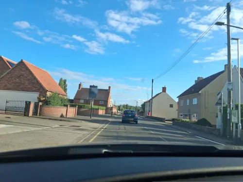
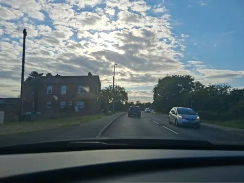

History
Clarborough is listed in the 1086 Domesday Book as "Claueburch" or "Claureburg." The chief value of the village was its land. Because of the village's geographical position, being at the foot of Clarborough Hill, land was useful for agriculture, including grazing. Being close to the increasingly important centre of Retford and with its parish boundary actually towards the centre of the town, Clarborough became an important local source of products.
Since the 1960s, with development of power stations in the area and improved communication links, Clarborough (along with Retford) had significant population increases with associated housing developments.
A post windmill was located on Clarborough Hill. It was standing in 1753, but burnt down in 1896.
From the History section of Clarborough on Wikipedia, under CC BY-SA 4.0.
More about Clarborough
Education
An elementary school was extant by 1 May 1871 and extracts from its Log Books suggest that the school might have been in existence before that date.
The school's capacity proved inadequate by the late 1950s. Initially this was addressed by an expansion of the Victorian buildings adjacent to the church of St. John the Baptist on Church Lane. However, as the village continued to expand through the 1960s, this too proved inadequate such that Nottinghamshire County Council initiated a proposed 2-phase development. The first phase, on newly created Hillview Crescent just off Main Street (the A620), was opened in 1970 and accommodated the junior classes – the Victorian building continuing to house older pupils. Phase 2 of this development was never carried forward as economic conditions of the early 1970s made it unaffordable.
From the Wikipedia article Clarborough, under CC BY-SA 4.0.
Churches and places of worship13
Schools, colleges and libraries1
Map of Clarborough
21 places. The map loads OpenStreetMap tiles when you open it.
Getting there and nearby towns
RAF Waddington (WTN) is the nearest airport with scheduled flights listed in OpenStreetMap, 20 miles away.
- Retford 2 mi southwest, about 4 min by car
- Gainsborough 6 mi northeast, about 10 min by car
- East Markham 6 mi south, about 10 min by car
- Worksop 10 mi west, about 15 min by car
- Boughton 11 mi south, about 17 min by car
- Woodsetts 11 mi west, about 18 min by car
- Dinnington 12 mi west, about 20 min by car
- Sutton on Trent 12 mi south, about 19 min by car
- Maltby 13 mi west, about 21 min by car
- Doncaster 15 mi northwest, about 25 min by car
Drive times are estimates from straight-line distance, not routes.
Towns near Clarborough


Keep exploring
Local news
Headlines from INDB.
Reviews, tips and questions
Loading what members have shared...
Sources and licences
- GeoNames (CC BY 4.0): population, coordinates, regions and time zone
- Mapillary (see each image): photos
- OpenStreetMap contributors (ODbL 1.0): places, airports, map data
- Wikidata (CC0 1.0): elevation, founding date, time zone, website, landmarks and historic places
- Wikimedia Commons (see each image): photos
- Wikipedia (CC BY-SA 4.0): overview and history text
Photo credits
- Bassetlaw Museum, Green goosberry, CC BY-SA 4.0
- Bug Arch at Idle Valley Nature Reserve, Idlevalley, CC BY-SA 3.0
- St swit hun church retford, Beep boop beep, CC BY-SA 4.0
- Boulder in wall of St Peter's Church, Clayworth, Dave.Dunford, CC BY-SA 4.0
- Street-level photo, Lapscle, CC BY-SA 4.0
- Street-level photo, Lapscle, CC BY-SA 4.0
Page built November 10, 2026. Spotted a mistake? Tell us or suggest a place.