


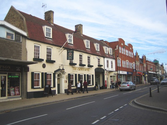


Biggleswade, United Kingdom
Biggleswade is a town of 16,551 people in England, United Kingdom.
Why visit Biggleswade
Townapedia lists 4 museums and landmarks, 18 parks and trails, 76 places to eat and 1 attraction in and around town.
Highlights include Shuttleworth Collection, Stratton Park Moated Enclosure, The Lodge RSPB reserve and The Riddy.
Weather in Biggleswade
Forecast from MET Norway (CC BY 4.0). Full forecast
About Biggleswade
Biggleswade is a market town and civil parish in Central Bedfordshire in Bedfordshire, England. It lies on the River Ivel, 11 miles (18 km) south-east of Bedford. Its population was 22,541 at the time of the 2021 census, an increase of 36% compared to the population of 16,551 in the 2011 census.
From the Wikipedia article Biggleswade (this version), under CC BY-SA 4.0.
Travel tips from other travellers: Biggleswade on Wikivoyage (CC BY-SA 4.0).
Photos of Biggleswade

Things to do1

Museums and landmarks4

Shuttleworth Collection
Museum · 2.5 mi
Aviation museum in Old Warden, Bedfordshire

Stratton Park Moated Enclosure
Monument and historic site · 1.3 mi
Moat in Biggleswade, Bedfordshire, England, UK


The Biggs Theatre
Museum
Originally built as Biggleswade Town Hall in 1844. Enlarged in 1888. Ceased as Town Hall in 1927. Used for retail subsequently.
Parks, trails and playgrounds18





6 more on the map.
Restaurants and cafes76

The Cock
Bar and pub · 1.5 mi
23 High Street, Biggleswade
"Mo-Th, Sa 12:00-22:00; Fr 12:00-23:00; Su 12:00-19:00"



64 more on the map.
History
The area around Biggleswade is thought to have been inhabited from about 10,000 BC. Arrowheads believed to be from this time have been found. Sherds of late Neolithic pottery from a single Peterborough ware Mortlake bowl were found in a pit excavated south of Biggleswade Hospital. A Neolithic cursus and five associated ring ditches south of Furzenhall Farm show as crop markings on aerial images.
Archaeological excavations in 2001 discovered a late Bronze Age pit to the north of the water tower on Topler's Hill. Iron Age pottery and a bead together with charred cereal grains of wheat and barley have been found in pits to the north of the town.
In Roman times, a loop road known as the White Way passed through Biggleswade (possibly along the course of the present-day Drove Road), linking with Ermine Way at Godmanchester. There is evidence for a probable Romano-Celtic temple and aligned enclosures straddling a tributary of the River Ivel at the north-east corner of Biggleswade Common.
In the 5th century AD, Saxon invaders settled. The name Biggleswade may derive from Biceil, an Anglo-Saxon personal name, and Waed, the Saxon word for ford. Variant spellings include Bykeleswad in 1396, Bykleswade in 15th-century law records, and Bickleswade on a 17th-century ivory seal now in the British Museum.
Read more of the history
Wells and pits dating from the early 7th century and a quantity of later Maxey ware have been excavated at Stratton.
Evidence of an Anglo-Saxon ringwork and bailey castle was discovered by aerial photography in 1954 between the A1 road and the River Ivel.
In 2001 a gold coin bearing the name Coenwulf was found at Biggleswade on a footpath beside the River Ivel. The 4.33 g (0.15 oz) mancus, worth about 30 silver pennies, is only the eighth known gold coin dating to the mid to late Anglo-Saxon period. Its inscription, "DE VICO LVNDONIAE", shows it was minted in London. Initially it was sold to American collector Allan Davisson for £230,000 at auction but the British Government subsequently put in place a temporary export ban in the hope of saving it for the nation. The British Museum bought the coin in February 2006 for £357,832, with the help of funding from the National Heritage Memorial Fund and the British Museum Friends. At the time it was the most expensive British coin purchased.
Biggleswade parish consisted of three settlements: Biggleswade, Holme and Stratton.
Biggleswade is mentioned in the Domesday Book as Bichelesuuade/Pichelsuuade: Ralph de l'Isle. 2 mills. Domesday records 27 heads of household in Stratton vill, but only 20 in Biggleswade. However, Biggleswade had overtaken Stratton by 1309.
In 1132, Henry I granted the manor of Biggleswade to Bishop Alexander the Magnificent of Lincoln, to help endow Lincoln Cathedral. A prebendal stall of Biggleswade is in the cathedral. King John (1196–1216) granted a charter to hold a market, which was confirmed by Henry III. The medieval parish Church of St Andrew contains a monumental brass of John Rudying featuring a figure of Death.
Stratton Park Moated Enclosure lies to the south of the town off Dunton Lane.
On 16 June 1785 a fire started at the Crown Inn and spread rapidly through neighbouring streets, destroying nearly one-third of the town. A national appeal raised funds for 332 people who lost their homes and others who lost their livelihoods.
The Great Fire is among the historical scenes shown in a Millennium stained-glass window in St Andrew's Church.
A medieval bridge carrying the Great North Road over the River Ivel at Biggleswade is first documented in the early 13th century. In 1302 Bishop Dalderby of Lincoln gave indulgences to all those contributing to the repair of the bridge, and from 1372 tolls were authorised under the pontage system. The Great North Road became a turnpike road in 1725 (from Biggleswade to Alconbury Hill) and in 1730 (from Stevenage to Biggleswade). In 1796 the medieval bridge in Shortmead Street was rebuilt with sandstone from Sandy. It had three rounded arches. A metal "Meccano"-type bridge was erected alongside in 1939. In 1948 the stone bridge was demolished and replaced with a second "Meccano" or Callender-Hamilton bridge as it was formally known. The town was bypassed by the A1 trunk road in 1961. The current bridge dates from 1999.
The River Ivel was made navigable to Biggleswade Mill in 1758 from its confluence with the River Ouse at Tempsford; and extended to Shefford in 1823. Timber and coal were transported. In 1876 the canal was abandoned by Act of Parliament.
Through the 19th century Biggleswade was a staging post for coaches. Destinations included London, Leeds, York and Boston, Lincolnshire.
Eastern National operated local bus services until 1952, followed by United Counties. A bus depot in Shortmead Street until 1989 was replaced by Millers Court retirement apartments. Stagecoach took over in November 1987 and relocated its depot in Hitchin Street. Private bus operators based in Biggleswade included Charles Cook Travel (1947–1997) and Fairway Coaches (1973–1997).
From about 1780, Brigham House, 93 High Street, (now George Hay, Chartered Accountants) housed the parish workhouse. The premises were closed following the completion of The Union Workhouse at London Road in 1836. The Biggleswade Poor Law Union was officially formed on 14 April 1835 and covered 25 parishes. The Union workhouse ceased operation in 1930. The London Road building was renamed The Limes and provided accommodation for the aged, infirm and vagrants. It was used as an old people's home until its closure in 1969 and demolished in 1972.
From the History section of Biggleswade on Wikipedia, under CC BY-SA 4.0.
More about Biggleswade
Geography
Biggleswade lies about 40 miles (60 km) north of Central London and 20 miles (30 km) west-south-west of Cambridge.
Biggleswade civil parish includes the nearby hamlet of Holme.
From Biggleswade station on the East Coast Main Line trains take about 45 minutes to reach London. The A1, Britain's Great North Road, bypasses the town; its old course is numbered A6001. The B1040 road leads north to Potton and St Ives and the B659 south to Langford and Henlow.
The town centre is about 28 m (92 ft) above sea level. The land rises to 78 m (256 ft) at the parish's southern boundary near the water tower on Topler's Hill.
The area's soil is mostly free-draining and slightly acid but with a base-rich, loamy texture of sand, silt and clay particles. Fertility is high.
The underlying geology of the Ivel Valley is alluvial. The town centre stands largely on river gravel, with smaller areas of green and brown sands and sandstones and glacial gravel. Boulder clay dominates the outlying southern and eastern parts.
Economy
In 2011 the five largest employment sectors for Biggleswade residents were: wholesale, retail and vehicle repairs at 18%, manufacturing at 13%, construction at 10%, human health and social work at 10% and education at 9%. The unemployment rate was 3.5% compared with 4.4% for England.
A 661,000 square feet (61,409 m2) Co-op Food Group regional distribution facility opened in May 2022 at Symmetry Park to the south of the town.
Arts and culture
The carnival has been held each June since 1957. It was launched to raise funds to build a public swimming pool. An outdoor heated pool in Playfield Close was opened in May 1968. Further funds raised through sponsors and donations have since been distributed to local community groups, sports clubs, schools, public services and charities.
A competition is held early each year to select a Carnival Court comprising a Queen, Princess and Prince. The main event is a Saturday afternoon parade of themed floats through the town. Carnival week features a funfair in the Market Square.
The town is mentioned twice in the diaries of Samuel Pepys. On 22 July 1661, Pepys stopped off at "Bigglesworth" to buy a pair of warm woollen stockings. On 5 August 1664, Pepys's wife, on a visit to relations in Huntingdonshire, sent him a message saying she had arrived in "Bigglesworth" on the coach from York and would be home next day.
The diarist John Byng, 5th Viscount Torrington often refers to the town and its Sun Inn.
Biggleswade is mentioned on the TV Series Monty Python's Flying Circus during a Piranha Brothers Sketch.
The Biggleswade high street can be seen in the opening credits of the 1971 Get Carter film.
In the Doonesbury comic strip, the character Zonker Harris buys a British peerage which grants him the title "His Lordship the Viscount St. Austell-in-the-Moor Biggleswade-Brixham".
Education
Biggleswade has a three-tier education system with lower schools catering for ages 5–9, middle schools for 9–13, and Stratton Upper School for 13–16 year olds and a sixth form.
Stratton Upper School and Community College (formerly Stratton Grammar Technical School) opened in 1950 and converted to Academy status in February 2012. There are over 600 pupils aged 13–16 and just under 400 in the sixth form.
Biggleswade Academy, established in 2012, is a merger of Holmemead Middle, Southlands Lower, and Brigham Pre-School. Holmemead opened in 1964 as a County Secondary Modern for pupils aged 11–16 but now caters for 9–13 year olds. Southlands County Primary School opened for 5–9 year olds in 1973.
There are two Church of England (C of E) Voluntary controlled schools (VC).
Edward Peake C of E (VC) Middle School opened in 1974 and is named after a 16th-century local philanthropist who left money for the education of five children in the parish of Holme. St Andrew's C of E (VC) Lower School was built on the playing field of the Victorian, Rose Lane school in 1988. A second site on the King's Reach development opened in September 2015.
Lawnside Academy is for pupils aged from 4–9 years and is a member of the Bedfordshire Schools Trust (BEST). From 1979 to December 2018 it was known as Lawnside Lower School. It opened in 1959 as Lawnside County Primary Infants School.
From the Wikipedia article Biggleswade, under CC BY-SA 4.0.
Notable people from Biggleswade
 Dan AlboneBritish cyclist (1860-1906)Photo: Unknown photographer, Public domain
- Henry TaylorBritish racing driver
- Philip E. HighBritish writer (1914–2006)
- William WindhamBritish rower
- Henry RylandBritish artist (1856-1924)
- Charles PenroseBritish comedian, entertainer, singer (1873–1952)
- William WelshRAF air marshal (1891-1962)
- Pat KruseEnglish footballer (born 1953)
- Reginald WardEnglish cricketer (1902-1968)
- Althea WynneEnglish sculptor
- Christine ChaundlerBritish children's author (1887–1972)
- Hubert FosterAustralian general (1885-1919)
Born in Biggleswade, according to Wikidata (CC0). Each name links to its Wikipedia article.
Churches and places of worship15
Shopping14
Gas and EV charging1
Schools, colleges and libraries11
Healthcare6
Map of Biggleswade
146 places. The map loads OpenStreetMap tiles when you open it.
Getting there and nearby towns
London Luton Airport (LTN) is the nearest airport with scheduled flights listed in OpenStreetMap, 15 miles away.
- Sandy 3 mi north, about 5 min by car
- Henlow 4 mi south, about 6 min by car
- Bedford 9 mi west, about 15 min by car
- Saint Neots 9 mi north, about 14 min by car
- Kempston 10 mi west, about 16 min by car
- Royston 11 mi east, about 17 min by car
- Flitwick 11 mi southwest, about 18 min by car
- Luton 16 mi southwest, about 25 min by car
- Codicote 16 mi south, about 26 min by car
- Cambridge 18 mi northeast, about 29 min by car
Drive times are estimates from straight-line distance, not routes.
Towns near Biggleswade


Keep exploring
Local news
Headlines from INDB.
Reviews, tips and questions
Loading what members have shared...
Sources and licences
- GeoNames (CC BY 4.0): population, coordinates, regions and time zone
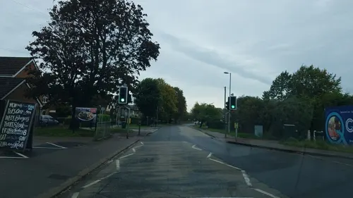
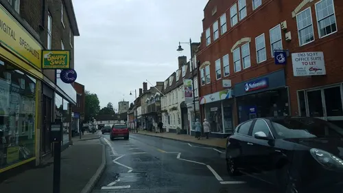
- Mapillary (see each image): photos
- OpenStreetMap contributors (ODbL 1.0): places, airports, map data
- Wikidata (CC0 1.0): elevation, founding date, time zone, website, landmarks and historic places
- Wikimedia Commons (see each image): photos
- Wikipedia (CC BY-SA 4.0): overview and history text
Photo credits
- Biggleswade1, Jack1956, Public domain
- Biggleswade Christmas Tree, Acather96, CC BY 3.0
- Biggleswade town, Knigma at English Wikipedia, Public domain
- Biggleswade.The Crown Hotel, Nigel Cox, CC BY-SA 2.0
- Bristol F2B D8096 flying 1, Kogo, GFDL
- Stratton Park Moated Enclosure opposite the causewayed entrance, Acather96, CC BY-SA 3.0
- Thelodge 1057, Bogbumper, CC BY-SA 3.0
- The Riddy and River ivel, Dudley Miles, CC BY-SA 4.0
- The Abbey Church of St Leonard, Mickyflick, CC BY-SA 3.0
- St George's Church, Edworth, Alexander P Kapp, CC BY-SA 2.0
- The Cock, Broom, Acather96, CC BY 3.0
- The Golden Pheasant public house, High Street, Biggleswade, Rupples, CC BY-SA 4.0
- Century House, Central Bedfordshire, England - 20101219, Acather96, CC BY 3.0
- Biggleswade War Memorial, Acather96, CC BY 3.0
- Street-level photo, bwade, CC BY-SA 4.0
- Street-level photo, bwade, CC BY-SA 4.0
- Street-level photo, adam2, CC BY-SA 4.0
- Street-level photo, adam2, CC BY-SA 4.0
- Street-level photo, adam2, CC BY-SA 4.0
- Street-level photo, adam2, CC BY-SA 4.0
- Street-level photo, wasd42, CC BY-SA 4.0
- Street-level photo, bwade, CC BY-SA 4.0
- Street-level photo, bwade, CC BY-SA 4.0
- Street-level photo, bwade, CC BY-SA 4.0
- Street-level photo, bwade, CC BY-SA 4.0
- Street-level photo, bwade, CC BY-SA 4.0
- Street-level photo, bwade, CC BY-SA 4.0
- Street-level photo, bwade, CC BY-SA 4.0
- Street-level photo, bwade, CC BY-SA 4.0
- Street-level photo, bwade, CC BY-SA 4.0
- Street-level photo, bwade, CC BY-SA 4.0
- Street-level photo, bwade, CC BY-SA 4.0
- Street-level photo, bwade, CC BY-SA 4.0
- Street-level photo, adam2, CC BY-SA 4.0


Page built November 10, 2026. Spotted a mistake? Tell us or suggest a place.