
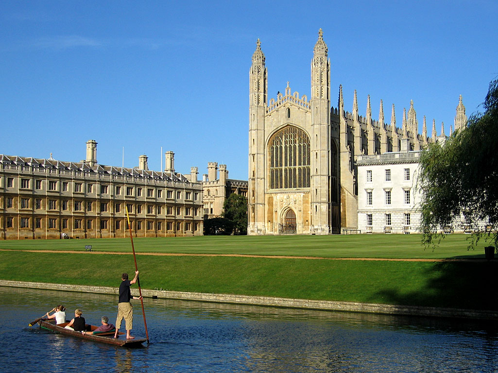


Cambridge, United Kingdom
Cambridge is a city of 145,674 people in England, United Kingdom, founded in 1.
Why visit Cambridge
Townapedia lists 80 museums and landmarks, 78 parks and trails, 152 places to eat, 39 places to stay and 32 attractions in and around town.
Highlights include Arts Picturehouse, Corpus Playroom, Whipple Museum of the History Of Science and Museum of Archaeology and Anthropology.
Weather in Cambridge
Forecast from MET Norway (CC BY 4.0). Full forecast
About Cambridge
Cambridge is a city and non-metropolitan district in the county of Cambridgeshire, England. It is the county town of Cambridgeshire and is located on the River Cam, 55 miles (89 km) north of London. As of the 2021 United Kingdom census, the population of the City of Cambridge was 145,700; the population of the wider built-up area (which extends outside the city council area) was 181,137. There is archaeological evidence of settlement in the area dating back to as early as the Bronze Age, and Cambridge became an important trading centre during the Roman and Viking eras.
From the Wikipedia article Cambridge (this version), under CC BY-SA 4.0.
Travel tips from other travellers: Cambridge on Wikivoyage (CC BY-SA 4.0).
Photos of Cambridge

Things to do32

Arts Picturehouse
Cinema and theater · 0.4 mi
38-39 Saint Andrew's Street, Cambridge
"depends on the showings"


Bridge of Sighs
Bridge · 0.6 mi
Bridge at St John's College, Cambridge University, England

Clare College Bridge
Bridge · 0.4 mi
Grade I listed bridge in Cambridge, England


Jesus Lock
Bridge · 0.9 mi
Bridge in Cambridge, Cambridgeshire, England, UK
The Light Cinema
Cinema and theater · 1.1 mi
Clifton Way, Cambridge
Mo-Su,PH 10:00-23:00+
Cambridge Arts Theatre
Cinema and theater
Theatre in Cambridge, England

Crusoe Bridge
Bridge
Bridge across the River Cam in Coe Fen, Cambridge, England
20 more on the map.
Museums and landmarks80

Whipple Museum of the History Of Science
Museum
Museum, part of the University of Cambridge, England, UK
Free School Lane, Cambridge
Mo-Fr 13:00-17:00; Sa 10:00-17:00

Museum of Archaeology and Anthropology
Museum
University museum in Cambridge, United Kingdom
Downing Street, Cambridge
Tu-Sa 10:00-17:00; Su 12:00-17:00


The Museum of Cambridge
Museum · 0.8 mi
2-3 Castle Street, Cambridge
Mo, We-Sa 10:00-17:00; Su 11:00-16:00

Museum of Classical Archaeology and Faculty of Classics, University of Cambridge
Museum
Sidgwick Avenue, Cambridge
Tu-Fr 10:00-17:00; Sa 10:00-13:00; Dec 21-Jan 04 off; PH off

Museum of Zoology
Museum
University museum in Cambridge, United Kingdom
Tu-Sa 10:00-16:30; Su 12:00-16:30


Cambridge Museum of Technology
Museum · 1.4 mi
Industrial heritage museum in Cambridge, England, United Kingdom
Cheddars Lane, Cambridge


Fitzwilliam Museum
Museum
Art and antiquities museum of the University of Cambridge, United Kingdom
Trumpington Street, Cambridge
Tu-Sa 10:00-17:00; Su 12:00-17:00
68 more on the map.
Parks, trails and playgrounds78


Jesus Green
Park · 0.9 mi
Park in the north of central Cambridge, England



66 more on the map.
Restaurants and cafes152

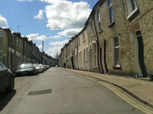
Cambridge Blue
Bar and pub · Burger · 1.0 mi
85-87 Gwydir Street, Cambridge
Mo-Sa 12:00-23:00; Su 12:00-22:30
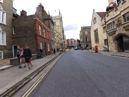
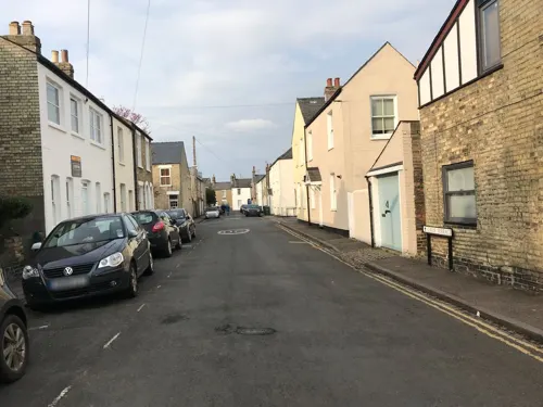
Live & Let Live
Bar and pub · 0.8 mi
Cosy urban real ale pub. Doesn't do food. Dogs welcome
40 Mawson Road, Cambridge
Mo-Th 16:00-24:00; Fr-Sa 12:00-24:00; Su 12:00-23:00


Côte Brasserie
Restaurant · French · 0.7 mi
21-24 Bridge Street, Cambridge
Mo-Sa 09:00-22:00; Su 09:00-21:30
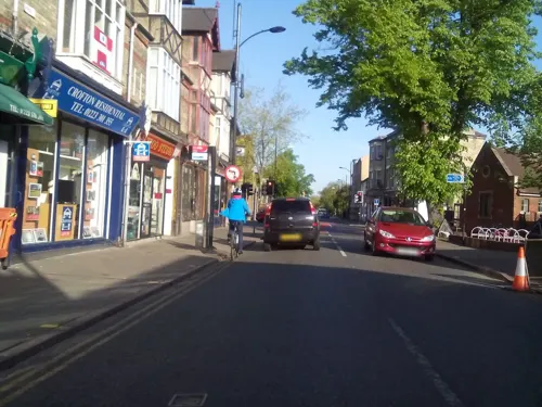
Devonshire Arms
Bar and pub · 1.0 mi
1 Devonshire Road, Cambridge
Mo-We 16:00-23:00; Th-Sa 12:00-23:00; Su 12:00-22:30
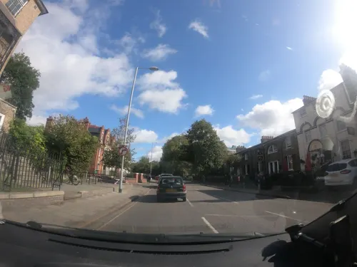
Hank's Dirty
Bar and pub
67 Lensfield Road, Cambridge
Mo 17:00-21:00; Tu-Fr 17:00-11:00; Sa 12:00-23:00; Su 12:00-21:00
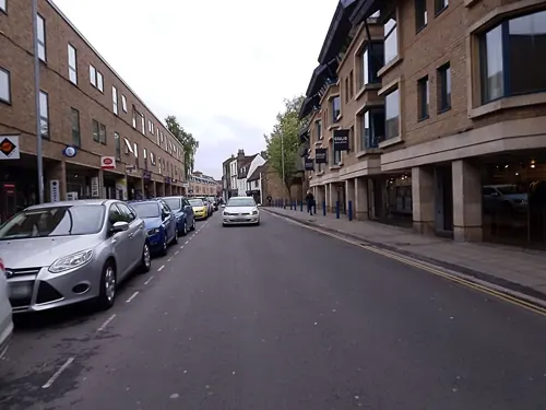
The Cambridge Brew House
Bar and pub · 0.6 mi
1 King Street, Cambridge
Mo-Th 11:00-23:30; Fr, Sa 11:00-00:00; Su 11:00-22:30


Royal Standard
Bar and pub · Greek · 1.4 mi
292 Mill Road, Cambridge
Mo-Sa 12:00-23:00; Su 12:00-22:30
140 more on the map.
History
Settlements have existed around the Cambridge area since prehistoric times. The earliest clear evidence of occupation is the remains of a 3,500-year-old farmstead discovered at the site of Fitzwilliam College. Archaeological evidence of occupation through the Iron Age is a settlement on Castle Hill from the 1st century BC, perhaps relating to wider cultural changes occurring in southeastern Britain linked to the arrival of the Belgae.
The principal Roman site is a small fort (castrum) Duroliponte on Castle Hill, just northwest of the city centre around the location of the earlier British village. The fort was bounded on two sides by the lines formed by the present Mount Pleasant, continuing across Huntingdon Road into Clare Street. The eastern side followed Magrath Avenue, with the southern side running near to Chesterton Lane and Kettle's Yard before turning northwest at Honey Hill. It was constructed around AD 70 and converted to civilian use around 50 years later. Evidence of more widespread Roman settlement has been discovered, including numerous farmsteads and a village in the Cambridge district of Newnham.
Read more of the history
Following the Roman withdrawal from Britain around 410, the location may have been abandoned by the Britons, although the site is usually identified as Cair Grauth, as listed among the 28 cities of Britain in the History of the Britons attributed to Nennius. Evidence exists that the invading Anglo-Saxons had begun occupying the area by the end of the century. Their settlement – also on and around Castle Hill – became known as Grantebrycge ("Granta bridge"). Anglo-Saxon grave goods have been found in the area. During this period, Cambridge benefited from good trade links across the hard-to-travel fenlands. By the 7th century, the town was less significant and described by Bede as a "little ruined city" containing the burial site of Æthelthryth (Etheldreda). Cambridge sat on the border between the East and Middle Anglian kingdoms, and the settlement slowly expanded on both sides of the river.. A recent article suggests the medieval location known as 'Holm' in St. Clements Parish is the site of the Battle of the Holme fought in 902.
The Anglo-Saxon Chronicle reports that Vikings arrived in 875; they imposed Viking rule, the Danelaw, by 878. Their vigorous trading habits resulted in rapid growth of the town. During this period, the town's centre shifted from Castle Hill on the left bank of the river to the area now known as the Quayside on the right bank. After the Viking period, the Saxons enjoyed a return to power, building churches, such as St Bene't's Church, as well as wharves, merchant houses, and a mint which produced coins with the town's name abbreviated to "Grant".
In 1068, two years after the Norman Conquest of England, William the Conqueror erected a castle on Castle Hill, the motte of which survives. Like the rest of the newly conquered kingdom, Cambridge fell under the control of the King and his deputies.
Cambridge's first town charter was granted by Henry I between 1120 and 1131. It granted the town monopoly of waterborne traffic and hithe tolls and recognised the borough court. The distinctive Round Church dates from this period. In 1209, Cambridge University was founded by Oxford students fleeing from hostility. The oldest existing college, Peterhouse, was founded in 1284.
Cambridge had a significant Jewish community in the middle ages, centred on what is now known as All Saints Passage, then known as the Jewry. A synagogue stood nearby. In January 1275, Eleanor of Provence expelled Jews from all of the towns within her dower lands, and the Jews of Cambridge were ordered to relocate to Norwich.
In 1349, Cambridge was affected by the Black Death. Few records survive but 16 of 40 scholars at King's Hall died. The town north of the river was severely impacted, being almost wiped out. Following further depopulation after a second national epidemic in 1361, a letter from the Bishop of Ely suggested that two parishes in Cambridge be merged as there were not enough people to fill even one church. With more than a third of English clergy dying in the Black Death, four new colleges were established at the university over the following years to train new clergymen, namely Gonville Hall, Trinity Hall, Corpus Christi, and Clare.
In 1382, a revised town charter effected a "diminution of the liberties that the community had enjoyed", due to Cambridge's participation in the Peasants' Revolt. This charter transferred supervision of baking and brewing, weights and measures, and forestalling and regrating, from the town to the university. The Cambridge Parliament was held in Barnwell Priory in 1388.
King's College Chapel was begun in 1446 by King Henry VI. Built in phases by a succession of kings of England from 1446 to 1515 — its history intertwined with the Wars of the Roses — the chapel was completed during the reign of King Henry VIII. The building would become synonymous with Cambridge, and currently is used in the logo for the Cambridge City Council.
Following repeated outbreaks of pestilence throughout the 16th century, sanitation and fresh water were brought to Cambridge by the construction of Hobson's Conduit in the early 1600s. Water was brought from Nine Wells, at the foot of the Gog Magog Hills to the southeast of Cambridge, into the centre of the town.
From the History section of Cambridge on Wikipedia, under CC BY-SA 4.0.
More about Cambridge
Geography
Cambridge is situated about 55 miles (89 km) north-by-east of London and 95 miles (153 km) east of Birmingham. The city is located in an area of level and relatively low-lying terrain just south of the Fens, which varies between 6 and 24 metres (20 and 79 ft) above sea level. The town was thus historically surrounded by low-lying wetlands that have been drained as the town has expanded.
The underlying geology of Cambridge consists of gault clay and Chalk Marl, known locally as Cambridge Greensand, partly overlaid by terrace gravel. A layer of phosphatic nodules (coprolites) under the marl was mined in the 19th century for fertiliser; this became a major industry in the county, and its profits yielded buildings such as the Corn Exchange, Fulbourn Hospital, and St. John's Chapel until the Quarries Act 1894 and competition from America ended production.
The River Cam flows through the city from the village of Grantchester, to the southwest. It is bordered by water meadows within the city such as Sheep's Green as well as residential development. Like most cities, modern-day Cambridge has many suburbs and areas of high-density housing. The city centre of Cambridge is mostly commercial, historic buildings, and large green areas such as Jesus Green, Parker's Piece and Midsummer Common. Some of the roads in the centre are pedestrianised.
Economy
The town's river link to the surrounding agricultural land, and good road connections to London in the south meant Cambridge has historically served as an important regional trading post. King Henry I granted Cambridge a monopoly on river trade, privileging this area of the economy of Cambridge. The town market provided for trade in a wide variety of goods and annual trading fairs such as Stourbridge Fair and Midsummer Fair were visited by merchants from across the country. The river was described in an account of 1748 as being "often so full of [merchant boats] that the navigation thereof is stopped for some time". For example, 2000 firkins of butter were brought up the river every Monday from the agricultural lands to the northeast, particularly Norfolk, to be unloaded in the town for road transportation to London. Changing patterns of retail distribution and the advent of the railways led to a decline in Cambridge's importance as a market town.
Arts and culture
Cambridge's main traditional theatre is the Arts Theatre, a venue with 666 seats in the town centre. The theatre often has touring shows, as well as those by local companies. The largest venue in the city to regular hold theatrical performances is the Cambridge Corn Exchange with a capacity of 1,800 standing or 1,200 seated. Housed within the city's 19th century former corn exchange building the venue was used for a variety of additional functions throughout the 20th century including tea parties, motor shows, sports matches and a music venue with temporary stage. The City Council renovated the building in the 1980s, turning it into a full-time arts venue, hosting theatre, dance and music performances.
The newest theatre venue in Cambridge is the 220-seat J2, part of Cambridge Junction in Cambridge Leisure Park. The venue was opened in 2005 and hosts theatre, dance, live music and comedy. The ADC Theatre is managed by the University of Cambridge, and typically has 3 shows a week during term time. It hosts the Cambridge University Footlights Dramatic Club which has produced many notable figures in British comedy. The Mumford Theatre is part of Anglia Ruskin University, and hosts shows by both student and non-student groups. There are also a number of venues within the colleges.
Education
Cambridge's two universities, the collegiate University of Cambridge and the local campus of Anglia Ruskin University, serve around 30,000 students, by some estimates. Cambridge University stated its 2020/21 student population was 24,270, and Anglia Ruskin reports 24,000 students across its two campuses (one of which is outside Cambridge, in Chelmsford) for the same period. ARU now (2019) has additional campuses in London and Peterborough. State provision in the further education sector includes Hills Road Sixth Form College, Long Road Sixth Form College, and Cambridge Regional College. The Open University had a presence in the city between 1979 and 2018.
From the Wikipedia article Cambridge, under CC BY-SA 4.0.
Notable people from Cambridge
 John Maynard KeynesBritish economist (1883–1946)Photo: Unknown, dedicated to Bettmann Archive, Public domain
 Olivia Newton-JohnBritish and Australian singer (1948–2022)Photo: Eva Rinaldi, CC BY-SA 2.0
 David GilmourEnglish musician, member of Pink Floyd (born 1946)Photo: Raph_PH, CC BY 2.0
 Syd BarrettBritish musician (1946–2006)Photo: Hit Parader magazine This is a..., Public domain
 Charli XCXBritish singer (born 1992)Photo: Elena Ternovaja, CC BY-SA 3.0
 Andrew WilesEnglish mathematician (1953–)Photo: "copyright C. J. Mozzochi, Princeton N.J", Attribution
 Matt BellamyEnglish singer-songwriter, member of MusePhoto: © Markus Felix | PushingPixels ( contact me ), CC BY-SA 4.0
 John SulstonBritish biologist and Nobel laureate (1942–2018)Photo: Arienette22, CC BY-SA 3.0
 John ClarkeBritish physicist (born 1942)Photo: UC Berkeley, CC BY 4.0
- Douglas AdamsBritish science fiction writer and humorist (1952–2001)
- George Paget ThomsonEnglish physicist (1892–1975)
- Richard AttenboroughBritish actor (1923–2014)
Born in Cambridge, according to Wikidata (CC0). Each name links to its Wikipedia article.
Where to stay39
The Fellows House Cambridge, Curio Collection by Hilton
Motel and hotel · 1.2 mi
33A Milton Road, Cambridge
Camping & Caravanning Club - Cambridge Club Site
Campground · 2.5 mi
19 Cabbage Moor, Great Shelford
Churches and places of worship62
Catholic Church of Our Lady and the English Martyrs
Church · Roman Catholic · 0.5 mi
Hills Road, Cambridge
Leper Chapel of St Mary Magdalene
Church · Anglican · 1.8 mi
Newmarket Road, Cambridge
Shopping73
Gas and EV charging24
Schools, colleges and libraries44
Coton Church of England (Voluntary Controlled) Primary School
School · Anglican · 2.5 mi
Whitwell Way, Cambridge
Healthcare38
Map of Cambridge
250 places. The map loads OpenStreetMap tiles when you open it.
Getting there and nearby towns
Cambridge City Airport (CBG) is the nearest airport with scheduled flights listed in OpenStreetMap, 2 miles away.
- Peterborough 30 mi northwest, about 48 min by car
- Luton 32 mi southwest, about 51 min by car
- Chelmsford 35 mi southeast, about 57 min by car
- Milton Keynes 39 mi west, about 1 h by car
- Enfield Town 39 mi south, about 1 h by car
- Colchester 40 mi southeast, about 1 h by car
- Northampton 42 mi west, about 1 h 15 min by car
- Tottenham 42 mi south, about 1 h 15 min by car
- Walthamstow 43 mi south, about 1 h 15 min by car
- London 49 mi south, about 1 h 15 min by car
Drive times are estimates from straight-line distance, not routes.
Towns near Cambridge


Keep exploring
Local news
Headlines from INDB.
Reviews, tips and questions
Loading what members have shared...
Sources and licences
- GeoNames (CC BY 4.0): population, coordinates, regions and time zone
- Mapillary (see each image): photos
- OpenStreetMap contributors (ODbL 1.0): places, airports, map data
- Wikidata (CC0 1.0): elevation, founding date, time zone, website, landmarks and historic places
- Wikimedia Commons (see each image): photos
- Wikipedia (CC BY-SA 4.0): overview and history text
Photo credits
- KingsCollegeChapelWest, Andrew Dunn, CC BY-SA 2.0
- 2005-07-23 - United Kingdom - England - Cambridge - Tourists 4887495171, CGP Grey, CC BY 2.0
- 2005-07-23 - United Kingdom - England - Cambridge - Judge Institute of Management Studies 4888086530, CGP Grey, CC BY 2.0
- 2005-07-23 - United Kingdom - England - Cambridge 4887489147, CGP Grey, CC BY 2.0
- 2005-07-23 - United Kingdom - England - Cambridge - King's College - Chapel 4888088496, CGP Grey, CC BY 2.0
- 2005-07-23 - United Kingdom - England - Cambridge - Japonese Tourists - Punting 4887493137, CGP Grey, CC BY 2.0
- 2005-07-23 - United Kingdom - England - Cambridge - Tourists - Punting 4888091736, CGP Grey, CC BY 2.0
- Bridge of Sighs, St John's College, Cambridge, UK - Diliff, Diliff, CC BY-SA 3.0
- Clare Bridge over the River Cam, Rafa Esteve, CC BY-SA 4.0
- Whipple Museum of the History of Science Free School Lane Cambridge CB2 3RH, Spudgun67, CC BY-SA 4.0
- Museum of Archeology and Anthropology, Cambridge, Magnus Manske, CC BY-SA 3.0
- Zoology museum, Cambridge, Magnus Manske, CC BY-SA 3.0
- 4649.CambridgeMuseumOfTechnology, Furrfu, CC BY-SA 3.0
- FitzwilliamMuseum, Unknown author, CC BY-SA 2.0
- Christs Pieces summer, Mincebert, Public domain
- Cambridge Jesus Green avenue RL, Cmglee, CC BY-SA 3.0
- CambridgeSunset, Andrew Dunn, CC BY-SA 2.0
- Barnwell II West 3, Dudley Miles, CC BY-SA 4.0
- Cambridge Business Park entrance, Cmglee, CC BY-SA 3.0
- Byron's Pool 1, Dudley Miles, CC BY-SA 4.0
- St Benets exterior, Cmglee, CC BY-SA 3.0
- Cambridge Parkers Piece Catholic Church, Cmglee, CC BY-SA 3.0
- ChristsCollege Overhead, Stuart Edwards, Public domain
- Queen's College 2008, (WT-shared) Albion, CC BY-SA 4.0
- Cambridge Gonville and Caius College, Photo: Andreas Praefcke, Public domain
- Cambridge University, Great St. Mary's Church, Photos taken for William Winfield; uploaded by Kimberlyblaker, Public domain
- Cmglee Cambridge Science Centre, Cmglee, CC BY-SA 3.0
- Cambridge Grand Arcade, Laurence Boyce at English Wikipedia, CC BY-SA 3.0
- Holy Trinity Church in Cambridge, joe from Currently located in Cork, Ireland., CC BY 2.0
- LeperChapelCambridge, Unknown author, CC BY-SA 2.0
- Lion Yard, Cambridge, Magnus Manske, CC BY-SA 3.0
- Casts of archaic Greek sculptures, Cambridge Museum of Classical Archaeology, 154246, Zde, CC BY-SA 4.0
- Primavera, Cambridge, Magnus Manske, CC BY-SA 3.0
- St Laurence's RC Church, Cambs, UK, Perferens, CC BY-SA 3.0
- 5 Market Hill, Cambridge, The wub, CC BY-SA 3.0
- 21-24 Bridge Street, Cambridge, Smb1001, CC BY-SA 4.0
- 30 Trumpington Street, Cambridge, Smb1001, CC BY-SA 4.0
- Corpus Christi Playroom, St Edward's Passage, Cambridge, Smb1001, CC BY-SA 4.0
- Powell & Bull, Cambridge, England - IMG 0659, Rept0n1x, CC BY-SA 3.0
- 30 Bridge Street, Cambridge, Smb1001, CC BY-SA 4.0
- 4, All Saints Passage, Magnus Manske, CC BY-SA 3.0
- 17, King's Parade, Magnus Manske, CC BY-SA 3.0
- 14, King's Parade, Magnus Manske, CC BY-SA 3.0
- West Pit 5, Dudley Miles, CC BY-SA 4.0
- Cambridge The Regal, Photo: Andreas Praefcke, Public domain
- Cambridge central library (26825486170), Libraries Taskforce, CC BY 2.0
- Arbury Court Library, Arbury Road, Cambridge, Smb1001, CC BY-SA 4.0
- Church of the Good Shepherd Arbury Cambridge, Cruccone, CC BY 3.0
- 210131.Christ the Redeemer, Cambridge, Smb1001, CC BY-SA 4.0
- The Cambridge Guest House, Milton Road, Cambridge, Smb1001, CC BY-SA 4.0
- Polar Museum (Cambridge) 02, GualdimG, CC BY-SA 4.0
- St Faith's School Site, Sfmark, CC BY-SA 4.0
- Centre for Computing History, DeFacto, CC BY-SA 4.0
- Castle Street Methodist Church, Cambridge, The wub, CC BY-SA 3.0
- Enid Porter plaque - Museum of Cambridge 2-3 Castle Street Cambridge CB3 0AQ, Spudgun67, CC0
- Doorway, Sedgwick Museum of Earth Sciences, Robert-brook, CC0
- Spring at Nine Wells, User:Rich257, CC BY-SA 3.0
- Street-level photo, smsm1, CC BY-SA 4.0
- Street-level photo, cyclestreets, CC BY-SA 4.0
- Street-level photo, cyclestreets, CC BY-SA 4.0
- Street-level photo, victuallers, CC BY-SA 4.0
- Street-level photo, lamaar639, CC BY-SA 4.0
- Street-level photo, lamaar639, CC BY-SA 4.0
- Street-level photo, cyclestreets, CC BY-SA 4.0
- Street-level photo, cyclestreets, CC BY-SA 4.0
- Street-level photo, cyclestreets, CC BY-SA 4.0
- Street-level photo, cyclestreets, CC BY-SA 4.0
- Street-level photo, cyclestreets, CC BY-SA 4.0
- Street-level photo, cyclestreets, CC BY-SA 4.0
- Street-level photo, smsm1, CC BY-SA 4.0
- Street-level photo, cyclestreets, CC BY-SA 4.0
- Street-level photo, cyclestreets, CC BY-SA 4.0
- Street-level photo, txllxt, CC BY-SA 4.0
- Street-level photo, volucris, CC BY-SA 4.0
- Street-level photo, volucris, CC BY-SA 4.0
- Street-level photo, smsm1, CC BY-SA 4.0
- Street-level photo, smsm1, CC BY-SA 4.0
- Street-level photo, cyclestreets, CC BY-SA 4.0
- Street-level photo, cyclestreets, CC BY-SA 4.0
- Street-level photo, cyclestreets, CC BY-SA 4.0
- Street-level photo, cyclestreets, CC BY-SA 4.0
- Street-level photo, cyclestreets, CC BY-SA 4.0
- Street-level photo, cyclestreets, CC BY-SA 4.0
- Street-level photo, cyclestreets, CC BY-SA 4.0
- Street-level photo, adam2, CC BY-SA 4.0
- Street-level photo, adam2, CC BY-SA 4.0
- Street-level photo, cyclestreets, CC BY-SA 4.0
- Street-level photo, cyclestreets, CC BY-SA 4.0
- Street-level photo, cyclestreets, CC BY-SA 4.0
- Street-level photo, smsm1, CC BY-SA 4.0


Page built November 10, 2026. Spotted a mistake? Tell us or suggest a place.