


Codicote, United Kingdom
Codicote is a town of 10,938 people in England, United Kingdom.
Why visit Codicote
Townapedia lists 9 museums and landmarks, 14 parks and trails, 25 places to eat and 2 attractions in and around town.
Highlights include Gordon Craig Theatre, Barn Theatre, Welwyn Garden City, Knebworth House and Shaw's Corner.
Weather in Codicote
Forecast from MET Norway (CC BY 4.0). Full forecast
About Codicote
Codicote is a village and civil parish in the North Hertfordshire district of Hertfordshire, England. It lies 7 miles (11 km) south of Hitchin, its post town, and 1.5 miles (2.4 km) north of Welwyn. Codicote was a small market town between the 13th and 16th centuries. The population of the parish was 3,586 at the 2021 census.
From the Wikipedia article Codicote (this version), under CC BY-SA 4.0.
Photos of Codicote


Things to do2

Gordon Craig Theatre
Cinema and theater · 3.7 mi
Theatre in Stevenage, Hertfordshire, England

Barn Theatre, Welwyn Garden City
Cinema and theater · 3.7 mi
Theatre in Welwyn Garden City, Hertfordshire, England, UK
Museums and landmarks9

Knebworth House
Monument and historic site · 1.8 mi
Country house in Knebworth, Hertfordshire, England, UK

Shaw's Corner
Museum · 1.7 mi
George Bernard Shaw's Villa. Shaw's Corner was the country home of playwright Bernard Shaw for 44 years
Bibbs Hall Lane, Welwyn
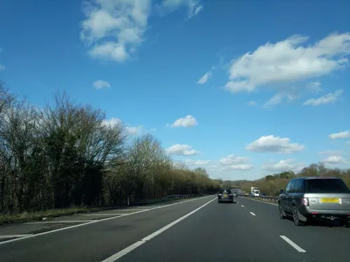
Welwyn Roman Baths
Monument and historic site · 1.9 mi
Thermae in Welwyn, Welwyn Hatfield, England, UK
Welwyn By-Pass Road, Welwyn
Sa 10:00-16:00
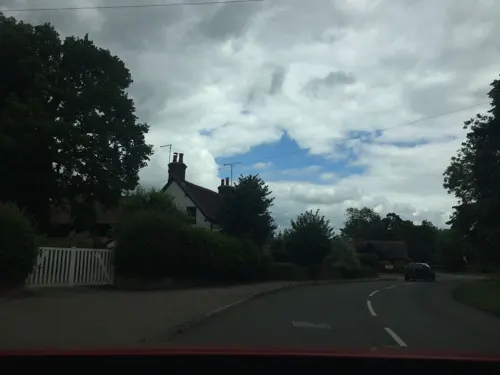
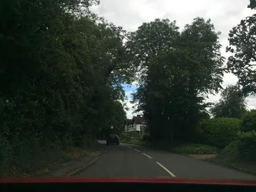

Six Hills
Monument and historic site · 3.6 mi
Collection of Roman barrows in Stevenage, Hertfordshire, England, UK

Lytton Memorial
Monument and historic site · 2.0 mi
Lytton Mausoleum In Knebworth Park, Including Railings
Lytton Mausoleum
Monument and historic site · 2.0 mi
Mausoleum in Knebworth, North Hertfordshire, England, UK
Parks, trails and playgrounds14


Lemsford Springs
Park · 3.8 mi
Nature reserve in Hertfordshire, England, UK


Stocking Springs Wood
Park · 2.0 mi
Nature reserve in Hertfordshire, England


Concerts at Knebworth House
Park · 1.8 mi
Open-air rock and pop concert

2 more on the map.
Restaurants and cafes25

Robin Hood & Little John
Bar and pub · Fine Dining, Fish And Chips, Ice Cream, Indian, Italian Pizza, Local, Noodles · 1.3 mi
Rabley Heath Road, Welwyn
Mo-Su 12:00-11:00


13 more on the map.
History
The first Anglo-Saxon settlements in England were created by the invaders themselves. Later individuals or small groups tended to leave these villages to found other secondary settlements in between. The element '-cote' in the name Codicote is typical of this second phase and so it is likely that this village was founded in the later period of colonisation. Thus at some time, perhaps around 600 AD, a man with a name something like Cudda came to the area and founded a settlement. The earliest form of the name is recorded in 1002 as Cuthingcoton, meaning the "cottages of Cuthhere's people". A later alternative form of the name was Cudingacotu in which the first element is "Cuda" a diminutive of Cuthhere.
Codicote is first recorded in 1002, when Æthelred the Unready, its owner, sold it by means of a charter for the sum of 150 mancusae, or 900 shillings of pure gold to his 'faithful minister' Ælfhelm. It was described as being 'five measures of ground' (of uncertain extent) and known as 'Æt Cuthingcoton'. Shortly after this it passed to the Abbot and Chapter of St Albans Abbey.
Read more of the history
By 1086, the Domesday Book shows its value at six pounds. There was a total of eight 'hides' in the manor, perhaps 960 acres (3.9 km2), of which the Abbot's bailiff farmed three and a quarter hides as the Abbot's 'home farm'. The rest was shared between a number of tenants, 16 'villeins', three humbler cottagers and one 'Frenchman' who may have been the bailiff. In addition there were four (landless) serfs. This suggests a total population of about 100 persons including women and children. There were two mills (now known as Codicote Mill and Fulling Mill, both on the Mimram), some meadow and pasture and some woodland.
No priest is mentioned in the Domesday Book at Codicote, suggesting it was not yet a parish. Codicote has a very irregular parish boundary with Welwyn (which did have a priest mentioned in the Domesday Book). Such irregular boundaries often indicate the division of a larger parish in the period after the Norman Conquest. Codicote's parish church of St Giles was built in the early 12th century. It is known that it was dedicated by Ralph d'Escures whilst he was Bishop of Rochester, which was between 1108 and 1115. Presumably, Codicote became a separate parish around the same time. The church was extensively restored in 1853; the main earlier material still visible is the 15th century tower.
St Giles stands on the north-eastern edge of the modern village, alongside the manor house, known as The Bury. The area around the church may indicate an early centre for the village. The main road through the parish (now High Street, the B656) passes 500 metres south-west of the church. In the late 13th century, St Albans Abbey as the manorial owner of Codicote secured a market charter and annual fair for Codicote. A market place was established at the junction of St Albans Road and High Street, and the focus for the village shifted to be around the market place (which became known as The Hill) and along High Street.
Codicote was badly affected by the Black Death of the late 1340s, with half the village's population dying from the disease. The market continued to operate until the Reformation. Codicote's landlord, St Albans Abbey, was dissolved in 1539, and Codicote's market seems to have ceased operating around the same time. The Codicote estates of St Albans Abbey were claimed by the crown and subsequently sold into private ownership.
The Welwyn Turnpike Trust was established in 1726 to improve various roads in the area, including Codicote's High Street as part of the main road linking Hitchin to the Great North Road at Welwyn. Codicote had several public houses along the High Street, including the George and Dragon, the Bell, and the Red Lion, which have all since closed and been converted to other uses. The prominent timber-framed George and Dragon, which dates back to at least the 16th century, became a Chinese restaurant before being converted into housing called Taverners Place. There are two pubs still operating on the High Street, being the Globe and the Goat, the latter being another timber-framed building dating back to the 16th century.
From the History section of Codicote on Wikipedia, under CC BY-SA 4.0.
More about Codicote
Geography
Codicote lies on a chalk ridge on the dip slope of the Chiltern Hills. The highest parts of the parish lie in the north and east, most of which is over 120 metres (390 ft) above sea level, and at one point 140 metres (460 ft) is reached. The River Mimram flows to the south-west of the village; this part of its valley is known as Codicote Bottom. On the west side of the river the land rises to about 120m at Abbotshay. As well as Codicote village itself, the parish also contains numerous small hamlets, including Nup End and Rabley Heath.
Node Court, in the countryside north of the village, was built as a model dairy farm in 1928 in a distinctive picturesque style with thatched roofs. The complex was badly damaged in a fire in 2015, and as at 2025 proposals for its reconstruction are still being considered.
Education
Codicote Church of England Primary School dates back to 1857 and the current school, on Meadow Way, was built in 1972.
State secondary education is provided by schools in nearby towns and the vast majority of pupils move on to Hitchin Boys' School, Hitchin Girls' School and Monk's Walk School. Private and other schools are also well catered for in nearby towns.
From the Wikipedia article Codicote, under CC BY-SA 4.0.
Notable people from Codicote
- John Clementsrecipient of the George Cross
Born in Codicote, according to Wikidata (CC0). Each name links to its Wikipedia article.
Churches and places of worship11
Shopping1
Schools, colleges and libraries4
Welwyn St Mary's Church of England Voluntary Aided Primary School
School · Anglican · 1.9 mi
15 London Road, Welwyn
Healthcare3
Map of Codicote
69 places. The map loads OpenStreetMap tiles when you open it.
Getting there and nearby towns
London Luton Airport (LTN) is the nearest airport with scheduled flights listed in OpenStreetMap, 6 miles away.
- Harpenden 6 mi southwest, about 9 min by car
- Luton 8 mi west, about 13 min by car
- Hertford 8 mi southeast, about 12 min by car
- Ware 9 mi east, about 15 min by car
- Potters Bar 11 mi south, about 18 min by car
- Henlow 13 mi north, about 20 min by car
- New Barnet 14 mi south, about 23 min by car
- Waltham Cross 14 mi southeast, about 23 min by car
- Enfield Town 15 mi southeast, about 24 min by car
- Watford 15 mi southwest, about 24 min by car
Drive times are estimates from straight-line distance, not routes.
Towns near Codicote


Keep exploring
Local news
Headlines from INDB.
Reviews, tips and questions
Loading what members have shared...
Sources and licences
- GeoNames (CC BY 4.0): population, coordinates, regions and time zone
- Mapillary (see each image): photos
- OpenStreetMap contributors (ODbL 1.0): places, airports, map data
- Wikidata (CC0 1.0): elevation, founding date, time zone, website, landmarks and historic places
- Wikimedia Commons (see each image): photos
- Wikipedia (CC BY-SA 4.0): overview and history text
Photo credits
- The Hill, Codicote, Richard Kelly, CC BY 4.0
- Codicote (5545842337), Peter O'Connor aka anemoneprojectors, CC BY-SA 2.0
- Stocks, Codicote (5545843719), Peter O'Connor aka anemoneprojectors, CC BY-SA 2.0
- Peace Memorial Hall, Codicote, Richard Kelly, CC BY 4.0
- Codicote war memorial (4932972699), Peter O'Connor aka anemoneprojectors, CC BY-SA 2.0
- St Giles Church, Codicote 2020-07-19, Colin, CC BY-SA 4.0
- St Giles Church, Codicote (4933565214), AnemoneProjectors ( talk ) ( on Flickr ), CC BY-SA 2.0
- Gordon Craig Theatre Front Facade, December 2015, Matthew James Manger, CC BY-SA 4.0
- Knebworth W front, Heron2 (Heron on en.wikipedia.org), CC BY-SA 3.0
- Shaw's Corner1, PaulSkin from UK, CC BY 2.0
- GOC Historic Stevenage 038 Six Hills Common, Stevenage (27357346026), Peter O'Connor aka anemoneprojectors, CC BY-SA 2.0
- Danesbury Park 2, Dudley Miles, CC BY-SA 4.0
- Stocking Springs Wood 7, Dudley Miles, CC BY-SA 4.0
- Cat Survival Trust Neofelis nebulosa, Graham Dean from Rayleigh, England, CC BY 2.0
- The ruined church at Ayot St Lawrence, Allan Engelhardt, CC BY-SA 2.0
- St Helen's Church, Wheathampstead, Colin Riegels / Legis at en.wikipedia, Public domain
- PalladianChurchAyotStLawrenceMay04, The original uploader was David Edgar at English Wikipedia ., CC BY-SA 3.0
- Ridlins Mire 2, Dudley Miles, CC BY-SA 4.0
- Lemsford Springs 10, Dudley Miles, CC BY-SA 4.0
- New St Lawrence Church, Ayot St Lawrence 2020-07-20, Colin, CC BY-SA 4.0
- Line of fixed engines (42717046791), oatsy40 from London, CC BY 2.0
- Toy windmills (28843287668), oatsy40 from London, CC BY 2.0
- Traction Engines (28843276938), oatsy40 from London, CC BY 2.0
- Street-level photo, adam2, CC BY-SA 4.0
- Street-level photo, chrisw100, CC BY-SA 4.0
- Street-level photo, chrisw100, CC BY-SA 4.0


Page built November 10, 2026. Spotted a mistake? Tell us or suggest a place.