


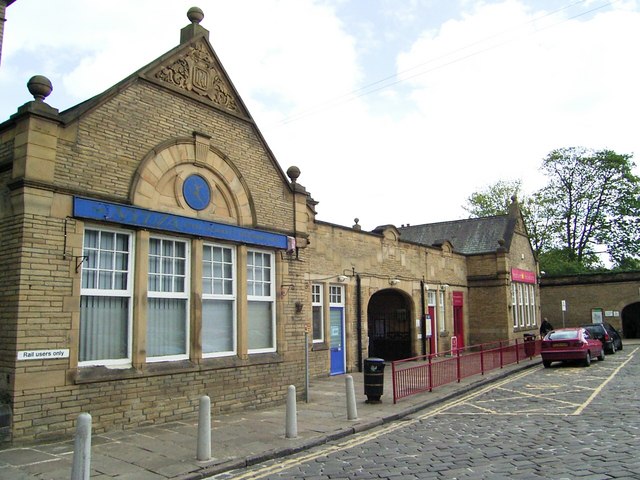


Why visit Bingley
Townapedia lists 23 museums and landmarks, 18 parks and trails, 83 places to eat, 5 places to stay and 5 attractions in and around town.
Highlights include Ireland Bridge, Bingley Five Rise Locks, East Riddlesden Hall and Northcliffe Park.
Weather in Bingley
Forecast from MET Norway (CC BY 4.0). Full forecast
About Bingley
Bingley is a market town and civil parish in the metropolitan borough of the City of Bradford, West Yorkshire, England. It is sited on the River Aire and the Leeds and Liverpool Canal. The town had a population of 18,040 at the 2021 Census.
From the Wikipedia article Bingley (this version), under CC BY-SA 4.0.
Travel tips from other travellers: Bingley on Wikivoyage (CC BY-SA 4.0).
Photos of Bingley

Things to do5


Museums and landmarks23

Bingley Five Rise Locks
Monument and historic site · 0.5 mi
A lock staircase on the historic Leeds Liverpool Canal conising of 5 lock gates. Still functioning and used by leisure barges. Steepest in UK.

East Riddlesden Hall
Museum · 2.5 mi
Grade I listed historic house museum in North Yorkshire, UK



Memorial to William Busfeild Ferrand
Monument and historic site · 1.3 mi

Museum of Rail Travel
Museum · 3.1 mi
Rail travel museum operated by the Vintage Carriages Trust in West Yorkshire, England, United Kingdom
St Ives Estate
Monument and historic site · 1.0 mi
A 500 acre country park belonging to the council with public access to a large part of the area. The Estate is the former country home...
11 more on the map.
Parks, trails and playgrounds18



Prince of Wales Park
Park · 0.8 mi
Park in Bingley, West Yorkshire, England
Bingley St Ives
Park · 0.9 mi
Country park in West Yorkshire, England



6 more on the map.
Restaurants and cafes83



The Anmol
Restaurant · Kebab · 1.3 mi
8 The Parade, Bingley
Mo,We,Su 17:00-23:45; Tu 17:00-23:50; Th 17:00-22:55; Fr...

The Potting Shed
Bar and pub · Burger, Pizza, Tapas
94 Main Street, Bingley
Mo-We 12:00-23:00, Th,Su 12:00-24:00, Fr,Sa 12:00-01:00
99 & Main
Bar and pub
99 Main Street, Bingley
Th 17:00-22:30, Fr,Sa 16:00-01:00, Su 16:00-22:00; Mo-We off
Firepit
Bar and pub
Market Street, Bingley
Mo-We 10:00-11:00, Th-Sa 10:00-01:00, Su 11:00-11:00

The Fishermans Inn
Bar and pub · 0.8 mi
Wagon Lane, Bingley
Mo,Tu 16:00-21:00; We,Th 14:00-21:00; Fr,Sa 12:00-23:00; Su 12:00-21:00
71 more on the map.
History
In 1775, a farmer near Bingley discovered a chest of silver coins on his land, of which some dated to the rule of Julius Caesar.
Bingley was likely founded by the Saxons, by a ford on the River Aire. This crossing gave access to Harden, Cullingworth and Wilsden on the southern side of the river.
The origins of the name are from the Old English personal name Bynna + ingas ("descendants of") + lēah ("clearing in a forest"). Altogether, this would mean the "wood or clearing of the Bynningas, the people called after Bynna".
In the Domesday Book of 1086, Bingley is listed as "Bingheleia":
m In Bingheleia hb. Gospatric iiij car' tra e' ad gld. tra ad ii car' Ernegis de burun h't. & Wast' e'. T.R.E. val, iiij lib'. Silva past' ii leu' lg' & i lat'. Tot' m' e iiij leu' lg' & ii lat'
In Bingheleia, Gospatric has a manor of four carucate of land to be taxed, land for two ploughs. Ernegis de Burun has it and it is waste. In the time of King Edward the Confessor it was valued at four pounds. Woodland pasture two leagues long and one broad. All the manor is four long and two broad.
The ford was superseded by Ireland Bridge. Bingley was a manor which extended several miles up and down the Aire valley, extending upstream to Marley on the outskirts of Keighley and downstream to Cottingley. Bingley became a market town with the grant of a Market Charter in 1212 by King John.
Read more of the history
According to the poll tax returns of 1379, Bingley had 130 households, and probably around 500 people. The nearby towns of Bradford, Leeds and Halifax had about half this population. Therefore, at this time Bingley was the largest town in the area.
No records tell of how Bingley fared in the Black Death that swept Europe in the 14th century. Approximately one third of all the people in Europe died of this plague, sometimes wiping out whole towns and villages. According to the 1379 Poll tax records, the nearby town of Boulton had no survivors worth taxing.
In 1592, Bingley was shown on a map by Yorkshire map-maker Christopher Saxton as a single street with about 20 houses on each side. The church sits at the west end of the street opposite a single large house, possibly a manor house. Since Bingley was a market town, the market stalls would have been set up on either side of the main street. One of the oldest buildings in Bingley is a coaching inn, the Old White Horse Inn, on the flatter north bank of the River Aire by Ireland Bridge.
Like many towns in the West Riding, Bingley prospered during the Industrial Revolution. The Bingley section of the Leeds and Liverpool Canal was completed in 1774, linking the town with Skipton, and Bradford via the Bradford Canal. The canal passes through the town centre and ascends the side of the valley via the Bingley Five Rise and Bingley Three Rise Locks. Several woollen and worsted mills were built and people migrated from the surrounding countryside to work in them. Many came from further afield such as Ireland in the wake of the Great Famine. A railway and line goods yard were constructed bringing further trade. The villages of Gilstead and Eldwick became conurbated with Bingley. The Bingley Building Society was also founded in this period.
Bingley Teacher Training College opened in 1911 with Helen Wodehouse as principal. The first intake of students was 102 women from in and around the then West Riding of Yorkshire. Before its closure in 1979, the college produced approximately 16,000 teachers.
The Beeching Axe demolished the goods yard, although the station still has trains to Leeds, Bradford, Skipton, Morecambe and Carlisle. The textile mills have largely been closed. The Damart mill still stands and trades in textiles. Since 1995 the tannery, Bingley Mill & Andertons, have been converted into flats. The most cramped and outdated terraced housing was partly replaced with council housing, Bingley Arts Centre and the headquarters of the Bradford & Bingley Building Society. Further council housing was built up the hill towards Gilstead including three tower blocks, which were later demolished in 2020. In the wake of Margaret Thatcher's reforms of council housing much of the council estate was sold and a substantial portion has been knocked down and rebuilt as private housing. The Bingley Permanent Building Society merged with the Bradford Equitable Building Society to form the Bradford & Bingley Building Society in 1964. It was decided to site the corporate headquarters in Bingley. This brought several thousand jobs to the town, but the building itself did not meet with universal acclaim and was demolished in 2015. The Bradford and Bingley collapsed in the 2008 credit crunch.
Bingley's most infamous son is Peter Sutcliffe, the Yorkshire Ripper, who was convicted of the murders of 13 women and the attempted murder of seven others.
Mark Rowntree, a spree killer, started his murderous campaign in Bingley before moving on to Eastburn and Leeds. He was convicted in 1976 of four murders.
In 1966, bookie Fred Craven was brutally murdered in his betting shop on Wellington Street, Bingley. Craven, who was well known in the area because of his short stature (he was 4 ft 7in tall), had gone into his shop to collect papers despite there being no racing that day. It is believed that he had £200 in his wallet (£3,200.00 in 2015 prices) which went missing. Mr Craven suffered extensive injuries at the hands of the killer. Because the local constabulary had a very narrow time frame for the murder, and the fact the killer must have been covered in blood, they anticipated a quick arrest. The Craven murder remains unsolved, but rumours that Peter Sutcliffe, the Yorkshire Ripper, was responsible for his murder resurfaced in 2017. ITV Calendar News asked Sutcliffe about Craven's death and also that of a taxi driver on Bingley Moor. In what was described as a "bizarre letter", Sutcliffe responded that he was not responsible for either crime to presenter Christine Talbot.
From the History section of Bingley on Wikipedia, under CC BY-SA 4.0.
More about Bingley
Arts and culture
Bradford City Council organised an annual music festival, Bingley Music Live in Myrtle Park. The festival evolved from Music At Myrtle and featured a range of musical genres including rock, alternative rock, indie rock and pop music. It was held at the end of August. First held in 2007, it was shortlisted in the 'Best New Festival' category of the Virtual Festival Awards. The ethos of the event is to present high quality music at an affordable price and give a platform for local bands from across West Yorkshire to a large audience. Artists such as The Charlatans, Happy Mondays, Scouting for Girls, The Automatic, Echo & The Bunnymen, Doves, The Zutons, Editors, Desert Eskimo, Calvin Harris, James, The Enemy, Seasick Steve and Professor Green have performed at Bingley Music Live since 2007.
Each year Bingley Show is held in Myrtle Park and is one of the largest one day shows in Europe. Its focus is on the horticultural and agricultural nature that reflects Bingley and its environs. The Bingley show has been held every year since 1867 apart from in 2012 when the event was cancelled due to flooding.
Bingley Little Theatre is both a venue and a major amateur group, with eight productions a year as well as studio pieces.
Education
Bingley provides a range of primary and secondary schools. The secondary schools are Beckfoot School, Bingley Grammar School and Samuel Lister Academy. Bingley Grammar School was founded in the 16th century and is one of the oldest schools in the country. Heather Bank School was a private preparatory school which closed in the 1970s. Beckfoot Grammar School moved into new, purpose-built, premises in June 2011 and the old buildings were demolished in 2012.
From the Wikipedia article Bingley, under CC BY-SA 4.0.
Notable people from Bingley
 Fred HoyleBritish astronomer (1915–2001)Photo: AIP Emilio Segrè Visual Archives,..., Attribution
 Harvey SmithBritish show jumping championPhoto: Rob Mieremet / Anefo, CC0
 Ian HutchinsonBritish motorcycle racerPhoto: Agljones at en.wikipedia, CC BY-SA 3.0
 Juno DawsonBritish youth fiction authorPhoto: The British Library, CC BY 3.0
 Ben Whitfieldassociation football player (born 1996)Photo: Timmy96, CC0
 Dan ScarbroughEnglish rugby union footballerPhoto: Siren-Com, CC BY-SA 3.0
 Peter James ThomasAcademic and entrepreneurPhoto: Ptbr10481, CC BY-SA 4.0
- Peter SutcliffeEnglish serial killer (1946–2020)
- Rodney BewesBritish actor (1937–2017)
- Steven SmithBritish jockey
- F. W. WalbankEnglish classical scholar and historian (1909–2008)
- Muriel AkedBritish film actress (1887-1955)
Born in Bingley, according to Wikidata (CC0). Each name links to its Wikipedia article.
Where to stay5
Churches and places of worship19
Shopping10
Gas and EV charging2
Schools, colleges and libraries14
Healthcare7
Map of Bingley
186 places. The map loads OpenStreetMap tiles when you open it.
Getting there and nearby towns
Leeds Bradford Airport (LBA) is the nearest airport with scheduled flights listed in OpenStreetMap, 7 miles away.
- Shipley 3 mi east, about 5 min by car
- Bradford 5 mi southeast, about 8 min by car
- Ilkley 5 mi north, about 8 min by car
- Guiseley 5 mi east, about 9 min by car
- Otley 7 mi northeast, about 11 min by car
- Pudsey 8 mi southeast, about 13 min by car
- Horsforth 8 mi east, about 13 min by car
- Cleckheaton 10 mi southeast, about 16 min by car
- Skipton 11 mi northwest, about 17 min by car
- Leeds 12 mi east, about 20 min by car
Drive times are estimates from straight-line distance, not routes.
Towns near Bingley


Keep exploring
Local news
Headlines from INDB.
Reviews, tips and questions
Loading what members have shared...
Sources and licences
- GeoNames (CC BY 4.0): population, coordinates, regions and time zone
- Mapillary (see each image): photos
- OpenStreetMap contributors (ODbL 1.0): places, airports, map data
- Wikidata (CC0 1.0): elevation, founding date, time zone, website, landmarks and historic places
- Wikimedia Commons (see each image): photos
- Wikipedia (CC BY-SA 4.0): overview and history text
Photo credits
- Bingley Panorama 001, Unknown author, CC BY-SA 2.0
- Ferrands Arms, Queen Street, Bingley (2611104246), Tim Green from Bradford, UK, CC BY 2.0
- Bingley Railway Station, Stanley Walker, CC BY-SA 2.0
- Bingley railway station 1799786 1bb6bf1b, Ben Brooksbank, CC BY-SA 2.0
- Midland Hotel, Bingley 2008, Tim Green from Bradford, CC BY 2.0
- Bingley Ireland Bridge 1, Unknown author, CC BY-SA 2.0
- Entrance to The Peace Museum, Salts Mill, Saltaire, The wub, CC BY-SA 4.0
- The woods in Northcliffe Park Shipley, The joy of all things, CC BY-SA 4.0
- Roberts Park, Saltaire (25th September 2010), Flickr user:Tim Green aka atouch, CC BY 2.0
- Holy Trinity Church Bingley, The joy of all things, CC BY-SA 4.0
- Saltaire - United Reformed Church - 1, Benjamin Smith, CC BY-SA 4.0
- Bingley All Saints Parish Church1, Unknown author, CC BY-SA 2.0
- Leeds Liverpool canal 5 rise locks, Sirenuk, CC BY-SA 3.0
- Brackenhall 017, Linda Spashett Storye book, CC BY 3.0
- Oakwood Hall 3, KJP1, CC BY-SA 3.0
- Bingley Old White Horse Inn, Michael Spiller from Bradford, UK, CC BY-SA 2.0
- Trinity All Saints CE Primary School, The joy of all things, CC BY-SA 4.0
- Bingley Independent Methodist Church, Simon Cobb, CC0
- Malt Shovel, Harden (4596160344), Tim Green from Bradford, UK, CC BY 2.0
- Bingley Catholic Church December 2025 cf 2, Secretlondon, CC BY 4.0
- Bingley Five Rise Locks 1, Unknown author, CC BY-SA 2.0
- East Riddlesden Hall 3 (2822557136), Tim Green from Bradford, CC BY 2.0
- Street-level photo, tallguy, CC BY-SA 4.0
- Street-level photo, tallguy, CC BY-SA 4.0


Page built November 10, 2026. Spotted a mistake? Tell us or suggest a place.