


Why visit Otley
Townapedia lists 47 museums and landmarks, 21 parks and trails, 89 places to eat, 4 places to stay and 12 attractions in and around town.
Highlights include Guiseley Theatre, Otley Bridge, Roman period native settlement and Old Otley Grammar School.
Weather in Otley
Forecast from MET Norway (CC BY 4.0). Full forecast
About Otley
Otley is a market town and civil parish at a bridging point on the River Wharfe, in the City of Leeds metropolitan borough in West Yorkshire, England. Historically a part of the West Riding of Yorkshire, the population was 13,668 at the 2011 census. It is in two parts: south of the river is the historic town of Otley and to the north is Newall, which was formerly a separate township. The town is in lower Wharfedale on the A660 road which connects it to Leeds.
From the Wikipedia article Otley (this version), under CC BY-SA 4.0.
Travel tips from other travellers: Otley on Wikivoyage (CC BY-SA 4.0).
Things to do12
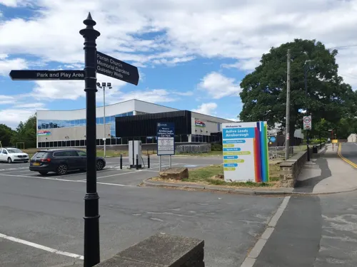
Guiseley Theatre
Cinema and theater · 2.4 mi
Theatre in Guiseley, Leeds, England, a former town hall

Surprise View
Scenic view · 0.8 mi
Panoramic view over Otley and Mid-Wharfedale. York Minster and the White Horse of Kilburn can be seen on very clear days.

Otley Bridge
Bridge
Road bridge in Otley, West Yorkshire, England, UK

Devil's Frying Pan
Scenic view · 0.8 mi
Popular local landmark and visit. A group of Millstone Grit rocks; one with a frying pan shaped depression.


Gill Beck Waterfall
Waterfall · 1.4 mi
Artificial waterfall flowing over the original dam construction for former Derrydiddle Mill
Museums and landmarks47


Old Otley Grammar School
Monument and historic site
Former school building
16 Manor Square, Otley

Bramhope Tunnel Memorial
Monument and historic site
The Navvies Memorial - In memory of 22 men killed building the Bramhope railway tunnel. Monument shaped like a tunnel. Restored in 2018.


Farnley Hall
Monument and historic site · 1.4 mi
Originally built in early C17th and added to. Home of the Fawkes of Farnley family.
Farnley Lane, Otley

Archbishop's Palace
Monument and historic site
Corner only of a former excavation of the original Otley manor house, the manor being owned by the Archbishop of York
Jubilee Clock
Monument and historic site
Free-standing clock tower, grade II-listed monument, originally built to celebrate Queen Victoria’s 50th year as monarch. Local landmark.
Otley War Memorial
Monument and historic site
WWI memorial. Moved here form SW of churchyard in 1966. Modelled on framents of saxon preachnng cross(es) found in church yard.
35 more on the map.
Parks, trails and playgrounds21

Chevin Forest Park
Hiking and trails · 1.0 mi
Chevin Forest Park is a local nature reserve since 1989 and country park with ancient and modern woodland, heathland, grassland and...



St. Davids
Park · 0.9 mi
An apology for a park provided by developers of contiguous new houses. Unmowed, no facilities at all except a sign
Grove Hill Park
Park · 0.5 mi
Created by the mill owners oppoisite. Reduced in size due to ewnew bypass.
Otley War Memorial Garden
Park
Former site of Grove House, now a garden of remberance. Was British Restaurant during WWII.
9 more on the map.
Restaurants and cafes89


Old Cock
Bar and pub
New pub (around 2010). Formerly Curlew cafe and before that Curlew Pottery.
11,13 Crossgate, Otley

The Black Bull
Bar and pub
Otley's oldest pub, reputedly drunk dry by King's men in Civil War
Market Place, Otley



The Royalty
Bar and pub · 1.0 mi
York Gate, Otley
Mo 12:00-24:00; Tu-Fr 12:00-21:00; Sa 12:00-21:30; Su 12:00-20:00

Mistål Kitchen
Cafe · Cake, Pie, Breakfast · 1.2 mi
East Chevin Road, Otley
Th-Fr 10:30-15:00; Sa-Su 09:30-16:00

Tapas & Tunes
Restaurant · Tapas, Spanish
50 Kirkgate, Otley
We 17:00-22:00; Th,Fr 12:00-14:30,17:00-23:00; Sa 12:00-23:00; Mo,Tu off
Buon Apps
Restaurant · Italian
50 Mill Way, Otley
We,Th 12:00-20:00; Fr,Sa 12:00-21:00; Su 09:30-19:00
77 more on the map.
History
Otley's name is derived from Otto, Otho, Othe, or Otta, a Saxon personal name and leah, a woodland clearing in Old English. It was recorded as Ottanlege in 972 and Otelai or Othelia in the Domesday Book of 1086. The name Chevin has close parallels to the early Brythonic Welsh term Cefn meaning ridge and may be a survival of the ancient Cumbric language.
There are pre-historic settlement finds alongside both sides of the River Wharfe and it is believed the valley has been settled at this site since the Bronze Age. There are Bronze Age carvings on rocks situated on top of The Chevin: one such example is the Knotties Stone. West Yorkshire Geology Trust has reference to Otley Chevin and Caley Crags having a rich history of human settlement stretching back into Palaeolithic times. Flint tools, Bronze Age rock carvings and Iron Age earthworks have been found. In medieval times the forest park was used as common pasture land, as a source of wood and sandstones for buildings and walls.
Read more of the history
The majority of the early development of the town dates from Saxon times and was part of an extensive manor granted by King Æthelstan to the see of York. The Archbishops of York had a residence and were lords of the manor. Their palace was located on the site occupied by the Manor House. Otley is close to Leeds and may have formed part of the kingdom of Elmet. Remains of the Archbishop's Palace were found during the construction of St Joseph's Primary School.
As in other areas of the north, the Norman Conquest largely laid waste this area. The Saxon church was replaced by a Norman one, but this contains much Saxon sculpture. Thus in the 11th and 12th century Otley would have been a loose congregation of buildings around the two focal points of the manor house by the bridge and the church. An important reason for the town's location was a water supply, the Calhead Beck (now covered over) which ran down from Otley Chevin over Whitley Croft, a little East of the church and then to the river near the bridge.
The town grew in the first half of the 13th century when the archbishops laid out burgage (freehold) plots to attract merchants and tradespeople. The burgage plots were on Boroughgate, Walkergate and Kirkgate. This began to create the layout of today, based on a triangle of these plots forming the streets. Bondgate was for the workers: bondsmen and tenants. A leper hospital was founded on the road to Harewood beyond Cross Green.
As well as farming and use of woodland, important local activities were quarrying stone, and the manufacture of potash from bracken, used to make a soap which therefore supported a community carrying out fulling, the cleansing and finishing of woollen cloth on Watergate. The Chevin provided stone for building (and millstones) as well as bracken, wood and common grazing, while the river provided reeds for thatching houses.
The woollen industry developed as a cottage industry but during the Industrial Revolution and the mechanisation of the textile industry, mills were built using water then steam power. A cotton mill and weaving shed for calicoes were built by the river in the late 18th century. Later woolcombing and worsted spinning were introduced. By the mid 19th century 500 inhabitants were employed in two worsted-mills, a paper-mill, and other mills. A tannery was established in the 19th century. At this time the opening of the new Leeds Road and Bradford Road greatly increased access for trade. Many houses were built from the middle of the 19th century onwards, including the first row of terraces by the newly formed Otley Building Society from 1847. Otley railway station opened in 1865 connecting goods and people to Leeds, with a connection to Bradford in 1875. At its peak it had 50 trains a day, but it was closed in 1965 under the Beeching cuts. Kirkgate was the first street to be paved in 1866, followed by sewers in 1869.
The Wharfedale Printing Machine was developed in Otley by William Dawson and David Payne. An early example can be seen in Otley Museum. By 1900 the printing machinery trade, with over 2,000 people employed in seven machine shops, was Otley's most important industry.
During the First World War, Farnley Camp at Otley housed the Northern Command Gas and Grenade School, which taught military personnel about explosives.
After the First World War there was a general shortage of housing in Britain, and much of it was crowded slums. Otley Council prepared one of the first subsidized housing schemes, commencing with relatively open land in Newall on the North of the river in 1920. The 1920s also saw the beginnings of the conversion of properties to a sewer drainage system, and electric lighting instead of gas on the streets.
Further estates followed and by 1955 there were more than 1,000 council houses. Private housing was also expanded during this time, but was greatly reduced in the Second World War. House building revived in the 1960s to 1980s, but industry declined, with many factories closing, including the printing machine works in 1981.
Wharfemeadows park provided leisure space for residents and the River Wharfe a place to swim with public open air swimming baths opening on the site in 1924. By the 1960s the outdoor pool was a popular leisure destination and was in use until 1993 when a fault with the pumping system precipitated its closure. In February 2016, in response to a Leeds City Council invitation for 'Expressions of Interest' for the site of 'the former Otley Lido', a group of local residents launched an ongoing campaign to regenerate the site as a modern open air swimming pool and community centre.
From the History section of Otley on Wikipedia, under CC BY-SA 4.0.
More about Otley
Geography
Otley lies 28 miles (45 km) south-west of York, 10 miles (16 km) north-west of Leeds, 10 miles (16 km) north-east of Bradford, and 196 miles (315 km) from London. The town lies in lower Wharfedale, at a bridging point over the River Wharfe where there is a seven-arched medieval bridge, and is surrounded by arable farmland. The historic town developed on the south bank of the Wharfe, but in the 20th century Otley expanded north of the river, to include new developments at Newall and the Weston Estate.
The south side of the valley is dominated by a gritstone escarpment overlooking Otley called the Chevin and to the north is Newall Carr. In 1944, Major Le G.G.W. Horton Fawkes of Farnley Hall donated 263 acres (106 ha) of land on the Chevin to the people of Otley. This has been expanded to 700 acres (280 ha) and constitutes Chevin Forest Park. It was from a quarry on the Chevin that the foundation stones for the Houses of Parliament were hewn.
To the east and west of Otley are flooded gravel pits, where sand and gravel have been extracted in the 20th century. The gravel pits to the east at Knotford Nook are a noted birdwatching site. Those to the west are devoted to angling and sailing.
To the west are the villages of Burley in Wharfedale and Menston. To the east is Pool-in-Wharfedale. To the south is the towns of Guiseley, and Yeadon.
Arts and culture
Otley has a diverse range of cultural organisations. It has five active Morris dance sides, the Wharfedale Wayzgoose (Border), The Buttercross Belles (Ladies Northwest), Flash Company (Border, Molly, Appalachian & Clog), Hellz Bellz (Contemporary) and Kitchen Taps (Appalachian Step).
Drama groups include the Otley Community Players, Otley Youth Theatre (OY), and a thriving arts centre in the former courthouse. There is a poetry society, which meets monthly in the Black Horse Hotel. The town has a Brass Band who perform at many events in the town. It is not a regular contesting band, but won first prize in the unregistered section at their first contest at Hardraw Scar in September 2007 and again in 2008. Since then they have competed in the 1st to 3rd section winning Second prize and Best March in 2014.
Otley hosts the annual Otley Folk Festival in September, a Victorian Fayre in December, a carnival in June, and, in May, what is reputed to be the oldest one day agricultural show in the country. This celebrated its bicentenary in 2009. There is a beer festival, organised by the church, in November.
Otley has four Scout troops, Otley Parish, Otley Bridge, 2nd Otley, and Otley Methodist Scouts. An Army Cadet Force detachment is also located in the town.
In January 2013 The Guardian newspaper featured an article in its Weekend section entitled Let's move to Otley, West Yorkshire.
Education
A grammar school was founded by Royal Charter issued to Thomas Cave in 1607 by King James VI and I, who named it "The Grammar School of Prince Henry". The single storey building was pulled down and rebuilt in the Elizabethan style with two storeys in 1840. It closed in 1878 and was used as a court-house, and in recent times has been commercial premises, then a public house until closure in 2020. In 1918 the foundation was re-established in temporary premises and in 1925 Prince Henry's Grammar School, Otley, in Farnley Lane opened.
From the Wikipedia article Otley, under CC BY-SA 4.0.
Notable people from Otley
 Julian SandsBritish actor (1958-2023)Photo: 5of7, CC BY-SA 2.0
 Thomas ChippendaleBritish cabinet-maker (1718–1779)Photo: Mtaylor848, CC BY-SA 4.0
 Lizzie DeignanEnglish track and road racing cyclistPhoto: Cs-wolves, CC BY-SA 4.0
 Nick HoughtonBritish Army generalPhoto: ©House of Lords / photography by Roger Harris, CC BY 3.0
 Craig AdamsmusicianPhoto: © Markus Felix ( talk to me ), CC BY-SA 3.0
 Malcolm RathmellBritish motorcycle racerPhoto: Insomnia Cured Here, CC BY-SA 2.0
 Frances CairncrossBritish journalist and economist (1944-)Photo: Tom Guarriello, CC BY 2.0
 Paul EdmondsonBritish motorcycle racerPhoto: GOGO Visual, CC BY 2.0
 Martin S. Briggsarchitectural historianPhoto: Storye book, CC BY-SA 4.0
- Mike TindallEnglish rugby union player
- Alan KernaghanIrish footballer
- Aidan WhiteIrish footballer
Born in Otley, according to Wikidata (CC0). Each name links to its Wikipedia article.
Where to stay4
Churches and places of worship13
Shopping18
Gas and EV charging3
Schools, colleges and libraries8
Healthcare4
Map of Otley
219 places. The map loads OpenStreetMap tiles when you open it.
Getting there and nearby towns
Leeds Bradford Airport (LBA) is the nearest airport with scheduled flights listed in OpenStreetMap, 3 miles away.
- Shipley 6 mi southwest, about 9 min by car
- Bradford 8 mi south, about 13 min by car
- Pudsey 8 mi south, about 12 min by car
- Leeds 10 mi southeast, about 15 min by car
- Wetherby 13 mi east, about 20 min by car
- Skipton 14 mi west, about 22 min by car
- Wakefield 17 mi southeast, about 28 min by car
- Ripon 17 mi northeast, about 28 min by car
- Huddersfield 18 mi south, about 29 min by car
- Burnley 23 mi west, about 37 min by car
Drive times are estimates from straight-line distance, not routes.
Towns near Otley


Keep exploring
Local news
Headlines from INDB.
Reviews, tips and questions
Loading what members have shared...
Sources and licences
- GeoNames (CC BY 4.0): population, coordinates, regions and time zone
- Mapillary (see each image): photos
- OpenStreetMap contributors (ODbL 1.0): places, airports, map data
- Wikidata (CC0 1.0): elevation, founding date, time zone, website, landmarks and historic places
- Wikimedia Commons (see each image): photos
- Wikipedia (CC BY-SA 4.0): overview and history text
Photo credits
- Otley Wharfemeadows 2009, TJBlackwell, CC BY-SA 3.0
- Black Bull, Otley (4575152077), Tim Green from Bradford, UK, CC BY 2.0
- Otley Chevin Forest Park, James Dolan, CC BY 3.0
- The Parish Church of St Oswald, Leathley, Alexander P Kapp, CC BY-SA 2.0
- WharfedaleHospital01, Chemical Engineer, Public domain
- Manor Club, Simon Cobb, CC0
- Iron Age settlement in Danefield Wood, Dave.Dunford, CC BY-SA 4.0
- Old Cock, Simon Cobb, CC0
- The Fleece, Otley (28th August 2017) 002, Mtaylor848, CC BY-SA 4.0
- Otley Navvies Monument 7 August 2017, Chemical Engineer, CC BY-SA 4.0
- The Black Bull in Otley, Mtaylor848, CC BY-SA 3.0
- Otley Tap House, Simon Cobb, CC0
- The Vaults Public House, Simon Cobb, CC0
- The Otley Tavern, Simon Cobb, CC0
- Otley Congregational Church And Sunday School, Simon Cobb, CC0
- Otley Library (29851830045), Libraries Taskforce, CC BY 2.0
- Black Horse, Simon Cobb, CC0
- Horse And Farrier, Simon Cobb, CC0
- North Bar Social, Simon Cobb, CC0
- Beech Hill Church, Otley, Chris Haley, CC BY-SA 4.0
- All Saints Otley exterior 01 7 August 2017, Chemical Engineer, CC BY-SA 4.0
- Otley - Surprise View, Les McLean, CC BY-SA 2.0
- Street-level photo, mcollinson, CC BY-SA 4.0
- Street-level photo, trekclimbing, CC BY-SA 4.0
- Street-level photo, trekclimbing, CC BY-SA 4.0
- Street-level photo, mapz4lolz, CC BY-SA 4.0


Page built November 10, 2026. Spotted a mistake? Tell us or suggest a place.