


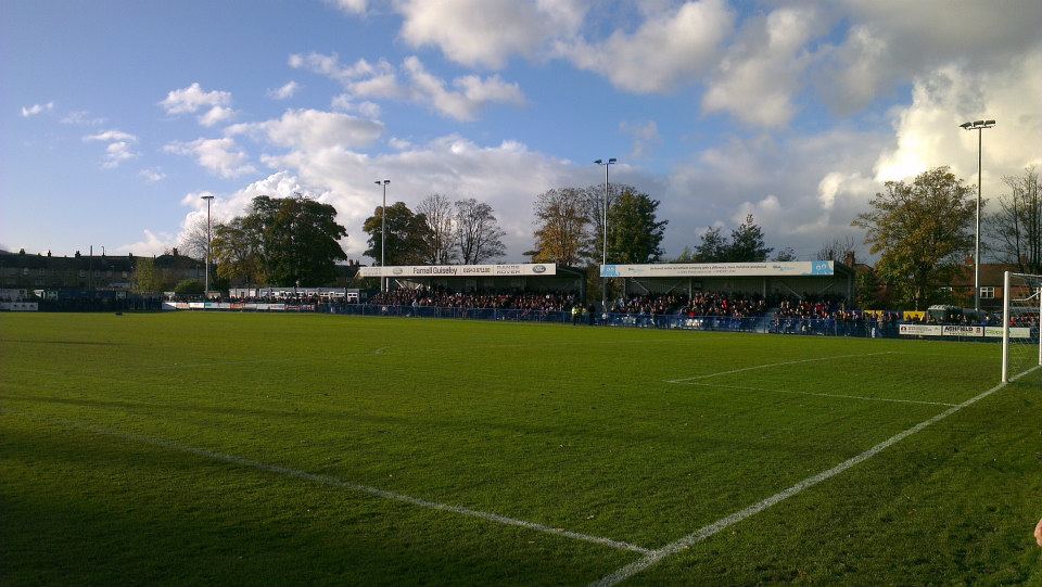


Guiseley, United Kingdom
Guiseley is a town of 21,000 people in England, United Kingdom.
Why visit Guiseley
Townapedia lists 19 museums and landmarks, 21 parks and trails, 87 places to eat, 3 places to stay and 16 attractions in and around town.
Highlights include Guiseley Theatre, Yeadon Town Hall, Guiseley Cross and Nethermoor Park.
Weather in Guiseley
Forecast from MET Norway (CC BY 4.0). Full forecast
About Guiseley
Guiseley is a small town in the City of Leeds, West Yorkshire, England. Historically part of the West Riding of Yorkshire, it is situated south of Otley and Menston and is now a north-western suburb of Leeds.
From the Wikipedia article Guiseley (this version), under CC BY-SA 4.0.
Things to do16
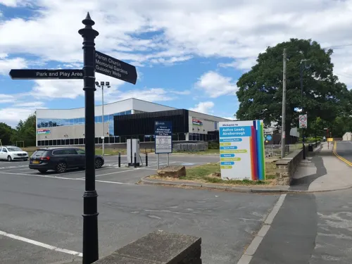
Guiseley Theatre
Cinema and theater
Theatre in Guiseley, Leeds, England, a former town hall
The Green


Surprise View
Scenic view · 1.5 mi
Panoramic view over Otley and Mid-Wharfedale. York Minster and the White Horse of Kilburn can be seen on very clear days.

Otley Bridge
Bridge · 2.4 mi
Road bridge in Otley, West Yorkshire, England, UK

Devil's Frying Pan
Scenic view · 1.5 mi
Popular local landmark and visit. A group of Millstone Grit rocks; one with a frying pan shaped depression.

Gill Beck Waterfall
Waterfall · 1.5 mi
Artificial waterfall flowing over the original dam construction for former Derrydiddle Mill
4 more on the map.
Museums and landmarks19

Derrydiddle Mill
Monument and historic site · 1.5 mi
Industrial revolution factory
Jenny's Cottage
Monument and historic site · 1.5 mi
Former cafe in 1 storey stone building
7 more on the map.
Parks, trails and playgrounds21



Yanki Doodlz Play Zone and Diner
Playground · 1.4 mi
2 Sizers Court, Leeds

Nunroyd Park Community Orchard
Park · 0.8 mi
Https://www.facebook.com/groups/friendsofnunroydpark/
Parkinson's Park community Orchard
Park
Https://www.facebook.com/groups/164802993988992/
Springfield Park Community Orchard
Park
Https://www.facebook.com/Guiseley-In-Bloom-247245008785129/ 12 apple & plum trees planted in Springfield Park, close to the Aireborough...
9 more on the map.
Restaurants and cafes87

The Woolpack
Bar and pub · 1.4 mi
18 New Road, Leeds
Mo 16:00-11:00; Tu-Sa 12:00-23:00; Su 12:00-22:30



Everybodys All Day Social
Cafe
91-97 Otley Road, Leeds
Mo-Th 10:00-21:00; Fr,Sa 10:00-01:00; Su 10:00-21:00
The Royalty
Bar and pub · 1.5 mi
York Gate, Otley
Mo 12:00-24:00; Tu-Fr 12:00-21:00; Sa 12:00-21:30; Su 12:00-20:00

Wetherby Whaler
Restaurant · Fish And Chips · 0.6 mi
Former Harry Ramsdens fish and chip shop.. a tourist attractioon
Otley Road, Leeds
Mo-Th 11:30-20:00; Fr,Sa 11:30-20:30; Su 12:00-21:00
Luck Thai
Restaurant · Thai · 0.6 mi
12 Bradford Road, Leeds
We-Sa 12:00-15:00, Tu-Su 17:30-22:00; Mo off
The Corner 19 Cafe & Bistro
Cafe · 1.5 mi
111 High Street, Leeds
Mo-We 08:30-15:00; Th-Sa 08:30-15:00,17:00-22:00; Su 09:00-15:00
75 more on the map.
History
There have been Stone Age and Bronze Age finds in Guiseley and a Roman road, Road 72b, ran nearby on Guiseley Moor. An Anglo-Saxon settlement existed around a spring which is now called Guiseley Wells and provided drinking water.
It was a largely farming community until the 18th century, when cottage-based woollen industry arose. In Victorian times it became industrialised, acquiring a railway connection in 1865 and a town hall (now Guiseley Theatre) in 1867.
Guiseley was an ancient parish in the West Riding of Yorkshire from the 12th century. The parish also included the townships of Carlton, Horsforth, Rawdon and Yeadon, all of which became separate civil parishes in 1866. In 1894 Guiseley became an urban district, on 1 April 1937 the district was abolished to form Aireborough Urban District, part also went to Ilkley Urban District. On 1 April 1937 the parish was abolished to form Aireborough, part also went to Ilkley. In 1931 the parish had a population of 5,607. In 1974 Aireborough was itself abolished and absorbed into the City of Leeds Metropolitan District in the new county of West Yorkshire.
From the History section of Guiseley on Wikipedia, under CC BY-SA 4.0.
More about Guiseley
Geography
Guiseley is situated in a hanging valley between Airedale and Wharfedale. The A65 road passes through, there is a railway station and Leeds Bradford Airport is nearby.
Economy
Crompton Parkinson was a major employer until its factory closed in 2004. The town was the home of Silver Cross, a pram manufacturer, whose factory was operational from 1936 to 2002.
The town is known for Harry Ramsden, whose fish and chip shop traded from a small shed next to the tram terminus at White Cross. In 1930 he opened "the world's biggest fish and chip shop". The original restaurant was closed in December 2011. The Wetherby Whaler group purchased the site and planned a £500,000 refurbishment to open during the summer of 2012.
Guiseley has two retail parks: Guiseley Retail Park in the centre of town, and Westside Retail Park between Guiseley and Yeadon. The town has a Morrisons supermarket, charity shops and beauty stores on Otley Road, as well as many pubs, bars, takeaways and restaurants located around the town and a leisure centre with a swimming pool and gym on The Green.
Many of the retail outlets in the town have been established on the converted sites of old factories or mills. Recently, an increasing number of well-known leading brands have stores in the town.
From the Wikipedia article Guiseley, under CC BY-SA 4.0.
Notable people from Guiseley
 Frank ParkinsonBritish businessman (1887-1946)Photo: Jimr1603, CC BY-SA 3.0
- Jack van GelovenEnglish county cricketer and umpire (1934-2003)
- John Claughtonschoolmaster and cricketer (born 1956)
- Matthew CorbettBritish television presenter
- Craig McKayBritish actor
- Ann EllisTrade union leader 1843-1919 (born Ann Waite)
Born in Guiseley, according to Wikidata (CC0). Each name links to its Wikipedia article.
Where to stay3
Churches and places of worship16
The Parish Church of Saint John the Evangelist
Church · Anglican · 1.3 mi
Barcroft Grove, Leeds
Shopping18
Gas and EV charging4
Schools, colleges and libraries17
St. Mary's Menston, a Catholic Voluntary Academy
School · Roman Catholic · 0.8 mi
Bradford Road, Ilkley
Healthcare5
Map of Guiseley
206 places. The map loads OpenStreetMap tiles when you open it.
Getting there and nearby towns
Leeds Bradford Airport (LBA) is the nearest airport with scheduled flights listed in OpenStreetMap, 2 miles away.
- Otley 2 mi north, about 4 min by car
- Shipley 4 mi southwest, about 6 min by car
- Horsforth 4 mi southeast, about 6 min by car
- Bradford 6 mi south, about 9 min by car
- Ilkley 6 mi northwest, about 9 min by car
- Pudsey 6 mi south, about 10 min by car
- Leeds 9 mi southeast, about 14 min by car
- Liversedge 12 mi south, about 19 min by car
- Heckmondwike 12 mi south, about 19 min by car
- Lofthouse 13 mi southeast, about 22 min by car
Drive times are estimates from straight-line distance, not routes.
Towns near Guiseley


Keep exploring
Local news
Headlines from INDB.
Reviews, tips and questions
Loading what members have shared...
Sources and licences
- GeoNames (CC BY 4.0): population, coordinates, regions and time zone
- Mapillary (see each image): photos
- OpenStreetMap contributors (ODbL 1.0): places, airports, map data
- Wikidata (CC0 1.0): elevation, founding date, time zone, website, landmarks and historic places
- Wikimedia Commons (see each image): photos
- Wikipedia (CC BY-SA 4.0): overview and history text
Photo credits
- Town Street, Guiseley, Mtaylor848, CC BY-SA 3.0
- Holy Trinity Church, Idle, Rude Health, CC BY-SA 2.0
- Nethermoor Park, Guiseley, Super Nintendo Chalmers, CC0
- St Paul's, Esholt 1 (3003913204), Tim Green from Bradford, UK, CC BY 2.0
- New Life Community Church, Yeadon Jan 2018, Chemical Engineer, CC BY-SA 4.0
- Guiseley Library (29851834155), Libraries Taskforce, CC BY 2.0
- Yeadon Library (29851829715), Libraries Taskforce, CC BY 2.0
- The Clothier's Arms, High Street, Yeadon (12328681664), Tim Green from Bradford, UK, CC BY 2.0
- The Woolpack, Yeadon (6299673049), Tim Green from Bradford, UK, CC BY 2.0
- SMM Colour, SMMupdates, CC BY-SA 4.0
- Yeadon Town Hall 29 June 2018 02, Chemical Engineer, CC BY-SA 4.0
- Otley - Surprise View, Les McLean, CC BY-SA 2.0
- Street-level photo, trekclimbing, CC BY-SA 4.0
- Street-level photo, trekclimbing, CC BY-SA 4.0
- Street-level photo, trekclimbing, CC BY-SA 4.0


Page built November 10, 2026. Spotted a mistake? Tell us or suggest a place.