


Carshalton, United Kingdom
Carshalton is a town of 45,525 people in England, United Kingdom.
Why visit Carshalton
Townapedia lists 17 museums and landmarks, 62 parks and trails, 252 places to eat, 5 places to stay and 9 attractions in and around town.
Highlights include Charles Cryer Studio Theatre, Charles Cryer Theatre, Carshalton Water Tower and The Lodge.
Weather in Carshalton
Forecast from MET Norway (CC BY 4.0). Full forecast
About Carshalton
Carshalton ( kar-SHAWL-tən, -SHOL-) is a town, with a historic village centre, in south London, England, within the London Borough of Sutton. It is situated around 9.5 miles (15.3 km) southwest of Charing Cross and around 1.2 miles (1.9 km) east of Sutton town centre, in the valley of the River Wandle, one of the sources of which is Carshalton Ponds in the south of the village. Prior to the creation of Greater London in 1965, Carshalton was in the administrative county of Surrey.
From the Wikipedia article Carshalton (this version), under CC BY-SA 4.0.
Photos of Carshalton


Things to do9

Charles Cryer Theatre
Cinema and theater · 0.4 mi
Theatre and former cinema in Carshalton, London


Fairfield Halls
Cinema and theater · 3.1 mi
Arts, entertainment and conference centre in Croydon, London

The Spread Eagle Theatre
Cinema and theater · 2.9 mi
Pub theatre above the Spread Eagle pub in Croydon, London, England

Warehouse Theatre
Cinema and theater · 3.2 mi
Former theatre in Croydon, London, England

Ashcroft Theatre
Cinema and theater · 3.1 mi
Theatre within the Fairfield Halls, Croydon, London, England

Museums and landmarks17

Carshalton Water Tower
Museum
The water tower is a very unusual early 18th century garden building. As the name suggests, this contained a water-powered pump which...


Croydon War Memorial
Monument and historic site · 3.0 mi
War memorial in London


Museum of Croydon
Museum · 3.0 mi
Local and social history museum in Croydon, London

Nonsuch Mansion
Museum · 2.7 mi
House in Epsom and Ewell, Surrey, England, UK

Whitehall
Museum · 2.2 mi
House museum in Cheam, Greater London, England, UK



Promenade de Verdun War Memorial
Monument and historic site · 2.6 mi
War memorial in Croydon, London
5 more on the map.
Parks, trails and playgrounds62

Carshalton Park
Park · 0.5 mi
Public park in Carshalton, in the London Borough of Sutton

Devonshire Avenue Nature Area
Park · 1.3 mi
Public nature reserve in London, England


The Spinney Local Nature Reserve
Park · 0.5 mi
Nature reserve in England

Wilderness Island
Park · 0.6 mi
Island and nature reserve in Carshalton, South London, UK


Cotelands
Park · 3.4 mi
Small park near Park Hill, managed by the London Borough of Croydon


50 more on the map.
Restaurants and cafes252
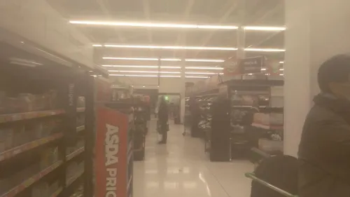
Asda Café
Cafe · Coffee Shop · 1.2 mi
229 High Street, Sutton
Mo-Fr 07:00-23:00; Sa 07:00-22:00; Su 11:00-17:00
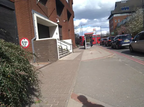
Caffè Nero
Cafe · Coffee Shop · 1.2 mi
2 Carshalton Road, Sutton
Mo-Fr 06:00-19:00; Sa 07:00-19:00; Su 07:00-18:00
M.Manze
Restaurant · Pie And Mash · 1.2 mi
226 High Street, Sutton
Mo-Fr 11:00-17:00; Sa 10:30-17:00; Su 11:00-16:00
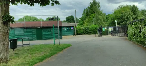
Sassis in The Grove
Cafe · Coffee Shop, Ice Cream
37a High St,, Carshalton
Mo-Fr 08:30-17:00; Sa-Su 09:00-17:00

Kokoro
Restaurant · Japanese, Sushi · 1.1 mi
162 High Street, Sutton
Mo-We 11:00-20:00, Th-Sa 11:00-21:00, Su 11:00-19:00
Number One Thai
Restaurant · Thai · 1.2 mi
1 Cheam Road, Sutton
Mo-Sa 11:30-14:45,17:30-23:00;Su 17:00-22:30
ii-ma Sushi
Restaurant · Japanese, Sushi · 1.2 mi
6 Mulgrave Road, Sutton
Mo 17:30-22:00; Tu-Sa 12:00-14:45

Caffè Nero
Cafe · Coffee Shop · 1.0 mi
72 Woodcote Road, Wallington
Mo-Fr 06:00-18:30; Sa 07:00-18:00; Su 08:30-17:30
240 more on the map.
History
To the south of the area now known as Carshalton, remains of artefacts dating from the Neolithic to the Iron Age have been found, suggesting that this was an early place of habitation. Prior to the Norman Conquest it is recorded that there were five manors in this location owned by five freemen.
The village lay within the Anglo-Saxon administrative division of Wallington hundred.
Carshalton appears in Domesday Book as Aultone. It was held by Goisfrid (Geoffrey) de Mandeville. Its domesday assets were: 3½ hides; 1 church, 10 ploughs, 1 mill worth £1 15s 0d, 22 acres (89,000 m2) of meadow, woodland worth 2 hogs. It rendered £15 10s 0d.
In the Domesday era there was a church and a water mill in Carshalton, which was then still made up of a number of hamlets dotted around the area, as opposed to a single compact village.
In the Middle Ages the land in the village was generally farmed in the form of a number of open fields, divided into strips. The number of strips which each land owner possessed was based roughly on his wealth. There was also an area of open downland in the south of the parish for grazing sheep.
Read more of the history
Carshalton was known for its springs; these may have given the place its name Cars – Aul – ton. Aul means well or spring. A ton is a farm which was in some way enclosed. The meaning of the Cars element is uncertain but early spellings (Kersaulton and Cresaulton) may indicate connection with a cross or perhaps cress, watercress having been grown locally.
In his book History of the Worthies of England, the 17th-century historian Thomas Fuller refers to Carshalton for its walnuts and trout.
Land was primarily put to arable use and the river Wandle gave rise to manufacturing using water power. A water mill to grind corn was mentioned in the Domesday Book. By the end of the 18th century, it was recorded that there were several mills for the production of paper and parchment, leather, snuff, log-wood and seed oil. There were also bleaching grounds for calico.
There were timber-framed houses from the end of the Middle Ages, and brick and wooden weather boarded houses from the 17th, 18th and 19th centuries. By the middle of the 19th century, Carshalton's population was 2,411, making it, at the time, the largest village in what was to become the London Borough of Sutton. It had a very varied character with houses for the wealthy at one extreme and tenements in back yards at the other. In 1847 a railway line was laid from Croydon to Epsom through Carshalton, but the first station was built in fields south of Wallington. A station in the village itself was not established until 1868 when the Sutton to Mitcham Line was constructed. The development of Carshalton got into its stride in the early 1890s when the Carshalton Park Estate was sold for housing development.
Carshalton is mentioned in the following historic Surrey folk-rhyme:
During the Victorian era and into the early 20th century, Carshalton was known for its lavender fields (also see below under "Landmarks"), but the increasing land demand for residential building put an end to commercial growing.
The Commonwealth War Graves Commission lists 78 civilian casualties in Carshalton during World War II.
Carshalton formed part of the Carshalton Urban District from 1894 to 1965; the UDC was based at the Carshalton Council Offices in The Square until the 1920s when it moved to The Grove.
From the History section of Carshalton on Wikipedia, under CC BY-SA 4.0.
More about Carshalton
Geography
Central Carshalton, around the ponds and High Street, retains a village character, although the busy A232 runs through the area. There are a number of buildings and open spaces protected by the Carshalton Village Conservation Area. given the status by the London Borough of Sutton. In 1993 its boundary was extended to include parts of Mill Lane and parts of The Square and Talbot Road, containing the All Saints Church Rectory. The Conservation Area contains many of the Listed and Locally Listed Buildings which contribute to the historical significance of the area, and is widely considered to contain some of the finest historical architecture and road layout within the Borough. An example is Stone Court, an early 19th-century building with a gate house, situated on the northern edge of Grove Park. The Sun public house, is a fine example of Victorian decorative brickwork, and makes a positive contribution to the Conservation Area.
The Conservation Area also comprises open parkland of historical importance, including the grounds of Carshalton House Estate (which contains St. Philomena's Catholic School, St Mary's Junior School, St Mary's Infants School and the Water Tower) and The Grove Park (which contains The Grove).
Other conservation areas in Carshalton are the Wrythe Green Conservation Area and the Park Hill Conservation Area.
Economy
A number of businesses and organisations are based in Carshalton, such as the Institute of Refrigeration.
Retailing also forms a significant part of the local economy. There are number of separate shopping areas, with the small network of streets in Carshalton Village the main one.
The Village contains a variety of mainly independent establishments, including an art gallery, gift stores, clock dealers, antique shops, niche shops, coffee houses, pubs and restaurants. In 2014 The Hope public house in West Street in Carshalton Village reached the Top Four of all pubs in the UK, according to CAMRA.
In Carshalton Beeches, half-a-mile to the south-east of the Village, there is a further shopping area, situated along a 300-yard stretch of the otherwise residential Beeches Avenue. Retail outlets in Beeches Avenue include an art gallery, a chocolatier, gift shops and hair and beauty salons.
Education
There are a number of primary schools and secondary schools as well as one college in Carshalton. These are listed below.
From the Wikipedia article Carshalton, under CC BY-SA 4.0.
Notable people from Carshalton
 Jack CorkEnglish footballer (born 1989)Photo: @cfcunofficial (Chelsea Debs) London, CC BY-SA 2.0
 Harry Aikines-AryeeteyBritish sprinterPhoto: JaceMerlyn, CC BY-SA 4.0
 Jill Parker-Hammersley-ShirleyBritish table tennis playerPhoto: Al de Man, CC BY-SA 4.0
 Edward George, Baron GeorgeGovernor of the Bank of England (1938-2009)Photo: International Monetary Fund, Public domain
 Jack RudoniEnglish footballer (born 2001)Photo: MilesaMFC, CC0
 Charlotte WardlawScottish association football player (born 2003)Photo: James Boyes from UK, CC BY 2.0
 Paul Deighton, Baron DeightonBritish politicianPhoto: Financial Times, CC BY 2.0
- Simon Conway MorrisBritish palaeontologist (born 1951)
- Arthur BarrettBritish general (1857-1926)
- Andy ThornEnglish footballer and manager (born 1966)
- Lee AngolBritish footballer (born 1994)
- Tom WilliamsCyprus footballer
Born in Carshalton, according to Wikidata (CC0). Each name links to its Wikipedia article.
Where to stay5
Churches and places of worship58
All Saint's Church
Church · Anglican · 1.1 mi
All Saints Road, Sutton
Shopping44
Gas and EV charging6
Schools, colleges and libraries47
Healthcare27
Map of Carshalton
250 places. The map loads OpenStreetMap tiles when you open it.
Getting there and nearby towns
London Biggin Hill Airport (BQH) is the nearest airport with scheduled flights listed in OpenStreetMap, 9 miles away.
- Wallington 1 mi southeast, about 1 min by car
- Sutton 2 mi southwest, about 3 min by car
- Mitcham 2 mi north, about 4 min by car
- Morden 2 mi northwest, about 4 min by car
- Croydon 3 mi east, about 5 min by car
- Purley 3 mi southeast, about 5 min by car
- Worcester Park 3 mi west, about 5 min by car
- Coulsdon 4 mi south, about 6 min by car
- Thornton Heath 4 mi northeast, about 6 min by car
- Kenley 4 mi southeast, about 7 min by car
Drive times are estimates from straight-line distance, not routes.
Towns near Carshalton


Keep exploring
Local news
Headlines from INDB.
Reviews, tips and questions
Loading what members have shared...
Sources and licences
- GeoNames (CC BY 4.0): population, coordinates, regions and time zone
- Mapillary (see each image): photos
- OpenStreetMap contributors (ODbL 1.0): places, airports, map data
- Wikidata (CC0 1.0): elevation, founding date, time zone, website, landmarks and historic places
- Wikimedia Commons (see each image): photos
- Wikipedia (CC BY-SA 4.0): overview and history text
Photo credits
- Carshalton 2007, G.Rogers ( Rodge500 ), CC BY-SA 2.5
- Carshalton, Surrey, London Borough of Sutton (5) - Flickr - tonymonblat, Tony Monblat, CC BY-SA 2.0
- Hope, Carshalton, 2026-03-06, Ewan-M, CC BY-SA 4.0
- Hope, Carshalton, SM5, Ewan-M, CC BY-SA 2.0
- A half in The Hope, Carshalton 2024-09-14, Matt Brown, CC BY 2.0
- Croydon Flyover, Pafcool2, Public domain
- Fairfield Halls - London, Jim Linwood, CC BY 2.0
- Spreadeagle, Croydon, CR0 (2353133094), Ewan Munro from London, UK, CC BY-SA 2.0
- Croydon War Memorial - West, hahnchen at Wikimedia Commons (must include link if medium allows), CC BY-SA 3.0
- Museum of Croydon, Pafcool2, Public domain
- The Grotto Carshalton Park, G.Rogers ( Rodge500 ), CC BY-SA 2.5
- Devonshire Avenue Nature Area 3, Dudley Miles, CC BY-SA 3.0
- Manor Park fountain Sutton, Kemal ATLI, CC BY-SA 2.0
- Cherry Wood 3, Dudley Miles, CC BY-SA 3.0
- Cotelands 284, Roger W. Haworth ( talk · contribs ), CC BY-SA 3.0
- Cranmer Green 1, Dudley Miles, CC BY-SA 3.0
- All Saints Church, Benhilton, SUTTON, Surrey, Greater London, A P Monblat, CC BY-SA 4.0
- Trinity Church , Cheam Road, SUTTON, Surrey, Greater London (2), A P Monblat, CC BY-SA 4.0
- Sutton, Surrey, Greater London, St Nicholas Church 6, A P Monblat, CC BY-SA 4.0
- Church of St Barnabas, Mitcham - 1, Euphorbia7, CC BY-SA 4.0
- St Peter's Church, Croydon - West, hahnchen at Wikimedia Commons (must include link if medium allows), CC BY-SA 3.0
- Croydon Parish Church - North East, hahnchen at Wikimedia Commons (must include link if medium allows), CC BY-SA 3.0
- Interior of Lumley Chapel, view of the rear-right wall, Bobulous, CC BY-SA 4.0
- Charles Cryer Theatre Carshalton, G.Rogers ( Rodge500 ), CC BY-SA 2.5
- BedZED 2007, Tom Chance from Peckham, CC BY 2.0
- Carshalton High School for Girls, Mx. Granger, CC0
- Student Nurse- Life at St Helier Hospital, Carshalton, Surrey, 1943 D13888, Richard Stone, Public domain
- Sutton Grammar School for Boys front, Mrpiprabbit, CC BY-SA 4.0
- Sutton High School Sutton London Surrey, A P Monblat, CC BY-SA 3.0
- WCGS2, Mmitchell10, CC BY-SA 4.0
- Carshalton Water Tower, socarra from London, CC BY-SA 2.0
- 40 Beeches Avenue, Little Holland House, Jhsteel, CC BY-SA 4.0
- Elm Lodge 1, Jhsteel, CC BY-SA 4.0
- Carshalton War Memorial 4, Jhsteel, CC BY-SA 4.0
- St Peter's Church, Bishopsford Road, Rosehill (July 2020) (2), User:Hassocks5489, CC0
- Bishop Andrewes' Church, Wigmore Road, St Helier (July 2020) (6), User:Hassocks5489, CC0
- 2014-09-20 05 Honeywood, Carshalton, woodenscroll, CC BY-SA 2.0
- Bishop Andrewes' Church, Wigmore Road, St Helier (July 2020) (1), User:Hassocks5489, CC0
- Sutton High School, SUTTON, Surrey, Greater London (4) - Flickr - tonymonblat, Tony Monblat, CC BY-SA 2.0
- ISH CannonHillCommon1, Ian Howard www.ianhoward.smugmug.com aka Drianhoward at en.wikipedia, CC BY 2.5
- Bennett's Hole and River Wandle 4, Dudley Miles, CC BY-SA 3.0
- The Spinney, Carshalton 2, Dudley Miles, CC BY-SA 3.0
- Wilderness Island 10, Dudley Miles, CC BY-SA 3.0
- Belmont Pastures 3, Dudley Miles, CC BY-SA 3.0
- Warehouse Theatre Warehouse Cafe Bar, Croydon, CR0 (6109125574), Ewan Munro from London, UK, CC BY-SA 2.0
- Nonsuch Mansion in Nonsuch Park - Surrey - 6 December 2014, Cristian Bortes from Cluj-Napoca, Romania, CC BY-SA 2.0
- Upstairs panelling at Whitehall, Cheam 2024-09-14, Matt Brown, CC BY 2.0
- Street-level photo, siriusmart, CC BY-SA 4.0
- Street-level photo, caranteth, CC BY-SA 4.0
- Street-level photo, siriusmart, CC BY-SA 4.0
- Street-level photo, jethro10, CC BY-SA 4.0
- Street-level photo, siriusmart, CC BY-SA 4.0
- Street-level photo, geomapper69, CC BY-SA 4.0
- Street-level photo, caranteth, CC BY-SA 4.0
- Street-level photo, siriusmart, CC BY-SA 4.0
- Street-level photo, siriusmart, CC BY-SA 4.0


Page built November 10, 2026. Spotted a mistake? Tell us or suggest a place.