


Why visit Sutton
Townapedia lists 10 museums and landmarks, 50 parks and trails, 155 places to eat, 4 places to stay and 3 attractions in and around town.
Highlights include Charles Cryer Theatre, Bishopsford Road Bridge, Whitehall and Little Holland House.
Weather in Sutton
Forecast from MET Norway (CC BY 4.0). Full forecast
About Sutton
Sutton is a town in the London Borough of Sutton in South London, England. It is the administrative headquarters of the Outer London borough. It is 10 miles (16 km) south-southwest of Charing Cross, one of the fourteen metropolitan centres in the London Plan.
From the Wikipedia article Sutton, London (this version), under CC BY-SA 4.0.
Photos of Sutton


Things to do3

Charles Cryer Theatre
Cinema and theater · 2.1 mi
Theatre and former cinema in Carshalton, London


Museums and landmarks10

Whitehall
Museum · 1.0 mi
A historic tudor home with later additions from the Stuart, Georgian and Victorian periods.


Nonsuch Mansion
Museum · 1.4 mi
House in Epsom and Ewell, Surrey, England, UK



Promenade de Verdun War Memorial
Monument and historic site · 2.9 mi
War memorial in Croydon, London

Parks, trails and playgrounds50

Devonshire Avenue Nature Area
Park · 0.6 mi
Public nature reserve in London, England


Nonsuch Park
Park · 1.4 mi
Park in Epsom and Ewell, Surrey, England, UK


Carshalton Park
Park · 1.9 mi
Public park in Carshalton, in the London Borough of Sutton




38 more on the map.
Restaurants and cafes155
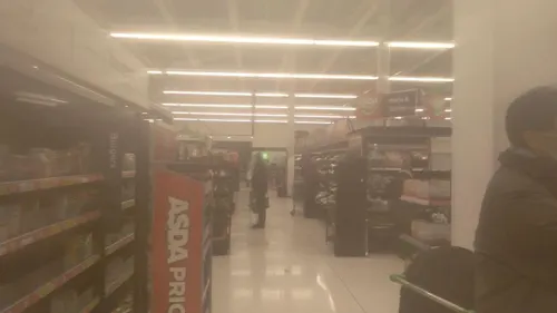
Asda Café
Cafe · Coffee Shop · 1.2 mi
229 High Street, Sutton
Mo-Fr 07:00-23:00; Sa 07:00-22:00; Su 11:00-17:00
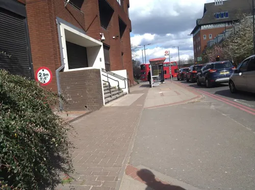
Caffè Nero
Cafe · Coffee Shop · 0.8 mi
2 Carshalton Road, Sutton
Mo-Fr 06:00-19:00; Sa 07:00-19:00; Su 07:00-18:00
M.Manze
Restaurant · Pie And Mash · 1.2 mi
226 High Street, Sutton
Mo-Fr 11:00-17:00; Sa 10:30-17:00; Su 11:00-16:00

Kokoro
Restaurant · Japanese, Sushi · 1.1 mi
162 High Street, Sutton
Mo-We 11:00-20:00, Th-Sa 11:00-21:00, Su 11:00-19:00
Lal Akash
Restaurant · Tandoori · 0.8 mi
49-51 Station Way, Cheam
Mo-Sa 11:30-15:00, 17:00-23:30; Su 11:30-16:00, 17:30-23:30
Number One Thai
Restaurant · Thai · 0.8 mi
1 Cheam Road, Sutton
Mo-Sa 11:30-14:45,17:30-23:00;Su 17:00-22:30
ii-ma Sushi
Restaurant · Japanese, Sushi · 0.7 mi
6 Mulgrave Road, Sutton
Mo 17:30-22:00; Tu-Sa 12:00-14:45

143 more on the map.
History
The placename Sutton is recorded in the 1086 Domesday Book as Sudtone. It is formed from Old English 'sūth' and 'tūn', meaning 'south farm'.
Archaeological finds in the region date back thousands of years, including the excavation of a Roman villa in Beddington. An implement from the Neolithic age was found in Sutton town centre. The Roman road of Stane Street formed part of the northern boundary of the parish.
Sutton was recorded as Sudtone in a charter of Chertsey Abbey believed to date from the late 7th century, when the Manor was granted to the Abbot of Chertsey by Frithwald, Governor of Surrey. Some sources state the name as Suthtone or Sudtana.
The 1086 Domesday Book records Sutton as spanning about 800 acres, and having about 30 houses and 200 people. It states that the Abbot of Chertsey held the manor. In 1538 it was sold to King Henry VIII and granted to Sir Nicholas Carew of Beddington. When Sir Nicholas was sentenced to death in 1539, the King seized the manor. Queen Mary I restored it to Francis, son of Sir Nicholas. It later became a Crown possession again until King Charles II granted it to the Duke of Portland, who sold it in 1669. It changed hands regularly thereafter.
From the time of Domesday until the 19th century, Sutton formed a parish in the Wallington hundred of Surrey in the feudal system.
Read more of the history
Jose Glover, who was Rector of Sutton from 1628 to 1636, became a pioneer of printing in the English colonies of North America and one of the people instrumental in establishing Harvard College in the 1630s.
The road from London to Banstead Downs, through Sutton, was a haven for highwaymen in the 18th century. In 1755, two turnpike roads, which met at Sutton, were built: one from London to Brighton (Brighton Road), the other from Carshalton to Ewell (Cheam Road). The toll bars for the roads were originally located by the Cock Hotel, a coaching inn at the junction. The inn's sign straddled the Brighton road.
The London to Brighton stagecoach began in 1760, and the Cock Hotel was the 9am stop for coaches leaving the city. Regular contact beyond the town brought expansion and sophistication. Small businesses opened up, at first related to travellers and later to provide goods for neighbouring areas. The toll bars moved away from the junction as Sutton expanded, remaining in use until 1882.
Sutton railway station was opened in 1847. Following the arrival of the new, fast link to central London, Sutton's population more than doubled between 1851 and 1861, and the village became a town. New housing was built in the Lind Road area, and called "New Town". A pub built in 1854 on the corner of Lind Road was named the Jenny Lind, after the famous Swedish opera singer Johanna Maria Lind, who was visiting friends in the area in 1847 and enchanted locals with her singing. It has recently been renamed the Nightingale, also after the singer, who was known as the Swedish Nightingale.
In about 1852 a residential school was built alongside the Sutton to Epsom Downs railway near Brighton Road. The building was designed by Edwin Nash and contained administrative, dining, dormitory and teaching areas. Boys were taught manual skills like shoemaking and metal working. Girls were taught such skills as needle work, laundry work, and ironing with a view to making them good servants, wives and mothers. Up to 1856, when large parts of it were destroyed by fire, the boys' and girls' sections were on the same site but after 1856 the girls' were moved into a new building on the other side of the railway in Banstead Road (now called Cotswold Road).
Sutton Water Company was incorporated in 1863, and the provision of water mains allowed houses to be built outside the Thanet Sands area. The Lord of the Manor, Mr Thomas Alcock, sold land for housing, and Sutton's population more than doubled again between 1861 and 1871, spurred by the development of upmarket Benhilton in north Sutton.
The High Street near the top was known as Cock Hill until the 1880s – the shops on the east side were built in 1880, ten years after those on the west side. The grand and decorative London and Provincial Bank building (now home to Barclays Bank) was built overlooking the historic crossroads in 1894. Designed in the French Renaissance architectural style, it is four storeys tall and forms a prominent local landmark. There is a series of arches at ground level, and an ornate entrance where the roads meet.
In 1884 Sutton High School for Girls was founded by the then Girls' Public Day School Trust.
In 1899 Sutton County Grammar School (now Sutton Grammar School for Boys) opened.
In 1897 Sutton Masonic Hall was built in Grove Road. Freemasons have met there since its foundation, apart during World War II when the military requisitioned it and it served as a shelter for displaced people.
By 1901, the town's population had reached 17,223 as further housing was built and the High Street was developed.
In 1902 the Banstead Road site of the South Metropolitan Industrial school was bought by the Metropolitan Asylums Board. The site later became the Downs Schools and then the Downs Hospital. It is now shared between the Royal Marsden and Sutton Hospitals, the Institute of Cancer Research, and the site of a new school to be opened in 2019.
The Sutton Adult School and Institute opened in 1910 in a large Edwardian building in Benhill Avenue. It later became the Thomas Wall Centre, named after the area's benefactor of Wall's sausage and ice cream fame. Thomas Wall's lack of education led to a desire to encourage learning in others, resulting in the establishment of a trust and the construction of the institute. The adult school is said to have had the best premises in the UK: by 1915 there were social clubs, a library, clubs for maternity and horticulture, debating and temperance societies, a legal advice committee, bible study and English literature classes, and what was claimed to be the finest public gymnasium in southern England.
From the History section of Sutton, London on Wikipedia, under CC BY-SA 4.0.
More about Sutton
Geography
Sutton is one of several towns located on a narrow bed of Thanet Sands which extends from Croydon in the east, to Epsom in the west. To the south of this belt is chalk of the North Downs, and to the north is clay. The southern part of the town is on the lower slopes of the North Downs. The belt of Thanet sands allowed wells to provide clean water, and this attracted settlements from a very early date. The Sutton and Cheam Water Company began operations in 1864, and by 1900 had built 142 miles of mains. The company merged with the East Surrey Water Company in 1996 to form Sutton and East Surrey Water.
Elevations in and around the town range from 115 metres (377 ft) AOD in Belmont to 23 metres (75 ft) in Sutton Common, at the start of the Pyl Brook stream.
Economy
Sutton is one of the eleven major metropolitan centres identified in the London Plan in a borough that benefits from very low crime by London standards. The town contains a major retail district, centred on Sutton High Street.
Sutton has over 6,800 businesses, an increase of about 19% since 1994. 863 new companies were formed in Sutton in 2012, the highest number since records began. Most of these were small or medium-sized, but several large businesses, such as RELX, the information and analytics company, are also present and have office space in the town: RELX occupies Sutton Park House opposite the police station, and is a major local employer.
Another important business locally is subsea engineering company Subsea 7.
Sutton Park House was the former office of G4S and Crown Agents Bank, a provider of the wholesale foreign exchange and cross-border payments services, was headquartered in Quadrant House, in the town centre, until 2024.
There is a town centre manager, who works in partnership with local businesses, the police and transport providers to promote the centre and its economic development. The manager acts as the focal point for a range of initiatives funded by the council and other partners. "Opportunity Sutton" and Sutton Chamber of Commerce also play a part in the local economy.
Arts and culture
Sutton has a range of public art, a large library, a music venue and a cinema and theatre. It is a hub for filming in south-west London.
Sutton Central Library's Art Gallery aims to provide the London Borough of Sutton's residents with a wide range of contemporary art, heritage and history experiences. The gallery space is available for hire to professional artists, collectives and non-profit groups wishing to exhibit their work individually or as a group. Entrance to the gallery and access to the exhibition is free for all members of the public, except for specific events.
In 2006 the annual Imagine festival of arts was launched. It has since gained Arts Council England funding.
Sutton town centre contains six main works of public art, as well as several other works. Of the main works, three are murals and three are sculptures.
There is a large town centre mosaic measuring 9 metres (30 ft) high and 5 metres (16 ft) wide covering the whole of a three-storey wall in the town square near the Waterstone's bookshop. One of the largest examples of wall art in Britain, it was commissioned by the London Borough of Sutton to celebrate the borough's heritage.
Created by artists Gary Drostle and Rob Turner, the mosaic was made from vitreous ceramic tesserae (small tiles made of glass and clay), and put in place in 1994.
Education
Sutton is the principal town in the London Borough of Sutton, a top performing borough for education. The town is home to a significant number of the borough's schools, including one of its boys' grammar schools, its boys' preparatory school and its girls' private secondary school.
In 2013 Sutton's GCSE performance was second across all boroughs in England. In 2011 Sutton was the top performing borough in England. For more performance information see London Borough of Sutton.
The main centre of Sutton College, originally named Sutton College of Liberal Arts, is based in Sutton. The college offers over 1000 part-time courses at its borough-wide centres.
From the Wikipedia article Sutton, London, under CC BY-SA 4.0.
Notable people from Sutton
 Penelope KeithEnglish actress (1940–2026)Photo: Mobil Masterpiece Theatre / PBS, Public domain
 James CracknellBritish rowerPhoto: Brian Minkoff-London Pixels, CC BY-SA 3.0
 Leslie SavageBritish swimmer, Olympic bronze medalistPhoto: Unknown author Unknown author, Public domain
 Andrew StunellBritish politician (1942–2024)Photo: Chris McAndrew, CC BY 3.0
 Brandon Ormonde-OttewillBritish association football player (born 1995)Photo: joshjdss, CC BY 2.0
 Lolly AdefopeBritish stand-up comedian and actressPhoto: PhilipRomanoPhoto, CC BY 4.0
- Quentin CrispEnglish writer, humorist and actor (1908-1999)
- Tony BartonEnglish footballer and manager (1937–1993)
- Neil Sullivanassociation football player
- Lionel GilesBritish sinologist, writer and philosopher (1875–1958)
- Martin AdamsEnglish darts player
- Luke GambinEnglish association football player
Born in Sutton, according to Wikidata (CC0). Each name links to its Wikipedia article.
Where to stay4
Churches and places of worship37
Shopping30
Gas and EV charging5
Schools, colleges and libraries25
St Dunstan's Cheam Church of England Primary School
School · Anglican · 1.0 mi
Anne Boleyns Walk, Sutton
Healthcare12
Mulgrave Road Pharmacy
Clinic and pharmacy · 0.7 mi
11 Upper Mulgrave Road, Sutton
Map of Sutton
250 places. The map loads OpenStreetMap tiles when you open it.
Getting there and nearby towns
London Biggin Hill Airport (BQH) is the nearest airport with scheduled flights listed in OpenStreetMap, 10 miles away.
- Carshalton 2 mi northeast, about 3 min by car
- Banstead 2 mi south, about 3 min by car
- Wallington 2 mi northeast, about 4 min by car
- London 11 mi north, about 18 min by car
- City of Westminster 11 mi north, about 17 min by car
- Woking 16 mi west, about 25 min by car
- Tottenham 18 mi north, about 30 min by car
- Walthamstow 18 mi northeast, about 30 min by car
- Watford 23 mi north, about 37 min by car
- Worthing 38 mi south, about 1 h by car
Drive times are estimates from straight-line distance, not routes.
Towns near Sutton


Keep exploring
Local news
Headlines from INDB.
Reviews, tips and questions
Loading what members have shared...
Sources and licences
- GeoNames (CC BY 4.0): population, coordinates, regions and time zone
- Mapillary (see each image): photos
- OpenStreetMap contributors (ODbL 1.0): places, airports, map data
- Wikidata (CC0 1.0): elevation, founding date, time zone, website, landmarks and historic places
- Wikimedia Commons (see each image): photos
- Wikipedia (CC BY-SA 4.0): overview and history text
Photo credits
- Sutton, Surrey London Sutton High Street -, A P Monblat, CC BY-SA 3.0
- Apartments, SUTTON, Surrey, Greater London (2) - Flickr - tonymonblat, Tony Monblat, CC BY-SA 2.0
- Apartments, SUTTON, Surrey, Greater London - Flickr - tonymonblat, Tony Monblat, CC BY-SA 2.0
- Apartments, SUTTON, Surrey, Greater London (3) - Flickr - tonymonblat, Tony Monblat, CC BY-SA 2.0
- The 'Chilterns' art deco apartments, SUTTON, Surrey, Greater London (2) - Flickr - tonymonblat, Tony Monblat, CC BY-SA 2.0
- The 'Chilterns' art deco apartments, SUTTON, Surrey, Greater London (3) - Flickr - tonymonblat, Tony Monblat, CC BY-SA 2.0
- The 'Chilterns' art deco apartments, SUTTON, Surrey, Greater London (10) - Flickr - tonymonblat, Tony Monblat, CC BY-SA 2.0
- The 'Chilterns' art deco apartments, SUTTON, Surrey, Greater London - Flickr - tonymonblat, Tony Monblat, CC BY-SA 2.0
- The 'Chilterns' art deco apartments, SUTTON, Surrey, Greater London (5) - Flickr - tonymonblat, Tony Monblat, CC BY-SA 2.0
- The Chilterns, Sutton, Surrey, Greater London (2) - Flickr - tonymonblat, Tony Monblat, CC BY-SA 2.0
- The Chilterns, Sutton, Surrey, Greater London (9) (16475746291), Tony Monblat, CC BY 2.0
- Sutton, Surrey, Greater London 6, A P Monblat, CC BY-SA 4.0
- The 'Chilterns' art deco apartments, SUTTON, Surrey, Greater London (7) - Flickr - tonymonblat, Tony Monblat, CC BY-SA 2.0
- The 'Chilterns' art deco apartments, SUTTON, Surrey, Greater London (4) - Flickr - tonymonblat, Tony Monblat, CC BY-SA 2.0
- Sutton Lodge, Brighton Rd, SUTTON, Surrey, Greater London (10) - Flickr - tonymonblat, Tony Monblat, CC BY-SA 2.0
- Sutton Lodge, Brighton Rd, SUTTON, Surrey, Greater London (7) - Flickr - tonymonblat, Tony Monblat, CC BY-SA 2.0
- Sutton Lodge, Brighton Rd, SUTTON, Surrey, Greater London - Flickr - tonymonblat, Tony Monblat, CC BY-SA 2.0
- Sutton Lodge, Brighton Rd, SUTTON, Surrey, Greater London (5) - Flickr - tonymonblat, Tony Monblat, CC BY-SA 2.0
- Sutton Lodge, Brighton Rd, SUTTON, Surrey, Greater London (8) - Flickr - tonymonblat, Tony Monblat, CC BY-SA 2.0
- Sutton Lodge, Brighton Rd, SUTTON, Surrey, Greater London (9) - Flickr - tonymonblat, Tony Monblat, CC BY-SA 2.0
- Sutton Lodge, Sutton, Surrey, Greater London - Flickr - tonymonblat, Tony Monblat, CC BY-SA 2.0
- Sutton Lodge, SUTTON, Surrey, Greater London (3) - Flickr - tonymonblat, Tony Monblat, CC BY-SA 2.0
- Charles Cryer Theatre Carshalton, G.Rogers ( Rodge500 ), CC BY-SA 2.5
- Devonshire Avenue Nature Area 3, Dudley Miles, CC BY-SA 3.0
- Manor Park fountain Sutton, Kemal ATLI, CC BY-SA 2.0
- The Grotto Carshalton Park, G.Rogers ( Rodge500 ), CC BY-SA 2.5
- Cherry Wood 3, Dudley Miles, CC BY-SA 3.0
- Trinity Church , Cheam Road, SUTTON, Surrey, Greater London (2), A P Monblat, CC BY-SA 4.0
- Interior of Lumley Chapel, view of the rear-right wall, Bobulous, CC BY-SA 4.0
- Sutton, Surrey, Greater London, St Nicholas Church 6, A P Monblat, CC BY-SA 4.0
- All Saints Church, Benhilton, SUTTON, Surrey, Greater London, A P Monblat, CC BY-SA 4.0
- Former Bugby Chapel, Prospect Place, Epsom (NHLE Code 1232197) (from SW), The Voice of Hassocks, CC0
- St Martin's Church, Church Street, Epsom (NHLE Code 1028592) (August 2013) (3), I, the copyright holder of this work, hereby publish it under the following license:, CC0
- 2016-06-04 TheSecombe, Ungry Young Man from Vienna , Austria, CC BY 2.0
- St Lawrence Church, Morden, 1851, unknown; no attribution given, Public domain
- St Mary the Virgin's Church, London Road, Ewell, The Voice of Hassocks, CC0
- Sutton Grammar School for Boys front, Mrpiprabbit, CC BY-SA 4.0
- Sutton High School Sutton London Surrey, A P Monblat, CC BY-SA 3.0
- 40 Beeches Avenue, Little Holland House, Jhsteel, CC BY-SA 4.0
- The Old Cottage, Jhsteel, CC BY-SA 4.0
- Sutton War Memorial, Manor Park, Sutton, Surrey, Greater London (26), A P Monblat, CC BY-SA 4.0
- Sutton Central library (41276375665), Libraries Taskforce, CC BY 2.0
- Cheam Baptist Church, Malden Road, Cheam (September 2020) (7), User:Hassocks5489, CC0
- Bennett's Hole and River Wandle 4, Dudley Miles, CC BY-SA 3.0
- Belmont Pastures 3, Dudley Miles, CC BY-SA 3.0
- Cuddington Meadows 1, Dudley Miles, CC BY-SA 3.0
- Derwent Floodwash 1, Dudley Miles, CC BY-SA 3.0
- Upstairs panelling at Whitehall, Cheam 2024-09-14, Matt Brown, CC BY 2.0
- Nonsuch Mansion in Nonsuch Park - Surrey - 6 December 2014, Cristian Bortes from Cluj-Napoca, Romania, CC BY-SA 2.0
- Belmont War Memorial, looking north-west, Bobulous, CC BY-SA 4.0
- WILLIAM HALE WHITE 'Mark Rutherford' 1831-1913 Novelist lived here, Spudgun67, CC BY-SA 4.0
- Nonsuch Park Surrey - 6 December 2014, Cristian Bortes from Cluj-Napoca, Romania, CC BY-SA 2.0
- Street-level photo, siriusmart, CC BY-SA 4.0
- Street-level photo, siriusmart, CC BY-SA 4.0
- Street-level photo, caranteth, CC BY-SA 4.0
- Street-level photo, geomapper69, CC BY-SA 4.0
- Street-level photo, caranteth, CC BY-SA 4.0
- Street-level photo, siriusmart, CC BY-SA 4.0
- Street-level photo, siriusmart, CC BY-SA 4.0
- Street-level photo, siriusmart, CC BY-SA 4.0
- Street-level photo, geomapper69, CC BY-SA 4.0


Page built November 10, 2026. Spotted a mistake? Tell us or suggest a place.