


Wallington, United Kingdom
Wallington is a town of 20,850 people in England, United Kingdom.
Why visit Wallington
Townapedia lists 17 museums and landmarks, 57 parks and trails, 168 places to eat and 8 attractions in and around town.
Highlights include Charles Cryer Studio Theatre, Charles Cryer Theatre, Carshalton Water Tower and The Lodge.
Weather in Wallington
Forecast from MET Norway (CC BY 4.0). Full forecast
About Wallington
Wallington is a town in the London Borough of Sutton, South London, England, 9.9 miles (16 km) south south-west of Charing Cross. Before the Municipal Borough of Beddington and Wallington merged into the London Borough of Sutton in Greater London in 1965, it was part of the county of Surrey. Wallington is a post town in the SM postcode area. By the 13th century, Wallington was partially known as Hakebrug for a bridge on the River Wandle.
From the Wikipedia article Wallington, London (this version), under CC BY-SA 4.0.
Photos of Wallington


Things to do8

Charles Cryer Theatre
Cinema and theater
Theatre and former cinema in Carshalton, London


Fairfield Halls
Cinema and theater · 2.6 mi
Arts, entertainment and conference centre in Croydon, London

The Spread Eagle Theatre
Cinema and theater · 2.4 mi
Pub theatre above the Spread Eagle pub in Croydon, London, England

Warehouse Theatre
Cinema and theater · 2.7 mi
Former theatre in Croydon, London, England

Ashcroft Theatre
Cinema and theater · 2.6 mi
Theatre within the Fairfield Halls, Croydon, London, England

Museums and landmarks17

Carshalton Water Tower
Museum · 0.6 mi
The water tower is a very unusual early 18th century garden building. As the name suggests, this contained a water-powered pump which...


Croydon War Memorial
Monument and historic site · 2.4 mi
War memorial in London


Museum of Croydon
Museum · 2.4 mi
Local and social history museum in Croydon, London

Nonsuch Mansion
Museum · 3.3 mi
House in Epsom and Ewell, Surrey, England, UK

Whitehall
Museum · 2.8 mi
House museum in Cheam, Greater London, England, UK



Promenade de Verdun War Memorial
Monument and historic site · 2.0 mi
War memorial in Croydon, London
5 more on the map.
Parks, trails and playgrounds57

Carshalton Park
Park · 0.4 mi
Public park in Carshalton, in the London Borough of Sutton

The Spinney Local Nature Reserve
Park · 0.9 mi
Nature reserve in England


Wilderness Island
Park · 0.7 mi
Island and nature reserve in Carshalton, South London, UK


Cotelands
Park · 2.8 mi
Small park near Park Hill, managed by the London Borough of Croydon


Croham Hurst
Park · 3.4 mi
Woodland in Croydon, Greater London, England, United Kingdom


Devonshire Avenue Nature Area
Park · 1.6 mi
Public nature reserve in London, England

45 more on the map.
Restaurants and cafes168
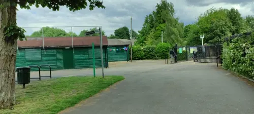
Sassis in The Grove
Cafe · Coffee Shop, Ice Cream
37a High St,, Carshalton
Mo-Fr 08:30-17:00; Sa-Su 09:00-17:00


Millers Kitchen
Cafe · Coffee Shop, American, Pancake, Breakfast, Cake · 0.7 mi
138 Stanley Park Road, Carshalton
Mo-Su 07:00-16:00

Caffè Nero
Cafe · Coffee Shop · 0.4 mi
72 Woodcote Road, Wallington
Mo-Fr 06:00-18:30; Sa 07:00-18:00; Su 08:30-17:30


156 more on the map.
History
The name "Wallington" derives from the Anglo Saxon "Waletone", meaning "village of the Britons".
Wallington appears in Domesday Book of 1086 and was held by William the Conqueror. Its domesday assets were: 11 hides. It had 2 mills worth £1 10s 0d, 11 ploughs, 8 acres (32,000 m2) of meadow. It rendered £10. The historic village was situated somewhat to the north of the current town centre around what is now Wallington Bridge over the River Wandle.
At the time of the Domesday book there were two mill ponds. The mill buildings have long been demolished, but the mill pond survives as The Grange boating lake. In the 1860s one Alfred Smee, surgeon to the Bank of England, constructed an elaborate garden on the north side of the Mill Pond, and wrote an illustrated book called "My Garden" in 1872.
Read more of the history
What was then called "Carshalton" railway station was opened in 1847 in the open fields to the south of Wallington because the owner of Carshalton Park objected to it being built near to Carshalton village. This acted as a spur to the development of the area and in the 1860s Nathaniel Bridges created a prestigious housing estate of gothic revival villas (architect E. L. Brock). To provide a church for the estate, Bridges sponsored the construction of Holy Trinity, and Wallington became a separate parish in 1867. The area around Holy Trinity Church is known as Wallington Old Town. In particular Clifton Road, Belmont Road and Park Road exhibit some imposing Victorian and Edwardian villas. This southward development continued towards Woodcote and by the time of the First World War the section of Woodcote Road to the south of the station had become the new High Street.
Wallington High School for Girls was established in 1888 by a collective of nuns.
Wallington Methodist Church was built in 1908 on a site in Beddington Gardens in the town centre.
Since 1902 the town has maintained the tradition of an annual crowning of the Wallington May Queen. The event begins with a procession through the town. Girls join the group at the age of three as "fairies", before graduating to "attendants to the May Queen" a year later. They then go on to become crown bearers before taking on the role of banner bearer. The girls then act as "princes", and become eligible to be a May Queen at the age of nine.
The Municipal Borough of Beddington and Wallington was incorporated in 1936 from the former Beddington and Wallington Urban District. Wallington Town Hall (architect Robert Atkinson)
and public library were built in Wallington town centre in the 1930s, as was the fire station in Belmont Road.
Wallington County Grammar School (for boys) was opened on London Road, close to Beddington Park in 1927.
Wallington was an important centre for the production of lavender oil until about the time of the First World War. Lavender and herb growing were very prominent in the area in Victorian times and much earlier, and extensive fields of lavender were to be seen in the Carshalton, Beddington and Wallington areas. Lavender growing was a very prosperous part of the local agriculture hereabouts in the 19th and early 20th centuries. In Wallington the area to the north of the station was chiefly used. The scale of the operation can be understood from the fact that the Daily News in 1914 was able to state that at nearby Carshalton Beeches "In every direction the low hill sides of the farm beyond Beeches Halt are swept with the bloomy pastel tint of the lavender flowers". The importance of lavender is remembered and commemorated in a number of ways, for example:
There is a large sculpture at the junction of Woodcote Road and Stafford Road representing a lavender plant. Created by sculptor, Guy Portelli, it was installed in 1999 when the new Sainsbury's store was built.
One of the local lavender farmers – John Jakson of Little Woodcote Farm – lent his name to a public house in Woodcote Road.
Local Scouts use lavender as the logo for the Sutton area on their shoulder badge.
Many of Wallington's young men served and lost their lives in the First World War, and in 1922 a memorial was unveiled on Wallington Green by General Edmund Elles to commemorate the fallen. The memorial was altered in 1949 to include the names of the locals who died in the Second World War.
The memorial is in the form of a Portland stone obelisk on a plinth, with a cross and a sunburst motif. On the sides are bronze plaques bearing the names of the fallen. It stands on blue Staffordshire engineering bricks and York stone. In 2005 it was discovered that the memorial was being attacked by moss, and English Heritage paid for its restoration.
From the History section of Wallington, London on Wikipedia, under CC BY-SA 4.0.
More about Wallington
Education
Wallington Primary Academy (Formerly Amy Johnson Primary School)
All three secondary schools are highly rated grammar schools, with one (Wilson's School) being one of the highest achieving state schools – including all state grammars – in Britain. See the London Borough of Sutton article for further details of education in the borough.
From the Wikipedia article Wallington, London, under CC BY-SA 4.0.
Notable people from Wallington
 Jeff BeckEnglish guitarist (1944–2023)Photo: Chris Hakkens, CC BY-SA 2.0
 Linsey Dawn McKenzieBritish pornographic film actressPhoto: Toglenn, CC BY-SA 3.0
- Elsie WiddowsonBritish nutritionist (1906–2000)
- Phyllis Mudford KingEnglish tennis player (1905–2006)
- Neil ArdleyBritish jazz musician (1937–2004)
- Arthur Calder-MarshallEnglish novelist, essayist, critic, memoirist and biographer
- Paul DukesBritish historian (1934-2021)
- Alfred Oliver PollardEnglish military officer (1893–1960); recipient of the Victoria Cross
- Peter Harveycricketer (1926-1966)
- Charles KennyEnglish cricketer (1929-1996)
- James AtkinsonBritish physicist (1916-2008)
- Gilly ReayBritish cricketer (1887-1967)
Born in Wallington, according to Wikidata (CC0). Each name links to its Wikipedia article.
Churches and places of worship47
Shopping26
Gas and EV charging6
Schools, colleges and libraries43
St Philomena's Catholic High School for Girls
School · Roman Catholic · 0.7 mi
Shorts Road, Carshalton
Healthcare16
H E Matthews Pharmacy
Clinic and pharmacy · 0.7 mi
140 Stanley Park Road, Carshalton
Map of Wallington
250 places. The map loads OpenStreetMap tiles when you open it.
Getting there and nearby towns
London Biggin Hill Airport (BQH) is the nearest airport with scheduled flights listed in OpenStreetMap, 8 miles away.
- Sutton 2 mi southwest, about 4 min by car
- Croydon 3 mi northeast, about 4 min by car
- Worcester Park 4 mi west, about 7 min by car
- West Wickham 6 mi east, about 10 min by car
- City of Westminster 9 mi north, about 15 min by car
- London 10 mi north, about 16 min by car
- Walton-on-Thames 11 mi west, about 18 min by car
- Islington 12 mi north, about 19 min by car
- Bexley 14 mi east, about 23 min by car
- Archway 14 mi north, about 23 min by car
Drive times are estimates from straight-line distance, not routes.
Towns near Wallington


Keep exploring
Local news
Headlines from INDB.
Reviews, tips and questions
Loading what members have shared...
Sources and licences
- GeoNames (CC BY 4.0): population, coordinates, regions and time zone
- Mapillary (see each image): photos
- OpenStreetMap contributors (ODbL 1.0): places, airports, map data
- Wikidata (CC0 1.0): elevation, founding date, time zone, website, landmarks and historic places
- Wikimedia Commons (see each image): photos
- Wikipedia (CC BY-SA 4.0): overview and history text
Photo credits
- Wallington Baptist Church, Wallington, Surrey, London Borough of Sutton - Flickr - tonymonblat, Tony Monblat, CC BY-SA 2.0
- Wallington Baptist Church, Wallington, Surrey, London Borough of Sutton (2) - Flickr - tonymonblat, Tony Monblat, CC BY-SA 2.0
- Holy Trinity Church Wallington, Jhsteel, CC BY-SA 4.0
- Croydon Flyover, Pafcool2, Public domain
- Fairfield Halls - London, Jim Linwood, CC BY 2.0
- Spreadeagle, Croydon, CR0 (2353133094), Ewan Munro from London, UK, CC BY-SA 2.0
- Croydon War Memorial - West, hahnchen at Wikimedia Commons (must include link if medium allows), CC BY-SA 3.0
- Museum of Croydon, Pafcool2, Public domain
- The Grotto Carshalton Park, G.Rogers ( Rodge500 ), CC BY-SA 2.5
- Waddon Ponds, Croydon, UK; from viewing platform, Eagleash, CC BY-SA 4.0
- Cotelands 284, Roger W. Haworth ( talk · contribs ), CC BY-SA 3.0
- Cranmer Green 1, Dudley Miles, CC BY-SA 3.0
- Croham Hurst path, Dudley Miles, CC BY-SA 3.0
- Devonshire Avenue Nature Area 3, Dudley Miles, CC BY-SA 3.0
- All Saints Church, Benhilton, SUTTON, Surrey, Greater London, A P Monblat, CC BY-SA 4.0
- St Peter's Church, Croydon - West, hahnchen at Wikimedia Commons (must include link if medium allows), CC BY-SA 3.0
- Croydon Parish Church - North East, hahnchen at Wikimedia Commons (must include link if medium allows), CC BY-SA 3.0
- Interior of Lumley Chapel, view of the rear-right wall, Bobulous, CC BY-SA 4.0
- 2016-06-04 TheSecombe, Ungry Young Man from Vienna , Austria, CC BY 2.0
- St Andrew's, Croydon, hahnchen at Wikimedia Commons (must include link if medium allows), CC BY-SA 3.0
- St Lawrence Church, Morden, 1851, unknown; no attribution given, Public domain
- Charles Cryer Theatre Carshalton, G.Rogers ( Rodge500 ), CC BY-SA 2.5
- BedZED 2007, Tom Chance from Peckham, CC BY 2.0
- Carshalton High School for Girls, Mx. Granger, CC0
- School From Front, Suttonner, CC BY-SA 4.0
- Carshalton Water Tower, socarra from London, CC BY-SA 2.0
- Greyhound Inn front, Jhsteel, CC BY-SA 4.0
- 40 Beeches Avenue, Little Holland House, Jhsteel, CC BY-SA 4.0
- Elm Lodge 1, Jhsteel, CC BY-SA 4.0
- Carshalton War Memorial 4, Jhsteel, CC BY-SA 4.0
- Bishop Andrewes' Church, Wigmore Road, St Helier (July 2020) (6), User:Hassocks5489, CC0
- 2014-09-20 05 Honeywood, Carshalton, woodenscroll, CC BY-SA 2.0
- Bishop Andrewes' Church, Wigmore Road, St Helier (July 2020) (1), User:Hassocks5489, CC0
- Bennett's Hole and River Wandle 4, Dudley Miles, CC BY-SA 3.0
- The Spinney, Carshalton 2, Dudley Miles, CC BY-SA 3.0
- Wilderness Island 10, Dudley Miles, CC BY-SA 3.0
- Belmont Pastures 3, Dudley Miles, CC BY-SA 3.0
- Cuddington Meadows 1, Dudley Miles, CC BY-SA 3.0
- Canine Clips (4117800791), Images George Rex from London, England, CC BY-SA 2.0
- 40 Manor Road, Jhsteel, CC BY-SA 4.0
- Warehouse Theatre Warehouse Cafe Bar, Croydon, CR0 (6109125574), Ewan Munro from London, UK, CC BY-SA 2.0
- Nonsuch Mansion in Nonsuch Park - Surrey - 6 December 2014, Cristian Bortes from Cluj-Napoca, Romania, CC BY-SA 2.0
- Upstairs panelling at Whitehall, Cheam 2024-09-14, Matt Brown, CC BY 2.0
- A half in The Hope, Carshalton 2024-09-14, Matt Brown, CC BY 2.0
- Street-level photo, jethro10, CC BY-SA 4.0
- Street-level photo, siriusmart, CC BY-SA 4.0
- Street-level photo, jethro10, CC BY-SA 4.0
- Street-level photo, jethro10, CC BY-SA 4.0
- Street-level photo, siriusmart, CC BY-SA 4.0
- Street-level photo, siriusmart, CC BY-SA 4.0
- Street-level photo, laye, CC BY-SA 4.0


Page built November 10, 2026. Spotted a mistake? Tell us or suggest a place.