


Why visit Croydon
Townapedia lists 16 museums and landmarks, 59 parks and trails, 255 places to eat, 16 places to stay and 11 attractions in and around town.
Highlights include Fairfield Halls, Vue Purley Way, Croydon War Memorial and Museum of Croydon.
Weather in Croydon
Forecast from MET Norway (CC BY 4.0). Full forecast
About Croydon
Croydon is a large town in South London, England, 9.3 miles (15 km) south of Charing Cross. Part of the London Borough of Croydon, a local government district of Greater London; it is one of the largest commercial districts in Greater London, with an extensive shopping area. The entire town had a population of 192,064 as of 2011, whilst the wider borough had a population of 384,837.
From the Wikipedia article Croydon (this version), under CC BY-SA 4.0.
Photos of Croydon


Things to do11

Fairfield Halls
Cinema and theater · 0.8 mi
Arts, entertainment and conference centre in Croydon, London
Park Lane, Croydon


Charles Cryer Theatre
Cinema and theater · 2.8 mi
Theatre and former cinema in Carshalton, London


South London Theatre
Cinema and theater · 3.4 mi
Theatre in West Norwood, London

The Spread Eagle Theatre
Cinema and theater · 0.8 mi
Pub theatre above the Spread Eagle pub in Croydon, London, England

Warehouse Theatre
Cinema and theater · 0.6 mi
Former theatre in Croydon, London, England

Ashcroft Theatre
Cinema and theater · 0.8 mi
Theatre within the Fairfield Halls, Croydon, London, England

David Lean Cinema
Cinema and theater · 0.8 mi
Katharine Street, Croydon
Museums and landmarks16

Croydon War Memorial
Monument and historic site · 0.8 mi
War memorial in London



Bethlem Gallery
Museum · 3.0 mi
Art gallery in Beckenham, Bromley, England

Streatham War Memorial
Monument and historic site · 3.0 mi
War memorial in London
4 more on the map.
Parks, trails and playgrounds59

Woodside Green
Park · 1.4 mi
Street and green space in the London Borough of Croydon, England, UK

Addiscombe Railway Park
Park · 0.9 mi
Park in London Borough of Croydon, United Kingdom



South Norwood Recreation Ground
Park · 1.2 mi
Park in London Borough of Croydon, United Kingdom
47 more on the map.
Restaurants and cafes255
The Spreadeagle
Bar and pub · 0.8 mi
39-41 Katharine Street, Croydon
Mo-Th 11:00-23:00; Fr-Sa 11:00-00:00; Su 11:00-22:30
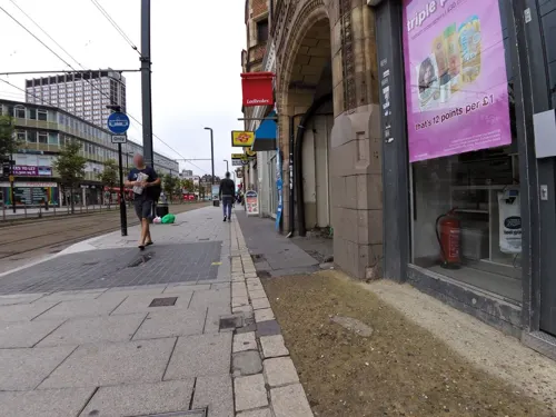
Caffè Nero
Cafe · Coffee Shop · 0.6 mi
93 George Street, Croydon
Mo-Fr 06:00-19:00; Sa 07:00-18:30; Su 07:30-18:00

Crispy Dosa
Restaurant · Indian, South Indian · 0.8 mi
38-40 High Street, Croydon
Mo-Fr 10:00-22:00; Sa-Su 09:00-22:00

Costa
Cafe · Coffee Shop · 0.6 mi
George Street, Croydon
Mo-Sa 05:00-20:00; Su 07:00-18:00
Starbucks
Cafe · Coffee Shop · 0.5 mi
26A Dingwall Road, Croydon
Mo-Fr 06:00-19:00; Sa 07:00-17:30; Su,PH 08:30-16:00

The Dutchie
Restaurant · Caribbean · 0.7 mi
32-34 High Street, Croydon
Mo-Th 11:30-23:00; Fr-Sa 11:30-00:00; Su 13:00-20:00

Frankie & Benny's
Diner · American · 1.1 mi
3 Hesterman Way, Croydon
Mo-Th 10:00-22:00; Fr-Sa 09:00-23:00; Su 09:00-22:00
243 more on the map.
History
The town lies on the line of the Roman road from London to Portslade, and there is some archaeological evidence for small-scale Roman settlement in the area: there may have been a mansio (staging-post) here. Later, in the 5th to 7th centuries, a large pagan Saxon cemetery was situated on what is now Park Lane, although the extent of any associated settlement is unknown.
By the late Saxon period Croydon was the hub of an estate belonging to the Archbishops of Canterbury. The church and the archbishops' manor house were situated in the area still known as "Old Town". The archbishops used the manor house as an occasional place of residence: as lords of the manor they dominated the life of the town well into the early modern period, and as local patrons they continue to have an influence. The earliest known mention of Croydon is in a Saxon chronicle of 809, where the name is spelt Crogeden (the modern spelling did not appear until the 13th century). Croydon appears in Domesday Book (1086) as Croindene, held by Archbishop Lanfranc. Its Domesday assets included 16 hides and 1 virgate of land; a church; a mill worth 5s; 38 plough-teams; 8 acres (3.2 ha) of meadow; and woodland for 200 hogs. It had a recorded population of 73 households (representing roughly 365 individuals); and its value in terms of taxes rendered was £37 10s 0d.
Read more of the history
The church had been established in the middle Saxon period, and was probably a minster church, a base for a group of clergy living a communal life. A charter issued by King Coenwulf of Mercia refers to a council that had taken place close to the monasterium (meaning minster) of Croydon. An Anglo-Saxon will made in about 960 is witnessed by Elfsies, priest of Croydon; and the church is also mentioned in Domesday Book. The will of John de Croydon, fishmonger, dated 6 December 1347, includes a bequest to "the church of S John de Croydon", the earliest clear record of its dedication. The church still bears the arms of Archbishop Courtenay and Archbishop Chichele, believed to have been its benefactors.
In 1264, the only battle reputed to have been fought in Croydon is said to have occurred. Following the defeat of Henry III at the Battle of Lewes, a London contingent was reportedly intercepted at Norbury by Royalist troops from Tonbridge and killed. One account suggests that the king’s forces lay in ambush in Norwood Forest and that the clash took place near Hermitage Bridge, close to an enclosure long known as Battle Close. However, this interpretation is based on later tradition rather than contemporary documentary evidence.
In 1276 Archbishop Robert Kilwardby acquired a charter for a weekly market, and this probably marks the foundation of Croydon as an urban centre. Croydon developed into one of the main market towns of north-east Surrey. The market place was laid out on the higher ground to the east of the manor house in the triangle now bounded by High Street, Surrey Street and Crown Hill. By the 16th century the manor house had become a substantial palace, used as the main summer home of the archbishops and visited by monarchs and other dignitaries. However, the palace gradually became dilapidated and surrounded by slums and stagnant ponds, and in 1781 the archbishops sold it, and in its place purchased a new residence at nearby Addington. Nevertheless, many of the buildings of the original Croydon Palace survive, having been occupied from 1889 to 2025 by Old Palace School.
Croydon had numerous inns from at least the 15th century. The oldest of these was the Greyhound, which occupied a site on the High Street from at least 1493 until it was demolished in 1962 to make way for St George’s Walk, although the building itself had been rebuilt over time. The inn had previously stood in Old Town before relocating to the present town centre alongside the wider trading community. Among its notable guests was General Sir Thomas Fairfax, the Parliamentarian commander during the English Civil War, who used the inn as his headquarters while his troops were billeted in the town between 1645 and 1647. In 1926, the Greyhound also became home to the Greyhound Theatre, described at the time as the smallest theatre in Croydon. Using the hotel’s ballroom and stage, it ran a repertory season (mainly comedies) from April to October, presenting weekly productions, many of which had previously been successful in the West End. Ticket prices ranged from 1s 2d to 3s 6d. In July 1928 the Croydon Repertory Association was formed to support the theatre, and its membership grew from a small initial group to more than 3,000 by the start of the 1930 season. The company remained at the Greyhound until 1932, when it relocated to 23 Wellesley Road, at the junction with Poplar Walk, where it reopened as the Croydon Repertory Theatre.
The parish church (now Croydon Minster) is a Perpendicular-style church, remodelled in the 1850s but destroyed in a great fire in 1867, after which only the tower, south porch, and outer walls remained. A new church was designed by Sir George Gilbert Scott, one of the greatest architects of the Victorian age, and opened in 1870. His design loosely followed the previous layout, with knapped flint facing and retaining many of the original features, including several tombs. The church is the burial place of six Archbishops of Canterbury: John Whitgift, Edmund Grindal, Gilbert Sheldon, William Wake, John Potter and Thomas Herring. Historically part of the Diocese of Canterbury, Croydon is now in the Diocese of Southwark. In addition to the suffragan Bishop of Croydon, the Vicar of Croydon is a preferment.
Addington Palace is a Palladian-style mansion between Addington Village and Shirley, in the London Borough of Croydon. Six archbishops lived there between 1807 and 1898, when it was sold. Between 1953 and 1996 it was the home of the Royal School of Church Music. It is now a conference and banqueting venue.
From the History section of Croydon on Wikipedia, under CC BY-SA 4.0.
More about Croydon
Geography
Croydon town centre is near the centre of the borough of Croydon, to the north of the North Downs and the Pilgrims' Way path. To the north of Croydon are typical London districts, whereas a short distance southeast (such as Coombe and Selsdon) is green, hilly and rural land. To the west are industrial areas, part of which are in the London Borough of Sutton. The southern suburbs are mainly affluent and also hilly.
The town centre is bordered by Waddon immediately southwest of central Croydon. To the west, inside the London Borough of Sutton lies Beddington. To the north are Broad Green, Thornton Heath and Selhurst. To the south lies South Croydon, and going further south are Purley and Sanderstead. To the east lie Addiscombe and Shirley.
Croydon High Street runs from South Croydon up to the point where it meets the street called North End. North End is the main shopping street, while Croydon High Street is the main restaurant quarter.
The High Street is also home to Wrencote House, a Grade II* listed building. Dating from the late 17th or early 18th centuries, and probably built as a merchant's house, it has a distinctive "H" plan form over its four floors (including basement and attic storey). External features include a rich red brick facade with black headers, and a heavily carved and enriched wooden eaves cornice.
Economy
As of 2011, Croydon's annual retail turnover from comparison goods was £353 million, the fifth-highest in Greater London behind the West End, Shepherd's Bush, Stratford and Kingston upon Thames. Croydon had as of 2012 320,991 square metres (3,455,120 sq ft) of total town centre floorspace, the second highest in Greater London only behind the West End.
Apart from its large central shopping district, Croydon has a number of smaller shopping areas, especially towards the southern end of the town in which are many restaurants. As of 2011, two of Croydon's restaurants were listed in The Good Food Guide.
In a 2015 study by CACI, Croydon was ranked 12th in the "Hot 100 UK retail locations" with a score of 90%.
Arts and culture
There are several arts venues. Foremost is the Fairfield Halls, opened in 1962, which consists of a large concert hall frequently used for BBC recordings, the Ashcroft Theatre and the Arnhem Gallery. Fairfield is the home of the London Mozart Players. Many famous faces have appeared at the Fairfield Halls, including the Beatles, Bucks Fizz, Omid Djalili, Robert Cray, JLS, Chuck Berry, B. B. King, Don McLean, The Monkees, Johnny Cash, Dionne Warwick, Gladys Knight, Morecambe and Wise, Tom Jones, The Stylistics, Status Quo, Level 42, A-HA, John Mayall, Jools Holland, Kenny Rogers, James Last, and Coolio. The main concert hall was used for the conference scene in the Ron Howard film The Da Vinci Code (2006). The Fairfield Halls reopened in 2019, following a programme of modernisation and refurbishment. Prior to the construction of The Fairfield Halls theatre entertainment was provided by the Theatre Royal (1868–1959) based on the high street on a site previously housing a venue known as 'the theatre'.
Education
The town is home to Croydon College, with its main site on Park Lane and College Road near East Croydon station. It has over 13,000 students attending one of its three sub-colleges. The sub-colleges were created in 2007. The three sub-colleges are the Croydon Sixth Form College, Croydon Skills and Enterprise College and the Croydon Higher Education College. The Higher Education College offers university-level education in a range of subjects from Law through to Fine Art. Croydon Skills and Enterprise College delivers training and education opportunities.
From the Wikipedia article Croydon, under CC BY-SA 4.0.
Notable people from Croydon
 Leona LewisBritish singer (born 1985)Photo: Daltoncitys, CC BY-SA 4.0
 Havelock EllisBritish physician, writer, and social reformer (1859-1939)Photo: Unknown author Unknown author, Public domain
 Dan StevensBritish actor (born 1982)Photo: Gage Skidmore, CC BY-SA 3.0
 Tracey EminEnglish sculptor, painter, and installation artist (born 1963)Photo: Piers Allardyce, crop by Tyrenius, CC BY 2.0
 Eunice GaysonEnglish actress (1928–2018)Photo: Bildcode: Com_L09-0086-0003-0003..., CC BY-SA 4.0
 StormzyEnglish-Ghanaian rapperPhoto: Raph_PH, CC BY 2.0
 Kirsty MacCollBritish singer (1959–2000)Photo: K8 fan at English Wikipedia, Public domain
 Alison CarrollBritish gymnast, model and actressPhoto: derivative work: Kanonkas (talk)..., CC BY-SA 3.0
- David LeanBritish filmmaker and editor (1908–1991)
- Edward WoodwardBritish actor (1930–2009)
- Sam Taylor-JohnsonBritish film director (born 1967)
- BurialBritish electronic musician
Born in Croydon, according to Wikidata (CC0). Each name links to its Wikipedia article.
Where to stay16
Ibis Styles London Croydon Hotel
Motel and hotel · 0.7 mi
585-589 London Road, Thornton Heath
Churches and places of worship75
Shopping61
Gas and EV charging11
Schools, colleges and libraries65
The Minster Nursery and Infants Church of England Academy
School · Anglican · 1.1 mi
Warrington Road, Croydon
Healthcare47
Map of Croydon
250 places. The map loads OpenStreetMap tiles when you open it.
Getting there and nearby towns
London Biggin Hill Airport (BQH) is the nearest airport with scheduled flights listed in OpenStreetMap, 7 miles away.
- Sutton 5 mi southwest, about 8 min by car
- City of Westminster 8 mi north, about 13 min by car
- London 9 mi north, about 14 min by car
- Islington 11 mi north, about 17 min by car
- Ilford 14 mi northeast, about 23 min by car
- Walthamstow 15 mi north, about 24 min by car
- Tottenham 15 mi north, about 25 min by car
- Dagenham 16 mi northeast, about 26 min by car
- Harrow 17 mi northwest, about 27 min by car
- Enfield Town 19 mi north, about 30 min by car
Drive times are estimates from straight-line distance, not routes.
Towns near Croydon


Keep exploring
Local news
Headlines from INDB.
Reviews, tips and questions
Loading what members have shared...
Sources and licences
- GeoNames (CC BY 4.0): population, coordinates, regions and time zone
- Mapillary (see each image): photos
- OpenStreetMap contributors (ODbL 1.0): places, airports, map data
- Wikidata (CC0 1.0): elevation, founding date, time zone, website, landmarks and historic places
- Wikimedia Commons (see each image): photos
- Wikipedia (CC BY-SA 4.0): overview and history text
Photo credits
- C.B.Fry - 144 St James's Road Croydon CRO 2UY, Spudgun67, CC BY-SA 4.0
- Oakfield, West Croydon, CR0, Ewan-M, CC BY-SA 2.0
- West Croydon Baptist Church - South East, hahnchen at Wikimedia Commons (must include link if medium allows), CC BY-SA 3.0
- West Croydon Baptist Church - North East, hahnchen at Wikimedia Commons (must include link if medium allows), CC BY-SA 3.0
- Fairfield Halls - London, Jim Linwood, CC BY 2.0
- Charles Cryer Theatre Carshalton, G.Rogers ( Rodge500 ), CC BY-SA 2.5
- Croydon Flyover, Pafcool2, Public domain
- South London Theatre 118125, RHaworth, CC BY-SA 2.0
- Croydon War Memorial - West, hahnchen at Wikimedia Commons (must include link if medium allows), CC BY-SA 3.0
- Museum of Croydon, Pafcool2, Public domain
- Joiners Arms, Woodside, SE25 (5717641899), Ewan Munro from London, UK, CC BY-SA 2.0
- Park Hill Entrance 2015, Eagleash, CC BY-SA 4.0
- Waddon Ponds, Croydon, UK; from viewing platform, Eagleash, CC BY-SA 4.0
- Wandle Park Croydon - Wandle River (12012995973), Anthony Spratt, CC BY 2.0
- Addington-hills-view, Harvest1, CC BY 3.0
- Croydon Parish Church - North East, hahnchen at Wikimedia Commons (must include link if medium allows), CC BY-SA 3.0
- Christ Church, Gipsy Hill, London SE19, Mark Ahsmann, CC BY-SA 3.0
- Church of St Barnabas, Mitcham - 1, Euphorbia7, CC BY-SA 4.0
- St John's Church, Penge (2017), Alan Hughes, CC BY-SA 2.0
- Addington Church, No machine-readable author provided. Ross Burgess assumed (based on copyright claims)., CC BY-SA 3.0
- Croydon clocktower, Ross Burgess, CC BY-SA 4.0
- Spreadeagle, Croydon, CR0 (2353133094), Ewan Munro from London, UK, CC BY-SA 2.0
- Al-Khair Secondary School, Mx. Granger, CC0
- Centrale, The original uploader was BbBear at English Wikipedia ., CC BY-SA 3.0
- Croydon University Hospital, bob walker from London, UK, CC BY-SA 2.0
- Whitgift Centre - North End entrance, Hzh, CC BY-SA 4.0
- Parish Church of St Michael and All Angels with St James, Croydon - North, hahnchen at Wikimedia Commons (must include link if medium allows), CC BY-SA 3.0
- Vue Purley Way, Pafcool2, CC BY-SA 3.0
- George, Croydon, CR0 (2353126638), Ewan Munro from London, UK, CC BY-SA 2.0
- Pump house surrey street side, Francis a b fernandes, CC BY-SA 4.0
- YCL Plaque, Ruskin House, Harry Bond, CC BY-SA 4.0
- Royal Standard, Croydon, CR0 (3432940722), Ewan Munro from London, UK, CC BY-SA 2.0
- Bennett's Hole and River Wandle 4, Dudley Miles, CC BY-SA 3.0
- C.B. FRY 1872-1956 All-round Sportsman was born here, Spudgun67, CC BY-SA 4.0
- 'Old Sam' (9266807815), Peter Trimming from Croydon, England, CC BY 2.0
- 'Old Sam' (9269588898), Peter Trimming from Croydon, England, CC BY 2.0
- 'Old Sam' (9723900477), Peter Trimming from Croydon, England, CC BY 2.0
- 'Old Sam' (9727129288), Peter Trimming from Croydon, England, CC BY 2.0
- Warehouse Theatre Warehouse Cafe Bar, Croydon, CR0 (6109125574), Ewan Munro from London, UK, CC BY-SA 2.0
- FREDERICK GEORGE CREED 1871-1957 Electrical Engineer Inventor of the Teleprinter lived and died here, Spudgun67, CC BY-SA 4.0
- ALFRED RUSSEL WALLACE 1823-1913 Naturalist lived here, Spudgun67, CC BY-SA 4.0
- Arthur Conan Doyle house, Pafcool2, Public domain
- Addiscombe Railway Park 4, Mx. Granger, CC0
- Street-level photo, jethro10, CC BY-SA 4.0
- Street-level photo, smsm1, CC BY-SA 4.0
- Street-level photo, agatefilm, CC BY-SA 4.0
- Street-level photo, ldonetc, CC BY-SA 4.0
- Street-level photo, agatefilm, CC BY-SA 4.0
- Street-level photo, agatefilm, CC BY-SA 4.0
- Street-level photo, tonys999, CC BY-SA 4.0
- Street-level photo, ldonetc, CC BY-SA 4.0
- Street-level photo, ldonetc, CC BY-SA 4.0
- Street-level photo, smsm1, CC BY-SA 4.0
- Street-level photo, agatefilm, CC BY-SA 4.0
- Street-level photo, agatefilm, CC BY-SA 4.0
- Street-level photo, agatefilm, CC BY-SA 4.0
- Street-level photo, 6643539, CC BY-SA 4.0
- Street-level photo, agatefilm, CC BY-SA 4.0
- Street-level photo, jethro10, CC BY-SA 4.0
- Street-level photo, ldonetc, CC BY-SA 4.0
- Street-level photo, smsm1, CC BY-SA 4.0
- Street-level photo, tonys999, CC BY-SA 4.0
- Street-level photo, richquansah1, CC BY-SA 4.0
- Street-level photo, richquansah1, CC BY-SA 4.0
- Street-level photo, smsm1, CC BY-SA 4.0


Page built November 10, 2026. Spotted a mistake? Tell us or suggest a place.