


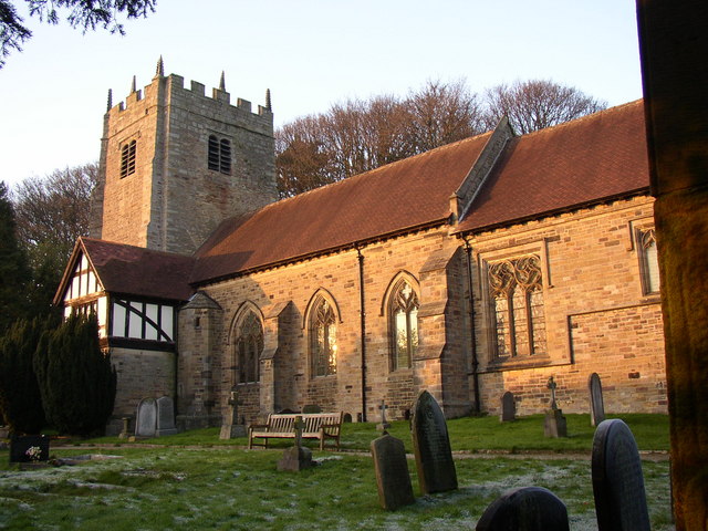

Why visit Caton
Townapedia lists 3 museums and landmarks, 4 parks and trails, 9 places to eat, 4 places to stay and 4 attractions in and around town.
Highlights include Lune Aqueduct, War Memorial, Lancaster Cemetery and Williamson Park.
Weather in Caton
Forecast from MET Norway (CC BY 4.0). Full forecast
About Caton
Caton-with-Littledale is a civil parish in the Lancaster district, in Lancashire, England, near the River Lune. The parish lies within the Forest of Bowland Area of Outstanding Natural Beauty and contains the villages of Caton, Brookhouse, Caton Green, Littledale and Townend. In the 2021 Census the population was 2,851.
From the Wikipedia article Caton-with-Littledale (this version), under CC BY-SA 4.0.
Photos of Caton


Things to do4

Lune Aqueduct
Bridge · 2.9 mi
Navigable aqueduct in Lancashire, England

Museums and landmarks3

War Memorial, Lancaster Cemetery
Monument and historic site · 2.9 mi
War memorial in Lancaster, Lancashire, England, UK
Parks, trails and playgrounds4

Williamson Park
Park · 3.4 mi
Park in Lancaster, Lancashire, England, UK


Restaurants and cafes9
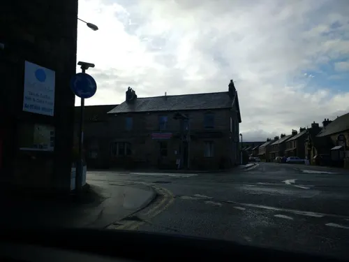
The Old Post Office
Cafe · Sandwich, Coffee
3 Hornby Road, Caton
Fr-Su 10:00-15:00
Black's Finest Fish & Chips
Fast food · Fish And Chips · 1.5 mi
159 High Road, Halton
Mo-Sa 11:30-13:30,16:30-20:00

The Centre @ Halton Coffee Shop
Cafe · 1.5 mi
Low Road, Halton
Mo-Fr 14:00-17:00; Sa,Su 10:00-17:00; PH 11:00-17:00

Brookhouse Takeaway
Fast food · Chinese, Fish And Chips · 0.6 mi
14 Sycamore Road, Brookhouse
History
The original settlement of Caton was renamed Brookhouse after Brookhouse Hall and is separated from modern Caton, originally Town End, by Artle Beck.
Evidence of the Roman occupation in the area is from a milestone, eight feet long found in Artle Beck in 1803, bearing the name of the
Emperor Hadrian; and further engraved stone found some time later.
Archaeological, place name and other evidence attests that Norse invaders settled in the area in the tenth century (Wainwright 1975). Caton is supposedly named from the Norse personal name Kati (Ekwall 1960), meaning 'cheerful' and ton. Geoffrey Hodgson (2008) argues that the Viking invasion of the area accounts for the relatively high frequency of the Hodgson surname in Caton and elsewhere in Lonsdale.
Read more of the history
In late 18th century five mills were built in Town End. Low Mill cotton mill was built for cotton weaving in 1783 on the site of a 13th-century corn mill. it was built by Thomas Hodgson (1738–1817), a son of a Liverpool merchant.(Hodgson 2008) It was powered by a millrace from the Artle Beck at Gresgarth. Water power was replaced by steam in 1819. In the mid 19th century there were two silk mills, two cotton mills, and a flax mill. In 1846 Ball Lane Mill was burnt down. Rumble Row Mill and Forge Mill operated until the 1930s and Willow Mill and Low Mill closed in the 1970s. In 1826 coal and slate were worked in Littledale and bobbins for the mills were made. In 1858 Adam Hodgson built a house which is now the Scarthwaite Hotel.
From the History section of Caton-with-Littledale on Wikipedia, under CC BY-SA 4.0.
More about Caton
Geography
Caton is 5 miles north-east of Lancaster on the road to Hornby in the valley of the River Lune. It covers over 8,000 acres of which 4,000 were moorland where stone was quarried. The township is hilly, Caton Moor in the east rises to over 1,000 feet (300 metres) above sea level and to the south rises to Clougha Pike at 1,355 feet (413 metres) and Ward's Stone at 1,841 feet (561 metres). The Artle Beck flows in a northerly direction towards the wider flatter valley of the River Lune.
Economy
The village is home to the Station Hotel. The Ship Inn public house closed in 2025.
Specialist Bobbin maker T. Wildman & Sons operated in Copy Lane from 1859 to 1973.
From the Wikipedia article Caton-with-Littledale, under CC BY-SA 4.0.
Where to stay4
Churches and places of worship12
Gas and EV charging1
Schools, colleges and libraries2
Caton St Paul's Church of England Primary School
School · Anglican · 0.8 mi
Moorside Road, Brookhouse
Healthcare2
Map of Caton
41 places. The map loads OpenStreetMap tiles when you open it.
Getting there and nearby towns
Walney Aerodrome (BWF) is the nearest airport with scheduled flights listed in OpenStreetMap, 22 miles away.
- Halton 2 mi west, about 3 min by car
- Lancaster 4 mi southwest, about 6 min by car
- Warton 5 mi north, about 8 min by car
- Morecambe 6 mi west, about 9 min by car
- Galgate 6 mi southwest, about 10 min by car
- Heysham 7 mi west, about 12 min by car
- Overton 7 mi southwest, about 11 min by car
- Silverdale 7 mi northwest, about 12 min by car
- High Bentham 9 mi east, about 14 min by car
- Kirkby Lonsdale 10 mi northeast, about 16 min by car
Drive times are estimates from straight-line distance, not routes.
Towns near Caton


Keep exploring
Local news
Headlines from INDB.
Reviews, tips and questions
Loading what members have shared...
Sources and licences
- GeoNames (CC BY 4.0): population, coordinates, regions and time zone
- Mapillary (see each image): photos
- OpenStreetMap contributors (ODbL 1.0): places, airports, map data
- Wikidata (CC0 1.0): elevation, founding date, time zone, website, landmarks and historic places
- Wikimedia Commons (see each image): photos
- Wikipedia (CC BY-SA 4.0): overview and history text
Photo credits
- Lancaster Canal Lune Aqueduct, Stevekraken, CC BY-SA 4.0
- St Chad's Church, Claughton, Alexander P Kapp, CC BY-SA 2.0
- St Cuthbert's Church, Over Kellet, Alexander P Kapp, CC BY-SA 2.0
- Lancaster Moor Hospital Chapel, Eileen Cowen, CC BY-SA 2.0
- St Wilfrid's Church, Halton, Humphrey Bolton, CC BY-SA 2.0
- St Paul's Church, Brookhouse, Alexander P Kapp, CC BY-SA 2.0
- Parish church, Brookhouse, Antiquary, CC BY-SA 4.0
- Close-up of the inscription (OpenBenches 5841), sjorford, CC BY-SA 4.0
- View from the bench (OpenBenches 5841-2), sjorford, CC BY-SA 4.0
- Long shot of the bench (OpenBenches 5841-1), sjorford, CC BY-SA 4.0
- Ashton Memorial in Williamson Park, Lancaster, Jhsteel, CC BY-SA 3.0
- Street-level photo, skifans, CC BY-SA 4.0
- Street-level photo, blind_leader, CC BY-SA 4.0
- Street-level photo, blind_leader, CC BY-SA 4.0
- Street-level photo, blind_leader, CC BY-SA 4.0
- Street-level photo, blind_leader, CC BY-SA 4.0
- Street-level photo, blind_leader, CC BY-SA 4.0
- Street-level photo, blind_leader, CC BY-SA 4.0
- Street-level photo, blind_leader, CC BY-SA 4.0
- Street-level photo, blind_leader, CC BY-SA 4.0
- Street-level photo, blind_leader, CC BY-SA 4.0
- Street-level photo, blind_leader, CC BY-SA 4.0
Page built November 10, 2026. Spotted a mistake? Tell us or suggest a place.