


Why visit Halton
Townapedia lists 8 museums and landmarks, 5 parks and trails, 9 places to eat, 7 places to stay and 10 attractions in and around town.
Highlights include Grand Theatre, Greyhound Bridge, Judges' Lodgings and Lancaster City Museum.
Weather in Halton
Forecast from MET Norway (CC BY 4.0). Full forecast
About Halton
Halton-with-Aughton is a civil parish and electoral ward located 3 miles (5 km) east of Lancaster, England, on the north bank of the River Lune. The main settlement is the village of Halton, or Halton-on-Lune, in the west, and the parish stretches to the hamlet of Aughton in the east. It lies in the City of Lancaster district of Lancashire, and has a population of 2,227, down from 2,360 in 2001.
From the Wikipedia article Halton-with-Aughton (this version), under CC BY-SA 4.0.
Photos of Halton


Things to do10

Grand Theatre
Cinema and theater · 2.5 mi
Theatre in Lancaster, England

Lune Aqueduct
Bridge · 1.5 mi
Navigable aqueduct in Lancashire, England



Carlisle Bridge
Bridge · 2.6 mi
Railway bridge in Lancaster, United Kingdom

Museums and landmarks8

Judges' Lodgings
Museum · 2.7 mi
Museum in Lancaster, Lancashire, England, United Kingdom

Lancaster City Museum
Museum · 2.7 mi
Museum in Lancaster, England, United Kingdom

Queen Victoria Memorial
Monument and historic site · 2.7 mi
Memorial in Lancaster, England

War Memorial, Lancaster Cemetery
Monument and historic site · 2.1 mi
War memorial in Lancaster, Lancashire, England, UK
Westfield War Memorial Village
Monument and historic site · 3.0 mi
Village in Lancashire, England, UK
Parks, trails and playgrounds5

Williamson Park
Park · 2.6 mi
Park in Lancaster, Lancashire, England, UK



Restaurants and cafes9
Black's Finest Fish & Chips
Fast food · Fish And Chips
159 High Road, Halton
Mo-Sa 11:30-13:30,16:30-20:00

The Centre @ Halton Coffee Shop
Cafe
Low Road, Halton
Mo-Fr 14:00-17:00; Sa,Su 10:00-17:00; PH 11:00-17:00
Where to stay7
Churches and places of worship17
Shopping1
Gas and EV charging1
Schools, colleges and libraries1
Healthcare1
Map of Halton
60 places. The map loads OpenStreetMap tiles when you open it.
Getting there and nearby towns
Walney Aerodrome (BWF) is the nearest airport with scheduled flights listed in OpenStreetMap, 21 miles away.
- Lancaster 3 mi southwest, about 5 min by car
- Morecambe 4 mi west, about 7 min by car
- Warton 5 mi north, about 8 min by car
- Heysham 6 mi southwest, about 10 min by car
- Overton 6 mi southwest, about 10 min by car
- Silverdale 7 mi north, about 10 min by car
- Milnthorpe 10 mi north, about 17 min by car
- High Bentham 10 mi east, about 17 min by car
- Kirkby Lonsdale 11 mi northeast, about 17 min by car
- Flookburgh 11 mi northwest, about 18 min by car
Drive times are estimates from straight-line distance, not routes.
Towns near Halton


Keep exploring
Local news
Headlines from INDB.
Reviews, tips and questions
Loading what members have shared...
Sources and licences
- GeoNames (CC BY 4.0): population, coordinates, regions and time zone
- Mapillary (see each image): photos
- OpenStreetMap contributors (ODbL 1.0): places, airports, map data
- Wikidata (CC0 1.0): elevation, founding date, time zone, website, landmarks and historic places
- Wikimedia Commons (see each image): photos
- Wikipedia (CC BY-SA 4.0): overview and history text
Photo credits
- Halton Post Office 6270, Photograph by Clem Rutter, Rochester, Kent. ( www.clemrutter.net )., CC BY-SA 3.0
- Halton High Road shops 6263, Photograph by Clem Rutter, Rochester, Kent. ( www.clemrutter.net )., CC BY-SA 3.0
- Halton 6264, Photograph by Clem Rutter, Rochester, Kent. ( www.clemrutter.net )., CC BY-SA 3.0
- Halton 6266, Photograph by Clem Rutter, Rochester, Kent. ( www.clemrutter.net )., CC BY-SA 3.0
- Halton High Road GP Surgery 6265, Photograph by Clem Rutter, Rochester, Kent. ( www.clemrutter.net )., CC BY-SA 3.0
- Halton High Road Junction 6255, Photograph by Clem Rutter, Rochester, Kent. ( www.clemrutter.net )., CC BY-SA 3.0
- Halton High Road Junction 6254, Photograph by Clem Rutter, Rochester, Kent. ( www.clemrutter.net )., CC BY-SA 3.0
- Halton Quarrry Road 6228, Photograph by Clem Rutter, Rochester, Kent. ( www.clemrutter.net )., CC BY-SA 3.0
- Halton Quarry Road 6227, Photograph by Clem Rutter, Rochester, Kent. ( www.clemrutter.net )., CC BY-SA 3.0
- Halton High Road 6261, Photograph by Clem Rutter, Rochester, Kent. ( www.clemrutter.net )., CC BY-SA 3.0
- Halton Station Road Bridge 6253, Photograph by Clem Rutter, Rochester, Kent. ( www.clemrutter.net )., CC BY-SA 3.0
- Halton Jubilee Oak 6229, Photograph by Clem Rutter, Rochester, Kent. ( www.clemrutter.net )., CC BY-SA 3.0
- Halton Jubilee Oak 6230, Photograph by Clem Rutter, Rochester, Kent. ( www.clemrutter.net )., CC BY-SA 3.0
- Manor House, Halton, Humphrey Bolton, CC BY-SA 2.0
- Lancaster Grand Theatre, Peter Bond, CC BY-SA 2.0
- Lancaster Canal Lune Aqueduct, Stevekraken, CC BY-SA 4.0
- Skerton Bridge, Lancaster, England - North Side, Maxine Armstrong, CC BY-SA 3.0
- Judges' Lodgings and Covell Cross, Lancaster 2025-06-16, The wub, CC BY-SA 4.0
- Lancaster City Museum - 2024-01-03, The wub, CC BY-SA 4.0
- Queen Victoria Memorial, Lancaster, Jhsteel, CC BY-SA 3.0
- Christ Church, Lancaster, Alexander P Kapp, CC BY-SA 2.0
- Holy Trinity Church, Bolton-le-Sands, Alexander P Kapp, CC BY-SA 2.0
- Lancaster Cathedral, November 2023, The wub, CC BY-SA 4.0
- St Cuthbert's Church, Over Kellet, Alexander P Kapp, CC BY-SA 2.0
- St John's Church, Lancaster, Phil Williams, CC BY-SA 2.0
- St Luke's Church, Skerton, Ian Taylor, CC BY-SA 2.0
- Lancaster Moor Hospital Chapel, Eileen Cowen, CC BY-SA 2.0
- St Paul's Church, Brookhouse, Alexander P Kapp, CC BY-SA 2.0
- St Wilfrid's Church, Halton, Humphrey Bolton, CC BY-SA 2.0
- Lune Millennium Bridge Panorama, David Pickavant from Lancaster, United Kingdom, CC BY-SA 2.0
- Dukes playhouse - panoramio, flipflopnick, CC BY-SA 3.0
- Ashton Memorial in Williamson Park, Lancaster, Jhsteel, CC BY-SA 3.0
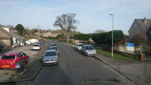
- Street-level photo, skifans, CC BY-SA 4.0
- Street-level photo, blind_leader, CC BY-SA 4.0
- Street-level photo, blind_leader, CC BY-SA 4.0
- Street-level photo, blind_leader, CC BY-SA 4.0
- Street-level photo, skifans, CC BY-SA 4.0
- Street-level photo, skifans, CC BY-SA 4.0
- Street-level photo, blind_leader, CC BY-SA 4.0
- Street-level photo, skifans, CC BY-SA 4.0
- Street-level photo, 767vbfxczicayv, CC BY-SA 4.0
- Street-level photo, blind_leader, CC BY-SA 4.0
- Street-level photo, blind_leader, CC BY-SA 4.0
- Street-level photo, blind_leader, CC BY-SA 4.0
- Street-level photo, blind_leader, CC BY-SA 4.0
- Street-level photo, blind_leader, CC BY-SA 4.0
- Street-level photo, skifans, CC BY-SA 4.0
- Street-level photo, blind_leader, CC BY-SA 4.0
- Street-level photo, mfk, CC BY-SA 4.0


Page built November 10, 2026. Spotted a mistake? Tell us or suggest a place.