


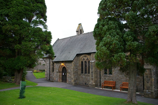
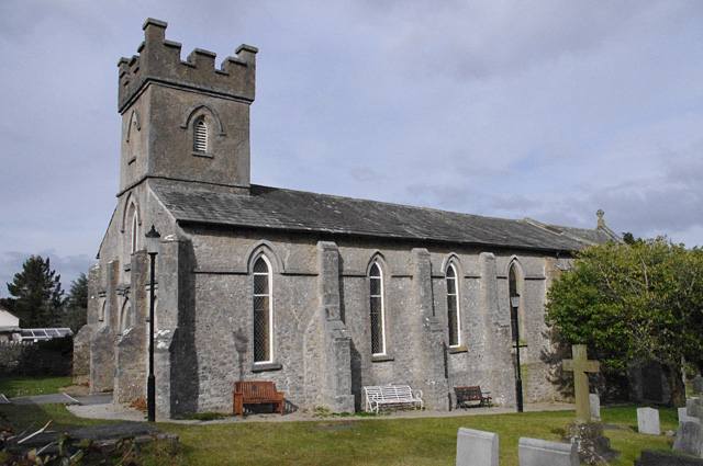


Silverdale, United Kingdom
Silverdale is a town of 1,326 people in England, United Kingdom.
Why visit Silverdale
Townapedia lists 8 museums and landmarks, 8 parks and trails, 8 places to eat, 5 places to stay and 5 attractions in and around town.
Highlights include Carnforth War Memorial, Leighton Hall, Lancashire, RSPB Leighton Moss and Lakeland Wildlife Oasis.
Weather in Silverdale
Forecast from MET Norway (CC BY 4.0). Full forecast
About Silverdale
Silverdale is a village and civil parish within the City of Lancaster district of Lancashire, England. The village stands on Morecambe Bay, near the border with Cumbria, 4.5 miles (7 km) north west of Carnforth and 8.5 miles (14 km) of Lancaster. The parish had a population of 1,599 in the 2021 census.
From the Wikipedia article Silverdale, Lancashire (this version), under CC BY-SA 4.0.
Photos of Silverdale


Things to do5

Museums and landmarks8
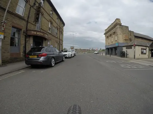
Carnforth War Memorial
Monument and historic site · 3.2 mi
War memorial in the UK

Leighton Hall, Lancashire
Museum · 1.7 mi
Country house in Lancashire, England, UK


Parks, trails and playgrounds8


Lakeland Wildlife Oasis
Park · 3.1 mi
Small zoological collection near the town of Milnthorpe, Cumbria, England
Leighton Moss RSPB reserve
Park · 0.7 mi
Nature reserve in Lancashire, England


Trowbarrow Quarry
Park · 1.1 mi
Limestone quarry and nature reserve in Lancashire, England, UK

Restaurants and cafes8



The Blossom Bird
Cafe · Coffee Shop, Ice Cream · 0.4 mi
Emesgate Lane, Silverdale
More about Silverdale
Geography
Nearby towns and cities: Lancaster, Carnforth, Kendal, Grange-over-Sands
Nearby villages: Arnside, Warton, Yealand Conyers, Yealand Redmayne, Yealand Storrs
Silverdale is within the Arnside and Silverdale National Landscape (formerly Area of Outstanding Natural Beauty or AONB). The parish includes several Sites of Special Scientific Interest (SSSIs), including: Eaves Wood, Gait Barrows National Nature Reserve, Hawes Water (not to be confused with Haweswater reservoir in Cumbria), Jack Scout, Leighton Moss, Silverdale Golf Course, and Trowbarrow Quarry, and the whole of Morecambe Bay is also an SSSI.
There are 20 listed buildings in Silverdale. The parish church and Slackwood Farmhouse are grade II* listed, while Lindeth Tower, the Silverdale Hotel, the lime kiln in Bottom's Lane, the chimney or tower at Jenny Brown's Point, twelve houses (four with barns) and two sets of entrance piers are grade II listed.
Arts and culture
The Gaskell Memorial Hall in the centre of the village hosts a wide range of activities and events. The Silverdale Village Players perform an annual Pantomime and another production each year, and the Silverdale Handbell Ringers (founded 1906, and formally the Silverdale Church Handbell Ringers) entertain at Christmas. The village has a Women's Institute, affiliated to the "Cumbria-Westmorland" Federation of Women's Institutes although Silverdale was not in Westmorland.
The Silverdale Village Institute is a registered charity and provides a building and playing field for public use. In 2013 its committee rejected a proposal for a skatepark on the field. The well-attended 2014 AGM saw a silent demonstration by the village's children in support of a skate park, and a major change in committee membership.
The annual Silverdale and Arnside Art and Craft Trail, when local and visiting artists display their works in many venues in the two villages, takes place each summer.
Education
Silverdale Primary School (full name "Silverdale St John's Church of England Voluntary Aided Primary School") is housed in a Victorian building with more recent extensions, and has around 80 pupils. It was graded "Good" in its 2024 Ofsted report. There is no secondary school in the village.
Bleasdale School, formerly Bleasdale House School, is a day special school for pupils with profound and multiple learning difficulties, with 20 pupils aged 2–19. It was graded "Outstanding" in its 2024 Ofsted school inspection report and "Outstanding" in its 2022 Ofsted social care inspection report.
The village has a branch library open 20 hours/week. Its premises were an outbuilding of Bleasdale School, and were an electrician's shop before becoming a library in the 1960s. The library benefitted from a major refurbishment in December 2011, was closed on 29 September 2016 despite protests from the village community, and reopened on 1 November 2017.
From the Wikipedia article Silverdale, Lancashire, under CC BY-SA 4.0.
Where to stay5
Churches and places of worship8
Shopping3
Schools, colleges and libraries3
Silverdale St John's Church of England Voluntary Aided Primary School
School · Anglican · 0.5 mi
Emesgate Lane, Carnforth
Healthcare1
Map of Silverdale
49 places. The map loads OpenStreetMap tiles when you open it.
Getting there and nearby towns
Walney Aerodrome (BWF) is the nearest airport with scheduled flights listed in OpenStreetMap, 18 miles away.
- Morecambe 7 mi south, about 11 min by car
- Lancaster 8 mi south, about 13 min by car
- Heysham 9 mi south, about 15 min by car
- Kendal 11 mi north, about 18 min by car
- Ulverston 11 mi west, about 18 min by car
- Burneside 13 mi north, about 21 min by car
- Staveley 15 mi north, about 23 min by car
- Barrow in Furness 17 mi west, about 27 min by car
- Fleetwood 18 mi southwest, about 30 min by car
- Thornton-Cleveleys 22 mi southwest, about 35 min by car
Drive times are estimates from straight-line distance, not routes.
Towns near Silverdale


Keep exploring
Local news
Headlines from INDB.
Reviews, tips and questions
Loading what members have shared...
Sources and licences
- GeoNames (CC BY 4.0): population, coordinates, regions and time zone
- Mapillary (see each image): photos
- OpenStreetMap contributors (ODbL 1.0): places, airports, map data
- Wikidata (CC0 1.0): elevation, founding date, time zone, website, landmarks and historic places
- Wikimedia Commons (see each image): photos
- Wikipedia (CC BY-SA 4.0): overview and history text
Photo credits
- Leighton Hall, March 2016, Anglovirtual, CC BY-SA 4.0
- Lakeland Wildlife Oasis Entrance 2020, TheArmchairSoldier, CC BY-SA 4.0
- St James' Church, Arnside, Alexander P Kapp, CC BY-SA 2.0
- St John's Church, Yealand Conyers, Ian Taylor, CC BY-SA 2.0
- St Michael's Church, Beetham, Alexander P Kapp, CC BY-SA 2.0
- St Oswald's Church, Warton, Alexander P Kapp, CC BY-SA 2.0
- Leighton Moss, Gidzy from England, CC BY 2.0
- Arnside Tower, Arnside - South Lakeland, Joyen69, CC BY-SA 4.0
- Arnside Tower, front, Feb 2016, Anglovirtual, CC BY-SA 3.0
- Lady's Slipper Orchid Cypripedium calceolus (5914358590), Len Worthington, CC BY-SA 2.0
- Silverdale Golf Club - panoramio, flipflopnick, CC BY-SA 3.0
- Street-level photo, mfk, CC BY-SA 4.0
- Street-level photo, a-sav, CC BY-SA 4.0
Page built November 10, 2026. Spotted a mistake? Tell us or suggest a place.