


Lancaster, United Kingdom
Lancaster is a town of 47,162 people in England, United Kingdom.
Why visit Lancaster
Townapedia lists 25 museums and landmarks, 38 parks and trails, 213 places to eat, 13 places to stay and 19 attractions in and around town.
Highlights include The Dukes, Grand Theatre, Lancaster City Museum and Lancaster Castle.
Weather in Lancaster
Forecast from MET Norway (CC BY 4.0). Full forecast
About Lancaster
Lancaster is a city in Lancashire, England, and the main cultural, economic and commercial centre of City of Lancaster district. The city is on the River Lune, directly inland from Morecambe Bay. Lancaster is the county town, although Lancashire County Council has been based at County Hall in Preston since its formation in 1889.
From the Wikipedia article Lancaster, Lancashire (this version), under CC BY-SA 4.0.
Travel tips from other travellers: Lancaster on Wikivoyage (CC BY-SA 4.0).
Photos of Lancaster


Things to do19

The Dukes
Cinema and theater
Theatre in Lancaster, England
Moor Lane, Lancaster
Mo off; Tu-Fr,Su 11:00-22:00; Sa 10:30-22:00


Lune Aqueduct
Bridge · 1.6 mi
Navigable aqueduct in Lancashire, England


Morecambe Winter Gardens
Cinema and theater · 3.4 mi
Theatre/entertainment venue in Morecambe, England


Alhambra Theatre
Cinema and theater · 3.5 mi
Former theatre and cinema in Morecambe, England, later cabaret and discotheque, then converted to shops and flats

Carlisle Bridge
Bridge · 0.7 mi
Railway bridge in Lancaster, United Kingdom
Conder Bridge
Bridge · 3.7 mi
Bridge in Thurnham, Lancaster, Lancashire, England, UK

Frontierland, Morecambe
Monument and historic site · 3.4 mi
Former Amusement Park
7 more on the map.
Museums and landmarks25

Lancaster City Museum
Museum
Museum in Lancaster, England, United Kingdom
Market Square, Lancaster
Mo-Tu,Fr-Su 10:30-16:00; We-Th off


Judges' Lodgings
Museum
Museum in Lancaster, Lancashire, England, United Kingdom

Morecambe and Heysham War Memorial
Monument and historic site · 3.5 mi
War memorial in Morecambe, Lancashire, England, UK

Queen Victoria Memorial
Monument and historic site
Memorial in Lancaster, England

13 more on the map.
Parks, trails and playgrounds38

Williamson Park
Park · 0.7 mi
Park in Lancaster, Lancashire, England, UK
24/7

Storey Gardens
Park
Enter through the café at the Storey, and go up the stairs in the backyard.
Meeting House Lane



26 more on the map.
Restaurants and cafes213

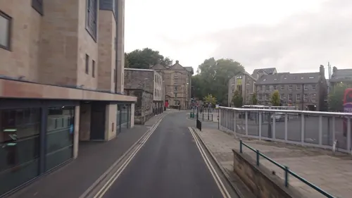
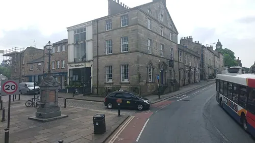
Quarterhouse
Restaurant · Modern British, Brunch, Sharers
13 Moor Lane, Lancaster
Mo off; Tu-Th 17:00-20:00; Fr 17:00-21:00; Sa 12:00-21:00; Su 12:00-18:00
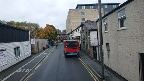
Whale Tail Cafe
Cafe · Regional, Coffee
78a Penny Street, Lancaster
Mo-Fr 09:00-16:00; Su 10:00-15:30; Sa 09:00-16:30
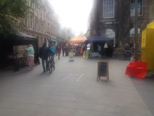
Caffè Nero
Cafe · Coffee Shop
23 Market Street, Lancaster
Mo-Fr 07:00-18:30; Sa 07:30-18:30; Su 08:30-18:00


Bella Italia
Restaurant · Italian
26-28 Church Street, Lancaster
Mo-Fr 11:30-22:00; Sa 11:30-23:00; Su 11:30-22:00
Quite Simply French
Restaurant · French · 0.6 mi
27a St George's Quay, Lancaster
Mo-Th 17:30-21:00; Fr,Sa 12:00-13:30,17:30-21:30; Su...
Costa
Cafe · Coffee Shop
Westbourne Road, Lancaster
Mo-Fr 06:00-19:30; Sa 06:30-19:00; Su 09:00-17:00

201 more on the map.
History
Lancaster was recorded in the Domesday Book of 1086, as Loncastre, where "Lon" refers to the River Lune and "castre" from the Old English cæster and Latin castrum for "fort" to the Roman fort that stood on the site.
A Roman fort was built by the end of the 1st century CE on the hill where Lancaster Castle now stands, possibly as early as the 60s, based on Roman coin evidence. Coin evidence also suggests that the fort was not continuously inhabited in its early years. It was rebuilt in stone about 102. The fort name is known only in a shortened form; the only evidence is a Roman milestone found 4 miles (6.4 km) outside Lancaster, with an inscription ending L MP IIII, meaning "from L – 4 miles, and that its name began with an L.
Roman baths were found in 1812 and can be seen near the junction of Bridge Lane and Church Street. There was presumably a bath-house with the 4th-century fort. The Roman baths incorporated a reused inscription of the Gallic Emperor Postumus, dating from 262 to 266. The 3rd-century fort was garrisoned by the ala Sebosiana and numerus Barcariorum Tigrisiensium.
Read more of the history
The ancient Wery Wall was identified in 1950 as the north wall of the 4th-century fort, which was a drastic remodelling of the 3rd-century one, while retaining the same orientation. The later fort is the only example in north-west Britain of a 4th-century type, with massive curtain-wall and projecting bastions typical of the Saxon Shore or Wales. Extension of the technique as far north as Lancaster shows that the coast between Cumberland and North Wales was not left defenceless after the west-coast attacks and the disaster in the Carausian Revolt of 296, which followed from those under Albinus in 197.
The fort at its largest extent covered 9–10 acres (4–4 ha). Evidence suggests that it stayed in use until the end of Roman occupation of Britain. Church Street and some of St Leonard's Gate probably mark the initial course of the Roman road up the valley to the fort at Over Burrow.
Little is known of Lancaster from the end of Roman rule in the early 5th century to the Norman Conquest of the late 11th century. Despite a lack of documentation for the period, it is thought that Lancaster remained inhabited. It lay on the fringes of the kingdoms of Mercia and Northumbria and over time may have passed from one to the other. Archaeological evidence suggests there was a monastery on or near the site of today's Lancaster Priory by the 700s or 800s. The Anglo-Saxon runic "Cynibald's cross" found at the Priory in 1807 is thought to date from the late 9th century. Lancaster was probably one of several abbeys founded under Wilfrid.
After the Norman conquest of England in 1066, Lancaster fell under the control of William I, as stated in the Domesday Book of 1086, which has the earliest known mention of Lancaster as such in any document. The founding Priory charter dated 1094 is the first known document specific to Lancaster. By this time William had passed Lancaster and its surroundings to Roger de Poitou. The document also suggests the monastery was refounded as a parish church some time before 1066.
Lancaster became a borough in 1193 under King Richard I. Its first charter, dated 12 June 1193, was from John, Count of Mortain, who later became King of England.
Lancaster Castle, partly built in the 13th century and enlarged by Elizabeth I, stands on the site of a Roman garrison. During The Great Raid of 1322, damage was done to the castle by Robert the Bruce, though it resisted the attack and was restored and strengthened by John of Gaunt, 1st Duke of Lancaster, who added much of the Gateway Tower and a turret on the keep or Lungess Tower, which has been named "John o' Gaunt's Chair". In 1322 the Scots burnt the town. It was rebuilt but removed from its position on the hill to the slope and foot. Again in 1389, after the Battle of Otterburn, it was destroyed by the Scots. Lancaster Castle is known as the site of the Pendle witch trials in 1612. It was said that the court based in the castle (the Lancaster Assizes) sentenced more people to be hanged than any other in the country outside London, earning Lancaster the nickname, "the Hanging Town". It also figured prominently in the suppression of Catholicism during the Reformation – at least eleven Catholic priests were executed and a memorial to them as the Lancaster Martyrs stands by the city centre.
The traditional emblem of the House of Lancaster is the Red Rose of Lancaster, similar to that of the House of York with a white rose. The names derive from emblems of the Royal Duchies of Lancaster and York in the 15th century. This erupted into a civil war over rival claims to the throne during the Wars of the Roses.
More recently the term "Wars of the Roses" has been applied to rivalry in sports between teams from Lancashire and Yorkshire. It is also applied to the annual Roses Tournament between Lancaster and York universities.
Lancaster gained a first charter in 1193 as a market town and borough, but had to await city status until 1937.
In 1700, the population of Lancaster was around 5,000. Many of the city's central buildings, including those lining St George's Quay date from the 18th century, as the Port of Lancaster became one of the UK's busiest and the Lancaster slave trade was the fourth largest in the UK slave trade. Among prominent Lancaster slavers were Dodshon Foster, Thomas Hinde and his namesake son. The last slave ship to be constructed in Lancaster was the 267-tonne Trafalgar, built in 1806 at Brockbank’s shipyard for Samuel Hinderland and William Hinde. Lancaster's role as a major port diminished as the river began to silt up and Morecambe, Glasson Dock and Sunderland Point became preeminent for brief periods. Heysham Port has now eclipsed all others on the Lune.
A permanent military presence was built up with the completion of Bowerham Barracks in 1880. The Phoenix Street drill hall was completed in 1894.
From the History section of Lancaster, Lancashire on Wikipedia, under CC BY-SA 4.0.
More about Lancaster
Geography
Lancaster is Lancashire's northernmost city, three miles (4.8 km) inland from Morecambe Bay. It is on the River Lune (from which comes its name), and the Lancaster Canal. It becomes hillier from the Lune Valley eastwards, with Williamson Hill in the north-west a notable height at 109 m (358 ft) and recognised as a TuMP: a hill with "thirty and upwards metres prominence". The central area of the city can be roughly defined by the railway to the west, the canal to the south and east, and the river to the north.
Lancaster, Morecambe and Heysham have been identified by the Office for National Statistics as forming the Lancaster/Morecambe Built-up area, with a population of 101,911 in the 2021 census. Within this, ONS identifies a Lancaster built-up area sub division with a 2021 population of 52,660.
There is a small portion of green belt on the northern fringe of Lancaster, covering the area into Carnforth and helping to prevent further urban expansion towards nearby Morecambe, Hest Bank, Slyne and Bolton-le-Sands.
Arts and culture
Lancaster has a range of historic buildings and venues, having retained many fine examples of Georgian architecture. Lancaster Castle, the Priory Church of St Mary and the Edwardian Ashton Memorial are among the sites of historical importance. Its many museums include Lancaster City Museum, Maritime Museum, the Cottage Museum and the Judges' Lodgings Museum.
Lancaster Friends Meeting House, dating from 1708, is the longest continual Quaker meeting site in the world, with an original building built in 1677. George Fox, founder of Quakerism, was near the site several times in the 1660s and spent two years imprisoned in Lancaster Castle. The meeting house holds regular Quaker meetings and a wide range of cultural activities including adult learning, meditation, art classes, music and political meetings. Lancaster Grand Theatre is another historic cultural venue, under its many names. It has played a major part in social and cultural life since it was built in 1782.
Lancaster is known nationally for its Arts scene. There are around 600 business and organisations in the region involved directly or indirectly in arts and culture.
Education
At Bailrigg south of the city is Lancaster University, a research university founded in 1964 as one of the seven "plate glass universities". It has an annual income of about £325 million (2020/21), 3,000 staff and 16,403 Lancaster-based students in 2021/22. Its business school is one of two in the country to gain a six-star research rating. Its physics department rated #1 in the United Kingdom in 2008. InfoLab21 at the university is a Centre of Excellence for Information and Communication Technologies. LEC (Lancaster Environment Centre) has over 200 staff and shares premises with the government-funded CEH. In 2023 it was 10th, 12th and 14th out of 120 UK universities in "the three main UK league tables". In 2017 it was rated 21st nationally for research in The Times Higher league table. For teaching, it gained the highest Gold ranking for quality in the 2017 government TEF, and in 2018 was ranked 9th for its teaching by The Independent and 9th by The Guardian. The Times Higher placed it 137th worldwide for research and 58th worldwide for arts and humanities. Lancaster University was named International University of the Year by The Times and The Sunday Times Good University Guide in 2020. It has campuses in Malaysia, China and Ghana and plans one in Leipzig, Germany.
From the Wikipedia article Lancaster, Lancashire, under CC BY-SA 4.0.
Notable people from Lancaster
 Scott McTominayScottish association football player (born 1996)Photo: Bryan Berlin, CC BY-SA 4.0
 William WhewellEnglish philosopher and historian of science (1794–1866)Photo: Unknown author, CC BY 4.0
 Joe AbercrombieBritish fantasy writer and film editor (born 1974)Photo: Sizzlipedia, CC BY-SA 4.0
 John WaiteBritish musicianPhoto: PaulHamaker, CC BY-SA 4.0
 Albert Charles SewardBritish botanist (1863–1941)Photo: Olive Edis, Public domain
 Henry D. GilpinUnited States Attorney General (1801-1860)Photo: Henry Inman, Public domain
- Richard OwenEnglish biologist and paleontologist (1804–1892)
- John Langshaw AustinEnglish philosopher (1911–1960)
- John Ambrose FlemingEnglish electrical engineer and physicist (1849-1945)
- Edward FranklandEnglish chemist (1825–1899)
- Michael HurstNew Zealand actor, director and writer
- Joanna DavidBritish actress
Born in Lancaster, according to Wikidata (CC0). Each name links to its Wikipedia article.
Where to stay13
The Shakespeare Bed and Breakfast
Motel and hotel
96 St Leonard's Gate, Lancaster
Churches and places of worship53
Shopping48
Gas and EV charging6
Schools, colleges and libraries33
Lancaster Christ Church Church of England Primary School
School · Anglican · 0.7 mi
Derwent Road, Lancaster
Scotforth St Paul's Church of England Primary and Nursery School
School · Anglican · 1.0 mi
Scotforth Road, Lancaster
Healthcare30
Map of Lancaster
250 places. The map loads OpenStreetMap tiles when you open it.
Getting there and nearby towns
Walney Aerodrome (BWF) is the nearest airport with scheduled flights listed in OpenStreetMap, 20 miles away.
- Morecambe 3 mi northwest, about 5 min by car
- Heysham 4 mi west, about 6 min by car
- Fleetwood 12 mi southwest, about 19 min by car
- Thornton-Cleveleys 15 mi southwest, about 24 min by car
- Cleveleys 15 mi southwest, about 24 min by car
- Ulverston 16 mi northwest, about 25 min by car
- Poulton-le-Fylde 17 mi southwest, about 27 min by car
- Blackpool 19 mi southwest, about 30 min by car
- Kendal 19 mi north, about 31 min by car
- Preston 20 mi south, about 32 min by car
Drive times are estimates from straight-line distance, not routes.
Towns near Lancaster


Keep exploring
Local news
Headlines from INDB.
Reviews, tips and questions
Loading what members have shared...
Sources and licences
- GeoNames (CC BY 4.0): population, coordinates, regions and time zone
- Mapillary (see each image): photos
- OpenStreetMap contributors (ODbL 1.0): places, airports, map data
- Wikidata (CC0 1.0): elevation, founding date, time zone, website, landmarks and historic places
- Wikimedia Commons (see each image): photos
- Wikipedia (CC BY-SA 4.0): overview and history text
Photo credits
- Lancaster and the Lune from the Greyhound Bridge, Lupin at English Wikipedia, CC BY-SA 3.0
- St Thomas' Church, Lancaster - 2023-03-25, The wub, CC BY-SA 4.0
- Lancaster, United Kingdom (Unsplash), Elliot Sloman esloman, CC0
- 91 King Street, Lancaster, Peter James, CC BY-SA 4.0
- 93 King Street, Lancaster, Peter James, CC BY-SA 4.0
- 99 King Street, Lancaster, Peter James, CC BY-SA 4.0
- 95 and 97 King Street, Lancaster, Peter James, CC BY-SA 4.0
- 89 King Street, Lancaster, Peter James, CC BY-SA 4.0
- 4 Queen Square, Lancaster, Peter James, CC BY-SA 4.0
- 87 King Street, Lancaster, Peter James, CC BY-SA 4.0
- Lancaster Grand Theatre, Peter Bond, CC BY-SA 2.0
- Lancaster Canal Lune Aqueduct, Stevekraken, CC BY-SA 4.0
- Morecambe WInter Gardens, Phantom56798, CC BY-SA 4.0
- Skerton Bridge, Lancaster, England - North Side, Maxine Armstrong, CC BY-SA 3.0
- Lancaster City Museum - 2024-01-03, The wub, CC BY-SA 4.0
- Judges' Lodgings and Covell Cross, Lancaster 2025-06-16, The wub, CC BY-SA 4.0
- Lancaster Cathedral, November 2023, The wub, CC BY-SA 4.0
- Christ Church, Lancaster, Alexander P Kapp, CC BY-SA 2.0
- Christ Church, Glasson, Alexander P Kapp, CC BY-SA 2.0
- Holy Trinity Church, Bolton-le-Sands, Alexander P Kapp, CC BY-SA 2.0
- Queen Victoria Memorial, Lancaster, Jhsteel, CC BY-SA 3.0
- Lancaster Castle - 2023-03-25, The wub, CC BY-SA 4.0
- The Ashton Memorial in Lancaster (12311695365), Mark Longair from London, United Kingdom, CC BY-SA 2.0
- St Thomas Lancaster drawing, Edmund Sharpe and E. G. Paley, Public domain
- Royal Lancaster Infirmary, Rathfelder, CC BY-SA 4.0
- Quaker Meeting House, Lancaster 2025-06-16, The wub, CC BY-SA 4.0
- St Luke's Church, Skerton, Ian Taylor, CC BY-SA 2.0
- The Borough, Lancaster, Dave.Dunford, CC BY-SA 4.0
- Old Custom House in Lancaster, Geni, CC BY-SA 4.0
- 15 and 17 Castle Hill, Lancaster, Peter I. Vardy, CC BY-SA 4.0
- St Thomas' Church Front View, AHuntedTheo, CC BY-SA 4.0
- Royal Lancaster Infirmary (original building), The wub, CC BY-SA 3.0
- Queen Victoria Memorial Lancaster South Face, Paul2point0, CC BY-SA 3.0
- Dukes playhouse - panoramio, flipflopnick, CC BY-SA 3.0
- Lune Millennium Bridge Panorama, David Pickavant from Lancaster, United Kingdom, CC BY-SA 2.0
- Morecambe and Heysham War Memorial - view from NW, Tom Parnell, CC BY-SA 4.0
- Ashton Memorial in Williamson Park, Lancaster, Jhsteel, CC BY-SA 3.0
- Street-level photo, skifans, CC BY-SA 4.0
- Street-level photo, skifans, CC BY-SA 4.0
- Street-level photo, blind_leader, CC BY-SA 4.0
- Street-level photo, skifans, CC BY-SA 4.0
- Street-level photo, skifans, CC BY-SA 4.0
- Street-level photo, skifans, CC BY-SA 4.0
- Street-level photo, blind_leader, CC BY-SA 4.0
- Street-level photo, skifans, CC BY-SA 4.0
- Street-level photo, blind_leader, CC BY-SA 4.0
- Street-level photo, mappo2, CC BY-SA 4.0
- Street-level photo, skifans, CC BY-SA 4.0
- Street-level photo, skifans, CC BY-SA 4.0
- Street-level photo, skifans, CC BY-SA 4.0
- Street-level photo, skifans, CC BY-SA 4.0
- Street-level photo, skifans, CC BY-SA 4.0
- Street-level photo, tonys999, CC BY-SA 4.0
- Street-level photo, tonys999, CC BY-SA 4.0
- Street-level photo, tonys999, CC BY-SA 4.0
- Street-level photo, tonys999, CC BY-SA 4.0
- Street-level photo, ocean_life, CC BY-SA 4.0
- Street-level photo, tonys999, CC BY-SA 4.0


Page built November 10, 2026. Spotted a mistake? Tell us or suggest a place.