


Why visit Croy
Townapedia lists 36 museums and landmarks, 10 parks and trails, 18 places to eat, 1 place to stay and 4 attractions in and around town.
Highlights include Bar Hill, Bar Hill Roman Fort, Old Ironstone Mine and Broadwood Stadium.
Weather in Croy
Forecast from MET Norway (CC BY 4.0). Full forecast
About Croy
Croy is a village in North Lanarkshire, Scotland. A former mining community, Croy is situated south of Kilsyth and north of Cumbernauld, some 13 miles (21 km) from Glasgow and 37 miles (60 km) from Edinburgh on the main railway line between the two cities. Croy has a population of about 1,390.
From the Wikipedia article Croy, North Lanarkshire (this version), under CC BY-SA 4.0.
Things to do4



Museums and landmarks36


Antonine Wall
Monument and historic site · 1.2 mi
Defensive fortification in Roman Britain

Westerwood Roman fort
Monument and historic site · 2.2 mi
Site of Roman fort on the Antonine Wall in central Scotland
Antonine Wall
Monument and historic site · 0.7 mi
A turf fortification on stone foundations, built by the Romans and representing the northernmost frontier barrier of the Roman Empire at...
24 more on the map.
Parks, trails and playgrounds10

Broadwood Stadium
Sports field and stadium · 1.1 mi
Ardgoil Drive, Cumbernauld

Dullatur Golf Course
Golf course · 0.9 mi
18 hole Par 70 Carrickstone course + 18 hole Par 69 Antonine course
Glen Douglas Drive, Cumbernauld


Restaurants and cafes18
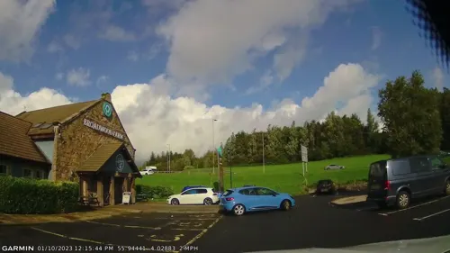
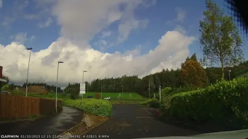

Red Deer
Bar and pub · 1.5 mi
1 Auchenkilns Park, Cumbernauld
Mo-Tu 12:00-22:00; We-Sa 12:00-23:00; Su 12:00-22:30

Red Lantern Chinese Buffet
Restaurant · Chinese · 1.5 mi
3 Auchenkilns Park, Cumbernauld


6 more on the map.
Notable people from Croy
- Jimmy QuinnScottish footballer
- Pat ClintonBritish boxer
- Pat McMahonScottish footballer
- Jimmy QuinnScottish association football player (1947-2002)
- Will StarrBritish musician
- Tommy Morrisonfootballer
- John MorrisonScottish footballer (1909-1992)
Born in Croy, according to Wikidata (CC0). Each name links to its Wikipedia article.
Where to stay1
Churches and places of worship9
Shopping6
Gas and EV charging3
Schools, colleges and libraries10
Map of Croy
97 places. The map loads OpenStreetMap tiles when you open it.
Getting there and nearby towns
Glasgow Airport (GLA) is the nearest airport with scheduled flights listed in OpenStreetMap, 17 miles away.
- Cumbernauld 2 mi southeast, about 3 min by car
- Kirkintilloch 5 mi west, about 7 min by car
- Muirhead 5 mi southwest, about 8 min by car
- Head of Muir 6 mi northeast, about 9 min by car
- Coatbridge 7 mi south, about 11 min by car
- Airdrie 7 mi south, about 11 min by car
- Bishopbriggs 8 mi southwest, about 13 min by car
- Viewpark 9 mi south, about 15 min by car
- Falkirk 10 mi east, about 16 min by car
- Glasgow 11 mi southwest, about 17 min by car
Drive times are estimates from straight-line distance, not routes.
Towns near Croy


Keep exploring
Local news
Headlines from INDB.
Reviews, tips and questions
Loading what members have shared...
Sources and licences
- GeoNames (CC BY 4.0): population, coordinates, regions and time zone
- Mapillary (see each image): photos
- OpenStreetMap contributors (ODbL 1.0): places, airports, map data
- Wikidata (CC0 1.0): elevation, founding date, time zone, website, landmarks and historic places
- Wikimedia Commons (see each image): photos
- Wikipedia (CC BY-SA 4.0): overview and history text
Photo credits
- Croy miners cottages, Wikibrowser24, CC BY-SA 4.0
- Broadwood Stadium, Chris Upson, CC BY-SA 2.0
- Bar Hill Fort 20090619 bath house from east, Otter, CC BY-SA 3.0
- Broadwood 2023 2, Crowsus, CC BY-SA 4.0
- Bar Hill Roman fort well, Lirazelf, CC BY-SA 4.0
- Castle Hill trig point, Lirazelf, CC BY-SA 4.0
- Street-level photo, gmc, CC BY-SA 4.0
- Street-level photo, ally447, CC BY-SA 4.0
- Street-level photo, gmc, CC BY-SA 4.0
- Street-level photo, ally447, CC BY-SA 4.0
- Street-level photo, gmc, CC BY-SA 4.0
- Street-level photo, gmc, CC BY-SA 4.0
- Street-level photo, ally447, CC BY-SA 4.0
Page built November 10, 2026. Spotted a mistake? Tell us or suggest a place.