


Why visit Falkirk
Townapedia lists 83 museums and landmarks, 25 parks and trails, 194 places to eat, 8 places to stay and 1 attraction in and around town.
Highlights include Cineworld, Callendar House, Arthur's O'on temple and The Helix.
Weather in Falkirk
Forecast from MET Norway (CC BY 4.0). Full forecast
About Falkirk
Falkirk ( FAWL-kurk; Scots: Fawkirk [ˈfɔːkɪrk]; Scottish Gaelic: An Eaglais Bhreac) is a town in the Central Lowlands of Scotland, historically within the county of Stirlingshire. It lies in the Forth Valley, 23+1⁄2 miles (38 kilometres) northwest of Edinburgh and 20+1⁄2 miles (33 km) northeast of Glasgow.
From the Wikipedia article Falkirk (this version), under CC BY-SA 4.0.
Travel tips from other travellers: Falkirk on Wikivoyage (CC BY-SA 4.0).
Photos of Falkirk

Things to do1

Museums and landmarks83


Arthur's O'on temple
Monument and historic site · 1.6 mi
Probable Roman temple near Falkirk, Scotland, destroyed in 1743


Falkirk Steeple and Visitor Information Point
Monument and historic site

Westquarter Dovecot
Monument and historic site · 1.8 mi
Dovecot Road, Falkirk

71 more on the map.
Parks, trails and playgrounds25




13 more on the map.
Restaurants and cafes194
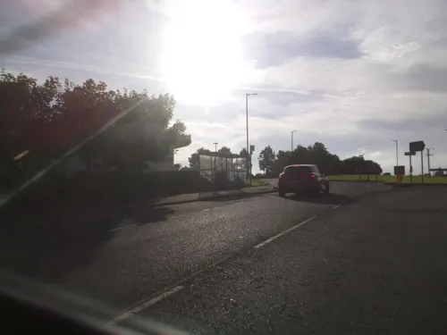
Boardwalk
Restaurant · Greek, Mediterranean, Italian, Breakfast · 2.1 mi
1 Millennium Wheel Drive, Falkirk
Mo-Th,Su 09:00-23:00; Fr-Sa 09:00-24:00
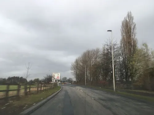
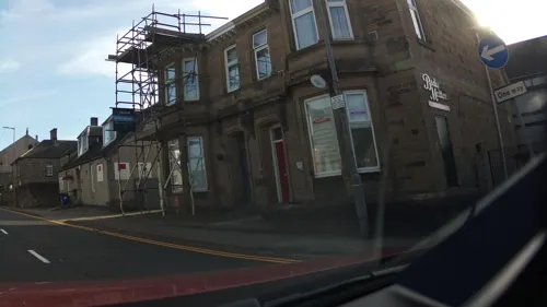


Erawan
Restaurant · Thai
11-13 East Bridge Street, Falkirk
Tu-Fr 12:00-14:00,17:00-23:00; Sa 12:00-23:00; Su 17:00-23:00; Mo off
Gambero Rosso
Restaurant · Italian · 0.6 mi
1 Burnbank Road, Falkirk
Tu-Th 12:00-14:30,17:00-21:30; Fr 12:00-14:30,17:00-22:00; Sa...
182 more on the map.
History
An Eaglais Bhreac is a derivative formed from the Scottish Gaelic cognate of the first recorded name Egglesbreth from the Brittonic for "speckled church", presumably referring to a church building built of many-coloured stones. The Scottish Gaelic name was calqued into Scots as Fawkirk (literally "variegated church"), then later amended to the modern English name of Falkirk. The Latin name Varia Capella also has the same meaning. Falkirk Old Parish Church stands on the site of the medieval church, which may have been founded as early as the 7th century.
The Antonine Wall, which stretches across the centre of Scotland, passed through the town and remnants of it can be seen at Callendar Park. Similar to Hadrian's Wall but built of turf rather than stone so less of it has survived, it marked the northern frontier of the Roman Empire between the Firth of Forth and Firth of Clyde during the AD 140s. Much of the best evidence of Roman occupation in Scotland has been found in Falkirk, including a large hoard of Roman coins and a cloth of tartan, thought to be the oldest ever recorded. A Roman fort was confirmed to be found by Geoff Bailey in the Pleasance area of Falkirk in 1991. A Roman themed park at Callendar House was awarded lottery funding to help raise awareness of the wall.
Read more of the history
In the 18th century the area was the cradle of Scotland's Industrial Revolution, becoming the earliest major centre of the iron-casting industry. James Watt cast some of the beams for his early steam engine designs at the Carron Iron Works in 1765. The area was at the forefront of canal construction when the Forth and Clyde Canal opened in 1790. The Union Canal (1822) provided a link to Edinburgh and early railway development followed in the 1830s and 1840s. The canals brought economic wealth to Falkirk and led to the town's growth. Through time, trunk roads and motorways followed the same canal corridors through the Falkirk area, linking the town with the rest of Scotland. Many companies set up work in Falkirk due to its expansion. A large brickworks was set up at this time, owned by the Howie family. During the 19th century, Falkirk became the first town in Great Britain to have a fully automated system of street lighting, designed and implemented by a local firm, Thomas Laurie & Co Ltd.
The Battle of Falkirk fought on 22 July 1298, saw the defeat of William Wallace by King Edward I of England.
The Battle of Falkirk Muir took place on 17 January 1746, the Jacobites under Charles Edward Stuart defeated a government army commanded by Lieutenant General Henry Hawley.
From the History section of Falkirk on Wikipedia, under CC BY-SA 4.0.
More about Falkirk
Geography
Falkirk is located in an area of undulating topography between the Slamannan Plateau and the upper reaches of the Firth of Forth. The area to the north of Falkirk is part of the floodplain of the River Carron. Two tributaries of the River Carron - the East Burn and the West Burn flow through the town and form part of its natural drainage system. Falkirk sits at between 50 metres (164 ft) and 125 metres (410 ft) above sea level.
The underlying geology of the town of Falkirk is characterised by glacial deposits. Elevations above 100 metres (328 ft) are covered by a mixture of glacial till and boulder clay with low-lying areas covered by sandy soils and loams. As Falkirk is not far from the coast, post-glacial features akin to raised beaches are particularly predominant to the north of the town centre, and this gives rise to differing elevations within the town.
Unsorted glacial till gives rise to such features of glacial deposition as eskers, and drumlins which are predominant over much of the area. Such elements provide natural transport routes and it is this complex underlying geology that the town is built upon.
Economy
Today, the economy of Falkirk is focused on retail and services, in contrast to the heavy industries and manufacturing sectors which contributed to the growth of the town over the last 300 years. Falkirk is a large retail centre catering to the town itself and a wide surrounding area, stretching from Cumbernauld in the west to Bo'ness in the east. The retailer Marks and Spencer opened a store in Falkirk Town Centre in 1936 but this closed in 2018 (the building is now a creative arts space). The High Street was pedestrianised in the late 1980s, and the Howgate Shopping Centre opened in April 1990. Another shopping centre, Callendar Square was opened in 1993 but finally closed in 2020. A number of supermarkets including Tesco, Asda, Morrisons and Scottish Co-op have developed on peripheral sites surrounding the town centre since the late 1990s.
Arts and culture
Anthony Aston's theatre company began a tour at the Falkirk tolbooth in 1728.
Falkirk hosted a national arts festival which ran in Callendar Park from 2000 to 2009 called Big In Falkirk. After its inception in 2000, the festival won Scottish Thistle Award for Events & Festivals in 2005. Consisting of a free weekend of events, the festival was one of the largest cultural events in Scotland, attracting over 100,000 people. Hosted in Falkirk's historical Callendar Park, the venue covers 180 acres (75 hectares) with Callendar House as the focal point, the entertainment featured a wide variety of outdoor theatre, pyrotechnic displays, arts, comedy and big name music acts, alongside activities for all ages.
Falkirk hosted the Royal National Mòd in 2008. The Gold medals were won by Falkirk resident Lyle Kennedy and Kerrie Finlay from Inverness. Interest in Gaelic has grown in Falkirk since the Mòd and there are now five Gaelic organisations active in the Falkirk area: An Clas Gàidhlig (provides Gaelic lessons to adults), An Comunn Gàidhealach Meur na h-Eaglaise Brice (is the local branch of An Comunn Gàidhealach), Fèis Fhoirt (provides traditional music and Gaelic song tuition for children and adults), Falkirk Gaelic Forum (promotes Gaelic in Falkirk) and Falkirk Junior Gaelic Choir (is a long established and successful youth choir).
Education
Falkirk is home to one of the four campuses of Forth Valley College which was formed on 1 August 2005 from the merger of Falkirk, Stirling and Clackmannan colleges. The Falkirk Campus is by far the largest of the four campuses.
Falkirk District is served by eight high schools which have all been recently rebuilt.
From the Wikipedia article Falkirk, under CC BY-SA 4.0.
Notable people from Falkirk
 Tommy DouglasScottish-born Canadian politician (1904-1986)Photo: Alexandra Studio, Attribution
 David WeirScottish association football manager (born 1970)Photo: Jeff Anderson from Harrow, Middx, CC BY 2.0
 Jimmy FinlaysonScottish actor (1887–1953)Photo: Abbe, Public domain
 Charles NapierBritish Royal Navy admiral (1786-1860)Photo: Thomas Musgrave Joy, Public domain
 Ruth ConnellBritish actressPhoto: Mandilea16, CC BY 4.0
 Samantha KerrScottish footballer (born 1999)Photo: Steffen Prößdorf, CC BY-SA 4.0
 Bob McGregorBritish swimmer, Olympic silver medallistPhoto: Kroon, Ron / Anefo, CC BY-SA 3.0 nl
 Elizabeth BlackadderScottish artist (1931–2021)Photo: Scottish Government, CC BY 2.0
 Aidan MoffatScottish musicianPhoto: Steven Illidge, Public domain
 Donald DouglasScottish actor (1933–2026)Photo: Eliza Douglas, CC BY-SA 3.0
- George ForrestScottish botanist (1873-1932)
- John AitkenScottish meteorologist, physicist and marine engineer (1839-1919)
Born in Falkirk, according to Wikidata (CC0). Each name links to its Wikipedia article.
Where to stay8
Churches and places of worship23
Tryst Church (Larbert Tryst Parish Church of Scotland)
Church · Church Of Scotland · 2.0 mi
Main Street, Stenhousemuir
Shopping49
Gas and EV charging7
Schools, colleges and libraries24
Healthcare19
Falkirk Community Hospital
Hospital · 0.5 mi
Westburn Avenue, Falkirk
Map of Falkirk
250 places. The map loads OpenStreetMap tiles when you open it.
Getting there and nearby towns
Edinburgh Airport (EDI) is the nearest airport with scheduled flights listed in OpenStreetMap, 17 miles away.
- Grangemouth 3 mi east, about 4 min by car
- Linlithgow 7 mi east, about 12 min by car
- Stirling 10 mi northwest, about 16 min by car
- Whitburn 10 mi southeast, about 16 min by car
- Livingston 12 mi southeast, about 20 min by car
- Rosyth 14 mi east, about 22 min by car
- Kirkintilloch 15 mi west, about 24 min by car
- Mossend 15 mi southwest, about 25 min by car
- Motherwell 17 mi southwest, about 27 min by car
- Wishaw 17 mi south, about 27 min by car
Drive times are estimates from straight-line distance, not routes.
Towns near Falkirk


Keep exploring
Local news
Headlines from INDB.
Reviews, tips and questions
Loading what members have shared...
Sources and licences
- GeoNames (CC BY 4.0): population, coordinates, regions and time zone
- Mapillary (see each image): photos
- OpenStreetMap contributors (ODbL 1.0): places, airports, map data
- Wikidata (CC0 1.0): elevation, founding date, time zone, website, landmarks and historic places
- Wikimedia Commons (see each image): photos
- Wikipedia (CC BY-SA 4.0): overview and history text
Photo credits
- Falkirk, UK - panoramio (2), douglas sheehan, CC BY-SA 3.0
- Falkirk, UK - panoramio, douglas sheehan, CC BY-SA 3.0
- Falkirk, UK - panoramio (6), douglas sheehan, CC BY-SA 3.0
- Falkirk Town Heritage Trail - The Old Town Hall, Mark Begbie, CC BY-SA 4.0
- Falkirk Town Heritage Trail - The Burgh Buildings, Mark Begbie, CC BY-SA 4.0
- St Andrew's West Church, Falkirk 05, Auldcathy, CC BY 4.0
- FalkirkHighStreet, Kevin Rae, CC BY-SA 2.0
- Arthur's oven - Gordon 1726, Unknown author Unknown author, Public domain
- Falkirk Old Parish Church, Texas Radio and The Big Beat, CC BY-SA 2.0
- Larbert High School, Drkirstyross, CC BY-SA 3.0
- The Kelpies, at The Helix, Scotland, Beninjam200, CC BY-SA 4.0
- Larbert East Church front of building, Drkirstyross, CC BY-SA 4.0
- The Kelpies at The Helix in Falkirk, Scotland, June 2014, Steven Straiton, CC BY 2.0
- Trinity Church, Falkirk, Stephencdickson, CC BY-SA 4.0
- Falkirk Public Library Plaque, Delphine Dallison, CC BY-SA 4.0
- Fiona Hyslop MSP and a Roman (Antonine Guard Living History Society) at the Roman vs Picts 5k race, Callendar House, amaldon, CC BY-SA 4.0
- Street-level photo, southglos, CC BY-SA 4.0
- Street-level photo, hobgoblin, CC BY-SA 4.0
- Street-level photo, tallguy, CC BY-SA 4.0
- Street-level photo, southglos, CC BY-SA 4.0
- Street-level photo, southglos, CC BY-SA 4.0
- Street-level photo, floatingboater, CC BY-SA 4.0
- Street-level photo, toho, CC BY-SA 4.0
- Street-level photo, southglos, CC BY-SA 4.0
- Street-level photo, southglos, CC BY-SA 4.0
- Street-level photo, smsm1, CC BY-SA 4.0
- Street-level photo, ccbb7766, CC BY-SA 4.0
- Street-level photo, hobgoblin, CC BY-SA 4.0
- Street-level photo, smsm1, CC BY-SA 4.0
- Street-level photo, southglos, CC BY-SA 4.0
- Street-level photo, southglos, CC BY-SA 4.0
- Street-level photo, southglos, CC BY-SA 4.0
- Street-level photo, hobgoblin, CC BY-SA 4.0
- Street-level photo, floatingboater, CC BY-SA 4.0


Page built November 10, 2026. Spotted a mistake? Tell us or suggest a place.